
Viewpoints · East of England
Landscape Lens'
In or near Wormingford.
Landscape Lens' is a viewpoint in the United Kingdom.

Robin Webster — CC BY-SA 2.0 via Wikimedia Commons licence

Plan your visit
- Typical visit
- 20 min–45 min
- Best time of year
- Clear days year-round
- Nearest railway station
- Bures · 5.8 km
- Free entry
- Dog-friendly
Getting there & planning your visit
To visit Landscape Lens', use the postcode CO6 4DN for sat-nav directions. The nearest railway station is Bures, located 5.8 km away. Entry to the viewpoint is free.
About
Landscape Lens' is a named viewpoint in Essex, East of England, marked on Ordnance Survey maps for its outlook. The site is within the Dedham Vale National Landscape (AONB). It sits within the Harwich and North Essex parliamentary constituency. The nearest railway station is Bures, about 5.8 km away. Postcode area CO6.
Photo gallery
Protected designations
- Area of Outstanding Natural Beauty: Dedham Vale
Designations sourced from Natural England open data under OGL v3.
From the Wikipedia article
The Landscape Institute (LI) is a UK based professional body for the landscape profession. Its membership includes landscape architects, urban designers, landscape planners, landscape scientists and landscape managers. The LI also has a category for academic members. Founded in 1929-30 as the Institute of Landscape Architects (ILA), it was granted a royal charter in 1997. In the words of its longest serving president, Geoffrey Jellicoe, “It is only in the present century that the collective landscape has emerged as a social necessity. We are promoting a landscape art on a scale never conceived of in history.” The LI seeks to promote landscape architecture and to regulate the landscape profession with a code of conduct that members must abide by. The LI had ‘over 900’ members at its fortieth birthday (in 1969) and by 1978 had over 1,500 members. In 2019 the total membership of the LI was 5,613. In 2025 this increased to over 6,000. The Landscape Institute royal charter was granted in 1997 and revised in 2008 and 2016. Its objects and purposes are specified as follows (in Clause 5. (1): ‘The objects and purposes for which the Institute is hereby constituted are to protect, conserve and enhance the natural and built environment for the benefit of the public by promoting the arts and sciences of Landscape Architecture (as such expression is hereinafter defined) and its several applications and for that purpose to foster and encourage the dissemination of knowledge relating to Landscape Architecture and the promotion of research and education therein, and in particular to establish, uphold and advance the standards of education, qualification, competence and conduct of those who practice Landscape Architecture as a profession, and to determine standards and criteria for education, training and experience.’ The Landscape Institute publishes the journal Landscape (formerly Landscape Design), and is a member of the International Federation of Landscape Architects.
Excerpt from Wikipedia under CC BY-SA 4.0. See the source article linked in Sources below.
Background
History
lived in Grove Terrace, Highgate, London]] ‘Landscape architecture’ is a modern name for an ancient art. The development of the ancient art is analysed by Geoffrey Jellicoe, in The Landscape of Man, and by Norman T. Newton in Design on the land. Jellicoe describes the cave paintings of Lascaux c30,000 BC as the ‘First Landscapes consciously conceived by man’. Newton, defines ‘landscape architecture’ as the art ‘of arranging land, together with the spaces and objects upon it, for safe, efficient, healthful, pleasant human use’ and writes that ‘the ancient art became a new profession officially, when in 1863 the title Landscape Architect was first used by the state-appointed Board of Central…
Sourced from Wikipedia under CC BY-SA 4.0.
- Coordinates
- 51.9556, 0.8496
- County
- Essex
- District
- Colchester
- Parish
- Little Horkesley
- Postcode
- CO6 4DN
- Parliamentary constituency
- Harwich and North Essex
- Nearest railway station
- Bures — 5.8 km
- Official site
- www.landscapeinstitute.org
Sources
- osm: n11042127232 (ODbL)
- wikipedia: Landscape Institute (CC BY-SA 4.0)
Other places nearby

Little Horkesley Village Sign
Public art & sculpture · 0.4 km
Little Horkesley War Memorial
Memorials & monuments · 0.4 km
.jpg?width=1200)
Wiston Mill
Mills · 0.9 km

Wissington
Villages · 1.1 km

Rushbanks Campsite
Campsites · 1.2 km

Wormingford
Towns & cities · 2.1 km

Nayland Bridge
Historic bridges · 2.2 km

Nayland Court Knoll
Castles · 2.2 km
The Anchor Public House
Historic pubs · 2.2 km

Court Knoll
Literary houses · 2.3 km

Nayland
Villages · 2.4 km

Nayland War Memorial
Memorials & monuments · 2.4 km
Nearby
📷 3Public art & sculpture · East of England
Little Horkesley Village Sign
Little Horkesley Village Sign — a public art in East of England, United Kingdom.
📷 3Memorials & monuments · East of England
Little Horkesley War Memorial
Little Horkesley War Memorial — Grade II listed building-listed memorial in england-east, United Kingdom.
📷 3Mills · East of England
Wiston Mill
Wiston Mill — mill in Nayland-with-Wissington, Babergh, England, UK.
📷 5📷 5Campsites · East of England
Rushbanks Campsite
Rushbanks Campsite — a campsite in england east.
📷 3Towns & cities · East of England
Wormingford
Wormingford — village and civil parish in Essex, United Kingdom.
Where to eat & stay near Landscape Lens'
Places to stay
📷 5Campsites · East of England
Rushbanks Campsite
Rushbanks Campsite — a campsite in england east.
 📷 5
📷 5B&Bs · East of England
Poplar Farmhouse
Poplar Farmhouse — a bed-and-breakfast in england east.
 📷 5
📷 5Campsites · East of England
Little Ropers Woodland Camping
Little Ropers Woodland Camping — a campsite in england east.
Caravan parks · East of England
Colchester Country Park
Colchester Country Park — a caravan park in england east.
 📷 5
📷 5Campsites · East of England
Colchester Country Park
Colchester Country Park — a campsite in england east.
 📷 5
📷 5Hotels · East of England
Premier Inn (Castle)
Premier Inn (Castle) — a hotel in england east.
Places to eat & drink
📷 5Historic pubs · East of England
The Anchor Public House
The Anchor Public House in England East, United Kingdom.
 📷 5
📷 5 📷 7
📷 7Restaurants · East of England
The Angel Inn
The Angel Inn — a restaurant in england east.
 📷 7
📷 7 📷 7
📷 7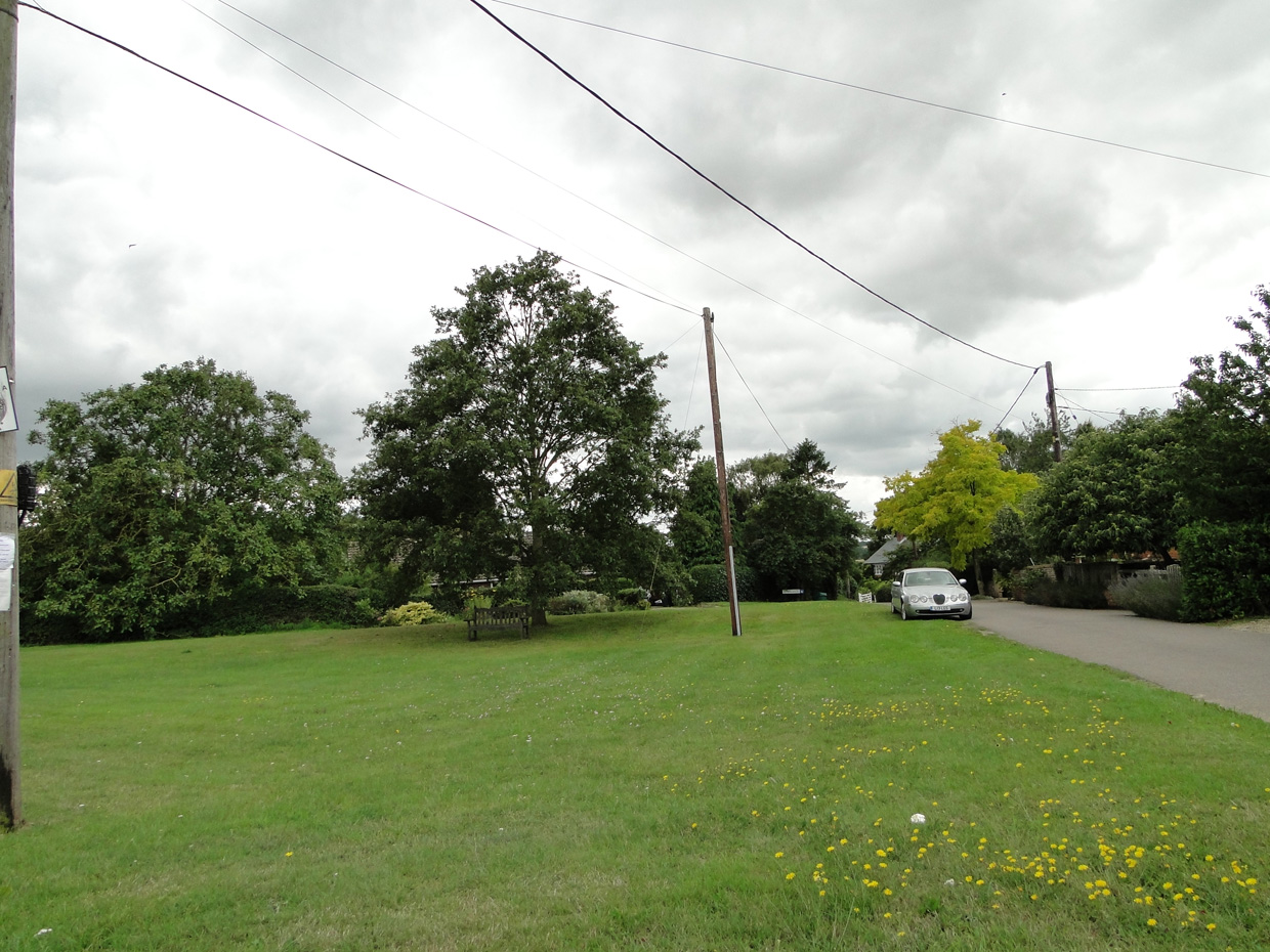 📷 5
📷 5More viewpoints in this region
 📷 5
📷 5 📷 5
📷 5 📷 5
📷 5 📷 5
📷 5Frequently asked questions
- Where is Landscape Lens'?
- Landscape Lens' is in Essex, East of England, United Kingdom (postcode CO6 4DN), in the parish of Little Horkesley.
- What is Landscape Lens'?
- Landscape Lens' is a viewpoint in the United Kingdom.
- How do I get to Landscape Lens'?
- The nearest railway station is Bures, about 5.8 km away. The nearest town is Wormingford. Drivers can use postcode CO6 4DN.
- Is Landscape Lens' a protected site?
- Yes — Landscape Lens' is part of the Dedham Vale National Landscape (AONB).
- Is Landscape Lens' free to visit?
- Yes, Landscape Lens' is free to enter.
- How do I get to Landscape Lens'?
- The nearest railway station is Bures, about 5.8 km away. Drivers can navigate to postcode CO6 4DN.