
Towns & cities · South West England
Wickwar
Wickwar — village and civil parish in Gloucestershire, UK.

Wikimedia Commons contributors — see linked file page for photographer and licence licence

Plan your visit
- Typical visit
- 3 h–6 h
- Nearest railway station
- Yate · 6.4 km
- Free entry
- Family-friendly
- Dog-friendly
About
Wickwar is a town, city, village or settlement in the United Kingdom. Recent population estimates put it at around 1,943 people. Address: GL12. Wikidata describes it as: "village and civil parish in Gloucestershire, UK". Coordinates: 51.5950°, -2.3980°.
Photo gallery
See it from the streetimagery from 2024
Imagery © Mapillary contributors, CC BY-SA 4.0
Official information
Wickwar is a location that focuses on online casino games, providing players with various options to enjoy gambling without the need to visit physical casinos. It offers free play modes and bonuses to attract both new and experienced players, allowing them to test games without financial risk.
Protected designations
- Area of Outstanding Natural Beauty: Cotswolds
- Ramsar wetland: Severn Estuary
Designations sourced from Natural England open data under OGL v3.
From the Wikipedia article
Wickwar is a village and civil parish in Gloucestershire, England, located between Yate and Charfield. At the 2021 census, the parish had a population of 2,083.
Excerpt from Wikipedia under CC BY-SA 4.0. See the source article linked in Sources below.
Background
History
Wickwar was mentioned in the Domesday Book of 1086, where it appears as "Wichen", from the Old English (aet) wicum, meaning "(at) the dwellings". The manor was given to John la Warre by King John and was held by Roger la Warre in 1285, when it was referred to as "Warre Wyke". Warre is a Norman family name which gave its name to Wickwar. The village lay on the Old Saltway from Droitwich to Old Sodbury and Pucklechurch, and was developed in the 13th century by the de la Warre family with the establishment of a market in 1285. The main street, the present High Street, was laid out around the market place with uniform burgage plots and rear access lanes. Burghers paid an annual fixed rent to…
Sourced from Wikipedia under CC BY-SA 4.0.
- Coordinates
- 51.5950, -2.3980
- District
- South Gloucestershire
- Parish
- Wickwar
- Postcode
- GL12
- Parliamentary constituency
- Thornbury and Yate
- Population
- 1,943
- Nearest railway station
- Yate — 6.4 km
- Official site
- www.wickwar.org
Sources
- wikidata: Q1222802 (CC0)
- wikipedia: Wickwar (CC BY-SA 4.0)
- commons: 2011 - B4060 Wickwar High Street - geograph.org.uk - 2525258.jpg (CC BY-SA 4.0)
Other places nearby

Wickwar War Memorial
Memorials & monuments · 0.4 km

Single-span bridge called Horse Bridge 260m WSW of Chase Hill House
Historic bridges · 0.5 km

WW2 Pillbox
Historic houses · 0.5 km

Bridge At National Grid Reference 7129 8760
Historic bridges · 1.6 km

Bridge At National Grid Reference St 7094 8718
Historic bridges · 2.1 km
St James' Church, Charfield
Historic churches · 2.6 km

Little Wood Caravan Park
Campsites · 3.0 km

Charfield War Memorial
Memorials & monuments · 3.7 km

Cromhall
Villages · 3.7 km

The Lake
Reservoirs & lochs · 3.8 km
The Lake
Wild swimming spots · 3.8 km

Charfield Hill
Mountains & hills · 3.8 km
Wickwar is a town located in South West England. Visitors can explore St James' Church in Charfield and the Somerset Monument. The area also features several historic bridges, including Horse Bridge.
At a glance
- Population
- 1,943
- Constituency
- Thornbury and Yate
- Top categories near here
Things to see in Wickwar
10 attractions within 12 km. Full guide: things to do in Wickwar →
 📷 5
📷 5Memorials & monuments · South West England
Somerset Monument
Somerset Monument is a memorial in the United Kingdom.
📷 5Historic houses · South West England
WW2 Pillbox
WW2 Pillbox — a historic house in england-south-east, United Kingdom.
📷 5Historic bridges · South West England
Bridge At National Grid Reference 7129 8760
Bridge At National Grid Reference 7129 8760 — Grade II listed building-listed bridge in england-south-east, United Kingdom.
📷 5Historic bridges · South West England
Bridge At National Grid Reference St 7094 8718
Bridge At National Grid Reference St 7094 8718 — Grade II listed building-listed bridge in england-south-east, United Kingdom.
📷 5Historic bridges · South West England
Single-span bridge called Horse Bridge 260m WSW of Chase Hill House
Single-span bridge called Horse Bridge 260m WSW of Chase Hill House — scheduled monument-listed bridge in england-south-east, United Kingdom.
📷 5Memorials & monuments · South West England
Wickwar War Memorial
Wickwar War Memorial — a memorial in england-south-east, United Kingdom.
📷 5Campsites · South West England
Little Wood Caravan Park
Little Wood Caravan Park — a campsite in england south east.
 📷 5
📷 5Campsites · South West England
Oakfield Farm Camping
Oakfield Farm Camping — a campsite in england south east.
 📷 5📷 3
Historic churches · South West England
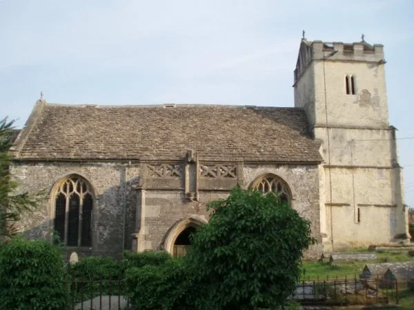
St James' Church, Charfield
St James' Church, Charfield — church in Charfield, South Gloucestershire, England, UK.
Nearby
📷 5Memorials & monuments · South West England
Wickwar War Memorial
Wickwar War Memorial — a memorial in england-south-east, United Kingdom.
📷 5Historic bridges · South West England
Single-span bridge called Horse Bridge 260m WSW of Chase Hill House
Single-span bridge called Horse Bridge 260m WSW of Chase Hill House — scheduled monument-listed bridge in england-south-east, United Kingdom.
📷 5Historic houses · South West England
WW2 Pillbox
WW2 Pillbox — a historic house in england-south-east, United Kingdom.
📷 5Historic bridges · South West England
Bridge At National Grid Reference 7129 8760
Bridge At National Grid Reference 7129 8760 — Grade II listed building-listed bridge in england-south-east, United Kingdom.
📷 5Historic bridges · South West England
Bridge At National Grid Reference St 7094 8718
Bridge At National Grid Reference St 7094 8718 — Grade II listed building-listed bridge in england-south-east, United Kingdom.
📷 3Historic churches · South West England
St James' Church, Charfield
St James' Church, Charfield — church in Charfield, South Gloucestershire, England, UK.
Where to eat & stay near Wickwar
Places to stay
📷 5Campsites · South West England
Little Wood Caravan Park
Little Wood Caravan Park — a campsite in england south east.
📷 5Campsites · South West England
Oakfield Farm Camping
Oakfield Farm Camping — a campsite in england south east.
 📷 5
📷 5Hotels · South West England
Tortworth Court Hotel
Tortworth Court Hotel — a hotel in england west midlands.
 📷 5
📷 5Hotels · South West England
Swan Hotel
Swan Hotel — a hotel in england west midlands.
 📷 7📷 5
Hotels · South West England
Rounceval House Hotel
Rounceval House Hotel — a hotel in england south east.
Places to eat & drink
 📷 7
📷 7Historic pubs · South West England
The Duke Of Beaufort Public House
The Duke Of Beaufort Public House in England South West, United Kingdom.
 📷 7
📷 7 📷 5
📷 5 📷 7
📷 7Cafés · South West England
The Cake Collective
The Cake Collective — a café in england west midlands.
 📷 5
📷 5Historic pubs · South West England
Ancient Ram Inn
Ancient Ram Inn in England South West, United Kingdom.
 📷 7
📷 7More towns in this region
 Flagship📷 10
Towns & cities · South West England
Shoscombe
Shoscombe — village and civil parish in Somerset, UK.
 Flagship📷 10
Towns & cities · South West England
Tarrant Keyneston
Tarrant Keyneston — village and civil parish in Dorset, United Kingdom.
 📷 5
📷 5 📷 5
📷 5Towns & cities · South West England
Arne
Arne — village in Purbeck, Dorset, United Kingdom.
Frequently asked questions
- Where is Wickwar?
- Wickwar is in South-West England, United Kingdom (postcode GL12), in the parish of Wickwar.
- What is Wickwar?
- Wickwar — village and civil parish in Gloucestershire, UK.
- How do I get to Wickwar?
- The nearest railway station is Yate, about 6.4 km away. Drivers can use postcode GL12.
- Is Wickwar a protected site?
- Yes — Wickwar is part of the Cotswolds National Landscape (AONB) and the Severn Estuary Ramsar wetland.
- Is Wickwar free to visit?
- Yes, Wickwar is free to enter.
- How do I get to Wickwar?
- The nearest railway station is Yate, about 6.4 km away. Drivers can navigate to postcode GL12.