
Historic bridges · South West England
Bridge At National Grid Reference St 7094 8718
In or near Wickwar.
Bridge At National Grid Reference St 7094 8718 — Grade II listed building-listed bridge in england-south-east, United Kingdom.

Steve F — CC BY-SA 2.0 via Wikimedia Commons licence

Plan your visit
- Typical visit
- 15 min–30 min
- Nearest railway station
- Yate · 4.7 km
- Free entry
- Dog-friendly
Getting there & planning your visit
The nearest railway station to the Bridge at National Grid Reference St 7094 8718 is Yate, which is 4.7 km away. Entry to the bridge is free. The postcode for the location is GL12 8PD.
About
Bridge At National Grid Reference St 7094 8718 is a Grade II listed building-listed bridge in england-south-east, United Kingdom, registered on the National Heritage List for England (NHLE entry 1128775). Listed status protects buildings and structures of special architectural or historic interest. See the linked Wikipedia article for further details.
Photo gallery
See it from the streetimagery from 2024
Imagery © Mapillary contributors, CC BY-SA 4.0
Heritage listing
Details ST 78 NW YATE 4/261 Bridge at NGR ST 7094 8718 - II Road bridge over the railway. Circa 1843 for the Bristol and Gloucestershire Railway; engineer, I.K. Brunel. Coursed squared rubble. Single segmental arch with ashlar voussoirs. Buttressed abutments. Coped parapet. The line was opened in 1844 and completed the through route from Newcastle to Exeter. Listing NGR: ST7094887181 Legacy The contents of this record have been generated from a legacy data system. Legacy System number: 34895 Legacy System: LBS
From the Historic England List Entry under OGL v3.
Protected designations
- Area of Outstanding Natural Beauty: Cotswolds
- Ramsar wetland: Severn Estuary
Designations sourced from Natural England open data under OGL v3.
Place summary
The Bridge at National Grid Reference St 7094 8718 is a Grade II listed bridge located in Wickwar, South-East England. This designation highlights its architectural and historical significance within the region.
AI-generated from the structured facts on this page (operator, designation, listing, era). Not a substitute for visiting.
- Coordinates
- 51.5827, -2.4207
- District
- South Gloucestershire
- Parish
- Wickwar
- Postcode
- GL12 8PD
- Parliamentary constituency
- Thornbury and Yate
- Nearest railway station
- Yate — 4.7 km
Sources
- wikidata: Q26421637 (CC0)
Other places nearby

Bridge At National Grid Reference 7129 8760
Historic bridges · 0.5 km

WW2 Pillbox
Historic houses · 1.5 km

Wickwar
Towns & cities · 2.1 km

Wickwar War Memorial
Memorials & monuments · 2.2 km

Little Wood Caravan Park
Campsites · 2.4 km

Single-span bridge called Horse Bridge 260m WSW of Chase Hill House
Historic bridges · 2.5 km

Rangeworthy
Towns & cities · 2.7 km

Priestwood Roman Villa
Roman villas · 3.5 km

Sodbury Camp, Barnhill Quarry
Vineyards · 3.6 km

Cromhall
Villages · 3.6 km
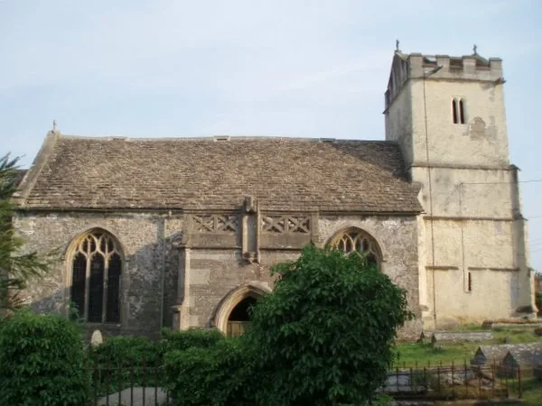
St James' Church, Charfield
Historic churches · 4.0 km

Tytherington War Memorial
Memorials & monuments · 4.2 km
Nearby
📷 5Historic bridges · South West England
Bridge At National Grid Reference 7129 8760
Bridge At National Grid Reference 7129 8760 — Grade II listed building-listed bridge in england-south-east, United Kingdom.
📷 5Historic houses · South West England
WW2 Pillbox
WW2 Pillbox — a historic house in england-south-east, United Kingdom.
📷 5Towns & cities · South West England
Wickwar
Wickwar — village and civil parish in Gloucestershire, UK.
📷 5Memorials & monuments · South West England
Wickwar War Memorial
Wickwar War Memorial — a memorial in england-south-east, United Kingdom.
📷 5Campsites · South West England
Little Wood Caravan Park
Little Wood Caravan Park — a campsite in england south east.
📷 5Historic bridges · South West England
Single-span bridge called Horse Bridge 260m WSW of Chase Hill House
Single-span bridge called Horse Bridge 260m WSW of Chase Hill House — scheduled monument-listed bridge in england-south-east, United Kingdom.
Where to eat & stay near Bridge At National Grid Reference St 7094 8718
Places to stay
📷 5Campsites · South West England
Little Wood Caravan Park
Little Wood Caravan Park — a campsite in england south east.
 📷 5
📷 5Campsites · South West England
Oakfield Farm Camping
Oakfield Farm Camping — a campsite in england south east.
 📷 7📷 5
Hotels · South West England
Rounceval House Hotel
Rounceval House Hotel — a hotel in england south east.
 📷 5
📷 5Hotels · South West England
Tortworth Court Hotel
Tortworth Court Hotel — a hotel in england west midlands.
 📷 5
📷 5Hotels · South West England
Swan Hotel
Swan Hotel — a hotel in england west midlands.
Places to eat & drink
📷 7 📷 7📷 7
 📷 7
📷 7Historic pubs · South West England
The Duke Of Beaufort Public House
The Duke Of Beaufort Public House in England South West, United Kingdom.
 📷 7
📷 7 📷 5
📷 5More bridges in this region
 📷 5
📷 5Historic bridges · South West England
Avoncliff Aqueduct
Avoncliff Aqueduct is a historic bridge in the United Kingdom.
📷 5Historic bridges · South West England
Avoncliff Aqueduct
Avoncliff Aqueduct is a historic bridge in the United Kingdom.
 📷 5
📷 5Historic bridges · South West England
Bradford Viaduct
Bradford Viaduct is a historic bridge in the United Kingdom.
 📷 5
📷 5Historic bridges · South West England
Chippenham Viaduct
Chippenham Viaduct is a historic bridge in the United Kingdom.
Frequently asked questions
- Where is Bridge At National Grid Reference St 7094 8718?
- Bridge At National Grid Reference St 7094 8718 is in South-East England, United Kingdom (postcode GL12 8PD), in the parish of Wickwar.
- What is Bridge At National Grid Reference St 7094 8718?
- Bridge At National Grid Reference St 7094 8718 — Grade II listed building-listed bridge in england-south-east, United Kingdom.
- How do I get to Bridge At National Grid Reference St 7094 8718?
- The nearest railway station is Yate, about 4.7 km away. Drivers can use postcode GL12 8PD.
- Is Bridge At National Grid Reference St 7094 8718 a listed building?
- Bridge At National Grid Reference St 7094 8718 is officially recognised as Grade II listed building listed.
- Is Bridge At National Grid Reference St 7094 8718 a protected site?
- Yes — Bridge At National Grid Reference St 7094 8718 is part of the Cotswolds National Landscape (AONB) and the Severn Estuary Ramsar wetland.
- Is Bridge At National Grid Reference St 7094 8718 free to visit?
- Yes, Bridge At National Grid Reference St 7094 8718 is free to enter.
- How do I get to Bridge At National Grid Reference St 7094 8718?
- The nearest railway station is Yate, about 4.7 km away. Drivers can navigate to postcode GL12 8PD.