Natural landmarks · North East England
Whaw
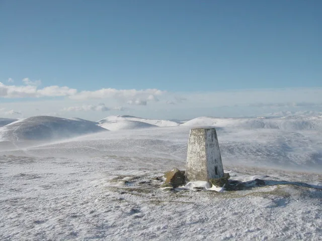
In or near Arkle Town.
Whaw in England North East, United Kingdom.

Gordon Hatton — CC BY-SA 2.0 via Wikimedia Commons licence
Plan your visit
- Typical visit
- 1 h–2 h
- Free entry
- Dog-friendly
About
Whaw is a place of interest in England North East, United Kingdom — drawn from open-data sources for visitor reference. See the linked Wikipedia article for the full description.
Photo gallery
Protected designations
- Site of Special Scientific Interest: Arkle Beck Meadows, Whaw SSSI
- Site of Special Scientific Interest: Arkengarthdale, Gunnerside and Reeth Moors SSSI
- Area of Outstanding Natural Beauty: North Pennines
Designations sourced from Natural England open data under OGL v3.
From the Wikipedia article
Whaw is a hamlet in Arkengarthdale in North Yorkshire, England. It is one of few settlements in the dale and is one of the smallest. Its name derives from the Old Norse of Kvi and Hagi, which means the enclosure of the sheep. It is about 2 miles (3.2 km) north of Langthwaite and 5 miles (8 km) north west of Reeth. The adjacent Arkle Beck Meadows form a Site of Special Scientific Interest. The hillsides around Whaw are scarred with the remnants of lead mining and former hushes are still in evidence. During the 18th and 19th centuries, the hamlet was (and the whole of Arkengarthdale) were subject to a higher population because of the miners working in the hills. In 1840, a Wesleyan chapel was built in Whaw, this survives but no longer as a religious house. The 1851 census counted 18 houses in Whaw. In the 2011 census, Whaw was counted in Arkengarthdale Parish as having 231 residents overall. From 1974 to 2023 it was part of the district of Richmondshire, it is now administered by the unitary North Yorkshire Council.
Excerpt from Wikipedia under CC BY-SA 4.0. See the source article linked in Sources below.
- Coordinates
- 54.4379, -2.0250
- District
- North Yorkshire
- Parish
- Arkengarthdale
- Postcode
- DL11 6RP
- Parliamentary constituency
- Richmond and Northallerton
Sources
Other places nearby

Arkle Beck Meadows, Whaw
Wildlife reserves · 0.6 km

Kitley Hill
Mountains & hills · 0.7 km

Arkengarthdale
Museums · 1.5 km

Old Smelting Mill
Archaeological sites · 1.6 km
Lead Flue
Historic houses · 1.6 km

Old Powder Magazine
Mines & mining heritage · 1.9 km

Eskeleth
National parks · 2.8 km

Arkengarthdale Cenotaph
Memorials & monuments · 2.8 km

Windegg Mine Caverns
Caves · 2.8 km

Great Pinseat
Mountains & hills · 2.9 km

Low Eskeleth
Villages · 2.9 km

Langthwaite
National parks · 2.9 km
Nearby
📷 3Wildlife reserves · North East England
Arkle Beck Meadows, Whaw
Arkle Beck Meadows, Whaw in England North East, United Kingdom.
📷 5Mountains & hills · North East England
Kitley Hill
Kitley Hill — mountain in england north west. Elevation: 445 m.
📷 4📷 3Archaeological sites · North East England
Old Smelting Mill
Old Smelting Mill — a archaeological in england-north-west, United Kingdom.
📷 3Historic houses · North East England
Lead Flue
Lead Flue — a historic house in england-north-west, United Kingdom.
📷 4Mines & mining heritage · North East England
Old Powder Magazine
Old Powder Magazine in England North East, United Kingdom.
Where to eat & stay near Whaw
Places to stay
 📷 5
📷 5Hotels · Yorkshire & the Humber
The Punch Bowl
The Punch Bowl — a hotel in england north west.
 📷 5
📷 5Campsites · Yorkshire & the Humber
Scabba Wath Campsite
Scabba Wath Campsite — a campsite in england yorkshire.
 📷 5
📷 5 📷 5
📷 5 📷 5
📷 5Hotels · Yorkshire & the Humber
The Kings Arms
The Kings Arms — a hotel in england yorkshire.
 📷 5
📷 5Campsites · Yorkshire & the Humber
Orchard Caravan And Camping Park
Orchard Caravan And Camping Park — a campsite in england yorkshire.
Places to eat & drink
 📷 5
📷 5 📷 5
📷 5Historic pubs · Yorkshire & the Humber
Kings Head Inn
Kings Head Inn in England North West, United Kingdom.
 📷 5
📷 5 📷 5
📷 5Historic pubs · North East England
Milbank Arms
Milbank Arms in England North East, United Kingdom.
 📷 5
📷 5Historic pubs · North East England
Blue Bell Public House
Blue Bell Public House in England North East, United Kingdom.
 📷 5
📷 5Historic pubs · North East England
The White Swan Public House And Swan Cottage
The White Swan Public House And Swan Cottage in England North East, United Kingdom.
More natural landmarks in this region
 📷 4
📷 4Natural landmarks · North East England
Cleveland Way
109-mile horseshoe trail around the North York Moors and its sea cliffs.
 📷 3
📷 3Natural landmarks · North East England
The Hand Stone
The Hand Stone — a other in england-yorkshire, United Kingdom.
 📷 3
📷 3Natural landmarks · North East England
The Face Stone
The Face Stone — a other in england-yorkshire, United Kingdom.
 📷 3
📷 3Frequently asked questions
- Where is Whaw?
- Whaw is in North-East England, United Kingdom (postcode DL11 6RP), in the parish of Arkengarthdale.
- What is Whaw?
- Whaw in England North East, United Kingdom.
- How do I get to Whaw?
- Drivers can use postcode DL11 6RP.
- Is Whaw a protected site?
- Yes — Whaw is part of the Arkle Beck Meadows, Whaw SSSI Site of Special Scientific Interest and the Arkengarthdale, Gunnerside and Reeth Moors SSSI Site of Special Scientific Interest.
- Is Whaw free to visit?
- Yes, Whaw is free to enter.
- How do I get to Whaw?
- Drivers can navigate to postcode DL11 6RP. It sits within the Richmond and Northallerton parliamentary constituency.