
National parks · North East England
Langthwaite
In or near Arkle Town.
Langthwaite in England North East, United Kingdom.

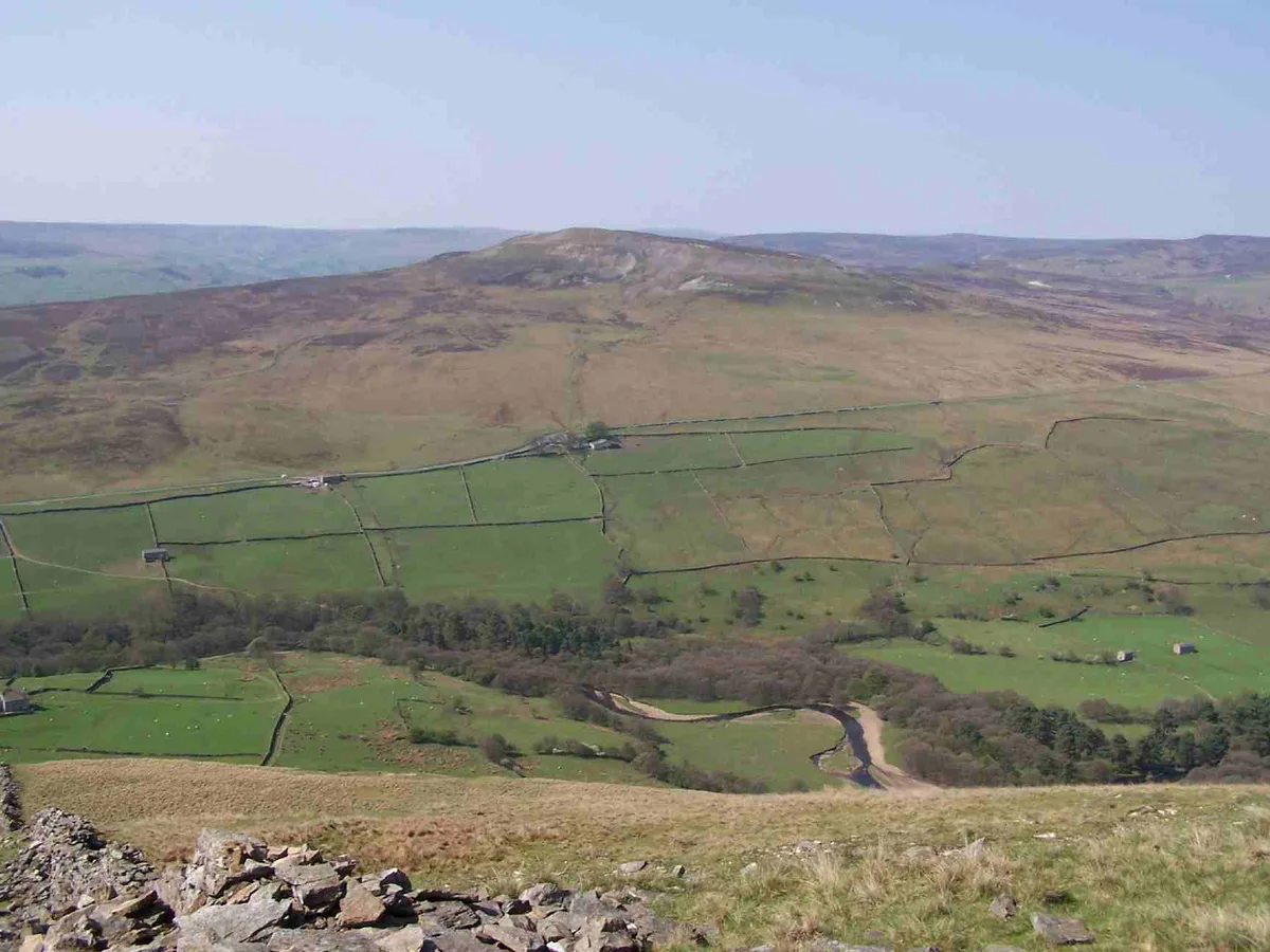
Maigheach-gheal — CC BY-SA 2.0 via Wikimedia Commons licence

Plan your visit
- Typical visit
- 4 h–8 h
- Best time of year
- Spring – autumn (Apr–Oct)
- Free entry
- Family-friendly
- Dog-friendly
About
Langthwaite is a place of interest in England North East, United Kingdom — drawn from open-data sources for visitor reference. See the linked Wikipedia article for the full description.
Photo gallery
Protected designations
- Site of Special Scientific Interest: Arkengarthdale, Gunnerside and Reeth Moors SSSI
Designations sourced from Natural England open data under OGL v3.
From the Wikipedia article
Langthwaite is one of the few villages in Arkengarthdale, North Yorkshire, England. It is 3.5 miles (5.6 km) north of Reeth and sits 870 feet (270 m) above sea level. It is the main settlement in the dale and is one of the most northerly settlements in the whole of Yorkshire Dales National Park. Langthwaite is one of two places in the dale that have houses clustered together closely in a traditional village set up; the rest of the settlements in the dale are populated by scattered buildings. It is home to a pub ('The Red Lion'), a shop and St Mary the Virgin's Church of 1818, Langthwaite is also home to the grade II* listed hexagonal Old Powder House, built in 1807 to store gunpowder used in the many mines dotted around the area. The 1851 census counted 48 houses in Langthwaite. The village was used for the filming of several scenes in the television series All Creatures Great and Small. The Red Lion was featured in the episode "Every Dog Has His Day" but was made out to be in fictional Briston, while the frontage of the fictional J. R. Stubbs provisions store and the bridge which Siegfried Farnon and James Herriot drive over, featured in the opening credits of the later series, are also in the village. Another TV series, Century Falls, also featured Langthwaite. The 1976 Disney film Escape from the Dark was partly filmed in Langthwaite and around Arkengarthdale. The name of the village is Old Norse in origin and means 'the long meadow' or 'the long clearing'.
Excerpt from Wikipedia under CC BY-SA 4.0. See the source article linked in Sources below.
- Coordinates
- 54.4179, -1.9953
- District
- North Yorkshire
- Parish
- Arkengarthdale
- Postcode
- DL11 6EL
- Parliamentary constituency
- Richmond and Northallerton
Sources
- wikidata: Q6486568 (CC0)
- wikipedia: Langthwaite (CC BY-SA 4.0)
Other places nearby

Arkengarthdale Cenotaph
Memorials & monuments · 0.1 km

Arkle Town
Towns & cities · 0.2 km

Low Eskeleth
Villages · 0.3 km

Eskeleth
National parks · 0.3 km

Old Powder Magazine
Mines & mining heritage · 1.1 km

Booze
Historic pubs · 1.1 km

Lead Flue
Historic houses · 1.3 km
Old Smelting Mill
Archaeological sites · 1.4 km

Washy Green Lead Mine
Archaeological sites · 2.1 km

Prostrate Cross
Memorials & monuments · 2.4 km
Calver Hill
Mountains & hills · 2.4 km

Arkle Beck Meadows, Whaw
Wildlife reserves · 2.6 km
Nearby
📷 3Memorials & monuments · Yorkshire & the Humber
Arkengarthdale Cenotaph
Arkengarthdale Cenotaph is a memorial in the United Kingdom.
📷 4📷 5📷 4📷 4Mines & mining heritage · North East England
Old Powder Magazine
Old Powder Magazine in England North East, United Kingdom.
📷 5Where to eat & stay near Langthwaite
Places to stay
 📷 5
📷 5Campsites · Yorkshire & the Humber
Scabba Wath Campsite
Scabba Wath Campsite — a campsite in england yorkshire.
 📷 5
📷 5 📷 5
📷 5Hotels · Yorkshire & the Humber
The Punch Bowl
The Punch Bowl — a hotel in england north west.
 📷 5
📷 5 📷 5
📷 5Hotels · Yorkshire & the Humber
The Kings Arms
The Kings Arms — a hotel in england yorkshire.
 📷 5
📷 5Campsites · Yorkshire & the Humber
Orchard Caravan And Camping Park
Orchard Caravan And Camping Park — a campsite in england yorkshire.
Places to eat & drink
📷 5 📷 5
📷 5Historic pubs · Yorkshire & the Humber
Kings Head Inn
Kings Head Inn in England North West, United Kingdom.
 📷 5
📷 5Historic pubs · North East England
Milbank Arms
Milbank Arms in England North East, United Kingdom.
 📷 5
📷 5 📷 5
📷 5Historic pubs · North East England
Blue Bell Public House
Blue Bell Public House in England North East, United Kingdom.
 📷 5
📷 5Historic pubs · North East England
The White Swan Public House And Swan Cottage
The White Swan Public House And Swan Cottage in England North East, United Kingdom.
More national parks in this region
 📷 4
📷 4 📷 4
📷 4National parks · North East England
Mallerstang
Mallerstang in England North East, United Kingdom.
 📷 4
📷 4National parks · North East England
Kisdon Force
Kisdon Force in England North East, United Kingdom.
 📷 4
📷 4Frequently asked questions
- Where is Langthwaite?
- Langthwaite is in North-East England, United Kingdom (postcode DL11 6EL), in the parish of Arkengarthdale.
- What is Langthwaite?
- Langthwaite in England North East, United Kingdom.
- How do I get to Langthwaite?
- Drivers can use postcode DL11 6EL.
- Is Langthwaite a protected site?
- Yes — Langthwaite is part of the Arkengarthdale, Gunnerside and Reeth Moors SSSI Site of Special Scientific Interest.
- Is Langthwaite free to visit?
- Yes, Langthwaite is free to enter.
- How do I get to Langthwaite?
- Drivers can navigate to postcode DL11 6EL. It sits within the Richmond and Northallerton parliamentary constituency.