
Canals · South East England
Wey and Arun Canal
In or near Alfold.
Wey and Arun Canal — canal in the south east of England.

Wikimedia Commons contributors — see linked file page for photographer and licence licence

Plan your visit
- Typical visit
- 1 h–2 h
- Nearest railway station
- Witley · 8.9 km
- Free entry
- Dog-friendly
Getting there & planning your visit
To visit the Wey and Arun Canal, the nearest railway station is Witley, located 8.9 km away. The postcode for the canal is GU6 8HZ. Entry is free.
About
Wey and Arun Canal is a canal in the United Kingdom. Wikidata describes it as: "canal in the south east of England". Coordinates: 51.1159°, -0.5212°.
Photo gallery
Protected designations
- National Nature Reserve: WEALDEN HEATHS
- Area of Outstanding Natural Beauty: Surrey Hills
Designations sourced from Natural England open data under OGL v3.
From the Wikipedia article
The Wey and Arun Canal is a partially open, 23-mile-long (37-kilometre) canal in the southeast of England. It runs southwards from the River Wey at Gunsmouth in Shalford, Surrey to the River Arun at Pallingham, in West Sussex. The canal comprises parts of two separate undertakings – the northern part of the Arun Navigation, opened in 1787 between Pallingham and Newbridge Wharf, and the Wey and Arun Junction Canal, opened in 1816, which connected the Arun at Newbridge to the Godalming Navigation near Shalford, south of Guildford. The Arun Navigation was built with three locks and one turf-sided flood lock. The Junction Canal was built with 23 locks Passing through a rural landscape, there was little freight traffic to justify its continued existence – the canal was officially abandoned in 1871. Without maintenance, the canal gradually became derelict over much of its length. However, since 1970, restoration by the Wey & Arun Canal Trust has led to several miles being restored to the standard navigable by narrowboats and small tour barges. Work is continuing, with the ultimate aim of reopening the entire canal to navigation.
Excerpt from Wikipedia under CC BY-SA 4.0. See the source article linked in Sources below.
Background
Description
The hump-backed road bridge at Loxwood was removed and in-filled in 1905, (to be confirmed) severing the canal in two and leaving a major obstacle to restoration. The last boat passed under the bridge in 1869. Modern regulations prevented the installation of a replacement hump-backed bridge, so restoration required the canal to burrow underneath, leaving the road at its existing level. This was a major engineering exercise, achieved by lowering a 440 yd length of canal so that there is adequate headroom for a boat to pass under the road. At the southern end of the length, Brewhurst Lock was reconstructed reducing its fall to 2 ft from the original drop of 8 ft, and hence lowering the level…
Sourced from Wikipedia under CC BY-SA 4.0.
- Coordinates
- 51.1159, -0.5212
- County
- Surrey
- District
- Waverley
- Parish
- Alfold
- Postcode
- GU6 8HZ
- Parliamentary constituency
- Godalming and Ash
- Established
- 1790
- Nearest railway station
- Witley — 8.9 km
Sources
- wikidata: Q7990274 (CC0)
- wikipedia: Wey and Arun Canal (CC BY-SA 4.0)
- commons: Lordings Lock waterwheel.JPG (CC BY-SA 4.0)
Other places nearby

Fast Bridge Over The Wey And Arun Canal
Historic bridges · 0.7 km

Camp / embankment (on aerial)
Archaeological sites · 2.0 km

Utworth Manor
Manor houses · 2.2 km

Church of St Nicholas
Historic churches · 2.2 km

Alfold War Memorial
Memorials & monuments · 2.3 km
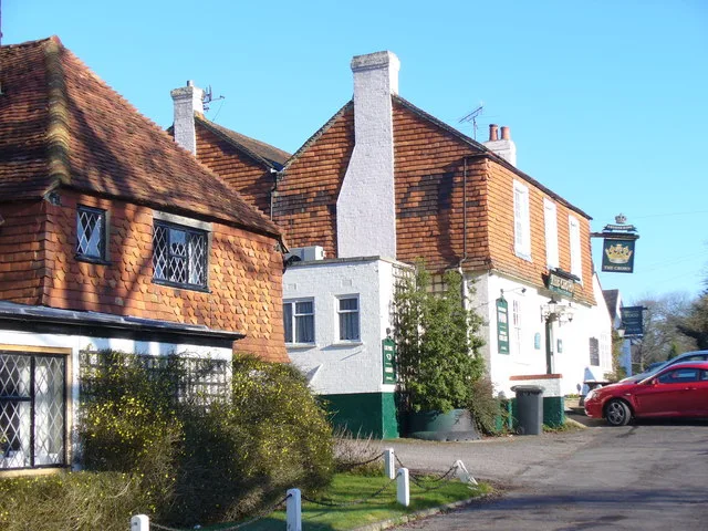
Alfold
Towns & cities · 2.3 km

Dunsfold Collection
Museums · 2.7 km

Dunsfold
Villages · 2.9 km
Dunsfold War Memorial and surrounding enclosure
Memorials & monuments · 2.9 km

Surrey Hills Wood Carving
Public art & sculpture · 3.0 km

Rydinghurst
Manor houses · 3.1 km

Smithbrook Manor
Manor houses · 3.3 km
Nearby
📷 5Historic bridges · South East England
Fast Bridge Over The Wey And Arun Canal
Fast Bridge Over The Wey And Arun Canal — Grade II listed building-listed bridge in england-south-east, United Kingdom.
📷 5Archaeological sites · South East England
Camp / embankment (on aerial)
Camp / embankment (on aerial) — an archaeological site in South East England, United Kingdom.
📷 5Manor houses · South East England
Utworth Manor
Utworth Manor — a manor in South East England, United Kingdom.
📷 5Historic churches · South East England
Church of St Nicholas
Church of St Nicholas — church in Alfold, Surrey, England, UK.
📷 5Memorials & monuments · South East England
Alfold War Memorial
Alfold War Memorial — Grade II listed building-listed memorial in england-south-east, United Kingdom.
Flagship📷 10Towns & cities · South East England
Alfold
Alfold — a village located in Waverley, United Kingdom.
Where to eat & stay near Wey and Arun Canal
Places to stay
 📷 5
📷 5 📷 5
📷 5Campsites · South East England
Shadow Woods (Yurts)
Shadow Woods (Yurts) — a campsite in england south east.
 📷 5
📷 5Campsites · South East England
Bentley Copse Activity Centre
Bentley Copse Activity Centre — a campsite in england south east.
 📷 5
📷 5Caravan parks · South East England
Slinfold Caravan Club Site
Slinfold Caravan Club Site — a caravan park in england south east.
 📷 5
📷 5Caravan parks · South East England
Edgeley Holiday Park
Edgeley Holiday Park — a caravan park in england south east.
 📷 5
📷 5Hotels · South East England
The Kings Arms and Royal Hotel
The Kings Arms and Royal Hotel — a hotel in england south east.
Places to eat & drink
 📷 7
📷 7Historic pubs · South East England
The Blue Ship Public House
The Blue Ship Public House in England South East, United Kingdom.
 📷 5
📷 5Cafés · South East England
Hambledon Village Shop
Hambledon Village Shop — a café in england south east. Cuisine: coffee shop;sandwich.
 📷 5
📷 5Historic pubs · South East England
The Scarlett Arms Public House
The Scarlett Arms Public House in England South East, United Kingdom.
 📷 5
📷 5Historic pubs · South East England
The Chequers Inn Public House
The Chequers Inn Public House in England South East, United Kingdom.
 📷 7
📷 7Historic pubs · South East England
The Star Public House
The Star Public House in England South East, United Kingdom.
 📷 7
📷 7Historic pubs · South East England
The Richmond Arms Public House
The Richmond Arms Public House in England South East, United Kingdom.
More places in this region
 📷 5
📷 5Canals · South East England
Thames and Medway Canal
Thames and Medway Canal — disused canal in Kent, England.
 📷 5
📷 5 📷 5
📷 5Canals · South East England
Basingstoke Canal
Basingstoke Canal is a canal in the United Kingdom.
 📷 5
📷 5Frequently asked questions
- Where is Wey and Arun Canal?
- Wey and Arun Canal is in Surrey, South-East England, United Kingdom (postcode GU6 8HZ), in the parish of Alfold.
- What is Wey and Arun Canal?
- Wey and Arun Canal — canal in the south east of England.
- How do I get to Wey and Arun Canal?
- The nearest railway station is Witley, about 8.9 km away. The nearest town is Alfold. Drivers can use postcode GU6 8HZ.
- When was Wey and Arun Canal built?
- Built or established in 1790.
- Is Wey and Arun Canal a protected site?
- Yes — Wey and Arun Canal is part of the WEALDEN HEATHS National Nature Reserve and the Surrey Hills National Landscape (AONB).
- Is Wey and Arun Canal free to visit?
- Yes, Wey and Arun Canal is free to enter.
- How do I get to Wey and Arun Canal?
- Drivers can navigate to postcode GU6 8HZ. It sits within the Godalming and Ash parliamentary constituency.