
Canals · South East England
Basingstoke Canal
In or near Pirbright.
Basingstoke Canal is a canal in the United Kingdom.

Wikimedia Commons contributors — see linked file page for photographer and licence licence

Plan your visit
- Typical visit
- 1 h–2 h
- Nearest railway station
- Brookwood · 1.4 km
- Free entry
- Dog-friendly
Getting there & planning your visit
To visit the Basingstoke Canal, the nearest railway station is Brookwood, located 1.4 km away. Entry to the canal is free, and it is accessible for visitors. The postcode for navigation is GU24 0NS.
About
Basingstoke Canal is a canal in the United Kingdom. Coordinates: 51.3028°, -0.6567°. This entry is part of The Great Britain Guide, a free, ad-free, open-data tourist directory.
Photo gallery
360° viewimagery from 2022
Imagery © Mapillary contributors, CC BY-SA 4.0
Protected designations
- Site of Special Scientific Interest: Basingstoke Canal SSSI
Designations sourced from Natural England open data under OGL v3.
From the Wikipedia article
The Basingstoke Canal is an English canal, completed in 1794, built to connect Basingstoke with the River Thames at Weybridge via the Wey Navigation. From Basingstoke, the canal passes through or near Greywell, North Warnborough, Odiham, Dogmersfield, Fleet, Farnborough Airfield, Aldershot, Mytchett, Brookwood, Knaphill and Woking. Its eastern end is at Byfleet, where it connects to the Wey Navigation. This, in turn, leads to the River Thames at Weybridge. Its intended purpose was to allow boats to travel from the docks in East London to Basingstoke. It was never a commercial success and, starting in 1950, a lack of maintenance allowed the canal to become increasingly derelict. After many years of neglect, restoration commenced in 1977 and on 10 May 1991 the canal was reopened as a fully navigable waterway from the River Wey to almost as far as the Greywell Tunnel. However its usage is currently still limited by low water supply and conservation issues.
Excerpt from Wikipedia under CC BY-SA 4.0. See the source article linked in Sources below.
Background
History
", these £100 shares crashed to £30 in 1800 and £5 in 1834.</small>]] | repeal_date = | amendments = | repealing_legislation = | related_legislation = | status = Amended | original_text = https://books.google.co.uk/books?id=FcAuAAAAIAAJ&pg=PA167 | collapsed = yes }} | type = Act | parliament = Parliament of Great Britain | long_title = An act for effectually carrying into execution an act of parliament of the eighteenth year of the reign of his present Majesty, for making a navigable canal from the town of Basingstoke, in the county of Southampton, to communicate with the river Wey, in the parish of Chertsey, in the county of Surrey, and to the south east side of the turnpike road, in the…
Architecture
Two sections of the canal totalling 101.3 ha are a Site of Special Scientific Interest and Nature Conservation Review site. These are the main length between Greywell and Brookwood Lye, and a short stretch between Monument Bridge and Scotland Bridge in Woking. It is the most botanically-rich aquatic area in England and flora include the nationally scarce hairlike pondweed and the nationally scarce tasteless water-pepper. The site is also nationally important for its invertebrates. There are 24 species of dragonfly and other species include two nationally rare Red Data Book insects. Eastwards from the mid point of the canal, it is surrounded by large areas of heathland. These are habitats…
Description
The canal is owned by both Hampshire County Council and Surrey County Council, with each authority owning the land within their jurisdiction. Until 1990, the two councils managed their own sections separately. It was decided that a central body should manage the entire waterway and the Basingstoke Canal Authority was formed. In 1993, the canal visitor centre at Mytchett was opened which now also acts as the central offices of the canal authority. The canal authority staff are employed, administered and supported by Hampshire County Council; however, the centre belongs to Surrey County Council. Each county council allocates revenue money to the canal authority, as well as the six riparian…
Sourced from Wikipedia under CC BY-SA 4.0.
- Coordinates
- 51.3028, -0.6567
- County
- Surrey
- District
- Guildford
- Parish
- Pirbright
- Postcode
- GU24 0NS
- Parliamentary constituency
- Surrey Heath
- Established
- 1794
- Nearest railway station
- Brookwood — 1.4 km
Sources
- wikidata: Q2935976 (CC0)
- wikipedia: Basingstoke Canal (CC BY-SA 4.0)
- commons: Woking-BasingstokeCanal.jpg (CC BY-SA 4.0)
Other places nearby

Cowshot Manor
Manor houses · 0.5 km

Military Field
Campsites · 0.7 km
Sergeant's mess
Campsites · 0.7 km

Inns of Court
Campsites · 0.8 km

Knowl Hill School
Natural landmarks · 0.9 km

National Rifle Association (United Kingdom)
Museums · 0.9 km

Sit Perpetuum Lawn
Campsites · 1.0 km
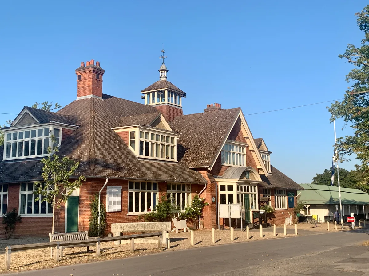
The Museum of The National Rifle Association
Museums · 1.0 km

Cross of Sacrifice
Memorials & monuments · 1.0 km

NRA Museum
Museums · 1.0 km

Maple Acre
Campsites · 1.0 km

Stone of Remembrance
Memorials & monuments · 1.0 km
Nearby
📷 5Manor houses · South East England
Cowshot Manor
Cowshot Manor — Grade II listed building-listed manor in england-south-east, United Kingdom.
📷 5📷 5📷 5📷 5Natural landmarks · South East England
Knowl Hill School
Knowl Hill School — a school heritage in england-south-east, United Kingdom.
📷 5Museums · South East England
National Rifle Association (United Kingdom)
The National Rifle Association (NRA) is the national governing body for fullbore rifle and pistol shooting sports in the United Kingdom founded in 1859. Its main activities includes organising civilia
Where to eat & stay near Basingstoke Canal
Places to stay
📷 5📷 5📷 5📷 5Campsites · South East England
Sit Perpetuum Lawn
Sit Perpetuum Lawn — a campsite in england south east.
📷 5 📷 5
📷 5Campsites · South East England
Furze Hill Camping Ground
Furze Hill Camping Ground — a campsite in england south east.
Places to eat & drink
 📷 7
📷 7 📷 5
📷 5Historic pubs · South East England
The Tumble Down Dick Pub
The Tumble Down Dick Pub in England South East, United Kingdom.
 📷 7
📷 7Historic pubs · South East England
Rodboro Buildings
Rodboro Buildings in England South East, United Kingdom.
 📷 7
📷 7Historic pubs · South East England
Horse And Groom Public House
Horse And Groom Public House in England South East, United Kingdom.
 📷 7
📷 7Historic pubs · South East England
The Angel Hotel
The Angel Hotel in England South East, United Kingdom.
 📷 7
📷 7More places in this region
 📷 5
📷 5Canals · South East England
Thames and Medway Canal
Thames and Medway Canal — disused canal in Kent, England.
 📷 5
📷 5 📷 5
📷 5 📷 5
📷 5Frequently asked questions
- Where is Basingstoke Canal?
- Basingstoke Canal is in Surrey, South-East England, United Kingdom (postcode GU24 0NS), in the parish of Pirbright.
- What is Basingstoke Canal?
- Basingstoke Canal is a canal in the United Kingdom.
- How do I get to Basingstoke Canal?
- The nearest railway station is Brookwood, about 1.4 km away. The nearest town is Pirbright. Drivers can use postcode GU24 0NS.
- When was Basingstoke Canal built?
- Built or established in 1794.
- Is Basingstoke Canal a protected site?
- Yes — Basingstoke Canal is part of the Basingstoke Canal SSSI Site of Special Scientific Interest.
- Is Basingstoke Canal free to visit?
- Yes, Basingstoke Canal is free to enter.
- How do I get to Basingstoke Canal?
- The nearest railway station is Brookwood, about 1.4 km away. Drivers can navigate to postcode GU24 0NS.