Reservoirs & lochs · North West England
West Pennine Moors
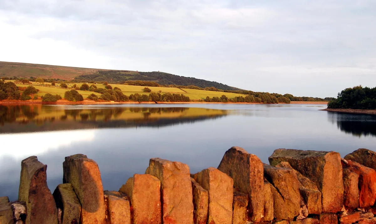
In or near Holcombe.
The West Pennine Moors is an area of the Pennines covering approximately 90 square miles (230 km2) of moorland and reservoirs in Lancashire and Greater Manchester, England. It is a Site of Special Sci

liz dawson — CC BY-SA 2.0 via Wikimedia Commons licence
Plan your visit
- Typical visit
- 1 h–2.5 h
- Nearest railway station
- Entwistle · 1.4 km
- Free entry
- Dog-friendly
Getting there & planning your visit
To visit the West Pennine Moors, the nearest railway station is Entwistle, located 1.4 km away. Entry is free, and the postcode for sat-nav is BL7 0NJ.
About
The West Pennine Moors is an area of the Pennines covering approximately 90 square miles (230 km2) of moorland and reservoirs in Lancashire and Greater Manchester, England. It is a Site of Special Scientific Interest. The West Pennine Moors are separated from the main Pennine range by the Irwell Valley to the east. The moorland includes Withnell, Anglezarke and Rivington Moors in the extreme west, Darwen and Turton Moors, Oswaldtwistle Moors and Holcombe Moors. These moors are lower in height than the main spine of the South Pennines. At 1,496 feet (456 m), the highest point is at Winter Hill. The area is of historical importance with archaeological evidence of human activity from Neolithic times. The area is close to urban areas, the dramatic backdrop to Bolton, Blackburn and Bury and neighbouring towns affording panoramic views across the Lancashire Plain and the Greater Manchester conurbation. The moorland is surrounded by the towns of Bolton, Chorley, Darwen, Horwich, Ramsbottom, Haslingden and Oswaldtwistle. Notable structures include Rivington Pike Tower, Winter Hill transmitting station, Peel Monument near Holcombe and the Jubilee Tower on Darwen Moor. United Utilities owns around 40% of the land for water catchment. The company operates four information centres at Rivington, Jumbles Country Park, Roddlesworth and Haslingden Grane.
Photo gallery
Protected designations
- Site of Special Scientific Interest: West Pennine Moors SSSI
Designations sourced from Natural England open data under OGL v3.
From the Wikipedia article
The West Pennine Moors is an area of the Pennines covering approximately 90 square miles (230 km2) of moorland and reservoirs in Lancashire and Greater Manchester, England. It is a Site of Special Scientific Interest. The West Pennine Moors are separated from the main Pennine range by the Irwell Valley to the east. The moorland includes Withnell, Anglezarke and Rivington Moors in the extreme west, Darwen and Turton Moors, Oswaldtwistle Moors and Holcombe Moors. These moors are lower in height than the main spine of the South Pennines. At 1,496 feet (456 m), the highest point is at Winter Hill. The area is of historical importance with archaeological evidence of human activity from Neolithic times. The area is close to urban areas, the dramatic backdrop to Bolton, Blackburn and Bury and neighbouring towns affording panoramic views across the Lancashire Plain and the Greater Manchester conurbation. The moorland is surrounded by the towns of Bolton, Chorley, Darwen, Horwich, Ramsbottom, Haslingden and Oswaldtwistle. Notable structures include Rivington Pike Tower, Winter Hill transmitting station, Peel Monument near Holcombe and the Jubilee Tower on Darwen Moor. United Utilities owns around 40% of the land for water catchment. The company operates four information centres at Rivington, Jumbles Country Park, Roddlesworth and Haslingden Grane.
Excerpt from Wikipedia under CC BY-SA 4.0. See the source article linked in Sources below.
Background
Visiting
In 1896, a mass trespass took place on the moors following the sale of land to Colonel Ainsworth for shooting. He tried to prevent members of the public from using the public rights of way. Reports claim a crowd of 10,000 people gathered to be confronted by a barrier and the police, but the crowd literally threw the police officers over the fence and proceeded to march across the land. A large amount of open moorland has been made accessible due to the Countryside and Rights of Way Act 2000 giving walkers the right to roam over the moorland. Much of this area is boggy and makes for difficult walking. The area around High Bullough reservoir is a nature reserve on the Anglezarke trail.…
Sourced from Wikipedia under CC BY-SA 4.0.
- Coordinates
- 53.6630, -2.4310
- District
- Blackburn with Darwen
- Parish
- North Turton
- Postcode
- BL7 0NJ
- Parliamentary constituency
- Rossendale and Darwen
- Nearest railway station
- Entwistle — 1.4 km
Sources
- wikipedia: West Pennine Moors (CC BY-SA 4.0)
Other places nearby
Turton and Entwistle Reservoir
Reservoirs & lochs · 1.1 km

The West Pennine Remembrance Park
Cemeteries · 1.4 km

Entwistle Hall
Historic houses · 1.7 km

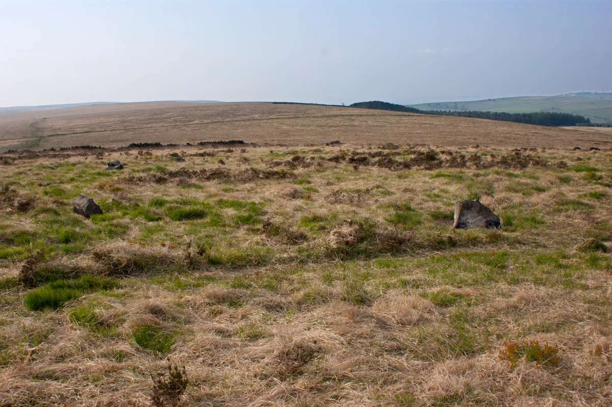
Turton Heights
Mountains & hills · 1.9 km
Turton Heights
Mountains & hills · 2.0 km
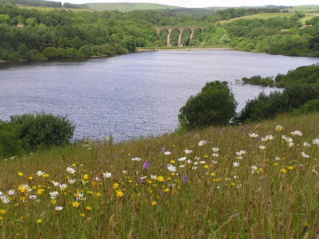
Wayoh Reservoir
Reservoirs & lochs · 2.4 km

Park Road Methodist Church War Memorial
Memorials & monuments · 2.5 km

Darwen Cemetery
Cemeteries · 2.6 km

Wives' Hill
Mountains & hills · 2.6 km
Cheetham Close
Hill forts · 2.7 km
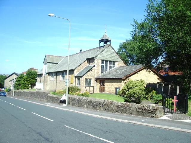
St Barnabas' Church, Darwen
Historic churches · 2.8 km

Druid Stone Circle
Stone circles · 2.8 km
Nearby
📷 3Reservoirs & lochs · North West England
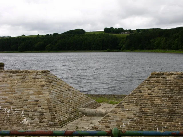
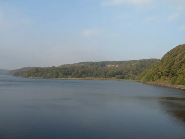
Turton and Entwistle Reservoir
Turton and Entwistle Reservoir — reservoir in Lancashire, England, UK.
📷 3Cemeteries · North West England
The West Pennine Remembrance Park
The West Pennine Remembrance Park is a cemetery in the United Kingdom.
📷 3Historic houses · North West England
Entwistle Hall
Entwistle Hall — house in North Turton, Blackburn with Darwen, England, UK.
📷 5Mountains & hills · North West England
Turton Heights
Turton Heights — a hill or mountain in england north west.
📷 5Mountains & hills · North West England
Turton Heights
Turton Heights — mountain in england north west. Elevation: 343 m.
📷 5Reservoirs & lochs · North West England
Wayoh Reservoir
Wayoh Reservoir — reservoir in Lancashire, England, UK.
Where to eat & stay near West Pennine Moors
Places to stay
 📷 5
📷 5Caravan parks · North West England
Walleach Caravan Park
Walleach Caravan Park — a caravan park in england north west.
 📷 5
📷 5Campsites · North West England
The Paddock Campsite
The Paddock Campsite — a campsite in england north west.
 📷 5
📷 5Caravan parks · North West England
Wilcocks Farm Caravan Park
Wilcocks Farm Caravan Park — a caravan park in england north west.
 📷 7
📷 7Hotels · North West England
Red Hall Hotel
Red Hall Hotel — a hotel in england north west.
 📷 5
📷 5Campsites · North West England
Burrs Country Park Caravan Club
Burrs Country Park Caravan Club — a campsite in england north west.
 📷 6
📷 6Hotels · North West England
Hampton by Hilton Blackburn
Hampton by Hilton Blackburn — a hotel in england north west. 3-star. Brand: Hampton.
Places to eat & drink
 📷 7
📷 7Historic pubs · North West England
Shoulder of Mutton
Shoulder of Mutton in England North West, United Kingdom.
 📷 7
📷 7Historic pubs · North West England
Blundell Arms
Blundell Arms in England North West, United Kingdom.
 📷 5
📷 5Historic pubs · North West England
Ye Olde Man & Scythe
Ye Olde Man & Scythe — Historic pub — listed building or notable heritage status.
 📷 7
📷 7Historic pubs · North West England
Old White Lion
Old White Lion in England North West, United Kingdom.
 📷 5
📷 5 📷 5
📷 5Historic pubs · North West England
The Shakespeare
The Shakespeare in England North West, United Kingdom.
More places in this region
 Flagship📷 5
Reservoirs & lochs · North West England
Yarrow Reservoir
Yarrow Reservoir — reservoir in Lancashire, England, UK.
.jpg?width=1200) 📷 3
📷 3Reservoirs & lochs · North West England
Abbey Village Reservoir
Abbey Village Reservoir — reservoir in Lancashire, England, UK.
 📷 3
📷 3Reservoirs & lochs · North West England
Anglezarke Reservoir
Anglezarke Reservoir — reservoir in Lancashire, England, UK.
 📷 3
📷 3Reservoirs & lochs · North West England
Ashworth Moor Reservoir
Ashworth Moor Reservoir — reservoir in Greater Manchester, England, UK.
Frequently asked questions
- Where is West Pennine Moors?
- West Pennine Moors is in North-West England, United Kingdom (postcode BL7 0NJ), in the parish of North Turton.
- What is West Pennine Moors?
- The West Pennine Moors is an area of the Pennines covering approximately 90 square miles (230 km2) of moorland and reservoirs in Lancashire and Greater Manchester, England. It is a Site of Special Sci
- How do I get to West Pennine Moors?
- The nearest railway station is Entwistle, about 1.4 km away. Drivers can use postcode BL7 0NJ.
- Is West Pennine Moors a protected site?
- Yes — West Pennine Moors is part of the West Pennine Moors SSSI Site of Special Scientific Interest.
- Is West Pennine Moors free to visit?
- Yes, West Pennine Moors is free to enter.
- How do I get to West Pennine Moors?
- The nearest railway station is Entwistle, about 1.4 km away. Drivers can navigate to postcode BL7 0NJ.