
Wild swimming spots · North West England
Wast Water
In or near Boot.
England's deepest lake — 79m deep, iconic view, popular wild swim.

Wikimedia Commons contributors — see linked file page for photographer and licence licence

Plan your visit
- Typical visit
- 1 h–2 h
- Nearest railway station
- Dalegarth · 5.7 km
- Free entry
- Dog-friendly
Getting there & planning your visit
Wast Water is located in North West England, with the nearest railway station being Dalegarth, which is 5.7 km away. Entry to Wast Water is free.
About
Wast Water in the western Lake District is England's deepest lake (79 metres) and the iconic 'Britain's favourite view' — the screes plunging into the lake, the Wasdale Head pyramidal mountains beyond. A popular wild swimming and open-water swimming venue (cold even in August), and the gateway to England's highest mountain Scafell Pike.
Photo gallery
Summary from the official site
Wast Water is a scenic lake located in the Lake District, known for its stunning natural beauty and dramatic surroundings. Visitors can enjoy various outdoor activities such as hiking, photography, and wildlife observation in this picturesque area.
Read more on the official property page.
Protected designations
- Site of Special Scientific Interest: Wast Water SSSI
- Site of Special Scientific Interest: Wasdale Screes SSSI
Designations sourced from Natural England open data under OGL v3.
From the Wikipedia article
Wast Water or Wastwater () is a lake located in Wasdale, a valley in the western part of the Lake District National Park, England. The lake is almost three miles (five kilometres) long and more than one-third mile (500 m) wide. It is a glacial lake, formed in a glacially "over-deepened" valley. It is the deepest lake in England at 258 feet (79 m). The surface of the lake is about 200 feet (60 m) above sea level, while its bottom is over 50 feet (15 m) below sea level. It is considered relatively clear (oligotrophic). It is owned by the National Trust.
Excerpt from Wikipedia under CC BY-SA 4.0. See the source article linked in Sources below.
Background
Description
In 1976, the "Wasdale Lady in the Lake", Margaret Hogg, was murdered by her husband and her body was disposed of in the lake. She was found after eight years, with her body preserved like wax due to the lack of oxygen in the water.
Sourced from Wikipedia under CC BY-SA 4.0.
- Coordinates
- 54.4467, -3.2839
- Nearest railway station
- Dalegarth — 5.7 km
- Official site
- web.archive.org
Sources
- wikidata: Q514635 (CC0)
- wikipedia: Wast Water (CC BY-SA 4.0)
- commons: Wast Water in the evening.jpg (CC BY-SA 4.0)
Featured in these 2 guides
Other places nearby

Wast Water
Lakes · 0.9 km
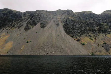
Illgill Head (summit)
Mountains & hills · 1.5 km
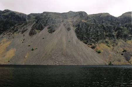
Illgill Head
Natural landmarks · 1.6 km

Illgill Head
Mountains & hills · 1.7 km

Wasdale Campsite
Campsites · 1.8 km
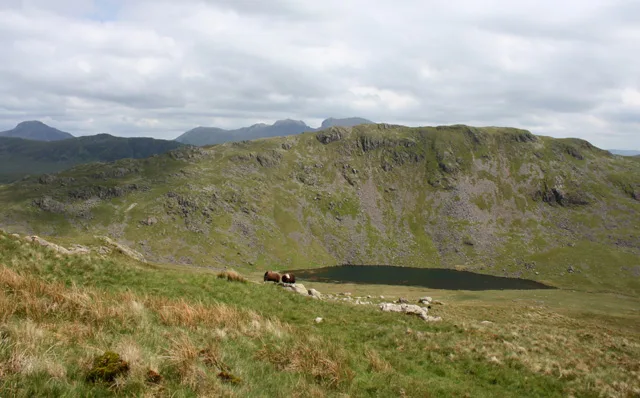
Middle Fell
Mountains & hills · 1.9 km

Maiden Castle Cairn
Castles · 1.9 km
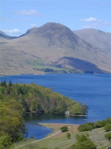
Yewbarrow
Mountains & hills · 2.1 km

Great Gable
Mountains & hills · 2.6 km

Yewbarrow North Top
Mountains & hills · 2.8 km

Wasdale Head Campsite
Campsites · 2.9 km

Joss Naylor Cairn
Memorials & monuments · 3.0 km
Nearby
📷 5📷 3Mountains & hills · North West England
Illgill Head (summit)
Illgill Head (summit) — Named summit at 608.8 m.
📷 3📷 5Mountains & hills · North West England
Illgill Head
Illgill Head — mountain in england north west. Elevation: 604 m.
📷 5Campsites · North West England
Wasdale Campsite
Wasdale Campsite — a campsite in england north west.
📷 3Where to eat & stay near Wast Water
Places to stay
📷 5Campsites · North West England
Wasdale Campsite
Wasdale Campsite — a campsite in england north west.
📷 5Campsites · North West England
Wasdale Head Campsite
Wasdale Head Campsite — a campsite in england north west.
 📷 5
📷 5Hostels · North West England
YHA Wasdale Hall
YHA Wasdale Hall — a hostel in england north west.
 📷 5
📷 5Campsites · North West England
Church Stile Farm And Holiday Park
Church Stile Farm And Holiday Park — a campsite in england north west.
 📷 5
📷 5Campsites · North West England
Eskdale Campsite
Eskdale Campsite — a campsite in england north west.
 📷 5
📷 5Hostels · North West England
YHA Eskdale
YHA Eskdale — a hostel in england north west.
Places to eat & drink
 📷 7
📷 7Cafés · North West England
Grange Bridge Cottage
Grange Bridge Cottage — a café in england north east.
 📷 5
📷 5Historic pubs · North West England
Blacksmiths Arms
Blacksmiths Arms in England North West, United Kingdom.
 📷 7
📷 7Historic pubs · North West England
Church House Public House
Church House Public House in England North West, United Kingdom.
 📷 7
📷 7Historic pubs · North West England
The Travellers Rest
The Travellers Rest in England North West, United Kingdom.
 📷 5
📷 5Restaurants · North West England
The Terrace Coffee House and Restaurant
The Terrace Coffee House and Restaurant — a restaurant in england north west. Cuisine: sandwich;lunch.
 📷 5
📷 5Other places from this era
 ★ Iconic📷 4
Wild swimming spots · Scottish Islands
Fairy Pools
Skye's iconic wild swimming spot — clear pools below the Black Cuillin.
More places in this region
 📷 5
📷 5Wild swimming spots · North West England
Pick Mere
Pick Mere — a wild swimming in england west midlands.
 📷 5
📷 5Wild swimming spots · North West England
Boundary Water Park
Boundary Water Park — a wild swimming in england west midlands.
 📷 5
📷 5Wild swimming spots · North West England
USwim Salford
USwim Salford — a wild swimming in england west midlands.
 📷 5
📷 5Frequently asked questions
- Where is Wast Water?
- Wast Water is in North-West England, United Kingdom.
- What is Wast Water?
- England's deepest lake — 79m deep, iconic view, popular wild swim.
- How do I get to Wast Water?
- The nearest railway station is Dalegarth, about 5.7 km away. Its coordinates are 54.4467°, -3.2839°.
- When was Wast Water built?
- Dates from the modern period.
- Is Wast Water a protected site?
- Yes — Wast Water is part of the Wast Water SSSI Site of Special Scientific Interest and the Wasdale Screes SSSI Site of Special Scientific Interest.
- Is Wast Water free to visit?
- Yes, Wast Water is free to enter.
- How do I get to Wast Water?
- The nearest railway station is Dalegarth, about 5.7 km away.