Natural landmarks · North West England
Illgill Head
In or near Boot.
Illgill Head — mountain in United Kingdom.

Wikimedia Commons contributors — see linked file page for photographer and licence licence
Plan your visit
- Typical visit
- 1 h–2 h
- Nearest railway station
- Dalegarth · 4.2 km
- Free entry
- Dog-friendly
About
Illgill Head is a named natural landmark in the United Kingdom. Wikidata describes it as: "mountain in United Kingdom". Coordinates: 54.4327°, -3.2826°.
Photo gallery
Protected designations
- Site of Special Scientific Interest: Wast Water SSSI
- Site of Special Scientific Interest: Wasdale Screes SSSI
Designations sourced from Natural England open data under OGL v3.
From the Wikipedia article
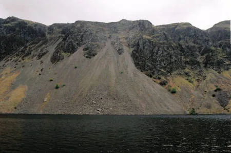
Illgill Head is a fell in the English Lake District. It is known more commonly as the northern portion of the Wastwater Screes. The fell is 609 metres (1,998 ft) high and stands along the south-east shore of Wastwater, the deepest lake in England.
Excerpt from Wikipedia under CC BY-SA 4.0. See the source article linked in Sources below.
- Coordinates
- 54.4327, -3.2826
- Address
- Cumbria, England
- Nearest railway station
- Dalegarth — 4.2 km
Sources
- wikidata: Q5999112 (CC0)
- wikipedia: Illgill Head (CC BY-SA 4.0)
- commons: Illgill Head screes.jpg (CC BY-SA 4.0)
Other places nearby
Illgill Head (summit)
Mountains & hills · 0.0 km

Illgill Head
Mountains & hills · 0.4 km

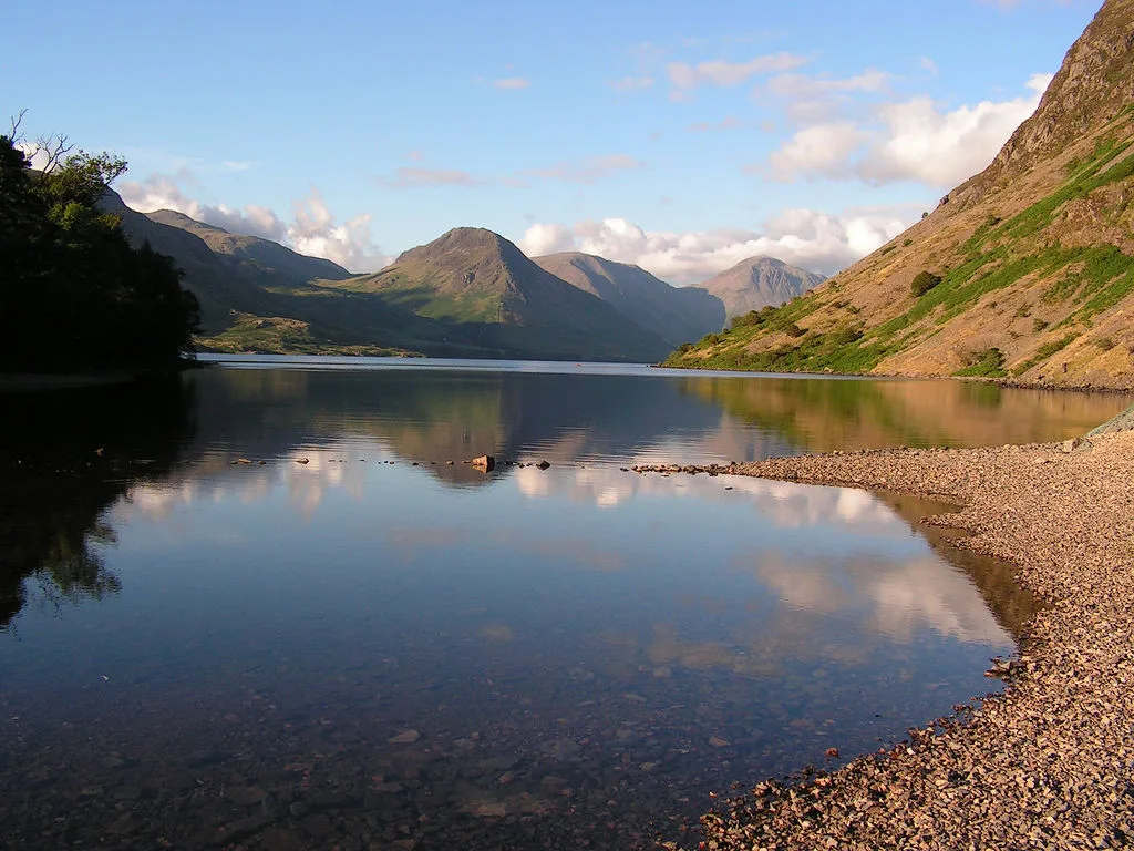
Wast Water
Lakes · 1.3 km
Wast Water
Wild swimming spots · 1.6 km

Maiden Castle Cairn
Castles · 1.7 km

Boat How
Mountains & hills · 1.7 km
Boat How
Mountains & hills · 1.7 km

Boat How Settlement
Archaeological sites · 1.8 km
Whin Rigg
Mountains & hills · 2.2 km

Whin Rigg (Wasdale)
Mountains & hills · 2.3 km

Whin Rigg
Natural landmarks · 2.3 km

YHA Wasdale Hall
Hostels · 2.4 km
Nearby
📷 3Mountains & hills · North West England
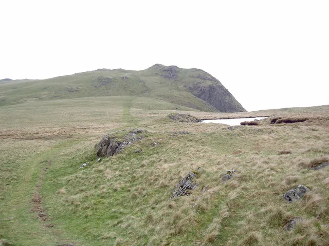
Illgill Head (summit)
Illgill Head (summit) — Named summit at 608.8 m.
📷 5Mountains & hills · North West England
Illgill Head
Illgill Head — mountain in england north west. Elevation: 604 m.
📷 5★ Iconic📷 4Wild swimming spots · North West England
Wast Water
England's deepest lake — 79m deep, iconic view, popular wild swim.
📷 3Castles · North West England
Maiden Castle Cairn
Maiden Castle Cairn — a castle in england-north-west, United Kingdom.
📷 5Mountains & hills · North West England
Boat How
Boat How — mountain in england north west. Elevation: 337 m.
Where to eat & stay near Illgill Head
Places to stay
📷 5Hostels · North West England
YHA Wasdale Hall
YHA Wasdale Hall — a hostel in england north west.
 📷 5
📷 5Campsites · North West England
Wasdale Campsite
Wasdale Campsite — a campsite in england north west.
 📷 5
📷 5Campsites · North West England
Eskdale Campsite
Eskdale Campsite — a campsite in england north west.
 📷 5
📷 5Campsites · North West England
Wasdale Head Campsite
Wasdale Head Campsite — a campsite in england north west.
 📷 5
📷 5Campsites · North West England
Church Stile Farm And Holiday Park
Church Stile Farm And Holiday Park — a campsite in england north west.
 📷 5
📷 5Hostels · North West England
YHA Eskdale
YHA Eskdale — a hostel in england north west.
Places to eat & drink
 📷 7
📷 7Cafés · North West England
Grange Bridge Cottage
Grange Bridge Cottage — a café in england north east.
 📷 5
📷 5Historic pubs · North West England
Blacksmiths Arms
Blacksmiths Arms in England North West, United Kingdom.
 📷 7
📷 7Historic pubs · North West England
Church House Public House
Church House Public House in England North West, United Kingdom.
 📷 5
📷 5Restaurants · North West England
The Terrace Coffee House and Restaurant
The Terrace Coffee House and Restaurant — a restaurant in england north west. Cuisine: sandwich;lunch.
 📷 7
📷 7Historic pubs · North West England
The Travellers Rest
The Travellers Rest in England North West, United Kingdom.
 📷 5
📷 5Historic pubs · North West England
Sun Cottage Sun Inn Public House
Sun Cottage Sun Inn Public House in England North West, United Kingdom.
More natural landmarks in this region
 📷 3
📷 3Natural landmarks · North West England
Statue of Oliver Cromwell
Statue of Oliver Cromwell — Public artwork (statue).
 📷 3
📷 3Natural landmarks · North West England
Dagfields Craft Centre
Dagfields Craft Centre — a other in england-west-midlands, United Kingdom.
 📷 3
📷 3Natural landmarks · North West England
Weaver Valley Cruises
Weaver Valley Cruises — a other in england-west-midlands, United Kingdom.
 📷 3
📷 3Natural landmarks · North West England
Golden Gates
Golden Gates — a other in england-west-midlands, United Kingdom.
Frequently asked questions
- Where is Illgill Head?
- Illgill Head is in North-West England, United Kingdom.
- What is Illgill Head?
- Illgill Head — mountain in United Kingdom.
- How do I get to Illgill Head?
- The nearest railway station is Dalegarth, about 4.2 km away. Its coordinates are 54.4327°, -3.2826°.
- Is Illgill Head a protected site?
- Yes — Illgill Head is part of the Wast Water SSSI Site of Special Scientific Interest and the Wasdale Screes SSSI Site of Special Scientific Interest.
- Is Illgill Head free to visit?
- Yes, Illgill Head is free to enter.
- How do I get to Illgill Head?
- The nearest railway station is Dalegarth, about 4.2 km away.