
Natural landmarks · North East England
Washfold
In or near Reeth.
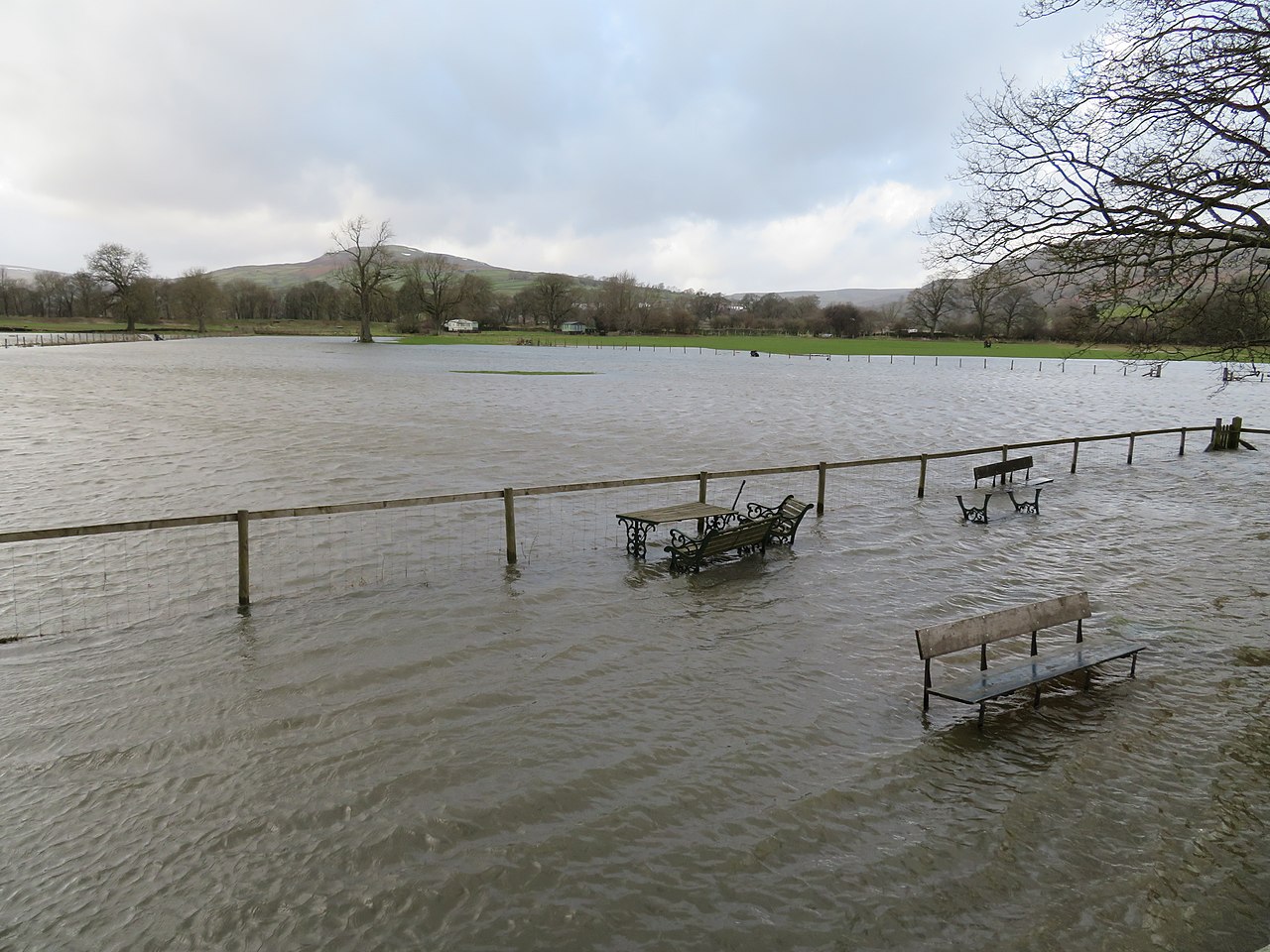
Washfold in England North East, United Kingdom.

Andy Waddington — CC BY-SA 2.0 via Wikimedia Commons licence

Plan your visit
- Typical visit
- 1 h–2 h
- Free entry
- Dog-friendly
About
Washfold is a place of interest in England North East, United Kingdom — drawn from open-data sources for visitor reference. See the linked Wikipedia article for the full description.
Photo gallery
Place summary
Washfold is a natural landmark located in North-East England. It is characterised by its distinct geological features and natural beauty within the region. The site offers a representation of the area's natural landscape.
AI-generated from the structured facts on this page (operator, designation, listing, era). Not a substitute for visiting.
- Coordinates
- 54.4231, -1.9087
- District
- North Yorkshire
- Parish
- Marrick
- Postcode
- DL11 7NP
- Parliamentary constituency
- Richmond and Northallerton
Sources
Other places nearby

Helwith
Forests & woodlands · 1.4 km

Hurst
Natural landmarks · 1.6 km

Holgate How
Mountains & hills · 1.8 km

Munn End
Mountains & hills · 2.0 km

Dicky Edge House
Historic houses · 2.6 km

Fremington Edge
Mountains & hills · 3.0 km

Whitgate
Historic houses · 3.0 km

David Johnson
Memorials & monuments · 3.0 km

Fremington Edge
National parks · 3.1 km

Forty Acres
Mountains & hills · 3.1 km

Orgate Force
Waterfalls · 3.3 km

Jabz Cave
Caves · 3.4 km
Nearby
📷 4📷 3📷 5Mountains & hills · Yorkshire & the Humber
Holgate How
Holgate How — mountain in england yorkshire. Elevation: 435.6 m.
📷 5Mountains & hills · Yorkshire & the Humber
Munn End
Munn End — mountain in england yorkshire. Elevation: 362.1 m.
📷 3Historic houses · Yorkshire & the Humber
Dicky Edge House
Dicky Edge House — a historic house in england-yorkshire, United Kingdom.
📷 5Mountains & hills · Yorkshire & the Humber
Fremington Edge
Fremington Edge — mountain in england yorkshire. Elevation: 475 m.
Where to eat & stay near Washfold
Places to stay
 📷 5
📷 5 📷 5
📷 5Hotels · Yorkshire & the Humber
The Kings Arms
The Kings Arms — a hotel in england yorkshire.
 📷 5
📷 5 📷 5
📷 5Campsites · Yorkshire & the Humber
Orchard Caravan And Camping Park
Orchard Caravan And Camping Park — a campsite in england yorkshire.
 📷 5
📷 5B&Bs · Yorkshire & the Humber
Ellerton Abbey House
Ellerton Abbey House — a bed-and-breakfast in england yorkshire.
 📷 5
📷 5Campsites · Yorkshire & the Humber
Scabba Wath Campsite
Scabba Wath Campsite — a campsite in england yorkshire.
Places to eat & drink
 📷 5
📷 5 📷 5
📷 5Historic pubs · North East England
Milbank Arms
Milbank Arms in England North East, United Kingdom.
 📷 4
📷 4Historic pubs · North East England
The Bar
The Bar in England North East, United Kingdom.
 📷 5
📷 5Historic pubs · Yorkshire & the Humber
Kings Head Inn
Kings Head Inn in England North West, United Kingdom.
 📷 5
📷 5Historic pubs · North East England
Blue Bell Public House
Blue Bell Public House in England North East, United Kingdom.
 📷 5
📷 5Historic pubs · North East England
The White Swan Public House And Swan Cottage
The White Swan Public House And Swan Cottage in England North East, United Kingdom.
More natural landmarks in this region
 📷 4
📷 4Natural landmarks · North East England
Cleveland Way
109-mile horseshoe trail around the North York Moors and its sea cliffs.
 📷 3
📷 3Natural landmarks · North East England
The Hand Stone
The Hand Stone — a other in england-yorkshire, United Kingdom.
 📷 3
📷 3Natural landmarks · North East England
The Face Stone
The Face Stone — a other in england-yorkshire, United Kingdom.
 📷 3
📷 3Frequently asked questions
- Where is Washfold?
- Washfold is in North-East England, United Kingdom (postcode DL11 7NP), in the parish of Marrick.
- What is Washfold?
- Washfold in England North East, United Kingdom.
- How do I get to Washfold?
- Drivers can use postcode DL11 7NP.
- Is Washfold free to visit?
- Yes, Washfold is free to enter.
- How do I get to Washfold?
- Drivers can navigate to postcode DL11 7NP. It sits within the Richmond and Northallerton parliamentary constituency.