Archaeological sites · North East England
Wark Forest
In or near Stonehaugh.
Wark Forest — southern part of Kielder Forest in Northumberland, England.

Oliver Dixon — CC BY-SA 2.0 via Wikimedia Commons licence
Plan your visit
- Typical visit
- 45 min–1.5 h
- Free entry
- Dog-friendly
About
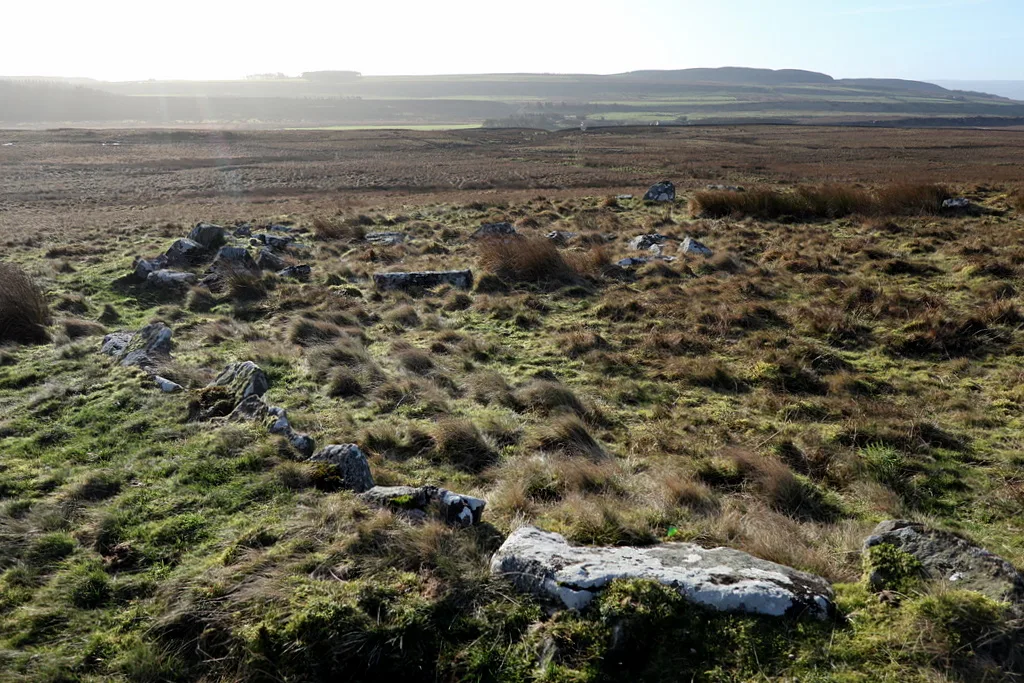
Wark Forest is an archaeological site in the United Kingdom. Wikidata describes it as: "southern part of Kielder Forest in Northumberland, England". Coordinates: 55.0910°, -2.4170°.
Photo gallery
Protected designations
- Site of Special Scientific Interest: Kielder Mires SSSI
- National Nature Reserve: KIELDER MIRES
Designations sourced from Natural England open data under OGL v3.
From the Wikipedia article
Wark Forest is the southern part of Kielder Forest in Northumberland, England. Wark Forest is found within the south-west tip of Northumberland National Park. It is near the village of Wark on Tyne to the south. The forest covers 10,467 hectares. The Wark Burn and waterfalls are located in the forest.
Excerpt from Wikipedia under CC BY-SA 4.0. See the source article linked in Sources below.
Background
History
In February 1990, the body of an unknown man was found in the forest. Thirty-five years later, in January 2025, Locate International issued an anniversary appeal seeking assistance in identifying the man.
Sourced from Wikipedia under CC BY-SA 4.0.
- Coordinates
- 55.0910, -2.4170
Sources
- wikidata: Q7969464 (CC0)
- wikipedia: Wark Forest (CC BY-SA 4.0)
Other places nearby

Cairnglastenhope
Mountains & hills · 3.2 km

Lampert Mosses
National parks · 4.0 km

Cairnglastenhope
Burial mounds & barrows · 4.1 km

Stonehaugh Trail
Mountain bike trails · 4.2 km

Stonehaugh Totem pole
Public art & sculpture · 5.7 km

Bell Crags
Mountains & hills · 5.9 km

Stonehaugh Campsite
Campsites · 6.0 km

Stonehaugh
Towns & cities · 6.0 km

Butterburn Flow
Wildlife reserves · 6.3 km

Churnsike Lodge
Historic houses · 7.1 km
Ring cairn and shieling immediately west of Chatley Crags
Archaeological sites · 7.3 km

Greenlee Meadows
Viewpoints · 7.7 km
Nearby
📷 5Mountains & hills · North East England
Cairnglastenhope
Cairnglastenhope — a hill or mountain in scotland lowlands.
📷 5National parks · North East England
Lampert Mosses
Lampert Mosses in England North East, United Kingdom.
📷 3Burial mounds & barrows · North East England
Cairnglastenhope
Cairnglastenhope — a burial mound in scotland-lowlands, United Kingdom.
📷 2Mountain bike trails · North East England
Stonehaugh Trail
Stonehaugh Trail — a mtb trail in scotland lowlands.
📷 3Public art & sculpture · North East England
Stonehaugh Totem pole
Stonehaugh Totem pole — a public art in scotland-lowlands, United Kingdom.
📷 5Mountains & hills · North East England
Bell Crags
Bell Crags — a hill or mountain in scotland lowlands.
Where to eat & stay near Wark Forest
Places to stay
📷 5Campsites · North East England
Stonehaugh Campsite
Stonehaugh Campsite — a campsite in scotland lowlands.
 📷 5
📷 5Hostels · North East England
Tarset Tor bunkhouse
Tarset Tor bunkhouse — a hostel in scotland lowlands.
 📷 5
📷 5 📷 5
📷 5Campsites · North East England
Winshields Farm Campsite
Winshields Farm Campsite — a campsite in scotland lowlands.
 📷 5
📷 5 📷 5
📷 5B&Bs · North East England
Old Repeater Station
Old Repeater Station — a bed-and-breakfast in scotland lowlands.
Places to eat & drink
 📷 7
📷 7Historic pubs · North East England
Anchor Hotel
Anchor Hotel in Scotland Lowlands, United Kingdom.
 📷 7
📷 7 📷 4
📷 4 📷 5
📷 5 📷 5
📷 5Historic pubs · North East England
The Redesdale Arms
The Redesdale Arms in Scotland Lowlands, United Kingdom.
 📷 4
📷 4Historic pubs · North West England
Hallbankgate
Hallbankgate in England North East, United Kingdom.
More archaeological sites in this region
 📷 5
📷 5Archaeological sites · North East England
Medieval Manorial Site of Low Dinsdale
Medieval Manorial Site of Low Dinsdale — archaeological in england yorkshire.
 📷 3
📷 3Archaeological sites · North East England
Old Smelting Mill
Old Smelting Mill — a archaeological in england-north-west, United Kingdom.
 📷 5
📷 5Archaeological sites · North East England
Roper Castle or Round Table (Roman Signal Station)
Roper Castle or Round Table (Roman Signal Station) — archaeological in england north west.
 📷 5
📷 5Archaeological sites · North East England
Nine Standards Rigg
Nine Standards Rigg — archaeological in england north west. Elevation: 662 m.
Frequently asked questions
- Where is Wark Forest?
- Wark Forest is in the Scottish Lowlands, United Kingdom.
- What is Wark Forest?
- Wark Forest — southern part of Kielder Forest in Northumberland, England.
- How do I get to Wark Forest?
- Its coordinates are 55.0910°, -2.4170°.
- Who owns Wark Forest?
- Wark Forest is owned by | website =.
- Is Wark Forest a protected site?
- Yes — Wark Forest is part of the Kielder Mires SSSI Site of Special Scientific Interest and the KIELDER MIRES National Nature Reserve.
- Is Wark Forest free to visit?
- Yes, Wark Forest is free to enter.