Archaeological sites · North East England
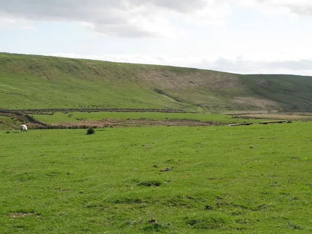
Ring cairn and shieling immediately west of Chatley Crags
In or near Bardon Mill.
Ring cairn and shieling immediately west of Chatley Crags — archaeological site in Henshaw, Northumberland, England, UK.

Wikimedia Commons contributors — see linked file page for photographer and licence licence
.jpg)
Plan your visit
- Typical visit
- 45 min–1.5 h
- Nearest railway station
- Bardon Mill · 6.5 km
- Free entry
- Dog-friendly
About
Ring cairn and shieling immediately west of Chatley Crags is a place of interest in the Scottish Lowlands. Officially recognised as scheduled monument. The site is a designated Site of Special Scientific Interest. It sits within the Hexham parliamentary constituency. The nearest railway station is Bardon Mill, about 6.5 km away. Postcode area NE47.
Photo gallery
Protected designations
- Site of Special Scientific Interest: Kielder Mires SSSI
- Site of Special Scientific Interest: River Eden and Tributaries SSSI
- Site of Special Scientific Interest: Roman Wall Escarpments SSSI
Designations sourced from Natural England open data under OGL v3.
Place summary
The Ring cairn and shieling immediately west of Chatley Crags is an archaeological site located in the Scottish Lowlands, within the parish of Henshaw (postcode NE47). This scheduled monument is part of several designated Sites of Special Scientific Interest (SSSIs), including Kielder Mires, River Eden and Tributaries, and Roman Wall Escarpments.
AI-generated from the structured facts on this page (operator, designation, listing, era). Not a substitute for visiting.
- Coordinates
- 55.0266, -2.3911
- District
- Northumberland
- Parish
- Henshaw
- Postcode
- NE47 7AP
- Parliamentary constituency
- Hexham
- Nearest railway station
- Bardon Mill — 6.5 km
Sources
- wikidata: Q17676621 (CC0)
- commons: Enclosed Cremation Cemetery near Chatley Crags (geograph 7084996).jpg (CC BY-SA 4.0)
Other places nearby

Greenlee Meadows
Viewpoints · 1.6 km

Hound Hill
Mountains & hills · 2.3 km

viewpoint near Steel Rigg
Viewpoints · 2.4 km

Hadrian's Wall Path
Long-distance walking trails · 2.5 km
Stone circle, defended settlement, Romano-British farmstead and field system, Roman camp and group of shielings immediately south of Greenlee Lough
Archaeological sites · 2.5 km

Steel Rigg
Viewpoints · 2.7 km

Peel Crags
Climbing & bouldering crags · 2.7 km

Milecastle 39 (Castle Nick)
Castles · 2.7 km

Milecastle 39
Castles · 2.7 km

Milecastle 40
Archaeological sites · 2.8 km
Milecastle 40 (Winshields)
Archaeological sites · 2.8 km

Robin Hood Tree
Natural landmarks · 2.8 km
Nearby
📷 3Viewpoints · North East England
Greenlee Meadows
Greenlee Meadows is a viewpoint in the United Kingdom.
📷 5Mountains & hills · North East England
Hound Hill
Hound Hill — mountain in scotland lowlands. Elevation: 306.6 m.
📷 3Viewpoints · North East England
viewpoint near Steel Rigg
viewpoint near Steel Rigg is a viewpoint in the United Kingdom.
📷 5Long-distance walking trails · North East England
Hadrian's Wall Path
An 84-mile National Trail following the line of Hadrian's Wall, the Roman frontier fortification, coast to coast across northern England from Wallsend on the Tyne to Bowness-on-Solway on the Cumbrian coast.
📷 3Archaeological sites · North East England
Stone circle, defended settlement, Romano-British farmstead and field system, Roman camp and group of shielings immediately south of Greenlee Lough
Stone circle, defended settlement, Romano-British farmstead and field system, Roman camp and group of shielings immediately south of Greenlee Lough — archaeological site in Bardon Mill, Northumberland, England, UK.
📷 3Where to eat & stay near Ring cairn and shieling immediately west of Chatley Crags
Places to stay
 📷 5
📷 5 📷 5
📷 5Campsites · North East England
Winshields Farm Campsite
Winshields Farm Campsite — a campsite in scotland lowlands.
 📷 5
📷 5Campsites · North East England
Hadrian's Wall Campsite
Hadrian's Wall Campsite — a campsite in scotland lowlands.
 📷 5
📷 5Caravan parks · North East England
Herding Hill Farm Camping
Herding Hill Farm Camping — a caravan park in scotland lowlands.
 📷 5
📷 5B&Bs · North East England
Old Repeater Station
Old Repeater Station — a bed-and-breakfast in scotland lowlands.
 📷 5
📷 5Caravan parks · North East England
Seldom Seen Caravan Park
Seldom Seen Caravan Park — a caravan park in scotland lowlands.
Places to eat & drink
 📷 7
📷 7Historic pubs · North East England
Anchor Hotel
Anchor Hotel in Scotland Lowlands, United Kingdom.
 📷 5
📷 5 📷 4
📷 4 📷 5
📷 5 📷 6
📷 6 📷 4
📷 4Historic pubs · North West England
Hallbankgate
Hallbankgate in England North East, United Kingdom.
More archaeological sites in this region
 📷 5
📷 5Archaeological sites · North East England
Medieval Manorial Site of Low Dinsdale
Medieval Manorial Site of Low Dinsdale — archaeological in england yorkshire.
 📷 3
📷 3Archaeological sites · North East England
Old Smelting Mill
Old Smelting Mill — a archaeological in england-north-west, United Kingdom.
 📷 5
📷 5Archaeological sites · North East England
Roper Castle or Round Table (Roman Signal Station)
Roper Castle or Round Table (Roman Signal Station) — archaeological in england north west.
 📷 5
📷 5Archaeological sites · North East England
Nine Standards Rigg
Nine Standards Rigg — archaeological in england north west. Elevation: 662 m.
Frequently asked questions
- Where is Ring cairn and shieling immediately west of Chatley Crags?
- Ring cairn and shieling immediately west of Chatley Crags is in the Scottish Lowlands, United Kingdom (postcode NE47 7AP), in the parish of Henshaw.
- What is Ring cairn and shieling immediately west of Chatley Crags?
- Ring cairn and shieling immediately west of Chatley Crags — archaeological site in Henshaw, Northumberland, England, UK.
- How do I get to Ring cairn and shieling immediately west of Chatley Crags?
- The nearest railway station is Bardon Mill, about 6.5 km away. Drivers can use postcode NE47 7AP.
- Is Ring cairn and shieling immediately west of Chatley Crags a listed building?
- Ring cairn and shieling immediately west of Chatley Crags is officially recognised as scheduled monument listed.
- Is Ring cairn and shieling immediately west of Chatley Crags a protected site?
- Yes — Ring cairn and shieling immediately west of Chatley Crags is part of the Kielder Mires SSSI Site of Special Scientific Interest and the River Eden and Tributaries SSSI Site of Special Scientific Interest.
- Is Ring cairn and shieling immediately west of Chatley Crags free to visit?
- Yes, Ring cairn and shieling immediately west of Chatley Crags is free to enter.
- How do I get to Ring cairn and shieling immediately west of Chatley Crags?
- The nearest railway station is Bardon Mill, about 6.5 km away. Drivers can navigate to postcode NE47 7AP.