Towns & cities · North East England
Stonehaugh
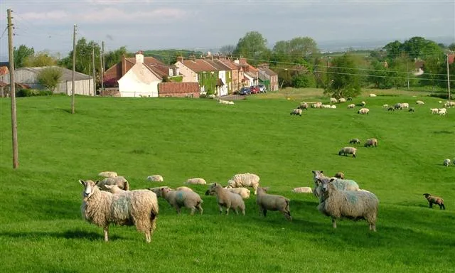
Stonehaugh — village in Northumberland, England, UK.

Wikimedia Commons licence
Plan your visit
- Typical visit
- 3 h–6 h
- Free entry
- Family-friendly
- Dog-friendly
About
Stonehaugh is a town, city, village or settlement in the United Kingdom. Address: NE48. Wikidata describes it as: "village in Northumberland, England, UK". Coordinates: 55.0830°, -2.3230°.
Photo gallery
From the Wikipedia article
Stonehaugh is a small settlement in Northumberland about 5 miles (8 km) west of Wark on Tyne and 4 Roman miles (6 km) north of Hadrian's Wall. It was purpose-built for housing forestry workers in the 1950s. Mechanization has reduced the necessity for such concentrated workforce, so the modern population is more diverse. It is located at the edge of the Wark Forest, and the National Cycle Route 68 (the Pennine Cycleway) passes through it. It was called one of the UK's best national park campsites by The Guardian, and a local artist's totem poles grace the local picnic area.
Excerpt from Wikipedia under CC BY-SA 4.0. See the source article linked in Sources below.
- Coordinates
- 55.0830, -2.3230
- District
- Northumberland
- Parish
- Wark
- Postcode
- NE48
- Parliamentary constituency
- Hexham
Sources
- wikidata: Q526502 (CC0)
- wikipedia: Stonehaugh (CC BY-SA 4.0)
Other places nearby

Stonehaugh Campsite
Campsites · 0.2 km

Stonehaugh Totem pole
Public art & sculpture · 0.6 km

Stonehaugh Trail
Mountain bike trails · 3.3 km

The Goatstones
Memorials & monuments · 3.9 km

Shitlington Cross
Historic houses · 4.0 km

Bell Crags
Mountains & hills · 4.3 km

Halleypike Lough
Natural landmarks · 4.9 km

Bridge Adjacent To Ramshaw's Mill
Historic bridges · 4.9 km

Cairnglastenhope
Mountains & hills · 5.6 km

Shitlington Crags
Natural landmarks · 5.7 km

Cairnglastenhope
Burial mounds & barrows · 5.8 km

Nanny's Hill
Mountains & hills · 5.9 km
Stonehaugh is located in the Scottish Lowlands. Our guide lists N attractions within reach.
At a glance
- Constituency
- Hexham
Things to see in Stonehaugh
14 attractions within 12 km. Full guide: things to do in Stonehaugh →
📷 4Memorials & monuments · North East England
The Goatstones
The Goatstones in England North East, United Kingdom.
 📷 5
📷 5National parks · North East England
Lampert Mosses
Lampert Mosses in England North East, United Kingdom.
📷 3Natural landmarks · North East England
Halleypike Lough
Halleypike Lough — lake in the United Kingdom.
 📷 3
📷 3Archaeological sites · North East England
Wark Forest
Wark Forest — southern part of Kielder Forest in Northumberland, England.
 📷 3
📷 3Archaeological sites · North East England
Turret 34A (Grindon West)
Turret 34A (Grindon West) — a archaeological in scotland-lowlands, United Kingdom.
📷 3Burial mounds & barrows · North East England
Cairnglastenhope
Cairnglastenhope — a burial mound in scotland-lowlands, United Kingdom.
📷 3Historic houses · North East England
Shitlington Cross
Shitlington Cross — a Grade II*-listed historic house in scotland-lowlands, United Kingdom.
📷 3Public art & sculpture · North East England
Stonehaugh Totem pole
Stonehaugh Totem pole — a public art in scotland-lowlands, United Kingdom.
📷 2Mountain bike trails · North East England
Stonehaugh Trail
Stonehaugh Trail — a mtb trail in scotland lowlands.
📷 5Campsites · North East England
Stonehaugh Campsite
Stonehaugh Campsite — a campsite in scotland lowlands.
 📷 5
📷 5Literary houses · North East England
Sewingshields Castle
Sewingshields Castle — a literary house museum in scotland lowlands.
📷 5Mountains & hills · North East England
Bell Crags
Bell Crags — a hill or mountain in scotland lowlands.
📷 5Mountains & hills · North East England
Cairnglastenhope
Cairnglastenhope — a hill or mountain in scotland lowlands.
📷 5Mountains & hills · North East England
Nanny's Hill
Nanny's Hill — mountain in scotland lowlands. Elevation: 280 m.
Nearby
📷 5Campsites · North East England
Stonehaugh Campsite
Stonehaugh Campsite — a campsite in scotland lowlands.
📷 3Public art & sculpture · North East England
Stonehaugh Totem pole
Stonehaugh Totem pole — a public art in scotland-lowlands, United Kingdom.
📷 2Mountain bike trails · North East England
Stonehaugh Trail
Stonehaugh Trail — a mtb trail in scotland lowlands.
📷 4Memorials & monuments · North East England
The Goatstones
The Goatstones in England North East, United Kingdom.
📷 3Historic houses · North East England
Shitlington Cross
Shitlington Cross — a Grade II*-listed historic house in scotland-lowlands, United Kingdom.
📷 5Mountains & hills · North East England
Bell Crags
Bell Crags — a hill or mountain in scotland lowlands.
Where to eat & stay near Stonehaugh
Places to stay
📷 5Campsites · North East England
Stonehaugh Campsite
Stonehaugh Campsite — a campsite in scotland lowlands.
 📷 5
📷 5Hotels · North East England
Battlesteads Hotel & Restaurant
Battlesteads Hotel & Restaurant — a hotel in scotland lowlands.
 📷 5
📷 5B&Bs · North East England
Old Repeater Station
Old Repeater Station — a bed-and-breakfast in scotland lowlands.
 📷 5
📷 5Campsites · North East England
Bellingham Camping & Caravaning Club Site
Bellingham Camping & Caravaning Club Site — a campsite in scotland lowlands.
 📷 5
📷 5Campsites · North East England
Demesne Farm Campsite & Granary Cottage
Demesne Farm Campsite & Granary Cottage — a campsite in scotland lowlands.
 📷 7
📷 7Places to eat & drink
 📷 7
📷 7Historic pubs · North East England
Anchor Hotel
Anchor Hotel in Scotland Lowlands, United Kingdom.
 📷 7
📷 7 📷 5
📷 5 📷 5
📷 5 📷 6
📷 6 📷 5
📷 5Historic pubs · North East England
The Redesdale Arms
The Redesdale Arms in Scotland Lowlands, United Kingdom.
More towns in this region
 Flagship📷 3
Towns & cities · North East England
Newby
Newby — village and civil parish in Hambleton, North Yorkshire, England, UK.
 📷 5
📷 5Towns & cities · North East England
Archdeacon Newton
Archdeacon Newton — village and civil parish in County Durham, England, UK.
 📷 3
📷 3Towns & cities · North East England
Boosbeck
Boosbeck — village in North Yorkshire, England, UK.
 📷 3
📷 3Frequently asked questions
- Where is Stonehaugh?
- Stonehaugh is in the Scottish Lowlands, United Kingdom (postcode NE48), in the parish of Wark.
- What is Stonehaugh?
- Stonehaugh — village in Northumberland, England, UK.
- How do I get to Stonehaugh?
- Drivers can use postcode NE48.
- Is Stonehaugh free to visit?
- Yes, Stonehaugh is free to enter.
- How do I get to Stonehaugh?
- Drivers can navigate to postcode NE48. It sits within the Hexham parliamentary constituency.