
Memorials & monuments · East Midlands
War Memorial and Boundary Wall
In or near Linby.
War Memorial and Boundary Wall — Grade II listed building-listed memorial in england-east-midlands, United Kingdom.

Dave Bevis — CC BY-SA 2.0 via Wikimedia Commons licence

Plan your visit
- Typical visit
- 15 min–45 min
- Nearest railway station
- Kirkby-in-Ashfield · 1.0 km
- Free entry
- Dog-friendly
Getting there & planning your visit
The War Memorial and Boundary Wall is located in Ashfield, Nottinghamshire, with the postcode NG17 7FH. The nearest railway station is Kirkby-in-Ashfield, which is approximately 1 km away. Entry to the memorial is free.
About
War Memorial and Boundary Wall is a Grade II listed building-listed memorial in england-east-midlands, United Kingdom, registered on the National Heritage List for England (NHLE entry 1221364). Listed status protects buildings and structures of special architectural or historic interest. See the linked Wikipedia article for further details.
Photo gallery
Heritage listing
Details SK 55NW KIRKBY IN ASHFIELD KINGSWAY (west side) 4/45 War Memorial and boundary wall II War memorial. c.1920. granite. Square base of 3 steps carrying coved plinth. Cross-pedimented corniced rectangular colum with inscriptions on each side. Those to north and south have projecting panels with hipped tops and scroll bases. Further inscriptions added, 1945. Quadrilateral dwarf boundary wall, coursed and square rubble, has chamfered concrete coping and square concrete piers with octagonal capitals. Patterned wrought iron railing and gate. Listing NGR: SK5081055418 This List entry has been amended to add sources for War Memorials Online and the War Memorials Register. These sources were not used in the compilation of this List entry but are added here as a guide for further reading, 4 October 2017. Legacy The contents of this record have been generated from a legacy data system. Legacy System number: 410933 Legacy System: LBS
From the Historic England List Entry under OGL v3.
Place summary
The War Memorial and Boundary Wall is located in the East Midlands. This structure is designated as a Grade II listed building, recognising its historical significance.
AI-generated from the structured facts on this page (operator, designation, listing, era). Not a substitute for visiting.
- Coordinates
- 53.0936, -1.2427
- County
- Nottinghamshire
- District
- Ashfield
- Parish
- Ashfield, unparished area
- Postcode
- NG17 7FH
- Parliamentary constituency
- Ashfield
- Nearest railway station
- Kirkby-in-Ashfield — 1 km
Sources
- wikidata: Q26515759 (CC0)
Other places nearby

Star Theatre
Theatres · 0.5 km

Robin Hood's Hills
Mountains & hills · 0.6 km

Kirkby-in-Ashfield
Museums · 0.6 km
Australia vs. England 1932-1933 Ashes Series
Memorials & monuments · 0.7 km

Kings Palace
Theatres · 0.9 km

Lowmoor Road
Stadiums · 1.1 km

East Kirkby
Villages · 1.2 km

Annesley
Castles · 1.4 km

Kirkby Summit Colliery
Memorials & monuments · 1.7 km
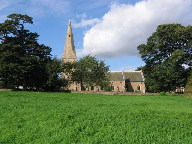
St. Wilfrid's Church, Kirkby-in-Ashfield
Historic churches · 1.8 km

Kirkby in Ashfield Castle Hill Camp
Castles · 1.8 km
Castle Hill fortified manor
Literary houses · 1.8 km
Nearby
📷 5Theatres · East Midlands
Star Theatre
Star Theatre — a cinema heritage in england-east-midlands, United Kingdom.
📷 5Mountains & hills · East Midlands
Robin Hood's Hills
Robin Hood's Hills — a hill or mountain in england east midlands.
📷 5Museums · East Midlands
Kirkby-in-Ashfield
Kirkby-in-Ashfield is a market town in the Ashfield District of Nottinghamshire, England. With a population of 21,285 in the 2021 census. The town is a part of the wider Mansfield Urban Area. Kirkby-i
📷 3Memorials & monuments · East Midlands
Australia vs. England 1932-1933 Ashes Series
Australia vs. England 1932-1933 Ashes Series — a memorial in england-east-midlands, United Kingdom.
📷 3📷 3Where to eat & stay near War Memorial and Boundary Wall
Places to stay
 📷 5
📷 5Campsites · East Midlands
Notts Sun Club
Notts Sun Club — a campsite in england east midlands.
 📷 5
📷 5 📷 5
📷 5Campsites · East Midlands
Fairview Farm Holiday Accomodation
Fairview Farm Holiday Accomodation — a campsite in england east midlands.
 📷 5
📷 5Campsites · East Midlands
Teversal Camping and Caravaning Club
Teversal Camping and Caravaning Club — a campsite in england east midlands.
 📷 5
📷 5 📷 5
📷 5Campsites · East Midlands
Golden Valley Caravan Park
Golden Valley Caravan Park — a campsite in england east midlands.
Places to eat & drink
 📷 7
📷 7 📷 7
📷 7Cafés · East Midlands
Mortons Farm Tea Rooms
Mortons Farm Tea Rooms — a café in england east midlands.
 📷 5
📷 5Historic pubs · East Midlands
Portland Arms Public House
Portland Arms Public House in England East Midlands, United Kingdom.
 📷 5
📷 5Historic pubs · East Midlands
The Old Ram Public House
The Old Ram Public House in England East Midlands, United Kingdom.
 📷 5
📷 5 📷 5
📷 5Historic pubs · East Midlands
The Bridge Tavern Public House
The Bridge Tavern Public House in England East Midlands, United Kingdom.
More memorials in this region
 📷 5
📷 5Memorials & monuments · East Midlands
Bainton Buttercross
Bainton Buttercross is a memorial in the United Kingdom.
 📷 5
📷 5Memorials & monuments · East Midlands
clock tower and war memorial
clock tower and war memorial is a memorial in the United Kingdom.
 📷 5
📷 5Memorials & monuments · East Midlands
John Clare Memorial
John Clare Memorial is a memorial in the United Kingdom.
 📷 5
📷 5Memorials & monuments · East Midlands
The Butter Cross
The Butter Cross is a memorial in the United Kingdom.
Frequently asked questions
- Where is War Memorial and Boundary Wall?
- War Memorial and Boundary Wall is in Nottinghamshire, the East Midlands, United Kingdom (postcode NG17 7FH), in the parish of Ashfield, unparished area.
- What is War Memorial and Boundary Wall?
- War Memorial and Boundary Wall — Grade II listed building-listed memorial in england-east-midlands, United Kingdom.
- How do I get to War Memorial and Boundary Wall?
- The nearest railway station is Kirkby-in-Ashfield, about 1.0 km away. Drivers can use postcode NG17 7FH.
- Is War Memorial and Boundary Wall a listed building?
- War Memorial and Boundary Wall is officially recognised as Grade II listed building listed.
- Is War Memorial and Boundary Wall free to visit?
- Yes, War Memorial and Boundary Wall is free to enter.
- How do I get to War Memorial and Boundary Wall?
- The nearest railway station is Kirkby-in-Ashfield, about 1.0 km away. Drivers can navigate to postcode NG17 7FH.