
Museums · East Midlands
Kirkby-in-Ashfield
In or near Linby.
Kirkby-in-Ashfield is a market town in the Ashfield District of Nottinghamshire, England. With a population of 21,285 in the 2021 census. The town is a part of the wider Mansfield Urban Area. Kirkby-i

Martin Kirk — CC BY-SA 2.0 via Wikimedia Commons licence

Plan your visit
- Typical visit
- 1.5 h–3 h
- Best time of year
- Year-round
- Nearest railway station
- Kirkby-in-Ashfield · 0.6 km
- Family-friendly
- Limited wheelchair access
About
Kirkby-in-Ashfield is a market town in the Ashfield District of Nottinghamshire, England. With a population of 21,285 in the 2021 census. The town is a part of the wider Mansfield Urban Area. Kirkby-in-Ashfield lies on the eastern edge of the Erewash Valley which separates Nottinghamshire and Derbyshire. The Head Offices of Ashfield District Council are located on Urban Road in the town centre.
Photo gallery
360° viewimagery from 2019
Imagery © Mapillary contributors, CC BY-SA 4.0
From the Wikipedia article
Kirkby-in-Ashfield is a market town in the Ashfield District of Nottinghamshire, England. With a population of 21,285 in the 2021 census. The town is a part of the wider Mansfield Urban Area. Kirkby-in-Ashfield lies on the eastern edge of the Erewash Valley which separates Nottinghamshire and Derbyshire. The Head Offices of Ashfield District Council are located on Urban Road in the town centre.
Excerpt from Wikipedia under CC BY-SA 4.0. See the source article linked in Sources below.
Background
History
Kirkby, as it is locally known, was originally a Danish settlement (Kirk-by translates as 'Church Town' in Danish) and is a collection of small villages including Old Kirkby, The Folly (East Kirkby), Nuncargate and Kirkby Woodhouse. It is mentioned in the Domesday Book and has two main churches: St Wilfrid's, a Norman church, which was gutted by fire on 6 January 1907 but quickly re-built; and St Thomas', built in the early 1910s in neo-gothic style. ]] Kirkby Manor dated back to the 13th Century. Its owner in 1284 Robert de Stuteville was fined by King Edward I for not attending the Royal summons. However, in 1292 Robert clearly forgiven, hosted the king at the manor to a nights stay.…
Sourced from Wikipedia under CC BY-SA 4.0.
- Coordinates
- 53.0990, -1.2450
- County
- Nottinghamshire
- District
- Ashfield
- Parish
- Ashfield, unparished area
- Postcode
- NG17 7AP
- Parliamentary constituency
- Ashfield
- Nearest railway station
- Kirkby-in-Ashfield — 0.6 km
Sources
- wikipedia: Kirkby-in-Ashfield (CC BY-SA 4.0)
Other places nearby
Australia vs. England 1932-1933 Ashes Series
Memorials & monuments · 0.1 km

Star Theatre
Theatres · 0.2 km

Kings Palace
Theatres · 0.4 km

Lowmoor Road
Stadiums · 0.5 km

War Memorial and Boundary Wall
Memorials & monuments · 0.6 km

Robin Hood's Hills
Mountains & hills · 0.7 km

Kirkby Summit Colliery
Memorials & monuments · 1.1 km
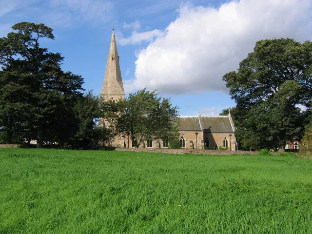
St. Wilfrid's Church, Kirkby-in-Ashfield
Historic churches · 1.6 km

Kirkby in Ashfield Castle Hill Camp
Castles · 1.6 km
Castle Hill fortified manor
Literary houses · 1.6 km

Kirkby Cross
Memorials & monuments · 1.7 km

East Kirkby
Villages · 1.8 km
Nearby
📷 3Memorials & monuments · East Midlands
Australia vs. England 1932-1933 Ashes Series
Australia vs. England 1932-1933 Ashes Series — a memorial in East Midlands, United Kingdom.
📷 5Theatres · East Midlands
Star Theatre
Star Theatre — a cinema heritage in england-east-midlands, United Kingdom.
📷 3📷 3📷 3Memorials & monuments · East Midlands
War Memorial and Boundary Wall
War Memorial and Boundary Wall — Grade II listed building-listed memorial in england-east-midlands, United Kingdom.
📷 5Mountains & hills · East Midlands
Robin Hood's Hills
Robin Hood's Hills — a hill or mountain in england east midlands.
Where to eat & stay near Kirkby-in-Ashfield
Places to stay
 📷 5
📷 5Campsites · East Midlands
Notts Sun Club
Notts Sun Club — a campsite in england east midlands.
 📷 5
📷 5 📷 5
📷 5Campsites · East Midlands
Teversal Camping and Caravaning Club
Teversal Camping and Caravaning Club — a campsite in england east midlands.
 📷 5
📷 5Campsites · East Midlands
Fairview Farm Holiday Accomodation
Fairview Farm Holiday Accomodation — a campsite in england east midlands.
 📷 5
📷 5 📷 5
📷 5Campsites · East Midlands
Golden Valley Caravan Park
Golden Valley Caravan Park — a campsite in england east midlands.
Places to eat & drink
 📷 7
📷 7 📷 5
📷 5Historic pubs · East Midlands
Portland Arms Public House
Portland Arms Public House in England East Midlands, United Kingdom.
 📷 5
📷 5Historic pubs · East Midlands
The Old Ram Public House
The Old Ram Public House in England East Midlands, United Kingdom.
 📷 5
📷 5Restaurants · East Midlands
The Horizon
The Horizon — a restaurant in england east midlands.
 📷 5
📷 5Historic pubs · East Midlands
The Bridge Tavern Public House
The Bridge Tavern Public House in England East Midlands, United Kingdom.
 📷 7
📷 7Cafés · East Midlands
Mortons Farm Tea Rooms
Mortons Farm Tea Rooms — a café in england east midlands.
More museums in this region
 📷 5
📷 5Museums · East Midlands
Stamford Town Hall
Stamford Town Hall — building in Stamford, Lincolnshire, England, UK.
 📷 5
📷 5Museums · East Midlands
Thorney Museum
Thorney Museum — a museum in East Midlands, United Kingdom.
 📷 5
📷 5Museums · East Midlands
Octavia Hill Birthplace Museum
Octavia Hill Birthplace Museum — a museum in East Midlands, United Kingdom.
 📷 5
📷 5Museums · East Midlands
Museum of Technology
Museum of Technology — a museum in East Midlands, United Kingdom.
Frequently asked questions
- Where is Kirkby-in-Ashfield?
- Kirkby-in-Ashfield is in Nottinghamshire, the East Midlands, United Kingdom (postcode NG17 7AP), in the parish of Ashfield, unparished area.
- What is Kirkby-in-Ashfield?
- Kirkby-in-Ashfield is a market town in the Ashfield District of Nottinghamshire, England. With a population of 21,285 in the 2021 census. The town is a part of the wider Mansfield Urban Area. Kirkby-i
- How do I get to Kirkby-in-Ashfield?
- The nearest railway station is Kirkby-in-Ashfield, about 0.6 km away. The nearest town is Linby. Drivers can use postcode NG17 7AP.
- How do I get to Kirkby-in-Ashfield?
- The nearest railway station is Kirkby-in-Ashfield, about 0.6 km away. Drivers can navigate to postcode NG17 7AP.