
National parks · North East England
Urra Moor
In or near Great Broughton.
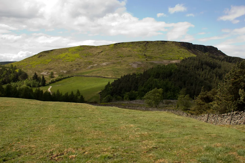
Urra Moor in England North East, United Kingdom.

Gordon Hatton — CC BY-SA 2.0 via Wikimedia Commons licence

Plan your visit
- Typical visit
- 4 h–8 h
- Best time of year
- Spring – autumn (Apr–Oct)
- Nearest railway station
- Battersby · 5.8 km
- Free entry
- Family-friendly
- Dog-friendly
Getting there & planning your visit
To visit Urra Moor, the nearest railway station is Battersby, which is 5.8 km away. Entry to the park is free.
About
Urra Moor is a place of interest in England North East, United Kingdom — drawn from open-data sources for visitor reference. See the linked Wikipedia article for the full description.
Photo gallery
See it from the streetimagery from 2022
Imagery © Mapillary contributors, CC BY-SA 4.0
Protected designations
- Site of Special Scientific Interest: North York Moors SSSI
Designations sourced from Natural England open data under OGL v3.
From the Wikipedia article
Urra Moor is the highest moor in the North York Moors, North Yorkshire, England. At 1,490 feet (454 m) above sea level it is the highest point in the former Hambleton District and the North York Moors National Park, and the fourteenth most prominent hill in England. The name is a mix of Old English and Old Norse (horh and haugr) which means The Dirty Hill. The name of Urra Moor applies to the moor as a whole; the summit itself is known as Round Hill. The summit is crowned by a trig point, and a track passes about 110 yards (100 m) to the south of this point. This track forms part of the route of both the Lyke Wake Walk and the Cleveland Way, and also forms the most commonly used route of ascent for Urra Moor. It is 1.9 miles (3 km) from the car park at Clay Bank to the summit via this route; total ascent is just under 660 feet (200 m). Urra Moor is noted for its prehistoric remains. There are a number of barrows, and several carved rocks, including some cup and ring carvings. Probably the most striking relic is the Face Stone, a carved stone about 3 feet 3 inches (1 m) in height into which has been carved the shape of a face.
Excerpt from Wikipedia under CC BY-SA 4.0. See the source article linked in Sources below.
- Coordinates
- 54.4055, -1.0864
- Address
- North York Moors, England
- Nearest railway station
- Battersby — 5.8 km
Sources
Other places nearby
The Hand Stone
Natural landmarks · 0.0 km

Round Hill
Mountains & hills · 0.1 km
Urra Moor - Round Hill
Mountains & hills · 0.1 km

The Face Stone
Natural landmarks · 0.3 km

Wayside cross known as Jenny Bradley 1000m north west of Bloworth Crossing on Greenhow Moor
Historic houses · 1.9 km

Cockayne Ridge
Mountains & hills · 2.5 km

Lawns Hill
Mountains & hills · 3.4 km
White Hill
Mountains & hills · 3.5 km

Cammon Stone
Natural landmarks · 3.6 km

Hasty Bank
Mountains & hills · 3.7 km

Methodist Chapel And Attached Schoolroom
Chapels · 3.9 km

Chop Gate
Villages · 4.0 km
Nearby
📷 3Natural landmarks · North East England
The Hand Stone
The Hand Stone — a other in england-yorkshire, United Kingdom.
📷 5Mountains & hills · Yorkshire & the Humber
Round Hill
Round Hill — mountain in england yorkshire. Elevation: 454 m.
📷 5Mountains & hills · Yorkshire & the Humber
Urra Moor - Round Hill
Urra Moor - Round Hill — a hill or mountain in england yorkshire.
📷 3Natural landmarks · North East England
The Face Stone
The Face Stone — a other in england-yorkshire, United Kingdom.
📷 3Historic houses · North East England
Wayside cross known as Jenny Bradley 1000m north west of Bloworth Crossing on Greenhow Moor
Wayside cross known as Jenny Bradley 1000m north west of Bloworth Crossing on Greenhow Moor — a Grade II*-listed historic house in england-yorkshire, United Kingdom.
📷 5Mountains & hills · Yorkshire & the Humber
Cockayne Ridge
Cockayne Ridge — mountain in england yorkshire. Elevation: 430 m.
Where to eat & stay near Urra Moor
Places to stay
 📷 5
📷 5Campsites · Yorkshire & the Humber
Kildale Camping & Barn
Kildale Camping & Barn — a campsite in england yorkshire.
 📷 5
📷 5Campsites · Yorkshire & the Humber
Lordstones Country Park
Lordstones Country Park — a campsite in england yorkshire.
 📷 5
📷 5Campsites · Yorkshire & the Humber
Southview Farm Campsite
Southview Farm Campsite — a campsite in england yorkshire.
 📷 5
📷 5Campsites · Yorkshire & the Humber
Holiday Lodge Park
Holiday Lodge Park — a campsite in england yorkshire.
 📷 5
📷 5Caravan parks · Yorkshire & the Humber
Angrove Country Park
Angrove Country Park — a caravan park in england yorkshire.
 📷 5
📷 5Campsites · Yorkshire & the Humber
Raven Gill Campsite
Raven Gill Campsite — a campsite in england yorkshire.
Places to eat & drink
 📷 4
📷 4Historic pubs · North East England
The Dudley Arms Public House
The Dudley Arms Public House in England North East, United Kingdom.
 📷 7
📷 7 📷 5
📷 5Historic pubs · North East England
The Royal Oak Hotel
The Royal Oak Hotel in England North East, United Kingdom.
 📷 7
📷 7Historic pubs · North East England
The Queen's Head Public House
The Queen's Head Public House in England North East, United Kingdom.
 📷 5
📷 5 📷 4
📷 4Historic pubs · North East England
The Bay Horse Inn
The Bay Horse Inn in England North East, United Kingdom.
More national parks in this region
 📷 4
📷 4 📷 4
📷 4National parks · North East England
Mallerstang
Mallerstang in England North East, United Kingdom.
 📷 4
📷 4National parks · North East England
Kisdon Force
Kisdon Force in England North East, United Kingdom.
 📷 4
📷 4Frequently asked questions
- Where is Urra Moor?
- Urra Moor is in North-East England, United Kingdom.
- What is Urra Moor?
- Urra Moor in England North East, United Kingdom.
- How do I get to Urra Moor?
- The nearest railway station is Battersby, about 5.8 km away. Its coordinates are 54.4055°, -1.0864°.
- Is Urra Moor a protected site?
- Yes — Urra Moor is part of the North York Moors SSSI Site of Special Scientific Interest.
- Is Urra Moor free to visit?
- Yes, Urra Moor is free to enter.
- How do I get to Urra Moor?
- The nearest railway station is Battersby, about 5.8 km away.