Other places · Central Scotland
Upper Hirst
In or near Airth.
Upper Hirst in Scotland Islands, United Kingdom.

Colin Pyle — CC BY-SA 2.0 via Wikimedia Commons licence
Plan your visit
- Typical visit
- 1 h–2 h
- Nearest railway station
- Alloa · 0.9 km
Getting there & planning your visit
To visit Upper Hirst in the Scottish Highlands, the nearest railway station is Alloa, which is 0.9 km away. The postcode for navigation is FK10 3LT. Entry information is not provided.
About
Upper Hirst is a place of interest in Scotland Islands, United Kingdom — drawn from open-data sources for visitor reference. See the linked Wikipedia article for the full description.
Photo gallery
From the Wikipedia article
The Upper Hirst is a coal seam in central Scotland that was mined on a large scale in the 1950s through to 2002, mainly to supply Kincardine Power Station, and later, Longannet Power Station, in Fife. This was a low-quality coal, unsuitable for most other purposes, and had mostly been disregarded previously. Its low sulfur content made it very suitable for power station use. It burns relatively slowly making it popular in the 16th century for the manufacture of salt and glass. The seam is also known locally as the Jenny Pate or the Janet Peat. The Upper Hirst coal is found within the Upper Limestone Group of strata, above the Limestone Coal Group, but below the Productive Coal Measures. The latter two groups of strata may be separated by up to 1,000 metres. In the Central Coal Field, which is in the form of a basin, the Productive Coal Measures, if they were ever deposited, have been lost by erosion except near the centre, where they outcrop near Alloa and Clackmannan, and have been mined until recently. The Limestone Coal Group of strata have been mined only around the edge of the basin, although in the 1950s there were plans for deep mines at Airth, where two large shafts were constructed to rockhead and then abandoned, and at Gartarry Toll, which was not begun. At Manor Powis, for example, the useful seams in the Limestone Coal Group were at a depth of about 400 metres, and included valuable anthracite; the Upper Hirst was above this and as well as being mined at mid-shaft in the old colliery, was reached by a pair of sloping adits constructed near the bank of the River Forth. The slope of the seam was followed for some distance down the dip of the basin, to the east. The Upper Hirst was initially mined experimentally at the site of Bannockburn colliery by a small drift mine, then at mid-shaft in Polmaise 3/4 (commonly called Fallin), Manor Powis, and later the drift mines at Dollar and Bogside, to supply Kincardine Power Station, but when Longannet Power…
Excerpt from Wikipedia under CC BY-SA 4.0. See the source article linked in Sources below.
Background
History
One of the first large scale early workings of the Upper Hirst also ended in a flood. The Upper Hirst outcropped to the north, west and south east of Culross and was mined extensively by George Bruce (later Sir George Bruce of Carnock) and his sons between 1575 and 1676, using methods technically advanced for the time, such as a horse-powered bucket and chain drainage system. But the finest achievement was The Moat Pit at Culross, a shaft (actually three concentric stone towers to protect a central shaft from the ingress of the sea) constructed in the Firth of Forth on the foreshore 400m to the south of the high water mark at the west end of Culross. The primary purpose was to promote…
Sourced from Wikipedia under CC BY-SA 4.0.
- Coordinates
- 56.1220, -3.7750
- District
- Clackmannanshire
- Postcode
- FK10 3LT
- Parliamentary constituency
- Alloa and Grangemouth
- Nearest railway station
- Alloa — 0.9 km
Sources
- wikidata: Q7898690 (CC0)
- wikipedia: Upper Hirst (CC BY-SA 4.0)
Other places nearby
Napoleon Pillar
Memorials & monuments · 0.1 km

Carsebridge House, Carsebridge Road, Alloa
Historic houses · 0.2 km
Napoleon Pillar, Carsebridge House, Carsebridge Road, Alloa
Memorials & monuments · 0.2 km
Alloa Mosque
Historic churches · 0.5 km
Gaberston Mill
Other places · 0.5 km
Recreation Park
Stadiums · 0.6 km
Sauchie Mining Memorial
Memorials & monuments · 0.7 km
Sauchie War Memorial, Fairfield Road, Sauchie, Alloa
Memorials & monuments · 0.7 km

Time Capsule
Public art & sculpture · 0.7 km

Sauchie
Other places · 0.9 km

Sauchie F.C.
Parks · 0.9 km

Sauchie
Villages · 0.9 km
Nearby
📷 3Memorials & monuments · Central Scotland
Napoleon Pillar
Napoleon Pillar — a memorial in scotland-central, United Kingdom.
📷 3Historic houses · Central Scotland
Carsebridge House, Carsebridge Road, Alloa
Carsebridge House, Carsebridge Road, Alloa — house in Alloa, Clackmannanshire, Scotland, UK.
📷 5Memorials & monuments · Central Scotland
Napoleon Pillar, Carsebridge House, Carsebridge Road, Alloa
Napoleon Pillar, Carsebridge House, Carsebridge Road, Alloa — category B listed building-listed memorial in scotland-central, United Kingdom.
📷 5Historic churches · Central Scotland
Alloa Mosque
Alloa Mosque — a church in scotland-central, United Kingdom.
📷 3📷 3Stadiums · Central Scotland
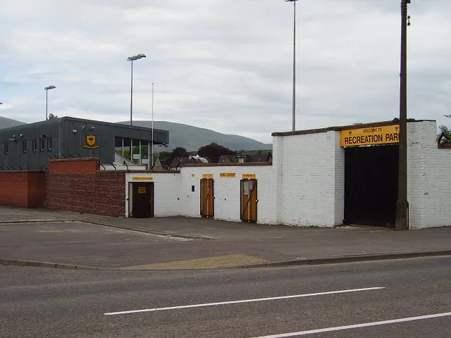
Recreation Park
Recreation Park — football stadium in Alloa, Clackmannanshire, Scotland, UK.
Where to eat & stay near Upper Hirst
Places to stay
 📷 5
📷 5Caravan parks · Central Scotland
The Woods Caravan Park
The Woods Caravan Park — a caravan park in scotland central.
 📷 5
📷 5 📷 5
📷 5Campsites · Central Scotland
Witches Craig Caravan and Camping Park
Witches Craig Caravan and Camping Park — a campsite in scotland central.
 📷 5
📷 5Hotels · Central Scotland
Stirling Court Hotel
Stirling Court Hotel — a hotel in scotland central.
 📷 5
📷 5Hostels · Central Scotland
William Wallace Hotel
William Wallace Hotel — a hostel in scotland central.
 📷 5
📷 5Hotels · Central Scotland
Glenbervie House Hotel
Glenbervie House Hotel — a hotel in scotland central.
Places to eat & drink
 📷 7
📷 7Historic pubs · Central Scotland
Johnstone Arms Hotel, 48 Stirling Street, Alva
Johnstone Arms Hotel, 48 Stirling Street, Alva in Scotland Central, United Kingdom.
 📷 6
📷 6Historic pubs · Central Scotland
The Gothenburg
The Gothenburg in Scotland Islands, United Kingdom.
 📷 7
📷 7Historic pubs · Central Scotland
Ye Olde House Inn, 25-26 Forth Street, Kincardine On Forth
Ye Olde House Inn, 25-26 Forth Street, Kincardine On Forth in Scotland Central, United Kingdom.
 📷 6
📷 6Historic pubs · Central Scotland
Westerton Arms, 34 Henderson Street, Bridge of Allan
Westerton Arms, 34 Henderson Street, Bridge of Allan in Scotland Central, United Kingdom.
 📷 7
📷 7Historic pubs · Central Scotland
Red Lion Inn, Low Causeway, Culross
Red Lion Inn, Low Causeway, Culross in Scotland Central, United Kingdom.
 📷 5
📷 5Historic pubs · Central Scotland
Dennyloanhead
Dennyloanhead in Scotland Islands, United Kingdom.
More places in this region
 📷 3
📷 3 📷 3
📷 3 📷 5
📷 5 📷 5
📷 5Frequently asked questions
- Where is Upper Hirst?
- Upper Hirst is in the Scottish Highlands, United Kingdom (postcode FK10 3LT).
- What is Upper Hirst?
- Upper Hirst in Scotland Islands, United Kingdom.
- How do I get to Upper Hirst?
- The nearest railway station is Alloa, about 0.9 km away. Drivers can use postcode FK10 3LT.
- How do I get to Upper Hirst?
- The nearest railway station is Alloa, about 0.9 km away. Drivers can navigate to postcode FK10 3LT.