
Mountains & hills · South Wales
Tor y Foel
Tor y Foel — Named summit at 552 m.

Wikimedia Commons contributors — see linked file page for photographer and licence licence

Plan your visit
- Typical visit
- 3 h–8 h
- Best time of year
- Late spring – early autumn (May–Oct)
- Nearest railway station
- Torpantau · 7.1 km
- Free entry
- Dog-friendly
About
Tor y Foel is a named summit in the United Kingdom. Wikidata describes it as: "Named summit at 552 m.". Coordinates: 51.8669°, -3.2872°.
Photo gallery
From the Wikipedia article
Tor y Foel is a hill in the Brecon Beacons National Park in the county of Powys in Wales. It is located on the eastern flank of Talybont Reservoir, and the summit at 551m is marked by a small cairn. It gives excellent panoramic views over the valley of the River Usk, across to the Black Mountains and west to the Brecon Beacons.
Excerpt from Wikipedia under CC BY-SA 4.0. See the source article linked in Sources below.
Background
Visiting
The upper reaches of the hill are mapped as open country and therefore available for walkers to roam at will. A minor public road from Talybont-on-Usk skirts the western side of the hill and a bridleway from Llangynidr gives access to the eastern corner of the hill.
Sourced from Wikipedia under CC BY-SA 4.0.
- Coordinates
- 51.8669, -3.2872
- District
- Powys
- Parish
- Talybont-on-Usk
- Postcode
- LD3 7YR
- Parliamentary constituency
- Brecon, Radnor and Cwm Tawe
- Nearest railway station
- Torpantau — 7.1 km
Sources
- osm: n1545868470 (ODbL)
- wikipedia: Tor y Foel (CC BY-SA 4.0)
- commons: Path coming down from Twyn-Du - geograph.org.uk - 1717641.jpg (CC BY-SA 4.0)
Other places nearby

Bryn Melyn
Mountains & hills · 1.2 km

YHA Danywenallt
Hostels · 1.3 km
YHA Danywenallt
Campsites · 1.3 km

Llanddetti Bridge (Canal Bridge No.139)
Historic bridges · 1.4 km

Pen-y-Wenallt Enclosure
Archaeological sites · 1.5 km

Obelisk monument S of St Tetta's church
Memorials & monuments · 1.5 km
Church Of St Tetta
Historic churches · 1.5 km
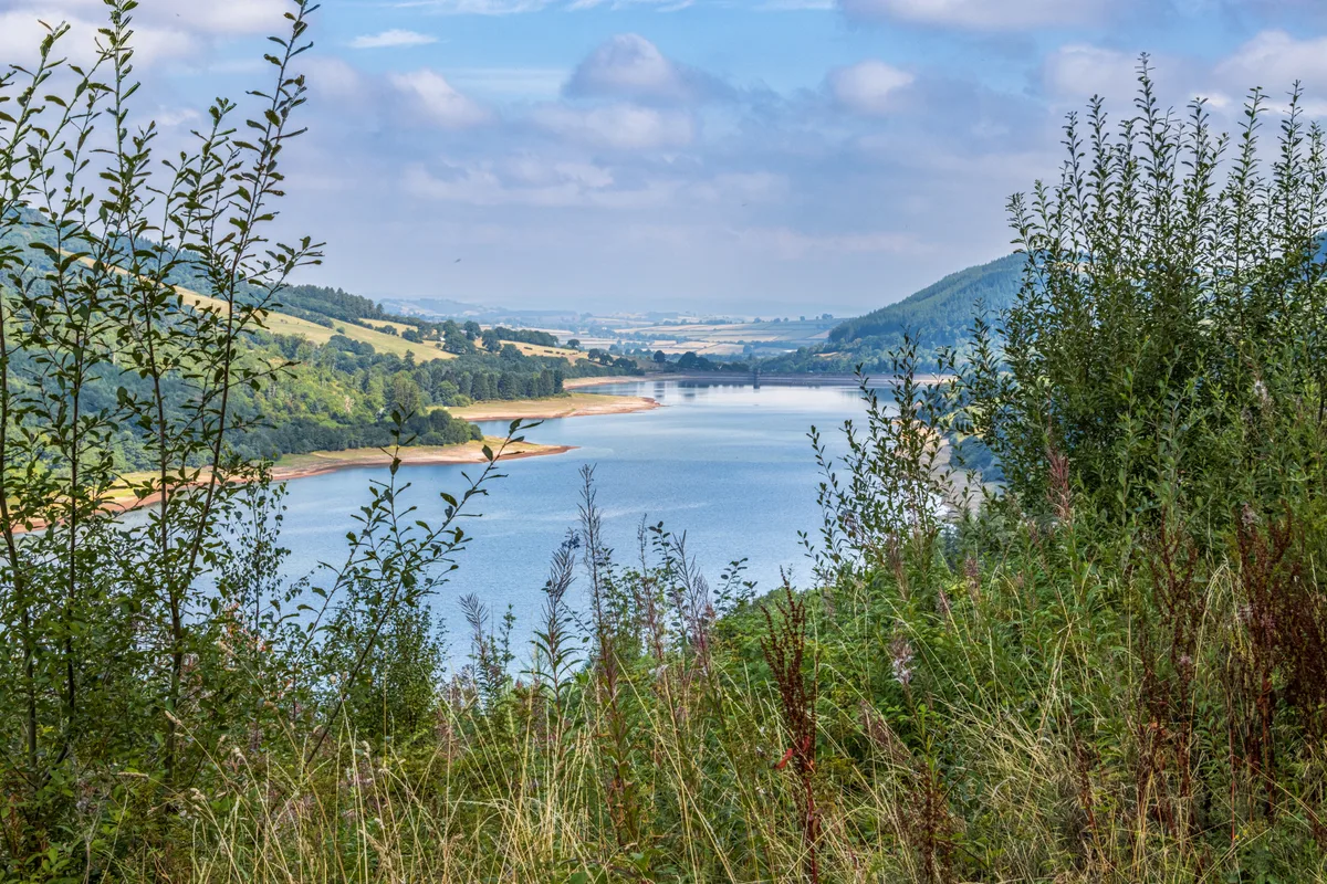
Talybont Reservoir
Reservoirs & lochs · 1.6 km

Wenallt Lower Bridge (Canal Bridge No.140)
Historic bridges · 1.6 km

Dan-y-graig Bridge (Canal Bridge No.137)
Historic bridges · 1.7 km

Wenallt Upper Bridge (Canal Bridge No.141)
Historic bridges · 1.9 km

Workhouse Bridge
Historic bridges · 2.0 km
Nearby
📷 5📷 5📷 5📷 5Historic bridges · South Wales
Llanddetti Bridge (Canal Bridge No.139)
Llanddetti Bridge (Canal Bridge No.139) — Grade II listed building-listed bridge in wales-south, United Kingdom.
📷 3Archaeological sites · South Wales
Pen-y-Wenallt Enclosure
Pen-y-Wenallt Enclosure — an archaeological site in South Wales, United Kingdom.
📷 5Memorials & monuments · South Wales
Obelisk monument S of St Tetta's church
Obelisk monument S of St Tetta's church — Grade II listed building-listed memorial in wales-south, United Kingdom.
Where to eat & stay near Tor y Foel
Places to stay
📷 5📷 5 📷 5
📷 5 📷 5
📷 5Campsites · South Wales
Talybont Farm Camping
Talybont Farm Camping — a campsite in wales south.
 📷 5
📷 5 📷 5
📷 5Places to eat & drink
 📷 5
📷 5Historic pubs · South Wales
White Hart
White Hart — Historic pub — listed building or notable heritage status.
 📷 7
📷 7 📷 7
📷 7Restaurants · South Wales
Chang Thai Cuisine
Chang Thai Cuisine — a restaurant in wales south.
 📷 4
📷 4 📷 5
📷 5Restaurants · South Wales
Sultan of Wales
Sultan of Wales — a restaurant in wales south.
 📷 5
📷 5Historic pubs · South Wales
Skirrid Mountain Inn
Skirrid Mountain Inn — Historic pub — listed building or notable heritage status.
More mountains in this region
 Flagship📷 3
Mountains & hills · South Wales
Milford Haven Waterway
Milford Haven Waterway — ria, or flooded valley, in Pembrokeshire, south-west Wales, UK.
 📷 5
📷 5Mountains & hills · South Wales
Ogof Ffynnon Ddu
Ogof Ffynnon Ddu — cave in the Upper Swansea Valley in South Wales.
 📷 3
📷 3 📷 3
📷 3Frequently asked questions
- Where is Tor y Foel?
- Tor y Foel is in South Wales, United Kingdom (postcode LD3 7YR), in the parish of Talybont-on-Usk.
- What is Tor y Foel?
- Tor y Foel — Named summit at 552 m.
- How do I get to Tor y Foel?
- The nearest railway station is Torpantau, about 7.1 km away. Drivers can use postcode LD3 7YR.
- Is Tor y Foel free to visit?
- Yes, Tor y Foel is free to enter.
- How do I get to Tor y Foel?
- The nearest railway station is Torpantau, about 7.1 km away. Drivers can navigate to postcode LD3 7YR.