
Campsites · South Wales
YHA Danywenallt
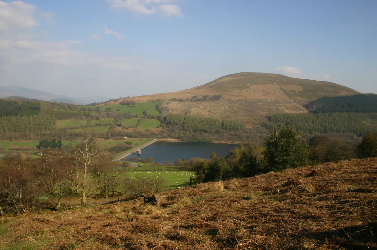
YHA Danywenallt — a campsite in wales south.

Derek Harper — CC BY-SA 2.0 via Wikimedia Commons licence

Plan your visit
- Typical visit
- 1 h–2 h
- Nearest railway station
- Torpantau · 7.0 km
About
YHA Danywenallt is a campsite located in wales south. Campsite listed with verified location and OSM metadata. Pitch availability, facilities (toilets, showers, electric hookup) and seasonal opening vary — confirm directly.
Photo gallery
Place summary
YHA Danywenallt is a campsite located in South Wales. It offers a natural setting for outdoor enthusiasts, with facilities catering to campers. Visitors can expect a range of amenities typical of youth hostels, providing a base for exploring the surrounding landscape. The site is well-positioned for access to local walking trails and outdoor activities.
AI-generated from the structured facts on this page (operator, designation, listing, era). Not a substitute for visiting.
- Coordinates
- 51.8766, -3.2984
- District
- Powys
- Parish
- Talybont-on-Usk
- Postcode
- LD3 7YS
- Parliamentary constituency
- Brecon, Radnor and Cwm Tawe
- Nearest railway station
- Torpantau — 7 km
Sources
- osm: n2960954718 (ODbL)
Other places nearby
YHA Danywenallt
Hostels · 0.0 km

Pen-y-Wenallt Enclosure
Archaeological sites · 0.6 km

Aber, Powys
Other places · 0.8 km
Aber Bridge
Historic bridges · 0.9 km

Wenallt
Mountains & hills · 1.1 km
Craig Danywenallt
Mountains & hills · 1.1 km
Tump Wood Camp
Vineyards · 1.1 km

Tump Wood Camp
Archaeological sites · 1.1 km
Tor y Foel
Mountains & hills · 1.3 km

Wenallt Lower Bridge (Canal Bridge No.140)
Historic bridges · 1.7 km

Llanddetti Bridge (Canal Bridge No.139)
Historic bridges · 1.7 km

Wenallt Upper Bridge (Canal Bridge No.141)
Historic bridges · 1.8 km
Nearby
📷 5📷 3Archaeological sites · South Wales
Pen-y-Wenallt Enclosure
Pen-y-Wenallt Enclosure — an archaeological site in South Wales, United Kingdom.
📷 5📷 5Historic bridges · South Wales
Aber Bridge
Aber Bridge — Grade II listed building-listed bridge in wales-south, United Kingdom.
📷 5📷 5Mountains & hills · South Wales
Craig Danywenallt
Craig Danywenallt — mountain in wales south. Elevation: 356 m.
Where to eat & stay near YHA Danywenallt
Places to stay
📷 5 📷 5
 📷 5
Campsites · South Wales
Talybont Farm Camping
Talybont Farm Camping — a campsite in wales south.
 📷 5
 📷 5
Campsites · South Wales
Pencelli Castle
Pencelli Castle — a campsite in wales south.
 📷 5
Caravan parks · South Wales
Pencelli Castle
Pencelli Castle — a caravan park in wales south.
Places to eat & drink
 📷 5
Historic pubs · South Wales
White Hart
White Hart — Historic pub — listed building or notable heritage status.
 📷 7
Restaurants · South Wales
Chang Thai Cuisine
Chang Thai Cuisine — a restaurant in wales south.
 📷 7
 📷 4
 📷 5
Restaurants · South Wales
Sultan of Wales
Sultan of Wales — a restaurant in wales south.
 📷 5
Historic pubs · South Wales
Skirrid Mountain Inn
Skirrid Mountain Inn — Historic pub — listed building or notable heritage status.
More places in this region
 📷 5
 📷 5
 📷 5
 📷 5
Campsites · South Wales
Cwmcarn Forest Drive Campsite
Cwmcarn Forest Drive Campsite — a campsite in wales south.
Frequently asked questions
- Where is YHA Danywenallt?
- YHA Danywenallt is in South Wales, United Kingdom (postcode LD3 7YS), in the parish of Talybont-on-Usk.
- What is YHA Danywenallt?
- YHA Danywenallt — a campsite in wales south.
- How do I get to YHA Danywenallt?
- The nearest railway station is Torpantau, about 7.0 km away. Drivers can use postcode LD3 7YS.
- How do I get to YHA Danywenallt?
- The nearest railway station is Torpantau, about 7.0 km away. Drivers can navigate to postcode LD3 7YS.