
Mountains & hills · South Wales
Milford Haven Waterway
In or near Johnston.
Milford Haven Waterway — ria, or flooded valley, in Pembrokeshire, south-west Wales, UK.

Wikimedia Commons contributors — see linked file page for photographer and licence licence

Plan your visit
- Typical visit
- 3 h–8 h
- Best time of year
- Late spring – early autumn (May–Oct)
- Nearest railway station
- Milford Haven · 5.5 km
- Free entry
- Dog-friendly
Getting there & planning your visit
To visit Milford Haven Waterway, the nearest railway station is Milford Haven, located 5.5 km away. The postcode for navigation is SA71 5BE, and entry to the site is free.
About
Milford Haven Waterway is a named summit in the United Kingdom. It covers approximately 2,192 km². Part of North Atlantic Ocean. Wikidata describes it as: "ria, or flooded valley, in Pembrokeshire, south-west Wales, UK". Coordinates: 51.7000°, -5.1167°.
Photo gallery
From the Wikipedia article
Milford Haven Waterway (Welsh: Dyfrffordd Aberdaugleddau) is a natural harbour in Pembrokeshire, Wales. It is a ria or drowned valley which was flooded at the end of the last ice age. The Daugleddau estuary winds west to the sea. As one of the deepest natural harbours in the world, it is a busy shipping channel, trafficked by ferries from Pembroke Dock to Ireland, oil tankers and pleasure craft. Admiral Horatio Nelson, visiting the haven with the Hamiltons, described it as the next best natural harbour to Trincomalee in Ceylon (today's Sri Lanka) and "the finest port in Christendom". Much of the coastline of the Waterway is designated as a Site of Special Scientific Interest, listed as Milford Haven Waterway SSSI.
Excerpt from Wikipedia under CC BY-SA 4.0. See the source article linked in Sources below.
Background
History
From the 790s until the Norman Invasion in 1066, the waterway was used occasionally by Vikings looking for shelter. During one visit in 854, the Viking Chieftain Hubba wintered in the Haven with 23 ships, eventually lending his name to the district of Hubberston. Evidence of metal working in the area was recently excavated, suggesting a level of industrialisation in the period 750–1100. A Benedictine priory (Pill Priory) was established at the head of Hubberston Pill in 1170, as a daughter house of St Dogmaels Abbey. Built on virgin land, it stood alongside the priory on Caldey Island as part of the Tironian Order in West Wales, and was dedicated to St Budoc. Founded by Adam de Rupe, it…
Sourced from Wikipedia under CC BY-SA 4.0.
- Coordinates
- 51.7000, -5.1167
- District
- Pembrokeshire
- Parish
- Angle
- Postcode
- SA71 5BE
- Parliamentary constituency
- Mid and South Pembrokeshire
- Nearest railway station
- Milford Haven — 5.5 km
Sources
- wikidata: Q166885 (CC0)
- wikipedia: Milford Haven Waterway (CC BY-SA 4.0)
- commons: Milford Haven Panoramic Attwood.jpg (CC BY-SA 4.0)
Other places nearby

Milford Haven
Natural landmarks · 0.0 km

Thorn Island Fort
Forts · 0.9 km

West Angle Bay
Vineyards · 1.2 km
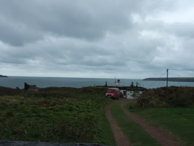
Great Castle Head Light
Lighthouses · 1.3 km

Great Castle Head
Vineyards · 1.3 km
Longoar Bay
Natural landmarks · 1.4 km

Chapel Bay Fort
Historic houses · 1.6 km

Chapel Bay Fort
Archaeological sites · 1.6 km
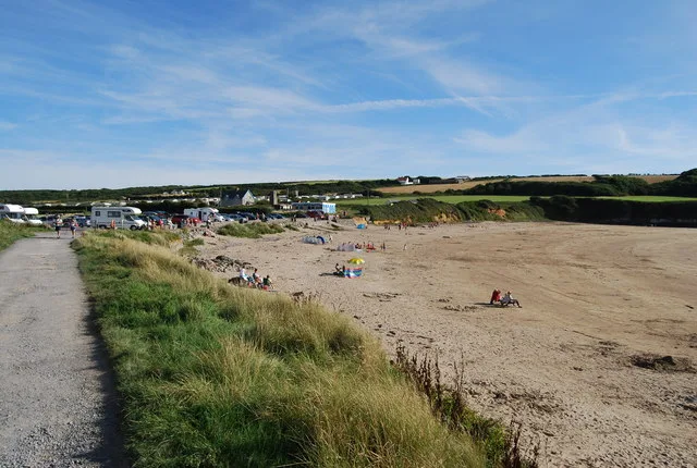
West Angle Bay
Beaches · 1.7 km

Stack Rock Fort
Forts · 1.7 km

Castles Bay Camp
Castles · 1.7 km

Chapel Bay
Natural landmarks · 1.8 km
Nearby
📷 5📷 5📷 5Vineyards · South Wales
West Angle Bay
West Angle Bay — a UK vineyard in wales south, producing English or Welsh wine from cool-climate grape varieties.
📷 3Lighthouses · South Wales
Great Castle Head Light
Great Castle Head Light — lighthouse, Grade II listed building in Pembrokeshire, Wales; situated on cliff-top at Great Castle Head some 1.5 km SSW of Sandy Haven, reached by long drive from Sandy Haven- St Ishmaels road.
📷 5Vineyards · South Wales
Great Castle Head
Great Castle Head — a UK vineyard in wales south, producing English or Welsh wine from cool-climate grape varieties.
📷 5Where to eat & stay near Milford Haven Waterway
Places to stay
 📷 5
📷 5 📷 5
📷 5 📷 5
📷 5 📷 5
📷 5 📷 5
📷 5Caravan parks · South Wales
Hasguard Cross Caravan Park
Hasguard Cross Caravan Park — a caravan park in wales south.
📷 5Campsites · South Wales
Redlands Touring Caravan & Camping Park
Redlands Touring Caravan & Camping Park — a campsite in wales south.
Places to eat & drink
 📷 5
📷 5
 📷 7
📷 7More mountains in this region
 📷 5
📷 5Mountains & hills · South Wales
Ogof Ffynnon Ddu
Ogof Ffynnon Ddu — cave in the Upper Swansea Valley in South Wales.
 📷 3
📷 3 📷 3
📷 3 📷 3
📷 3Frequently asked questions
- Where is Milford Haven Waterway?
- Milford Haven Waterway is in South Wales, United Kingdom (postcode SA71 5BE), in the parish of Angle.
- What is Milford Haven Waterway?
- Milford Haven Waterway — ria, or flooded valley, in Pembrokeshire, south-west Wales, UK.
- How do I get to Milford Haven Waterway?
- The nearest railway station is Milford Haven, about 5.5 km away. Drivers can use postcode SA71 5BE.
- Is Milford Haven Waterway free to visit?
- Yes, Milford Haven Waterway is free to enter.
- How do I get to Milford Haven Waterway?
- The nearest railway station is Milford Haven, about 5.5 km away. Drivers can navigate to postcode SA71 5BE.