
Canals · South East England
Titchfield Canal
In or near Titchfield.
Titchfield Canal is a canal in the United Kingdom.

Wikimedia Commons licence
Plan your visit
- Typical visit
- 1 h–2 h
- Nearest railway station
- Fareham · 3.2 km
- Free entry
- Dog-friendly
Getting there & planning your visit
To visit Titchfield Canal, the nearest railway station is Fareham, located 3.2 km away. The postcode for the canal is PO14 4AJ, which you can use for sat-nav. Entry to the canal is free.
About
Titchfield Canal is a canal in the United Kingdom. Coordinates: 50.8510°, -1.2380°. This entry is part of The Great Britain Guide, a free, ad-free, open-data tourist directory.
Photo gallery
Protected designations
- Site of Special Scientific Interest: Lee-on-The Solent to Itchen Estuary SSSI
Designations sourced from Natural England open data under OGL v3.
From the Wikipedia article
The Titchfield Canal is a two-mile watercourse between the village of Titchfield, Hampshire, and the coast at Titchfield Haven adjacent to the modern nature reserve. Lying above and roughly parallel to the nearby River Meon it is plainly artificial, but its origins and purpose have been warmly debated. It should not be confused with the "New River", a leat from the north eastern corner of Wickham along the western side of the Meon valley, being supplied by various springs before almost joining the river north of Fontley mill. It reappears and its course has been restored near Bridge Lane, Originally, it followed a hillside course to the millpond supplying Titchfied Hammer. Originally designed to irrigate the water meadows in Funtley, it was taken over by the occupants of the forge which resulted in litigation between the forge operators and local farmers. That the "canal" has been used as a feeder channel for a water meadow system is beyond question. The telltale surface patterns of water meadows can still be made out in places from the path along the Canal, and are even clearer from Google Earth images. Further, the remains of a couple of the sluices through which water was admitted from the Canal to the water meadows can still be seen, and 19th century 1:2500 maps show a dozen more but it was never used as a channel for ships to dock at Titchfield for which there is no evidence whatsoever. A very few ships landed goods at Titchfield Haven. On 24 June 1611 the parish register notes that "the same day Titchfield Haven was shutt out by one Richard Talbotts industrie under gods permisione at the costs of the right honourable the Earle of Southampton". It has been inferred from this that a dike was built across the Meon Estuary, preventing sailing vessels from entering the river and cutting off Titchfield from seaborne trade. There is certainly a dike across the Estuary now, but what in detail was done in 1611 is not known. It has been further inferred that to get…
Excerpt from Wikipedia under CC BY-SA 4.0. See the source article linked in Sources below.
- Coordinates
- 50.8510, -1.2380
- County
- Hampshire
- District
- Fareham
- Parish
- Fareham, unparished area
- Postcode
- PO14 4AJ
- Parliamentary constituency
- Hamble Valley
- Nearest railway station
- Fareham — 3.2 km
- Official site
- www.titchfieldfestivaltheatre.com
Sources
- wikidata: Q7809918 (CC0)
- wikipedia: Titchfield Canal (CC BY-SA 4.0)
Other places nearby

Titchfield War Memorial
Memorials & monuments · 0.2 km

The Bugle Hotel
Hotels · 0.3 km

Titchfield
Towns & cities · 0.3 km

Titchfield Festival Theatre
Theatres · 0.5 km

Posbrook Lane Cemetery
Cemeteries · 0.6 km

Titchfield Festival Theatre
Open-air theatres · 0.6 km
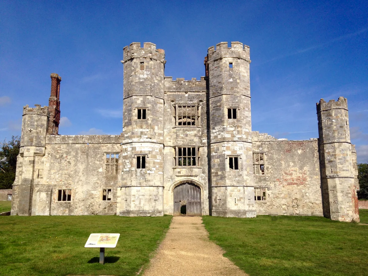
Titchfield Abbey
Abbeys & priories · 0.7 km
Drove Lea Farm
Caravan parks · 1.0 km

Carefree Nurseries
Caravan parks · 1.2 km

Robann Park
Caravan parks · 1.8 km

Heathfield Manor
Manor houses · 1.9 km

Titchfield Haven
Forests & woodlands · 2.2 km
Nearby
📷 5Memorials & monuments · South East England
Titchfield War Memorial
Titchfield War Memorial — Grade II listed building-listed memorial in england-south-east, United Kingdom.
📷 5Hotels · South East England
The Bugle Hotel
The Bugle Hotel — a hotel in england south east.
📷 5Towns & cities · South East England
Titchfield
Titchfield — village in Hampshire, UK.
📷 5Theatres · South East England
Titchfield Festival Theatre
Titchfield Festival Theatre is a theatre in the United Kingdom.
📷 5Cemeteries · South East England
Posbrook Lane Cemetery
Posbrook Lane Cemetery is a cemetery in the United Kingdom.
📷 5Open-air theatres · South East England
Titchfield Festival Theatre
Titchfield Festival Theatre — a open-air theatre in england south east.
Where to eat & stay near Titchfield Canal
Places to stay
📷 5Hotels · South East England
The Bugle Hotel
The Bugle Hotel — a hotel in england south east.
Caravan parks · South East England
Drove Lea Farm
Drove Lea Farm — a caravan park in england south east.
📷 4Caravan parks · South East England
Carefree Nurseries
Carefree Nurseries — a caravan park in england south east.
📷 5 📷 5
📷 5 📷 5
📷 5Caravan parks · South East England
Solent Breezes
Solent Breezes — a caravan park in england south east.
Places to eat & drink
 📷 5
📷 5Historic pubs · South East England
Jolly Farmer Public House
Jolly Farmer Public House in England South East, United Kingdom.
 📷 5
📷 5Historic pubs · South East England
The Golden Lion Public House
The Golden Lion Public House in England South East, United Kingdom.
 📷 5
📷 5Historic pubs · South East England
The Victory Inn
The Victory Inn in England South East, United Kingdom.
 📷 5
📷 5Historic pubs · South East England
Jolly Sailor Public House
Jolly Sailor Public House in England South East, United Kingdom.
 📷 7
📷 7Historic pubs · South East England
The Square Cow
The Square Cow in England South East, United Kingdom.
 📷 7
📷 7Historic pubs · South East England
The Old House Hotel
The Old House Hotel in England South East, United Kingdom.
More places in this region
 📷 5
📷 5Canals · South East England
Thames and Medway Canal
Thames and Medway Canal — disused canal in Kent, England.
 📷 5
📷 5 📷 5
📷 5Canals · South East England
Basingstoke Canal
Basingstoke Canal is a canal in the United Kingdom.
 📷 5
📷 5Frequently asked questions
- Where is Titchfield Canal?
- Titchfield Canal is in Hampshire, South-East England, United Kingdom (postcode PO14 4AJ), in the parish of Fareham, unparished area.
- What is Titchfield Canal?
- Titchfield Canal is a canal in the United Kingdom.
- How do I get to Titchfield Canal?
- The nearest railway station is Fareham, about 3.2 km away. The nearest town is Titchfield. Drivers can use postcode PO14 4AJ.
- Is Titchfield Canal a protected site?
- Yes — Titchfield Canal is part of the Lee-on-The Solent to Itchen Estuary SSSI Site of Special Scientific Interest.
- Is Titchfield Canal free to visit?
- Yes, Titchfield Canal is free to enter.
- How do I get to Titchfield Canal?
- The nearest railway station is Fareham, about 3.2 km away. Drivers can navigate to postcode PO14 4AJ.