
Forts · South Wales
Thorn Island Fort
In or near Johnston.
Thorn Island Fort — fort in wales south.

Alan Hughes — CC BY-SA 2.0 via Wikimedia Commons licence

Plan your visit
- Typical visit
- 45 min–1.5 h
- Nearest railway station
- Milford Haven · 5.9 km
About
Thorn Island Fort is a fort located in wales south. A British historic fort or fortification recorded in OpenStreetMap. Recorded in OpenStreetMap with verified coordinates and name attribution. British features of this type are typically catalogued in Ordnance Survey 1:50k mapping.
Photo gallery
Place summary
Thorn Island Fort is a coastal fortification located in South Wales, within the parish of Angle. This structure is situated on Thorn Island, which lies in the Milford Haven Waterway. It was built to defend the waterway and is notable for its historical military significance. The fort remains an interesting example of 19th-century military architecture.
AI-generated from the structured facts on this page (operator, designation, listing, era). Not a substitute for visiting.
- Coordinates
- 51.6918, -5.1178
- District
- Pembrokeshire
- Parish
- Angle
- Postcode
- SA71 5BE
- Parliamentary constituency
- Mid and South Pembrokeshire
- Nearest railway station
- Milford Haven — 5.9 km
Sources
Other places nearby

West Angle Bay
Vineyards · 0.5 km

Castles Bay Camp
Castles · 0.8 km

Milford Haven
Natural landmarks · 0.9 km

Milford Haven Waterway
Mountains & hills · 0.9 km
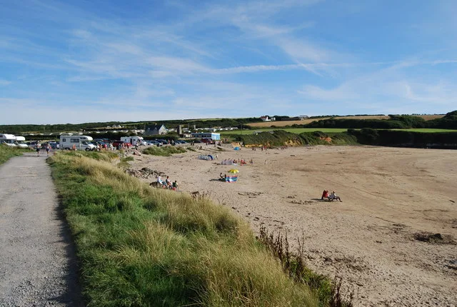
West Angle Bay
Beaches · 1.0 km

Chapel Bay Fort
Historic houses · 1.3 km

Chapel Bay Fort
Archaeological sites · 1.3 km

Chapel Bay
Natural landmarks · 1.6 km
North Hill, Angle
Literary houses · 1.7 km

Castles Bay Camp
Literary houses · 2.0 km
Castles Bay
Vineyards · 2.0 km

Whitedole Bay
Natural landmarks · 2.1 km
Nearby
📷 5Vineyards · South Wales
West Angle Bay
West Angle Bay — a UK vineyard in wales south, producing English or Welsh wine from cool-climate grape varieties.
📷 5📷 5Flagship📷 3Mountains & hills · South Wales
Milford Haven Waterway
Milford Haven Waterway — ria, or flooded valley, in Pembrokeshire, south-west Wales, UK.
📷 3📷 3Historic houses · South Wales
Chapel Bay Fort
Chapel Bay Fort — a historic house in wales-south, United Kingdom.
Where to eat & stay near Thorn Island Fort
Places to stay
 📷 5
📷 5 📷 5
📷 5 📷 5
📷 5 📷 5
📷 5 📷 5
📷 5 📷 5
📷 5Places to eat & drink
 📷 5
📷 5
 📷 7
📷 7More forts in this region
 📷 3
📷 3Forts · South Wales
Battle of Carn Mountain 1081
Battle of Carn Mountain 1081 is a fort in the United Kingdom.
 📷 3
📷 3 📷 3
📷 3 📷 3
📷 3Frequently asked questions
- Where is Thorn Island Fort?
- Thorn Island Fort is in South Wales, United Kingdom (postcode SA71 5BE), in the parish of Angle.
- What is Thorn Island Fort?
- Thorn Island Fort — fort in wales south.
- How do I get to Thorn Island Fort?
- The nearest railway station is Milford Haven, about 5.9 km away. Drivers can use postcode SA71 5BE.
- How do I get to Thorn Island Fort?
- The nearest railway station is Milford Haven, about 5.9 km away. Drivers can navigate to postcode SA71 5BE.