
Follies · South West England
The Storm Tower
In or near Maer.
The Storm Tower — Folly or eyecatcher.

Wikimedia Commons contributors — see linked file page for photographer and licence licence

Plan your visit
- Typical visit
- 20 min–45 min
- Free entry
- Dog-friendly
- Wheelchair accessible
About
The Storm Tower is a folly — a piece of decorative architecture built more for the view than any practical purpose — in the United Kingdom. Records date its origin to 1835. Wikidata describes it as: "Folly or eyecatcher.". Coordinates: 50.8290°, -4.5549°.
Photo gallery
See it from the streetimagery from 2023
Imagery © Mapillary contributors, CC BY-SA 4.0
Heritage listing
The Storm Tower at Compass Point, Bude–Stratton, Cornwall, England, is an octagonal lookout tower, modelled on the Tower of the Winds in Athens, Greece. It is known locally as the Pepperpot. The tower was built in 1835 on the instructions of Sir Thomas Dyke Acland, 10th Baronet, to a design by George Wightwick, as a place from which coastguards could observe ships on the adjacent Atlantic Ocean. Historic England describe it thus: Roughly-dressed stone brought to course with freestone quoins... on plinth with 3 granite steps up to entrance on east side. Entrance has entablature and pediment on freestone pilasters. Each side has slit window with stone sill, those to north-east and north-west blocked. The points of the compass are carved as a frieze in sans-serif below the moulded cornice.
From the Historic England List Entry under OGL v3.
Official information
The Heritage Centre at The Castle offers visitors a chance to explore the local history of Bude and its surroundings. It features themed areas and exhibits dedicated to notable figures and events, including the life of Sir Goldsworthy Gurney, who built The Castle in 1830.
Protected designations
- Site of Special Scientific Interest: Bude Coast SSSI
- Area of Outstanding Natural Beauty: Cornwall
Designations sourced from Natural England open data under OGL v3.
From the Wikipedia article
The Storm Tower at Compass Point, Bude–Stratton, Cornwall, England, is an octagonal lookout tower, modelled on the Tower of the Winds in Athens, Greece. It is known locally as the Pepperpot. The tower was built in 1835 on the instructions of Sir Thomas Dyke Acland, 10th Baronet, to a design by George Wightwick, as a place from which coastguards could observe ships on the adjacent Atlantic Ocean. Historic England describe it thus: Roughly-dressed stone brought to course with freestone quoins... on plinth with 3 granite steps up to entrance on east side. Entrance has entablature and pediment on freestone pilasters. Each side has slit window with stone sill, those to north-east and north-west blocked. The points of the compass are carved as a frieze in sans-serif below the moulded cornice. Low pyramidal roof with moulded base to cross formerly surmounting tower. Interior has slate floor and brick dressings to slit windows. The current roof is not original. As built, the tower was aligned to magnetic north, but polar drift means this is now seven degrees out. The tower sits on a sandstone and shale cliff that is described as friable and which is subject to erosion, averaging 1 metre (1.1 yd) a year, but with the potential for a 25-metre (27 yd) loss at any time. As a result, the tower had to be moved a short distance from the cliff edge in 1881. Because of the ongoing threat of erosion, the tower was again dismantled and reconstructed 100 metres (110 yd) further inland, at a cost of around £450,000, over a six-month period starting in late April 2023 and finishing in March 2024. Funding was provided by the National Lottery Heritage Fund (£249,362), public crowdfunding (£58,000), Cornwall Council (£50,000) and Bude-Stratton town council (£40,000). The work was undertaken by specialist contractors Sally Strachey Historic Conservation. The tower has been Grade II listed since September 1985, giving it legal protection against unauthorised alteration or demolition.
Excerpt from Wikipedia under CC BY-SA 4.0. See the source article linked in Sources below.
- Coordinates
- 50.8290, -4.5549
- District
- Cornwall
- Parish
- Bude-Stratton
- Postcode
- EX23 8SE
- Parliamentary constituency
- North Cornwall
- Phone
- 01288 357300
- Established
- 1835
Sources
- osm: w560082922 (ODbL)
- wikipedia: Compass Point Storm Tower (CC BY-SA 4.0)
- commons: Storm Tower, Compass Point. - panoramio.jpg (CC BY-SA 4.0)
Featured in this guide
Other places nearby

Compass Cove
Beaches · 0.2 km

Post medieval sea lock at Bude Canal
Canal locks · 0.2 km

Sea Lock, Lock Gates And Hand Winches
Canal locks · 0.2 km

Summerleaze Beach
Beaches · 0.3 km
.jpg?width=1200)
Bude Sea Pool
Beaches · 0.4 km

The Old Forge
Natural landmarks · 0.4 km
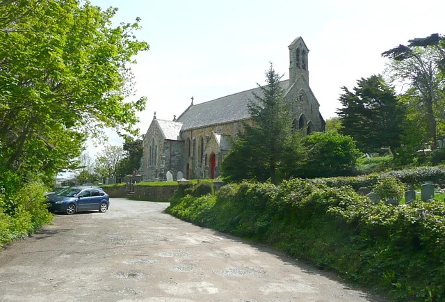
St Michael and All Angels Church, Bude
Historic churches · 0.4 km
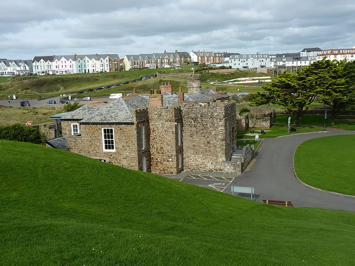
The Castle Heritage Centre
Museums · 0.4 km

Bude Light
Memorials & monuments · 0.5 km

Bude Canal
Canals · 0.5 km

Middle Beach
Beaches · 0.5 km

Efford Downs Campsite
Campsites · 0.5 km
Nearby
📷 5📷 5Canal locks · South West England
Post medieval sea lock at Bude Canal
Post medieval sea lock at Bude Canal — lock in Bude-Stratton, Cornwall, England, UK.
📷 3Canal locks · South West England
Sea Lock, Lock Gates And Hand Winches
Sea Lock, Lock Gates And Hand Winches — lock in Bude-Stratton, Cornwall, England, UK.
📷 3Beaches · South West England
Summerleaze Beach
Summerleaze Beach is a beach in the United Kingdom.
📷 5Beaches · South West England
Bude Sea Pool
Bude Sea Pool — Outdoor swimming pool / lido.
📷 3Natural landmarks · South West England
The Old Forge
The Old Forge — a other in england-south-west, United Kingdom.
Where to eat & stay near The Storm Tower
Places to stay
📷 5Campsites · South West England
Efford Downs Campsite
Efford Downs Campsite — a campsite in england south west.
 📷 5
📷 5Caravan parks · South West England
Bude Holiday Park
Bude Holiday Park — a caravan park in england south west.
Caravan parks · South West England
Atlantic Surf Pods
Atlantic Surf Pods — a caravan park in england south west.
 📷 5
📷 5Caravan parks · South West England
Wooda Farm Park
Wooda Farm Park — a caravan park in england south west.
 📷 5
📷 5Campsites · South West England
Sandparks Campsite
Sandparks Campsite — a campsite in england south west.
 📷 5
📷 5Caravan parks · South West England
Bryder Farm Camping
Bryder Farm Camping — a caravan park in england south west.
Places to eat & drink
 📷 7
📷 7Historic pubs · South West England
The Old Cartaret Arms
The Old Cartaret Arms in England South West, United Kingdom.
 📷 7
📷 7Historic pubs · South West England
The Old Smithy
The Old Smithy in England South West, United Kingdom.
 📷 7
📷 7Restaurants · South West England
Napoleon Inn
Napoleon Inn — a restaurant in england south west.
 📷 7
📷 7Other follies from this era
 📷 5
📷 5.jpg?width=1200) 📷 5
📷 5.jpg?width=1200) 📷 5
📷 5 📷 5
📷 5More follies in this region
 📷 5
📷 5Follies · South West England
Batheaston Villa Temple
Batheaston Villa Temple — Folly or eyecatcher.
 📷 5
📷 5Follies · South West England
Beckford's Tower
Beckford's Tower — Folly or eyecatcher.
 📷 5
📷 5Follies · South West England
Belvedere Tower
Belvedere Tower — Folly or eyecatcher.
 📷 5
📷 5Frequently asked questions
- Where is The Storm Tower?
- The Storm Tower is in South-West England, United Kingdom (postcode EX23 8SE), in the parish of Bude-Stratton.
- What is The Storm Tower?
- The Storm Tower — Folly or eyecatcher.
- How do I get to The Storm Tower?
- The nearest town is Maer. Drivers can use postcode EX23 8SE.
- When was The Storm Tower built?
- Built or established in 1835.
- Who owns The Storm Tower?
- The Storm Tower is owned by | designation1 = Grade II.
- Is The Storm Tower a listed building?
- The Storm Tower is officially recognised as Grade II listed building listed.
- Is The Storm Tower a protected site?
- Yes — The Storm Tower is part of the Bude Coast SSSI Site of Special Scientific Interest and the Cornwall National Landscape (AONB).
- Is The Storm Tower free to visit?
- Yes, The Storm Tower is free to enter.