
Follies · South West England
Browne's Folly
Also known as: Brown's Folly
In or near Bathford.
Browne's Folly — Folly or eyecatcher.

Wikimedia Commons contributors — see linked file page for photographer and licence licence

Plan your visit
- Typical visit
- 20 min–45 min
- Nearest railway station
- Bath Spa · 4.5 km
- Free entry
- Dog-friendly
Getting there & planning your visit
To visit Browne's Folly, the nearest railway station is Bath Spa, located 4.5 km away. The postcode for sat-nav is BA1 7TP, and entry is free.
About
Browne's Folly is a folly — a piece of decorative architecture built more for the view than any practical purpose — in the United Kingdom. OpenStreetMap heritage rating: 2/5. Also known as: Brown's Folly. Wikidata describes it as: "Folly or eyecatcher.". Coordinates: 51.3932°, -2.2962°.
Photo gallery
Protected designations
- Site of Special Scientific Interest: Brown's Folly SSSI
- Area of Outstanding Natural Beauty: Cotswolds
Designations sourced from Natural England open data under OGL v3.
From the Wikipedia article
Browne's Folly, or Brown's Folly (grid reference ST793662), is a folly tower sitting within a 39.9 hectare biological and geological Site of Special Scientific Interest (SSSI) near the English village of Bathford in Somerset, notified in 1974: the site itself is known as the Farleigh (sometimes Farly) Down Stone Quarry and is managed as a nature reserve by the Avon Wildlife Trust (AWT). The tower was built in 1848 and is a Grade II listed building. The site is situated on steep west-facing slopes which overlook the River Avon. The calcareous soils have developed on Lower Lias clays, fuller's earth and oolitic limestone strata of Jurassic age. The local geology is of major importance in the context of the British Bathonian stratigraphy. The site forms part of the Bath and Bradford-on-Avon Bats Special Area of Conservation and includes the remains of quarries used for the extraction of Bath Stone. These provide a rich variety of wildlife habitats. Downland flora has covered the spoilheaps where wild thyme, harebell and nine species of orchid (including the rare Fly Orchid) are found. Yellow Bird's-nest occurs here. The damp cliff faces support a variety of ferns, fungi and spiders. Pockets of ancient woodland on the lower slopes are home to woodpeckers, and unusual plants such as Bath asparagus.
Excerpt from Wikipedia under CC BY-SA 4.0. See the source article linked in Sources below.
Background
Visiting
In 2000, access was unilaterally withdrawn by the Avon Wildlife Trust pending the results of a mine inspector's report on the safety of the mines. This report was required because of the Health and Safety at Work Act which affects employees and volunteers of Avon Wildlife Trust who might have to enter the mine to count the bats. These legal requirements do not affect leisure access by cavers. Prior to 2000, access to the mine was controlled by the Council of Southern Caving Clubs and cavers coexisted with a thriving bat population with voluntary restrictions on access during the bat roosting season.
Sourced from Wikipedia under CC BY-SA 4.0.
- Coordinates
- 51.3932, -2.2962
- District
- Bath and North East Somerset
- Parish
- Bathford
- Postcode
- BA1 7TP
- Parliamentary constituency
- Bath
- Nearest railway station
- Bath Spa — 4.5 km
Sources
- osm: w159038676 (ODbL)
- wikipedia: Browne's Folly (CC BY-SA 4.0)
- commons: Farly Down Quarry.jpg (CC BY-SA 4.0)
Featured in this guide
Other places nearby

Bathford Hill
Mountains & hills · 0.0 km

The Blackberries Camping Park
Campsites · 0.6 km

Bathford Manor
Manor houses · 0.9 km

Bathford
Towns & cities · 0.9 km

The Inn And Public House
Historic pubs · 0.9 km
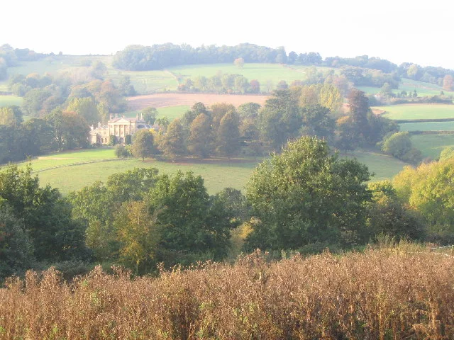
Shockerwick House
Stately homes · 1.0 km
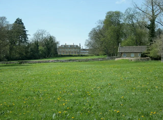
Monkton Farleigh Manor
Stately homes · 1.2 km

Multi-span bridge called Bathford Bridge
Historic bridges · 1.3 km

Two Monuments In The Churchyard About 13 Metres North West Of Tower Of Church Of St Peter
Memorials & monuments · 1.4 km
Three Monuments In The Churchyard Between 3 And 8 Metres North Of Chancel Of Church Of St Peter
Memorials & monuments · 1.4 km

Bridge Over Kennet And Avon Canal At National Grid Reference St7876 6471
Historic bridges · 1.5 km

Claverton Pumping Station
Canals · 1.7 km
Nearby
📷 5Mountains & hills · South West England
Bathford Hill
Bathford Hill — a hill or mountain in england south east.
📷 5Campsites · South West England
The Blackberries Camping Park
The Blackberries Camping Park — a campsite in england south east.
📷 5Manor houses · South West England
Bathford Manor
Bathford Manor — Grade II listed building-listed manor in england-south-east, United Kingdom.
📷 5Towns & cities · South West England
Bathford
Bathford — a village located in Bath and North East Somerset, United Kingdom.
📷 7Historic pubs · South West England
The Inn And Public House
The Inn And Public House in England South West, United Kingdom.
📷 5Stately homes · South West England
Shockerwick House
Shockerwick House — Grade I listed house in Bathford, Somerset, England, UK.
Where to eat & stay near Browne's Folly
Places to stay
📷 5Campsites · South West England
The Blackberries Camping Park
The Blackberries Camping Park — a campsite in england south east.
 📷 6
📷 6B&Bs · South West England
Dolphin House
Dolphin House — a bed-and-breakfast in england south east.
 📷 5
📷 5Hotels · South West England
Bailbrook House Hotel
Bailbrook House Hotel — a hotel in england south east.
📷 7Hotels · South West England
Bailbrook Lodge Hotel
Bailbrook Lodge Hotel — a hotel in england south east.
 📷 5
📷 5B&Bs · South West England
Rainbow Wood Farm
Rainbow Wood Farm — a bed-and-breakfast in england south east.
 📷 5
📷 5Places to eat & drink
📷 7Historic pubs · South West England
The Inn And Public House
The Inn And Public House in England South West, United Kingdom.
 📷 7
📷 7Restaurants · South West England
The Bathampton Mill
The Bathampton Mill — a restaurant in england south east.
 📷 6
📷 6 📷 5
📷 5 📷 5
📷 5Restaurants · South West England
joya
joya — a restaurant in england south east.
 📷 5
📷 5More follies in this region
 📷 5
📷 5Follies · South West England
Batheaston Villa Temple
Batheaston Villa Temple — Folly or eyecatcher.
 📷 5
📷 5Follies · South West England
Beckford's Tower
Beckford's Tower — Folly or eyecatcher.
 📷 5
📷 5Follies · South West England
Belvedere Tower
Belvedere Tower — Folly or eyecatcher.
 📷 5
📷 5Frequently asked questions
- Where is Browne's Folly?
- Browne's Folly is in South-West England, United Kingdom (postcode BA1 7TP), in the parish of Bathford.
- What is Browne's Folly?
- Browne's Folly — Folly or eyecatcher.
- How do I get to Browne's Folly?
- The nearest railway station is Bath Spa, about 4.5 km away. The nearest town is Bathford. Drivers can use postcode BA1 7TP.
- Is Browne's Folly a protected site?
- Yes — Browne's Folly is part of the Brown's Folly SSSI Site of Special Scientific Interest and the Cotswolds National Landscape (AONB).
- Is Browne's Folly free to visit?
- Yes, Browne's Folly is free to enter.
- How do I get to Browne's Folly?
- The nearest railway station is Bath Spa, about 4.5 km away. Drivers can navigate to postcode BA1 7TP.