
Caravan parks · North Wales
The Ring
The Ring — a caravan park in wales north.

Gerald England — CC BY-SA 2.0 via Wikimedia Commons licence

Plan your visit
- Typical visit
- 1 h–2 h
About
The Ring is a caravan park located in wales north. Phone: +44 1407 830720. Caravan park listed with verified location and OSM metadata. Touring pitches, static availability and seasonal opening vary — confirm directly with the park.
Photo gallery
Place summary
The Ring is a caravan park located in North Wales. It offers a natural setting for visitors looking to enjoy the outdoors. Guests can expect facilities suitable for caravanning, with access to local attractions and scenic views. The park provides a relaxed atmosphere, ideal for families and individuals seeking a countryside retreat.
AI-generated from the structured facts on this page (operator, designation, listing, era). Not a substitute for visiting.
- Coordinates
- 53.3762, -4.3932
- District
- Isle of Anglesey
- Parish
- Rhosybol
- Postcode
- LL66 0AB
- Parliamentary constituency
- Ynys Môn
- Phone
- +44 1407 830720
- Official site
- www.theringanglesey.co.uk
Sources
- osm: n6521919285 (ODbL)
Other places nearby

Rhosgoch
Historic churches · 0.2 km

Bodewryd Standing Stone
Windmills · 1.0 km
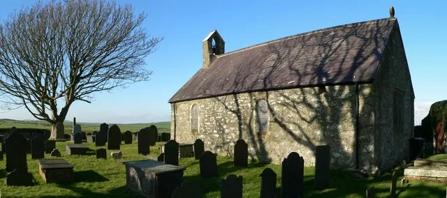
St Mary's Church, Bodewryd
Historic churches · 1.6 km

Plas Bodewryd
Gardens · 1.8 km

Bodewryd
Historic churches · 1.8 km

Rhosybol
Historic churches · 1.9 km

Penyfynwent
Archaeological sites · 2.5 km

Carreglefn
Historic churches · 2.6 km
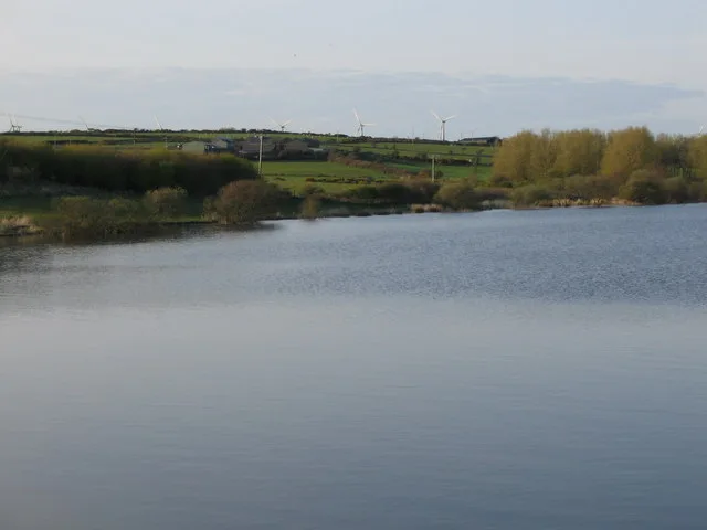
Llyn Alaw
Reservoirs & lochs · 2.9 km
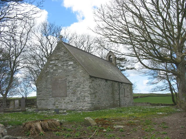
St Peirio's Church
Historic churches · 3.1 km

St Peirio's Church, Rhosbeirio
Historic churches · 3.1 km

Gwredog
Villages · 3.1 km
Nearby
📷 5Historic churches · North Wales
Rhosgoch
Rhosgoch (; meaning: 'red moor') is a small village in the north of the island of Anglesey, Wales, about 3.5 miles (5.6 km) to the south-west of Amlwch. It is in the community of Rhosybol. A short dis
📷 5Windmills · North Wales
Bodewryd Standing Stone
Bodewryd Standing Stone — a post mill in wales-north, United Kingdom.
📷 3Historic churches · North Wales
St Mary's Church, Bodewryd
St Mary's Church, Bodewryd — church in Bodewryd, Anglesey, Wales.
📷 4📷 5Historic churches · North Wales
Bodewryd
Bodewryd (Welsh: [bod'ɛrʊi̯d]; ) is a village in Anglesey, Wales, in the community of Mechell.
📷 5Historic churches · North Wales
Rhosybol
Rhosybol (Welsh for 'moor in the hollow') is a village and community in Anglesey, Wales. The community population at the 2011 census was 1,078. Located 2.5 miles (4.0 km) south of the town of Amlwch,
Where to eat & stay near The Ring
Places to stay
 📷 5
📷 5Hotels · North Wales
Dinorben Arms
Dinorben Arms — a hotel in wales north.
 📷 5
📷 5 📷 5
📷 5 📷 5
📷 5Caravan parks · North Wales
Point Lynas Caravan Park
Point Lynas Caravan Park — a caravan park in wales north.
 📷 5
📷 5Caravan parks · North Wales
Tyddyn Isaf Caravan Park
Tyddyn Isaf Caravan Park — a caravan park in wales north.
 📷 5
📷 5Places to eat & drink
 📷 5
📷 5Historic pubs · North Wales
The Kings Head Hotel
The Kings Head Hotel in Wales North, United Kingdom.
 📷 5
📷 5Historic pubs · North Wales
The Bull Hotel, Llangefni
The Bull Hotel, Llangefni in Wales North, United Kingdom.
 📷 5
📷 5 📷 5
📷 5Restaurants · North Wales
Oyster Catcher
Oyster Catcher — a restaurant in wales north.
 📷 5
📷 5Historic pubs · North Wales
The George and Dragon
The George and Dragon — Historic pub — listed building or notable heritage status.
 📷 7
📷 7More places in this region
 📷 5
📷 5Caravan parks · North Wales
Green Pastures Caravan Park
Green Pastures Caravan Park — a caravan park in wales north.
 📷 5
📷 5 📷 5
📷 5Caravan parks · North Wales
Gimblet Rock Holiday Park
Gimblet Rock Holiday Park — a caravan park in wales north.
 📷 5
📷 5Frequently asked questions
- Where is The Ring?
- The Ring is in North Wales, United Kingdom (postcode LL66 0AB), in the parish of Rhosybol.
- What is The Ring?
- The Ring — a caravan park in wales north.
- How do I get to The Ring?
- Drivers can use postcode LL66 0AB.
- How do I get to The Ring?
- Drivers can navigate to postcode LL66 0AB. It sits within the Ynys Môn parliamentary constituency.