
Historic churches · North Wales
Rhosgoch
Rhosgoch (; meaning: 'red moor') is a small village in the north of the island of Anglesey, Wales, about 3.5 miles (5.6 km) to the south-west of Amlwch. It is in the community of Rhosybol. A short dis

Gerald England — CC BY-SA 2.0 via Wikimedia Commons licence

Plan your visit
- Typical visit
- 30 min–1 h
- Free entry
About
Rhosgoch (; meaning: 'red moor') is a small village in the north of the island of Anglesey, Wales, about 3.5 miles (5.6 km) to the south-west of Amlwch. It is in the community of Rhosybol. A short distance to the west of the village is the small lake Llyn Hafodol and a mile to the south is Anglesey's largest body of water: the reservoir Llyn Alaw (Water Lily Lake). The village once had a station on the Anglesey Central Railway. Although the tracks still exist, no train has run on them since 1993. Also connected to the railway was a short south-west facing spur that led to an oil terminal. This was linked to a floating dock in the sea off Amlwch, where super-tankers could dock in all tides and feed oil via Rhosgoch and a pipeline to Stanlow oil refinery. This operation lasted for 16 years between 1974 and 1990. The first tornado of the record-breaking 1981 United Kingdom tornado outbreak, an F1/T2 tornado, touched down close to Rhosgoch at around 10:19 local time on 23 November 1981.
Photo gallery
From the Wikipedia article
Rhosgoch (; meaning: 'red moor') is a small village in the north of the island of Anglesey, Wales, about 3.5 miles (5.6 km) to the south-west of Amlwch. It is in the community of Rhosybol. A short distance to the west of the village is the small lake Llyn Hafodol and a mile to the south is Anglesey's largest body of water: the reservoir Llyn Alaw (Water Lily Lake). The village once had a station on the Anglesey Central Railway. Although the tracks still exist, no train has run on them since 1993. Also connected to the railway was a short south-west facing spur that led to an oil terminal. This was linked to a floating dock in the sea off Amlwch, where super-tankers could dock in all tides and feed oil via Rhosgoch and a pipeline to Stanlow oil refinery. This operation lasted for 16 years between 1974 and 1990. The first tornado of the record-breaking 1981 United Kingdom tornado outbreak, an F1/T2 tornado, touched down close to Rhosgoch at around 10:19 local time on 23 November 1981.
Excerpt from Wikipedia under CC BY-SA 4.0. See the source article linked in Sources below.
- Coordinates
- 53.3750, -4.3920
- District
- Isle of Anglesey
- Parish
- Rhosybol
- Postcode
- LL66 0AB
- Parliamentary constituency
- Ynys Môn
Sources
- wikipedia: Rhosgoch (CC BY-SA 4.0)
Other places nearby

The Ring
Caravan parks · 0.2 km

Bodewryd Standing Stone
Windmills · 1.1 km
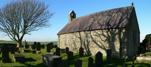
St Mary's Church, Bodewryd
Historic churches · 1.7 km

Rhosybol
Historic churches · 1.8 km

Bodewryd
Historic churches · 1.9 km

Plas Bodewryd
Gardens · 1.9 km

Penyfynwent
Archaeological sites · 2.4 km

Carreglefn
Historic churches · 2.7 km
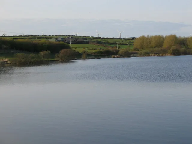
Llyn Alaw
Reservoirs & lochs · 2.9 km

Gwredog
Villages · 3.0 km

Parys Mountain View
Viewpoints · 3.1 km
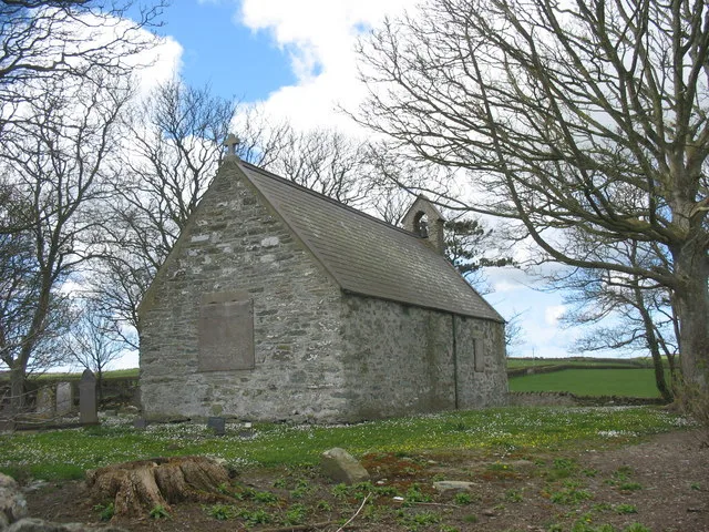
St Peirio's Church
Historic churches · 3.2 km
Nearby
📷 5📷 5Windmills · North Wales
Bodewryd Standing Stone
Bodewryd Standing Stone — a post mill in wales-north, United Kingdom.
📷 3Historic churches · North Wales
St Mary's Church, Bodewryd
St Mary's Church, Bodewryd — church in Bodewryd, Anglesey, Wales.
📷 5Historic churches · North Wales
Rhosybol
Rhosybol (Welsh for 'moor in the hollow') is a village and community in Anglesey, Wales. The community population at the 2011 census was 1,078. Located 2.5 miles (4.0 km) south of the town of Amlwch,
📷 5Historic churches · North Wales
Bodewryd
Bodewryd (Welsh: [bod'ɛrʊi̯d]; ) is a village in Anglesey, Wales, in the community of Mechell.
📷 4Where to eat & stay near Rhosgoch
Places to stay
📷 5 📷 5
📷 5Hotels · North Wales
Dinorben Arms
Dinorben Arms — a hotel in wales north.
 📷 5
📷 5 📷 5
📷 5 📷 5
📷 5Caravan parks · North Wales
Point Lynas Caravan Park
Point Lynas Caravan Park — a caravan park in wales north.
 📷 5
📷 5Caravan parks · North Wales
Tyddyn Isaf Caravan Park
Tyddyn Isaf Caravan Park — a caravan park in wales north.
Places to eat & drink
 📷 5
📷 5Historic pubs · North Wales
The Kings Head Hotel
The Kings Head Hotel in Wales North, United Kingdom.
 📷 5
📷 5Historic pubs · North Wales
The Bull Hotel, Llangefni
The Bull Hotel, Llangefni in Wales North, United Kingdom.
 📷 5
📷 5 📷 5
📷 5Restaurants · North Wales
Oyster Catcher
Oyster Catcher — a restaurant in wales north.
 📷 5
📷 5Historic pubs · North Wales
The George and Dragon
The George and Dragon — Historic pub — listed building or notable heritage status.
 📷 7
📷 7More places in this region
 📷 3
📷 3Historic churches · North Wales
All Saints Church
All Saints Church — Anglican church in Deganwy, Wales.
 📷 3
📷 3Historic churches · North Wales
All Saints Church, Great Saughall
All Saints Church, Great Saughall — grade II listed church in Saughall, Cheshire West and Chester, Cheshire, England, UK.
 📷 3
📷 3Historic churches · North Wales
All Saints Church, Higher Kinnerton
All Saints Church, Higher Kinnerton — church in United Kingdom.
 📷 3
📷 3Historic churches · North Wales
All Saints' Church, Gresford
All Saints' Church, Gresford — church in Gresford, north Wales.
Frequently asked questions
- Where is Rhosgoch?
- Rhosgoch is in North Wales, United Kingdom (postcode LL66 0AB), in the parish of Rhosybol.
- What is Rhosgoch?
- Rhosgoch (; meaning: 'red moor') is a small village in the north of the island of Anglesey, Wales, about 3.5 miles (5.6 km) to the south-west of Amlwch. It is in the community of Rhosybol. A short dis
- How do I get to Rhosgoch?
- Drivers can use postcode LL66 0AB.
- Is Rhosgoch free to visit?
- Yes, Rhosgoch is free to enter.
- How do I get to Rhosgoch?
- Drivers can navigate to postcode LL66 0AB. It sits within the Ynys Môn parliamentary constituency.