
Museums · South East England
The Pantiles
In or near Pembury.
The Pantiles is a Georgian colonnade in the town of Royal Tunbridge Wells, Kent, England. Formerly known as "The Walks" and the (Royal) "Parade", it leads from the well that gave the town its name. Th

N Chadwick — CC BY-SA 2.0 via Wikimedia Commons licence

Plan your visit
- Typical visit
- 1.5 h–3 h
- Best time of year
- Year-round
- Nearest railway station
- Tunbridge Wells West · 0.5 km
- Family-friendly
- Limited wheelchair access
Getting there & planning your visit
The Pantiles is located in Tunbridge Wells, Kent, with the nearest railway station being Tunbridge Wells West, which is 0.5 km away. The postcode for sat-nav is TN2 5TN. Accessibility is limited for wheelchair users.
About
The Pantiles is a Georgian colonnade in the town of Royal Tunbridge Wells, Kent, England. Formerly known as "The Walks" and the (Royal) "Parade", it leads from the well that gave the town its name. The area, developed following the discovery of a chalybeate spring in 1606, has become a popular tourist-attraction. As of 2022 the Pantiles includes a variety of specialist shops, art galleries, cafés, restaurants and bars, as well as a farmers market held outside every other Saturday. Throughout the summer jazz bands play outside on the bandstand, attracting hundreds of people.
Photo gallery
Protected designations
- Area of Outstanding Natural Beauty: High Weald
- Area of Outstanding Natural Beauty: Kent Downs
Designations sourced from Natural England open data under OGL v3.
From the Wikipedia article
The Pantiles is a Georgian colonnade in the town of Royal Tunbridge Wells, Kent, England. Formerly known as "The Walks" and the (Royal) "Parade", it leads from the well that gave the town its name. The area, developed following the discovery of a chalybeate spring in 1606, has become a popular tourist-attraction. As of 2022 the Pantiles includes a variety of specialist shops, art galleries, cafés, restaurants and bars, as well as a farmers market held outside every other Saturday. Throughout the summer jazz bands play outside on the bandstand, attracting hundreds of people.
Excerpt from Wikipedia under CC BY-SA 4.0. See the source article linked in Sources below.
Background
History
The pantiles used to pave the Upper Walks should not be confused with roofing pantiles. The paving installed there comprised one-inch thick square tiles made from heavy wealden clay, so named because they were shaped in a wooden pan before firing. Most of the Pantiles is listed: mostly built early to mid 19th century. No.7 is c.1660; 39-41 was formerly the Gloster Tavern; the Corn Exchange and Royal Victoria Hotel are both early 19th century.
Sourced from Wikipedia under CC BY-SA 4.0.
- Coordinates
- 51.1262, 0.2578
- County
- Kent
- District
- Tunbridge Wells
- Parish
- Tunbridge Wells, unparished area
- Postcode
- TN2 5TN
- Parliamentary constituency
- Tunbridge Wells
- Nearest railway station
- Tunbridge Wells West — 0.5 km
Sources
- wikipedia: The Pantiles (CC BY-SA 4.0)
Other places nearby

Theatre, Tunbridge Wells
Open-air theatres · 0.0 km

The Swan Hotel
Hotels · 0.1 km

The Sussex Arms Public House
Historic pubs · 0.1 km
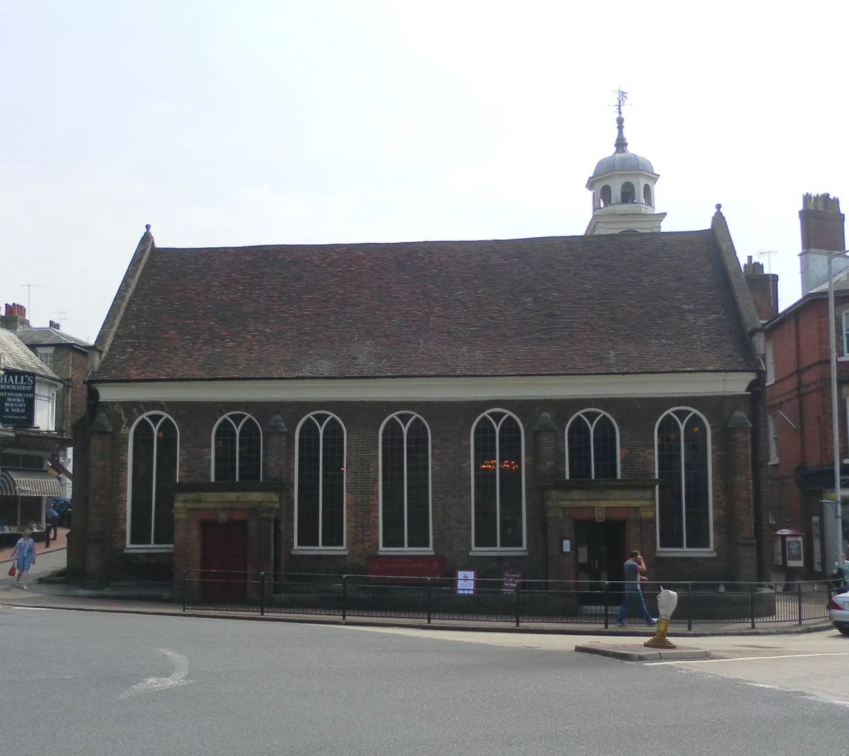
Church of King Charles the Martyr, Royal Tunbridge Wells
Historic churches · 0.1 km

Bijou Cinema
Theatres · 0.3 km

Borough of Tunbridge Wells
Historic churches · 0.4 km

Entrance to Grove Hill Gardens, The Grove
Memorials & monuments · 0.6 km

68 London Road
Historic houses · 0.7 km

ABC Tunbridge Wells
Theatres · 0.7 km

Ashton Lodge
Gardens · 0.7 km

Royal Tunbridge Wells
Historic churches · 0.7 km

Entrance to Grove Hill Gardens, Grove Hill Gardens
Memorials & monuments · 0.8 km
Nearby
📷 5Open-air theatres · South East England
Theatre, Tunbridge Wells
former theatre (1802-?) in Tunbridge Wells, England, replaced by the Corn Exchange, now a small shopping centre, only the façade remaining
📷 5📷 5Historic pubs · South East England
The Sussex Arms Public House
The Sussex Arms Public House in England South East, United Kingdom.
📷 5Historic churches · South East England
Church of King Charles the Martyr, Royal Tunbridge Wells
Church of King Charles the Martyr, Royal Tunbridge Wells — church in Tunbridge Wells, UK.
📷 5📷 5Historic churches · South East England
Borough of Tunbridge Wells
The Borough of Tunbridge Wells is a local government district with borough status in Kent, England. It takes its name from its main town, Royal Tunbridge Wells. The borough also contains the towns of
Where to eat & stay near The Pantiles
Places to stay
📷 5 📷 5
📷 5Hotels · South East England
The Royal Wells Hotel
The Royal Wells Hotel — a hotel in england south east.
 📷 7
📷 7Hotels · South East England
The Spa Hotel
The Spa Hotel — a hotel in england south east.
 📷 5
📷 5 📷 5
📷 5Campsites · South East England
Adamswell Scout Camp
Adamswell Scout Camp — a campsite in england south east.
 📷 5
📷 5Hotels · South East England
The Camden Arms Hotel
The Camden Arms Hotel — a hotel in england south east.
Places to eat & drink
📷 5Historic pubs · South East England
The Sussex Arms Public House
The Sussex Arms Public House in England South East, United Kingdom.
 📷 7
📷 7Historic pubs · South East England
5-11, Langton Road
5-11, Langton Road in England South East, United Kingdom.
 📷 6
📷 6Historic pubs · South East England
Opera House, Royal Tunbridge Wells
Opera House, Royal Tunbridge Wells in England South East, United Kingdom.
 📷 5
📷 5Historic pubs · South East England
The George
The George — Historic pub — listed building or notable heritage status.
.jpg?width=1200) 📷 5
📷 5Historic pubs · South East England
Nevill Crest and Gun
Nevill Crest and Gun — Historic pub — listed building or notable heritage status.
 📷 7
📷 7Historic pubs · South East England
The George And Dragon
The George And Dragon in England South East, United Kingdom.
More museums in this region
 📷 5
📷 5Museums · South East England
Coldrum Long Barrow
Coldrum Long Barrow — neolithic chambered long barrow near Trottiscliffe, Kent, England, UK.
 📷 5
📷 5Museums · South East England
Guildford House
Guildford House — house in Guildford, Surrey, England, UK.
 📷 5
📷 5Museums · South East England
Huguenot Museum
Huguenot Museum — museum in Rochester, England, UK.
 📷 5
📷 5Museums · South East England
Medway megaliths
Medway megaliths — group of long barrows in Kent, England.
Frequently asked questions
- Where is The Pantiles?
- The Pantiles is in Kent, South-East England, United Kingdom (postcode TN2 5TN), in the parish of Tunbridge Wells, unparished area.
- What is The Pantiles?
- The Pantiles is a Georgian colonnade in the town of Royal Tunbridge Wells, Kent, England. Formerly known as "The Walks" and the (Royal) "Parade", it leads from the well that gave the town its name. Th
- How do I get to The Pantiles?
- The nearest railway station is Tunbridge Wells West, about 0.5 km away. Drivers can use postcode TN2 5TN.
- Is The Pantiles a protected site?
- Yes — The Pantiles is part of the High Weald National Landscape (AONB) and the Kent Downs National Landscape (AONB).
- How do I get to The Pantiles?
- The nearest railway station is Tunbridge Wells West, about 0.5 km away. Drivers can navigate to postcode TN2 5TN.