
Historic bridges · East of England
The Iron Bridge At Culford School
In or near West Stow.
The Iron Bridge At Culford School — a Grade I-listed bridge in england-east, United Kingdom.

Stuart Shepherd — CC BY-SA 2.0 via Wikimedia Commons licence

Plan your visit
- Typical visit
- 15 min–30 min
- Nearest railway station
- Bury St Edmunds · 5.8 km
- Paid entry
- Dog-friendly
Getting there & planning your visit
To visit The Iron Bridge at Culford School, the nearest railway station is Bury St Edmunds, located 5.8 km away. Entry is paid, and the postcode for navigation is IP28 6TX.
About
The Iron Bridge At Culford School is a Grade I-listed building in england-east, United Kingdom. Grade I status is conferred by Historic England (or Cadw, Historic Environment Scotland or NIEA equivalents) on buildings of exceptional national interest. See the linked Wikipedia article for full historical and architectural details.
Photo gallery
Heritage listing
The Iron Bridge is a grade I listed early cast-iron bridge crossing a tributary of the River Lark in the grounds of Culford Park in the village of Culford near Bury St Edmunds, Suffolk. The bridge is of exceptional interest as one of the earliest bridges with an unmodified cast-iron structure to survive. Built for Charles Cornwallis, 2nd Marquess Cornwallis, the owner of Culford Park in 1804, it is a unique example of a cast-iron bridge built to the patent of Samuel Wyatt. The rib castings feature oval tubular sections and are the earliest known example with hollow ribs, leading to the structure receiving a grade I listing on 15 May 1996.
From the Historic England List Entry under OGL v3.
Protected designations
- Site of Special Scientific Interest: Breckland Farmland SSSI
Designations sourced from Natural England open data under OGL v3.
From the Wikipedia article
The Iron Bridge is a grade I listed early cast-iron bridge crossing a tributary of the River Lark in the grounds of Culford Park in the village of Culford near Bury St Edmunds, Suffolk. The bridge is of exceptional interest as one of the earliest bridges with an unmodified cast-iron structure to survive. Built for Charles Cornwallis, 2nd Marquess Cornwallis, the owner of Culford Park in 1804, it is a unique example of a cast-iron bridge built to the patent of Samuel Wyatt. The rib castings feature oval tubular sections and are the earliest known example with hollow ribs, leading to the structure receiving a grade I listing on 15 May 1996. The woods to the Southwest of the bridge are known as Iron Bridge Carr.
Excerpt from Wikipedia under CC BY-SA 4.0. See the source article linked in Sources below.
Background
Architecture
On 10 June 1800, Samuel Wyatt patented a new design for ...constructing bridges, warehouses, and other buildings without the use of wood... which was published in the Repertory of Arts and Manufactures: Vol.14 in 1801. The patent describes how to construct a bridge using: <blockquote>...hollow pieces of cast iron in a longitudinal direction and plates or pipes of the same material, having sockets on them, to receive the ends or shoulders of the said pipes, tubes, or other hollow pieces, placed transversely; and extending from one side of the bridge to the other, so that when the required number of pipes, tubes, or other hollow pieces of cast-iron, and transverse places, or pieces, are put…
Sourced from Wikipedia under CC BY-SA 4.0.
- Coordinates
- 52.3013, 0.6795
- County
- Suffolk
- District
- West Suffolk
- Parish
- Culford
- Postcode
- IP28 6TX
- Parliamentary constituency
- West Suffolk
- Nearest railway station
- Bury St Edmunds — 5.8 km
Sources
- wikidata: Q17526761 (CC0)
- wikipedia: The Iron Bridge, Culford Park (CC BY-SA 4.0)
Other places nearby

Culford Hall
Manor houses · 0.4 km

West Stow
Towns & cities · 0.8 km

West Stow Village Sign
Public art & sculpture · 0.8 km

West Stow Pods
Campsites · 0.9 km

Culford Village Sign
Public art & sculpture · 1.0 km
Culford Estate War Memorial
Memorials & monuments · 1.0 km

West Stow Hall
Historic houses · 1.3 km

Settlement site W of Hengrave mill
Vineyards · 1.5 km

Flempton-cum-Hengrave War Memorial
Memorials & monuments · 1.5 km

Flempton
Villages · 1.6 km
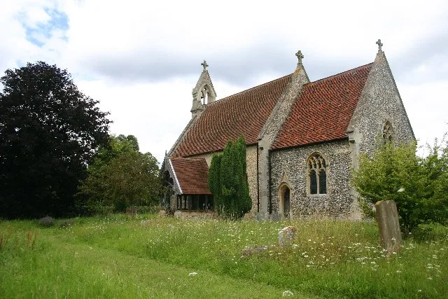
All Saints Church, Wordwell
Historic churches · 1.6 km
Hengrave
Villages · 1.8 km
Nearby
📷 3📷 5Towns & cities · East of England
West Stow
West Stow — village and civil parish in Suffolk, United Kingdom.
📷 3Public art & sculpture · East of England
West Stow Village Sign
West Stow Village Sign — a public art in england-east, United Kingdom.
📷 5📷 3Public art & sculpture · East of England
Culford Village Sign
Culford Village Sign — a public art in england-east, United Kingdom.
📷 3Memorials & monuments · East of England
Culford Estate War Memorial
Culford Estate War Memorial is a memorial in the United Kingdom.
Where to eat & stay near The Iron Bridge At Culford School
Places to stay
📷 5 📷 5
📷 5Caravan parks · East of England
King's Forest Caravan Park
King's Forest Caravan Park — a caravan park in england east.
 📷 7
📷 7 📷 5
📷 5Hotels · East of England
Angel Hotel
Angel Hotel — a hotel in england east.
 📷 7
📷 7Hotels · East of England
Chantry Hotel
Chantry Hotel — a hotel in england east.
 📷 5
📷 5Hotels · East of England
Dragonfly Hotel
Dragonfly Hotel — a hotel in england east.
Places to eat & drink
 📷 7
📷 7Historic pubs · East of England
Three Kings Public House And Attached House Stable Block
Three Kings Public House And Attached House Stable Block in England East, United Kingdom.
 📷 7
📷 7Historic pubs · East of England
The White Horse Public House Cottage And Coach House
The White Horse Public House Cottage And Coach House in England East, United Kingdom.
 📷 6
📷 6Historic pubs · East of England
The Linden Tree Public House
The Linden Tree Public House in England East, United Kingdom.
 📷 6
📷 6Historic pubs · East of England
The Bushel Public House
The Bushel Public House in England East, United Kingdom.
 📷 5
📷 5Historic pubs · East of England
The Rising Sun Public House
The Rising Sun Public House in England East, United Kingdom.
 📷 7
📷 7Historic pubs · East of England
The Market Tavern Public House
The Market Tavern Public House in England East, United Kingdom.
More bridges in this region
.JPG?width=1200) 📷 5
📷 5Historic bridges · East of England
Albert Bridge
Albert Bridge is a historic bridge in the United Kingdom.
.jpg?width=1200) 📷 5
📷 5Historic bridges · East of England
Bedford Town Bridge
Bedford Town Bridge is a historic bridge in the United Kingdom.
 📷 5
📷 5Historic bridges · East of England
Bethnal Green and King's Lynn Line
Bethnal Green and King's Lynn Line is a historic bridge in the United Kingdom.
 📷 5
📷 5Historic bridges · East of England
Bethnal Green and King's Lynn Line
Bethnal Green and King's Lynn Line is a historic bridge in the United Kingdom.
Frequently asked questions
- Where is The Iron Bridge At Culford School?
- The Iron Bridge At Culford School is in Suffolk, East of England, United Kingdom (postcode IP28 6TX), in the parish of Culford.
- What is The Iron Bridge At Culford School?
- The Iron Bridge At Culford School — a Grade I-listed bridge in england-east, United Kingdom.
- How do I get to The Iron Bridge At Culford School?
- The nearest railway station is Bury St Edmunds, about 5.8 km away. The nearest town is West Stow. Drivers can use postcode IP28 6TX.
- Who owns The Iron Bridge At Culford School?
- The Iron Bridge At Culford School is owned by Culford School.
- Is The Iron Bridge At Culford School a listed building?
- The Iron Bridge At Culford School is officially recognised as Grade I listed.
- Is The Iron Bridge At Culford School a protected site?
- Yes — The Iron Bridge At Culford School is part of the Breckland Farmland SSSI Site of Special Scientific Interest.
- How do I get to The Iron Bridge At Culford School?
- The nearest railway station is Bury St Edmunds, about 5.8 km away. Drivers can navigate to postcode IP28 6TX.