
Historic bridges · West Midlands
The Iron Bridge
Also known as: Iron Bridge
In or near Ironbridge.
The Iron Bridge is a historic bridge in the United Kingdom.

Wikimedia Commons contributors — see linked file page for photographer and licence licence

Plan your visit
- Typical visit
- 15 min–30 min
- Nearest railway station
- Horsehay & Dawley · 4.0 km
- Free entry
- Dog-friendly
Getting there & planning your visit
To visit The Iron Bridge, the nearest railway station is Horsehay & Dawley, located 4 km away. The postcode for sat-nav is TF8 7JP, and entry to the bridge is free.
About
The Iron Bridge is a named historic bridge in the United Kingdom. Records date its origin to 1779. OpenStreetMap heritage rating: 1/5. Coordinates: 52.6273°, -2.4855°.
Photo gallery
Heritage listing
The Iron Bridge is a cast iron arch bridge that crosses the River Severn in Shropshire, England. Opened in 1781, it was the first major bridge in the world to be made of cast iron. Its success inspired the widespread use of cast iron as a structural material, and today the bridge is celebrated as a symbol of the Industrial Revolution. The geography of the deep Ironbridge Gorge, formed by glacial action during the last ice age, meant that there are industrially useful deposits of coal, iron ore, limestone and fire clay present near the surface where they are readily mined, but also that it was difficult to build a bridge across the river at this location.
From the Historic England List Entry under OGL v3.
From the Wikipedia article
The Iron Bridge is a cast iron arch bridge that crosses the River Severn in Shropshire, England. Opened in 1781, it was the first major bridge in the world to be made of cast iron. Its success inspired the widespread use of cast iron as a structural material, and today the bridge is celebrated as a symbol of the Industrial Revolution. The geography of the deep Ironbridge Gorge, formed by glacial action during the last ice age, meant that there are industrially useful deposits of coal, iron ore, limestone and fire clay present near the surface where they are readily mined, but also that it was difficult to build a bridge across the river at this location. To cope with the instability of the banks and the need to maintain a navigable channel in the river, a single-span iron bridge was proposed by Thomas Farnolls Pritchard. After initial uncertainty about the use of iron, construction took place over two years, with Abraham Darby III responsible for the ironwork. The bridge crosses the Ironbridge Gorge with a main span of 100 ft 6 in (30.63 m), allowing sufficient clearance for boats to pass underneath. In 1934 it was designated a scheduled monument and closed to vehicular traffic. Tolls for pedestrians were collected until 1950, when the bridge was transferred into public ownership. After being in a poor state of repair for much of its life, extensive restoration works in the latter half of the 20th century have protected the bridge. The bridge, the adjacent settlement of Ironbridge and the Ironbridge Gorge form the UNESCO Ironbridge Gorge World Heritage Site.
Excerpt from Wikipedia under CC BY-SA 4.0. See the source article linked in Sources below.
Background
History
The Ironbridge Gorge was formed at the end of the last ice age by the overflowing of Lake Lapworth, which resulted in the exposure of useful deposits of resources such as coal, iron ore, fire clay and limestone near the surface where they were readily mined. With the river providing a means of transport, the local area was an important centre of the emerging Industrial Revolution. Abraham Darby I first smelted local iron ore with coke made from Coalbrookdale coal in 1709, and in the coming decades Shropshire became a centre for industry due to the low price of fuel from local mines. The River Severn was used as a key trading route, but it was also a barrier to travel around the deep…
Architecture
The bridge is to a carpenters' design typically used for wood structures, built from five sectional cast-iron ribs that give a span of 100 ft. Components were cast individually to fit with each other, rather than being of standard sizes, with discrepancies of up to several centimetres between 'identical' components in different locations. A foreman at the foundry, Thomas Gregory, drew the detailed designs for the members, resulting in the use of carpentry jointing details such as mortise and tenon joints and dovetails.
Sourced from Wikipedia under CC BY-SA 4.0.
- Coordinates
- 52.6273, -2.4855
- District
- Telford and Wrekin
- Parish
- The Gorge
- Postcode
- TF8 7JP
- Parliamentary constituency
- Telford
- Established
- 1779
- Nearest railway station
- Horsehay & Dawley — 4 km
- Opening
- 1 January 1781
Sources
- osm: w33181114 (ODbL)
- wikipedia: The Iron Bridge (CC BY-SA 4.0)
- commons: Ironbridge 2014.jpg (CC BY-SA 4.0)
Other places nearby

The Iron Bridge Tollhouse
Museums · 0.0 km

Benthall Edge Picnic Site
Natural landmarks · 0.1 km

War Memorial Ironbridge
Memorials & monuments · 0.1 km

Ironbridge War Memorial
Memorials & monuments · 0.1 km

Ironbridge
Towns & cities · 0.1 km

Bridge House
Historic houses · 0.1 km

Crown Inn Including Outbuildings Adjoining South West
Historic houses · 0.3 km

Crown Inn Including Outbuildings Adjoining South West
Historic pubs · 0.3 km
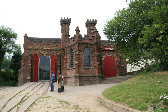
Museum of the Gorge
Museums · 0.5 km

The Rotunda
Viewpoints · 0.5 km

Bedlam Furnaces
Archaeological sites · 0.6 km

The Merrythought Teddy Bear Shop & Museum
Museums · 0.6 km
Nearby
📷 3Museums · West Midlands
The Iron Bridge Tollhouse
The Iron Bridge Tollhouse — a museum in West Midlands, United Kingdom.
📷 3Natural landmarks · West Midlands
Benthall Edge Picnic Site
Benthall Edge Picnic Site — a place in West Midlands, United Kingdom.
📷 3Memorials & monuments · West Midlands
War Memorial Ironbridge
War Memorial Ironbridge is a memorial in the United Kingdom.
📷 3Memorials & monuments · West Midlands
Ironbridge War Memorial
Ironbridge War Memorial — Grade II listed building-listed memorial in england-west-midlands, United Kingdom.
📷 5Towns & cities · West Midlands
Ironbridge
Ironbridge — village in Shropshire, England.
📷 3Historic houses · West Midlands
Bridge House
Bridge House — house in The Gorge, Telford and Wrekin, Shropshire, England, UK.
Where to eat & stay near The Iron Bridge
Places to stay
 📷 5
📷 5 📷 5
📷 5 📷 5
📷 5Campsites · West Midlands
Iron Gorge Camping
Iron Gorge Camping — a campsite in england west midlands.
 📷 5
📷 5Caravan parks · West Midlands
Pool View Caravan Park
Pool View Caravan Park — a caravan park in england west midlands.
 📷 5
📷 5 📷 5
📷 5Places to eat & drink
📷 5Historic pubs · West Midlands
Crown Inn Including Outbuildings Adjoining South West
Crown Inn Including Outbuildings Adjoining South West in England West Midlands, United Kingdom.
 📷 5
📷 5Historic pubs · West Midlands
The Golden Ball Public House
The Golden Ball Public House in England West Midlands, United Kingdom.
 📷 5
📷 5Historic pubs · West Midlands
The Beacon Public House
The Beacon Public House in England West Midlands, United Kingdom.
 📷 7
📷 7Historic pubs · West Midlands
The Coalbrookdale Inn
The Coalbrookdale Inn in England West Midlands, United Kingdom.
 📷 5
📷 5Historic pubs · West Midlands
All Nations Inn
All Nations Inn in England West Midlands, United Kingdom.
 📷 5
📷 5Historic pubs · West Midlands
The Brewery Inn
The Brewery Inn in England West Midlands, United Kingdom.
Other bridges from this era
 📷 5
📷 5Historic bridges · London
Chertsey Bridge
Chertsey Bridge is a historic bridge in the United Kingdom.
 📷 5
📷 5Historic bridges · London
Macclesfield Bridge
Macclesfield Bridge is a historic bridge in the United Kingdom.
 📷 5
📷 5Historic bridges · London
Staines Bridge
Staines Bridge is a historic bridge in the United Kingdom.
 📷 5
📷 5Historic bridges · London
Vauxhall Bridge
Vauxhall Bridge is a historic bridge in the United Kingdom.
More bridges in this region
 📷 3
📷 3Historic bridges · West Midlands
Wolseley Bridge
Wolseley Bridge is a historic bridge in the United Kingdom.
 📷 3
📷 3Historic bridges · West Midlands
Bridge, Gatepiers, Walls And Ha Ha South Of Blithfield Hall
Bridge, Gatepiers, Walls And Ha Ha South Of Blithfield Hall — Grade II listed building-listed bridge in england-east-midlands, United Kingdom.
 📷 3
📷 3Historic bridges · West Midlands
Bridge Over River Swarbourn At West End Of Town Hill
Bridge Over River Swarbourn At West End Of Town Hill — Grade II listed building-listed bridge in england-east-midlands, United Kingdom.
 📷 3
📷 3Historic bridges · West Midlands
Viaduct over Trent and Mersey Canal at SK 0485 1780
Viaduct over Trent and Mersey Canal at SK 0485 1780 — Grade II listed building-listed bridge in england-east-midlands, United Kingdom.
Frequently asked questions
- Where is The Iron Bridge?
- The Iron Bridge is in the West Midlands, United Kingdom (postcode TF8 7JP), in the parish of The Gorge.
- What is The Iron Bridge?
- The Iron Bridge is a historic bridge in the United Kingdom.
- How do I get to The Iron Bridge?
- The nearest railway station is Horsehay & Dawley, about 4.0 km away. The nearest town is Ironbridge. Drivers can use postcode TF8 7JP.
- When was The Iron Bridge built?
- Built or established in 1779.
- Who owns The Iron Bridge?
- The Iron Bridge is owned by Telford and Wrekin Council.
- Is The Iron Bridge a listed building?
- The Iron Bridge is officially recognised as Grade II listed building listed.
- Is The Iron Bridge free to visit?
- Yes, The Iron Bridge is free to enter.
- How do I get to The Iron Bridge?
- The nearest railway station is Horsehay & Dawley, about 4.0 km away. Drivers can navigate to postcode TF8 7JP.