
Hill forts · East Midlands
The Bull Ring
In or near Dove Holes.
The Bull Ring — Neolithic henge monument.

Wikimedia Commons contributors — see linked file page for photographer and licence licence

Plan your visit
- Typical visit
- 1 h–2 h
- Nearest railway station
- Dove Holes · 0.4 km
- Free entry
- Dog-friendly
Getting there & planning your visit
To visit The Bull Ring, you can take a train to Dove Holes station, which is 0.4 km away. The postcode for sat-nav is SK17 8DU, and entry is free.
About
The Bull Ring is a hill fort in the United Kingdom. Heritage designation: scheduled monument. Wikidata describes it as: "Neolithic henge monument". Coordinates: 53.3010°, -1.8838°.
Photo gallery
From the Wikipedia article
The Bull Ring is a Class II henge that was built in the Late Neolithic period near Dove Holes in Derbyshire, England. It has coordinates 53.300695°N 1.884423°W / 53.300695; -1.884423 (grid reference SK 0785 7823), and is National Monument number 23282. There are also two barrows about 20m away from the henge; one oval, one bowl. The henge consists of a large, circular earthwork, which is currently about 1 metre (3 ft) high and 9–11 metres (30–36 ft) wide; however it was originally 2 metres (7 ft) high and 5.5–7 metres (18–23 ft) wide. The henge has a ditch on the inside, which varies between 0.5 and 1 metre (1 ft 8 in and 3 ft 3 in) deep and 8 and 12 metres (26 and 39 ft) wide; it was originally 1.2–2 metres (3 ft 11 in – 6 ft 7 in) deep and 5–6.5 metres (16–21 ft) wide. The ditch and bank are separated by a berm, which was originally 5 metres (16 ft) wide. It encloses an area 53 (north–south) by 46 (east–west) metres, with entrances to the north and south, each of which have a causeway across the ditch. A skeleton was reputedly found near the north entrance; this entrance was also damaged in the 19th century by quarrying. The centre of the henge was ploughed in the 18th century; a drystone wall was also built across the site during the same era. A single standing stone (orthostat) was recorded as remaining in 1789 by Pilkington, potentially the remnant of a stone circle. It has been suggested that stones from the henge were used as sleepers for the Peak Forest Tramway circa 1790. A minor excavation was carried out in the west ditch in 1902 by Micah Salt; this reputedly discovered some pottery sherds and flint flakes, which have since been lost. A trial excavation by Oxford University Archaeological Society in 1949 established that the ring has two entrances, and also provided information about the original size of the bank and ditch. However, it did not provide any evidence of stones on the site. The excavation also turned up flint flakes, as well as a rim from a…
Excerpt from Wikipedia under CC BY-SA 4.0. See the source article linked in Sources below.
- Coordinates
- 53.3010, -1.8838
- County
- Derbyshire
- District
- High Peak
- Parish
- Chapel-en-le-Frith
- Postcode
- SK17 8DU
- Parliamentary constituency
- High Peak
- Nearest railway station
- Dove Holes — 0.4 km
Sources
- wikidata: Q2410079 (CC0)
- wikipedia: The Bull Ring (CC BY-SA 4.0)
- commons: BullRingDoveHoles.JPG (CC BY-SA 4.0)
Other places nearby

Bullring henge
Archaeological sites · 0.0 km

Dove Holes War Memorial
Memorials & monuments · 0.4 km

Dove Holes
Towns & cities · 0.4 km

Cowlow Pot
Caves · 0.4 km
Dove Holes Hill
Mountains & hills · 0.7 km

Bee Low
Mountains & hills · 1.8 km

Black Edge - Summit
Mountains & hills · 1.9 km

Black Edge
Mountains & hills · 1.9 km
Black Edge - Trig Point
Mountains & hills · 2.0 km

Promontory fort on Combs Edge
Vineyards · 2.5 km

Castle Naze
Castles · 2.5 km

Black Edge - South Top
Mountains & hills · 2.6 km
Nearby
📷 3Archaeological sites · East Midlands
Bullring henge
Bullring henge — an archaeological site in East Midlands, United Kingdom.
📷 3Memorials & monuments · East Midlands
Dove Holes War Memorial
Dove Holes War Memorial — Grade II listed building-listed memorial in england-east-midlands, United Kingdom.
📷 3📷 5Caves · East Midlands
Cowlow Pot
Cowlow Pot — a cave broad in england-east-midlands, United Kingdom.
Mountains & hills · East Midlands
Dove Holes Hill
Dove Holes Hill — a mountain in england east midlands.
📷 5Where to eat & stay near The Bull Ring
Places to stay
 📷 5
📷 5Campsites · East Midlands
Combs Valley Campsite
Combs Valley Campsite — a campsite in england east midlands.
 📷 5
📷 5 📷 5
📷 5Campsites · East Midlands
Cold Springs Farm Campsite
Cold Springs Farm Campsite — a campsite in england east midlands.
 📷 5
📷 5Hotels · East Midlands
Old Hall Hotel
Old Hall Hotel — a hotel in england east midlands.
 📷 5
📷 5 📷 5
📷 5Campsites · East Midlands
chapel view campsite
chapel view campsite — a campsite in england east midlands.
Places to eat & drink
 📷 5
📷 5Historic pubs · East Midlands
The Old Nags Head
The Old Nags Head in England Yorkshire, United Kingdom.
 📷 5
📷 5 📷 5
📷 5Historic pubs · East Midlands
Cat and Fiddle Inn
Cat and Fiddle Inn in England South East, United Kingdom.
 📷 5
📷 5Historic pubs · East Midlands
The Hare And Hounds Hotel
The Hare And Hounds Hotel in England Yorkshire, United Kingdom.
 📷 7
📷 7Historic pubs · East Midlands
The Three Stags' Heads
The Three Stags' Heads in England South East, United Kingdom.
 📷 5
📷 5Historic pubs · North West England
Disley Friends Meeting House
Disley Friends Meeting House in England North West, United Kingdom.
More places in this region
 📷 3
📷 3Hill forts · East Midlands
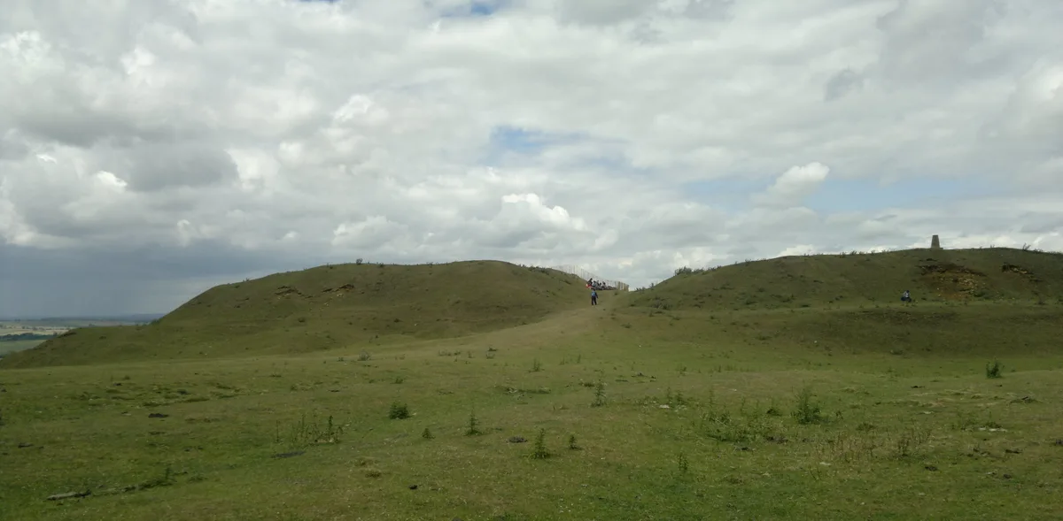
Burrough Hill
Burrough Hill — Iron Age hill fort in Leicestershire, England, UK.
 📷 5
📷 5Hill forts · East Midlands
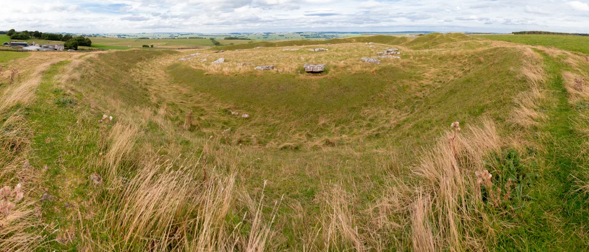
Arbor Low
Arbor Low — Neolithic henge monument.
 📷 5
📷 5Hill forts · East Midlands
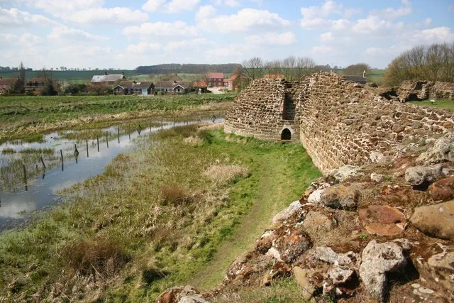
Bolingbroke Castle
Bolingbroke Castle — castle in Bolingbroke, England.
 📷 3
📷 3Hill forts · East Midlands
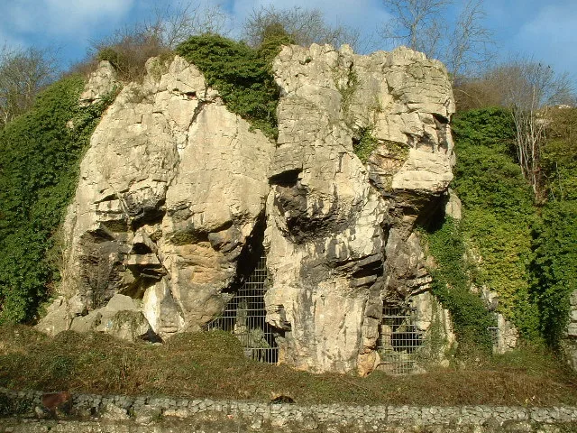
Creswell Crags
Creswell Crags — limestone gorge on the border between Derbyshire and Nottinghamshire, England.
Frequently asked questions
- Where is The Bull Ring?
- The Bull Ring is in Derbyshire, the East Midlands, United Kingdom (postcode SK17 8DU), in the parish of Chapel-en-le-Frith.
- What is The Bull Ring?
- The Bull Ring — Neolithic henge monument.
- How do I get to The Bull Ring?
- The nearest railway station is Dove Holes, about 0.4 km away. The nearest town is Dove Holes. Drivers can use postcode SK17 8DU.
- Is The Bull Ring a listed building?
- The Bull Ring is officially recognised as scheduled monument listed.
- Is The Bull Ring free to visit?
- Yes, The Bull Ring is free to enter.
- How do I get to The Bull Ring?
- The nearest railway station is Dove Holes, about 0.4 km away. Drivers can navigate to postcode SK17 8DU.