
Hill forts · Central Scotland
Tappoch Broch
In or near Plean.
Tappoch Broch — iron-age broch located near Falkirk, Scotland.

Wikimedia Commons contributors — see linked file page for photographer and licence licence

Plan your visit
- Typical visit
- 1 h–2 h
- Nearest railway station
- Larbert · 3.6 km
- Free entry
- Dog-friendly
Getting there & planning your visit
To visit Tappoch Broch, the nearest railway station is Larbert, located 3.6 km away. Entry is free, and the postcode for sat-nav is FK5 4SW.
About
Tappoch Broch is a hill fort in the United Kingdom. Heritage designation: scheduled monument. Wikidata describes it as: "iron-age broch located near Falkirk, Scotland". Coordinates: 56.0435°, -3.8744°.
Photo gallery
From the Wikipedia article
Tappoch Broch, better known as Torwood Broch, is an iron-age broch located in a remote spot in dense woodland near Falkirk, Scotland.
Excerpt from Wikipedia under CC BY-SA 4.0. See the source article linked in Sources below.
Background
History
Tappoch broch was first excavated in 1864 by Colonel Joseph Dundas. Small-scale excavations have taken place near the site sporadically since. In 2014, a conservation project run by Archaeology Scotland and grant aided by Forestry Commission Scotland cleared the site of scrub vegetation. The broch was then surveyed by laser scanning undertaken by AOC Archaeology. This was combined by an key-hole excavation of the surrounding earlier hillfort by Dr Murray Cook. The results of which were published in the Proceedings of The Society of Antiquaries of Scotland and are available here.
Description
The chamber of the broch, whose walls are about six metres thick, still reach a height of two or three metres, but in recent times whole wall sections have collapsed. The dry stonework is built of large, irregular stone blocks from the immediate vicinity. The oval chamber measures 10.8 to 9.8 metres, is paved and has a large fire spot in the middle. Access, with some of the fallen stones still in situ, is from the southeast. About halfway down the passage is a stop for a door with a latch for the door beam. In the south-west of the chamber a short aisle branches off to the right and leads to an unusually well-preserved staircase in the wall. In 1864 there were still eleven steps, some of…
Sourced from Wikipedia under CC BY-SA 4.0.
- Coordinates
- 56.0435, -3.8744
- District
- Falkirk
- Postcode
- FK5 4SW
- Parliamentary constituency
- Alloa and Grangemouth
- Nearest railway station
- Larbert — 3.6 km
Sources
- wikidata: Q3410873 (CC0)
- wikipedia: Tappoch Broch (CC BY-SA 4.0)
- commons: Tappoch Broch - southern side - geograph.org.uk - 1024967.jpg (CC BY-SA 4.0)
Other places nearby

Tappoch
Mountains & hills · 0.0 km
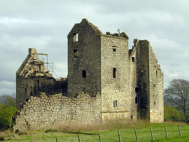
Torwood Castle
Castles · 0.7 km

Torwood
Castles · 0.8 km

Plean
Towns & cities · 0.9 km

Langlands
Vineyards · 1.2 km

Doghillock, broch site
Archaeological sites · 1.2 km

Wallace Oak
Forests & woodlands · 1.4 km

Gamekeeper's Cottage (ruin)
Historic houses · 1.6 km
Stable Block
Historic houses · 1.7 km
Greater Butterfly Orchid Carving
Public art & sculpture · 1.7 km
Plean House
Historic houses · 1.7 km

Plean House
Archaeological sites · 1.7 km
Nearby
📷 5📷 3Castles · Central Scotland
Torwood Castle
Torwood Castle — castle in Falkirk, Scotland, UK.
📷 4📷 3📷 5Vineyards · Central Scotland
Langlands
Langlands — a UK vineyard in scotland central, producing English or Welsh wine from cool-climate grape varieties.
📷 3Archaeological sites · Central Scotland
Doghillock, broch site
Doghillock, broch site — a archaeological in scotland-central, United Kingdom.
Where to eat & stay near Tappoch Broch
Places to stay
 📷 5
📷 5Hotels · Central Scotland
Glenbervie House Hotel
Glenbervie House Hotel — a hotel in scotland central.
 📷 5
📷 5Campsites · Central Scotland
Wheel Caravan park
Wheel Caravan park — a campsite in scotland central.
 📷 6
📷 6 📷 7
📷 7 📷 5
📷 5Hotels · Central Scotland
The Grange Manor
The Grange Manor — a hotel in scotland central.
 📷 5
📷 5Hostels · Central Scotland
William Wallace Hotel
William Wallace Hotel — a hostel in scotland central.
Places to eat & drink
 📷 5
📷 5Historic pubs · Central Scotland
Dennyloanhead
Dennyloanhead in Scotland Islands, United Kingdom.
 📷 6
📷 6Historic pubs · Central Scotland
The Gothenburg
The Gothenburg in Scotland Islands, United Kingdom.
 📷 7
📷 7Historic pubs · Central Scotland
Ye Olde House Inn, 25-26 Forth Street, Kincardine On Forth
Ye Olde House Inn, 25-26 Forth Street, Kincardine On Forth in Scotland Central, United Kingdom.
 📷 5
📷 5Historic pubs · Central Scotland
The Masonic Arms, 62 Main Street, Cumbernauld Village
The Masonic Arms, 62 Main Street, Cumbernauld Village in Scotland Central, United Kingdom.
 📷 7
📷 7Historic pubs · Central Scotland
Johnstone Arms Hotel, 48 Stirling Street, Alva
Johnstone Arms Hotel, 48 Stirling Street, Alva in Scotland Central, United Kingdom.
 📷 6
📷 6Historic pubs · Central Scotland
Westerton Arms, 34 Henderson Street, Bridge of Allan
Westerton Arms, 34 Henderson Street, Bridge of Allan in Scotland Central, United Kingdom.
More places in this region
 📷 3
📷 3Hill forts · Central Scotland
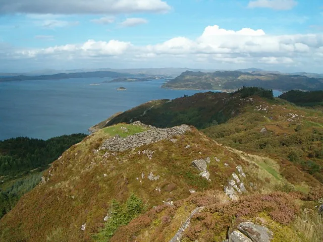
Castle Dounie, dun, Knapdale
Castle Dounie, dun, Knapdale — archaeological site in Argyll and Bute, Scotland, UK.
 📷 5
📷 5Hill forts · Central Scotland
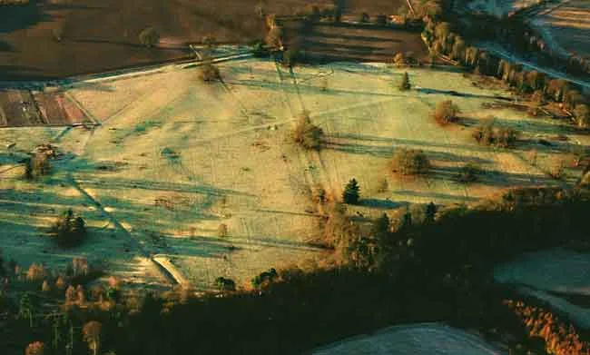
Castra Pinnata
Castra Pinnata is a hill fort in the United Kingdom.
 📷 5
📷 5 📷 3
📷 3Hill forts · Central Scotland
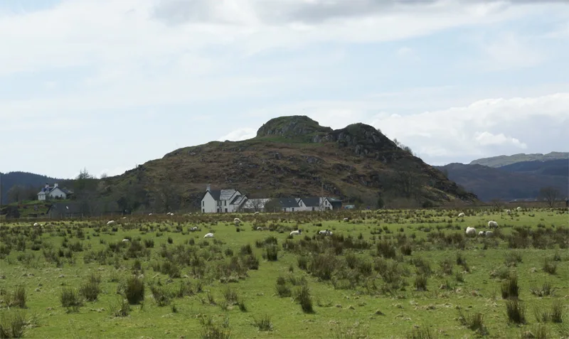
Lochbuie House, stone circle and standing stones, Mull
Lochbuie House, stone circle and standing stones, Mull — archaeological site in Argyll and Bute, Scotland, UK.
Frequently asked questions
- Where is Tappoch Broch?
- Tappoch Broch is in central Scotland, United Kingdom (postcode FK5 4SW).
- What is Tappoch Broch?
- Tappoch Broch — iron-age broch located near Falkirk, Scotland.
- How do I get to Tappoch Broch?
- The nearest railway station is Larbert, about 3.6 km away. Drivers can use postcode FK5 4SW.
- Is Tappoch Broch a listed building?
- Tappoch Broch is officially recognised as scheduled monument listed.
- Is Tappoch Broch free to visit?
- Yes, Tappoch Broch is free to enter.
- How do I get to Tappoch Broch?
- The nearest railway station is Larbert, about 3.6 km away. Drivers can navigate to postcode FK5 4SW.