
Castles · Central Scotland
Torwood
Also known as: Coille Tor
In or near Plean.
Torwood in Scotland Islands, United Kingdom.

James Allan — CC BY-SA 2.0 via Wikimedia Commons licence

Plan your visit
- Typical visit
- 1.5 h–3 h
- Nearest railway station
- Larbert · 3.0 km
- Family-friendly
- Limited wheelchair access
Getting there & planning your visit
To visit Torwood Castle in the Scottish Highlands, the nearest railway station is Larbert, located 3 km away. The postcode for sat-nav is FK5 4ZR. Entry is free, but accessibility is limited for wheelchair users.
About
Torwood is a place of interest in Scotland Islands, United Kingdom — drawn from open-data sources for visitor reference. See the linked Wikipedia article for the full description.
Photo gallery
From the Wikipedia article
Torwood (Scottish Gaelic: Coille Tor) is a small village located 2 miles (3.2 km) north-northwest of Larbert, 4 miles (6.4 km) north-west of Falkirk and 6 miles (9.7 km) south-southeast of Stirling. Torwood lies within the Falkirk Council area of Scotland. The population recorded in the 2011 UK Census was 245. The A9 road between Bannockburn and Camelon runs through the village. Torwood Has 5 streets: Provost Gardens, Stirling Road, Castle Crescent, Forrester Gait & Glen Road. Glen Road leads on to Torwood Castle, Quarry and Broch.
Excerpt from Wikipedia under CC BY-SA 4.0. See the source article linked in Sources below.
Background
History
The Forresters used to own the lands of Torwood and Torwood Castle but now a private trust owns the castle. Forrester Gait was named after the family. The Torwood was a large forested area in the 12th century stretching from the River Carron west and north towards Stirling, and inland towards the Campsie Hills. It was traversed by an old Roman Road at this time. In preparation for the Battle of Bannockburn, it was used as the encampment for the men of Sir James Douglas, one of the leaders of the army of King Robert the Bruce.
Sourced from Wikipedia under CC BY-SA 4.0.
- Coordinates
- 56.0420, -3.8620
- District
- Falkirk
- Postcode
- FK5 4ZR
- Parliamentary constituency
- Alloa and Grangemouth
- Nearest railway station
- Larbert — 3 km
Sources
Other places nearby
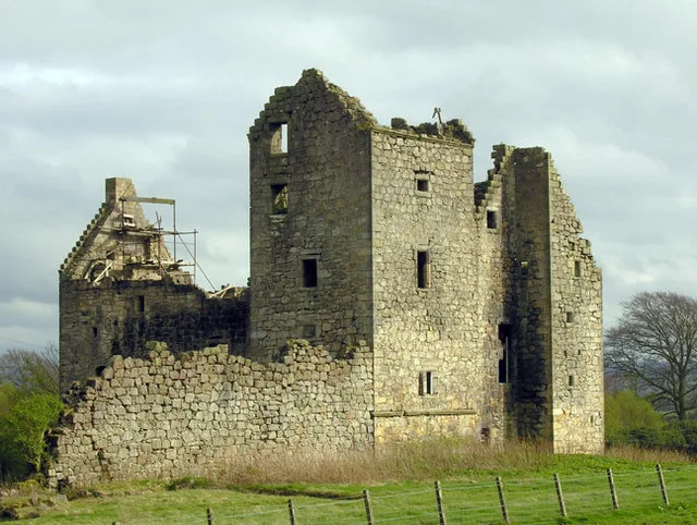
Torwood Castle
Castles · 0.7 km

Wallace Oak
Forests & woodlands · 0.7 km
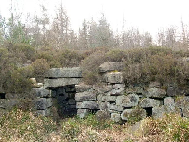
Tappoch Broch
Hill forts · 0.8 km

Tappoch
Mountains & hills · 0.8 km

Plean
Towns & cities · 0.9 km

Glenbervie House Hotel
Hotels · 1.1 km

Alloa Junction railway station
Heritage railway stations · 1.7 km

William Simpson Asylum
Other places · 1.9 km

Doghillock, broch site
Archaeological sites · 1.9 km

M876 motorway
Historic bridges · 1.9 km

Langlands
Vineyards · 2.0 km

Royal Scottish National Hospital
Other places · 2.1 km
Nearby
📷 3Castles · Central Scotland
Torwood Castle
Torwood Castle — castle in Falkirk, Scotland, UK.
📷 4Forests & woodlands · Central Scotland
Wallace Oak
Wallace Oak in Scotland Islands, United Kingdom.
📷 5Hill forts · Central Scotland
Tappoch Broch
Tappoch Broch — iron-age broch located near Falkirk, Scotland.
📷 5📷 3📷 5Hotels · Central Scotland
Glenbervie House Hotel
Glenbervie House Hotel — a hotel in scotland central.
Where to eat & stay near Torwood
Places to stay
📷 5Hotels · Central Scotland
Glenbervie House Hotel
Glenbervie House Hotel — a hotel in scotland central.
 📷 5
📷 5Campsites · Central Scotland
Wheel Caravan park
Wheel Caravan park — a campsite in scotland central.
 📷 6
📷 6 📷 7
📷 7 📷 5
📷 5Hotels · Central Scotland
The Grange Manor
The Grange Manor — a hotel in scotland central.
 📷 5
📷 5Places to eat & drink
 📷 5
📷 5Historic pubs · Central Scotland
Dennyloanhead
Dennyloanhead in Scotland Islands, United Kingdom.
 📷 6
📷 6Historic pubs · Central Scotland
The Gothenburg
The Gothenburg in Scotland Islands, United Kingdom.
 📷 7
📷 7Historic pubs · Central Scotland
Ye Olde House Inn, 25-26 Forth Street, Kincardine On Forth
Ye Olde House Inn, 25-26 Forth Street, Kincardine On Forth in Scotland Central, United Kingdom.
 📷 5
📷 5Historic pubs · Central Scotland
The Masonic Arms, 62 Main Street, Cumbernauld Village
The Masonic Arms, 62 Main Street, Cumbernauld Village in Scotland Central, United Kingdom.
 📷 7
📷 7Historic pubs · Central Scotland
Johnstone Arms Hotel, 48 Stirling Street, Alva
Johnstone Arms Hotel, 48 Stirling Street, Alva in Scotland Central, United Kingdom.
 📷 6
📷 6Historic pubs · Central Scotland
Westerton Arms, 34 Henderson Street, Bridge of Allan
Westerton Arms, 34 Henderson Street, Bridge of Allan in Scotland Central, United Kingdom.
More castles in this region
 📷 3
📷 3 📷 2
📷 2 📷 4
📷 4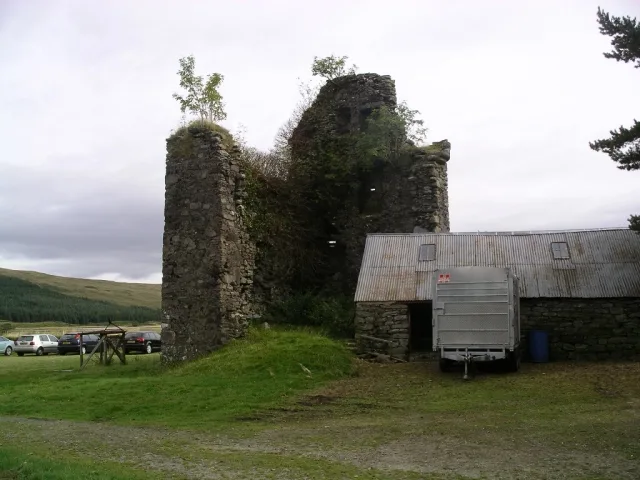 📷 3
📷 3Castles · Central Scotland
Achallader Castle
Achallader Castle — castle in Argyll and Bute, Scotland, UK.
Frequently asked questions
- Where is Torwood?
- Torwood is in the Scottish Highlands, United Kingdom (postcode FK5 4ZR).
- What is Torwood?
- Torwood in Scotland Islands, United Kingdom.
- How do I get to Torwood?
- The nearest railway station is Larbert, about 3.0 km away. Drivers can use postcode FK5 4ZR.
- Does Torwood charge admission?
- Torwood typically charges admission. Check the official site for current ticket prices and opening hours.
- How do I get to Torwood?
- The nearest railway station is Larbert, about 3.0 km away. Drivers can navigate to postcode FK5 4ZR.