
Hill forts · South East England
Taplow burial
In or near Taplow.
Taplow burial — medieval barrow in England.

Wikimedia Commons contributors — see linked file page for photographer and licence licence
.jpg)
Plan your visit
- Typical visit
- 1 h–2 h
- Nearest railway station
- Taplow · 1.3 km
- Free entry
- Dog-friendly
Getting there & planning your visit
To visit Taplow burial, the nearest railway station is Taplow, located 1.3 km away. The postcode for your sat-nav is SL6 0ER, and entry is free.
About
Taplow burial is a hill fort in the United Kingdom. Part of Saxon barrow, church and cemeteries in the old churchyard at Taplow Court. Wikidata describes it as: "medieval barrow in England". Coordinates: 51.5311°, -0.6951°.
Photo gallery
See it from the streetimagery from 2019
Imagery © Mapillary contributors, CC BY-SA 4.0
Protected designations
- Area of Outstanding Natural Beauty: Chilterns
Designations sourced from Natural England open data under OGL v3.
From the Wikipedia article
The Taplow Barrow is an early medieval burial mound in Taplow Court, an estate in the south-eastern English county of Buckinghamshire. Constructed in the seventh century, when the region was part of an Anglo-Saxon kingdom, it contained the remains of a deceased individual and their grave goods, now mostly in the British Museum. It is often referred to in archaeology as the Taplow burial. The Taplow burial was made in what archaeologists call the "conversion period", during which the Anglo-Saxon kingdoms were undergoing Christianisation. This period saw the erection of "Final Phase" burials: a select number of inhumations featuring lavish grave goods far richer than the graves of the preceding "migration period" (fifth and sixth centuries). The majority of these Final Phase burials were spatially separate from the new churchyard burials, although the Taplow Burial—which was likely placed next to an early church—is one of the few known exceptions. Located atop a hill, the area around it was previously an Iron Age hillfort and offers widespread views of the local landscape. Interred beneath the mound was a single individual—interpreted by archaeologists as a local chieftain—buried with a range of grave goods. These included military gear such as a sword, three spears, and two shields, as well as other items like drinking horns and glass beakers. Such elite items likely reflected the individual's aristocratic status. Several of these items were of probable Kentish manufacture, suggesting that the individual may have had links with the Kingdom of Kent. Little of the body survived, preventing osteoarchaeological analysis to determine their age or sex, although the content of the grave goods has led archaeologists to believe the individual was male. The mound was excavated in 1883 by three local antiquarians. At the time, it represented the most lavish Anglo-Saxon burial then known and remained so until the discovery of the ship burial at Sutton Hoo, Suffolk in the 1930s.…
Excerpt from Wikipedia under CC BY-SA 4.0. See the source article linked in Sources below.
Background
History
The name Taplow itself is in origin that of the burial mound, from Old English Tæppas hláw "Tæppa's mound", so that the name of the unknown chief or nobleman buried in the mound would seem to have been Tæppa. Stevens suggested that it derived from hlæw (mound) and tap or top, meaning "the mound on the crest of the hill". During Stevens' investigation, the mound measured 15 feet in eight at its centre, and 240 feet in circumference. He described it as being "somewhat bell-shaped", suggesting that this had been caused by the addition of later inhumation burials around its eastern perimeter. The Taplow barrow is located within an earlier Iron Age hillfort. It is positioned on the only hill in…
Description
Various archaeologists have suggested that the interred individual was male. After completing his excavation of the site, Stevens concluded that the individual interred was "a great chief" who ruled before Christianity came to Anglo-Saxon England. Given that Buckinghamshire was in Mercia for much of this period, Stevens noted that "it is not beyond the bounds of probability that he was a Mercian Angle of distinction." The archaeologists Stuart Brookes and Sue Harrington noted that the individual buried at Taplow has often been considered to be "a Kentish 'prince' by virtue of the sheer quality and point of origin of his material culture". They added that the burial had "prompted discussion…
Sourced from Wikipedia under CC BY-SA 4.0.
- Coordinates
- 51.5311, -0.6951
- District
- Buckinghamshire
- Parish
- Taplow
- Postcode
- SL6 0ER
- Parliamentary constituency
- Beaconsfield
- Nearest railway station
- Taplow — 1.3 km
Sources
- wikidata: Q7684716 (CC0)
- wikipedia: Taplow Barrow (CC BY-SA 4.0)
- commons: Taeppas Mound in the old churchyard, Taplow (geograph 3814805).jpg (CC BY-SA 4.0)
Other places nearby

Taeppa's Low
Archaeological sites · 0.0 km
Grenfell Memorial south of old churchyard, Taplow Court
Public art & sculpture · 0.0 km
Grenfell
Memorials & monuments · 0.0 km
Taplow Court
Historic houses · 0.1 km
Diana the Huntress
Memorials & monuments · 0.1 km

Taplow
Vineyards · 0.2 km

Richard Dimbleby
Memorials & monuments · 0.4 km

Taplow House Hotel
Hotels · 0.4 km

Boulter's Lock
Canal locks · 0.4 km

Weeping Cedar tree planted by Sir Winston Churchill
Memorials & monuments · 0.5 km
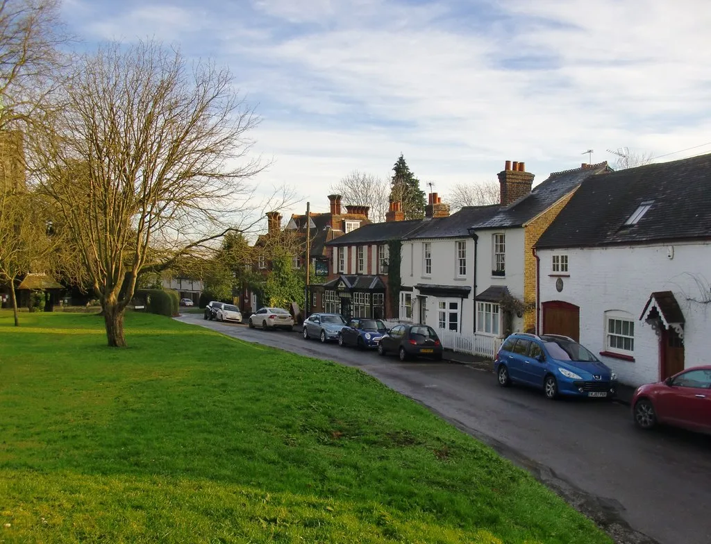
Taplow
Towns & cities · 0.5 km

Jubilee River
Canals · 0.8 km
Nearby
📷 5Archaeological sites · South East England
Taeppa's Low
Taeppa's Low — a archaeological in england-south-east, United Kingdom.
📷 5Public art & sculpture · South East England
Grenfell Memorial south of old churchyard, Taplow Court
Grenfell Memorial south of old churchyard, Taplow Court in England South East, United Kingdom.
📷 5Memorials & monuments · South East England
Grenfell
Grenfell — a memorial in england-south-east, United Kingdom.
📷 5Historic houses · South East England
Taplow Court
Taplow Court is a Victorian house in the village of Taplow in Buckinghamshire, England. Its origins are an Elizabethan manor house, remodelled in the early 17th century. In the 18th century the court
📷 5Memorials & monuments · South East England
Diana the Huntress
Diana the Huntress — a memorial in england-south-east, United Kingdom.
📷 5Vineyards · South East England
Taplow
Taplow — a UK vineyard in england south east, producing English or Welsh wine from cool-climate grape varieties.
Where to eat & stay near Taplow burial
Places to stay
📷 5Hotels · South East England
Taplow House Hotel
Taplow House Hotel — a hotel in england south east.
 📷 7
📷 7 📷 5
📷 5Caravan parks · South East England
Amerden Caravan Park
Amerden Caravan Park — a caravan park in england south east.
 📷 5
📷 5Hotels · South East England
Cliveden House
Cliveden House — a hotel in england south east.
 📷 5
📷 5 📷 5
📷 5Hotels · South East England
Bel and the Dragon
Bel and the Dragon — a hotel in england south east.
Places to eat & drink
 📷 7
📷 7Historic pubs · South East England
Green Dragon Public House
Green Dragon Public House in England South East, United Kingdom.
 📷 5
📷 5Historic pubs · South East England
Gardeners Arms Public House
Gardeners Arms Public House in England South East, United Kingdom.
 📷 5
📷 5Restaurants · South East England
The Waterside Inn
The Waterside Inn — a restaurant in england south east. Cuisine: french. 3-star.
 📷 5
📷 5Historic pubs · South East England
The Fat Duck
The Fat Duck in England South East, United Kingdom.
 📷 7
📷 7Historic pubs · South East England
The Feathers Public House
The Feathers Public House in England South East, United Kingdom.
 📷 7
📷 7Historic pubs · South East England
The Pineapple Public House
The Pineapple Public House in England South East, United Kingdom.
More places in this region
 📷 5
📷 5Hill forts · South East England
Ankerwycke Priory
Ankerwycke Priory — Benedictine nunnery with associated moat and fishponds.
 📷 5
📷 5Hill forts · South East England
Shornemead Fort
Shornemead Fort — fort in Shorne, Kent, England, UK.
 📷 5
📷 5Hill forts · South East England
Smythe's Megalith
Smythe's Megalith — neolithic monument in Kent, England.
 📷 5
📷 5Hill forts · South East England
White Horse Stone
White Horse Stone — Two megaliths near Aylesford, Kent, England.
Frequently asked questions
- Where is Taplow burial?
- Taplow burial is in South-East England, United Kingdom (postcode SL6 0ER), in the parish of Taplow.
- What is Taplow burial?
- Taplow burial — medieval barrow in England.
- How do I get to Taplow burial?
- The nearest railway station is Taplow, about 1.3 km away. Drivers can use postcode SL6 0ER.
- Is Taplow burial a protected site?
- Yes — Taplow burial is part of the Chilterns National Landscape (AONB).
- Is Taplow burial free to visit?
- Yes, Taplow burial is free to enter.
- How do I get to Taplow burial?
- The nearest railway station is Taplow, about 1.3 km away. Drivers can navigate to postcode SL6 0ER.