
National landscapes (AONB) · East of England
Suffolk & Essex Coast & Heaths National Landscape
In or near Dunwich.
The Suffolk & Essex Coast & Heaths National Landscape is an Area of Outstanding Natural Beauty in Suffolk and Essex, England. The AONB covers ancient woodland, commercial forestry, the estuaries of th

Roger Jones — CC BY-SA 2.0 via Wikimedia Commons licence

Plan your visit
- Typical visit
- 3 h–6 h
- Nearest railway station
- Saxmundham · 9.1 km
- Free entry
- Dog-friendly
Getting there & planning your visit
To visit the Suffolk & Essex Coast & Heaths National Landscape, the nearest railway station is Saxmundham, located 9.1 km away. The postcode for the area is IP16 4UE, and entry is free.
About
The Suffolk & Essex Coast & Heaths National Landscape is an Area of Outstanding Natural Beauty in Suffolk and Essex, England. The AONB covers ancient woodland, commercial forestry, the estuaries of the Alde, Blyth, Deben, Orwell and Stour rivers, farmland, salt marsh, heathland, mudflats, reed beds, small towns and villages, shingle beaches and low eroding cliffs along 60 miles of coastline. Features include the coastal towns of Aldeburgh and Southwold, Bawdsey, Covehithe, Dunwich, Minsmere, Orford, Orford Ness, Sizewell, Thorpeness, Walberswick and the RSPB Minsmere Reserve. There are three National Nature Reserves in the area and many Sites of Special Scientific Interest. Three long-distance footpaths pass through the AONB: the Suffolk Coast Path, the Sandlings Walk and the Stour and Orwell Walk. In July 2020 the AONB was extended by around 38 square kilometres to cover land north of Brantham, and an area around Mistley and Wrabness in Essex. It was the first extension to any AONB in England since 2011.
Photo gallery
Protected designations
- Area of Outstanding Natural Beauty: Suffolk Coast & Heaths
Designations sourced from Natural England open data under OGL v3.
From the Wikipedia article
The Suffolk & Essex Coast & Heaths National Landscape is an Area of Outstanding Natural Beauty in Suffolk and Essex, England. The AONB covers ancient woodland, commercial forestry, the estuaries of the Alde, Blyth, Deben, Orwell and Stour rivers, farmland, salt marsh, heathland, mudflats, reed beds, small towns and villages, shingle beaches and low eroding cliffs along 60 miles of coastline. Features include the coastal towns of Aldeburgh and Southwold, Bawdsey, Covehithe, Dunwich, Minsmere, Orford, Orford Ness, Sizewell, Thorpeness, Walberswick and the RSPB Minsmere Reserve. There are three National Nature Reserves in the area and many Sites of Special Scientific Interest. Three long-distance footpaths pass through the AONB: the Suffolk Coast Path, the Sandlings Walk and the Stour and Orwell Walk. In July 2020 the AONB was extended by around 38 square kilometres to cover land north of Brantham, and an area around Mistley and Wrabness in Essex. It was the first extension to any AONB in England since 2011.
Excerpt from Wikipedia under CC BY-SA 4.0. See the source article linked in Sources below.
- Coordinates
- 52.2136, 1.6236
- County
- Suffolk
- District
- East Suffolk
- Parish
- Leiston
- Postcode
- IP16 4UE
- Parliamentary constituency
- Suffolk Coastal
- Established
- 1970
- Nearest railway station
- Saxmundham — 9.1 km
- Official site
- www.suffolkcoastandheaths.org
Sources
- wikipedia: Suffolk & Essex Coast & Heaths National Landscape (CC BY-SA 4.0)
Featured in these 2 guides
Other places nearby

Sizewell
Villages · 0.4 km

Sizewell Gap Engelandvaarder Memorial
Public art & sculpture · 0.7 km

Beach View Holiday Park (Formerly Cliff House Park)
Campsites · 1.2 km
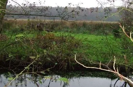
Sizewell Belts
Wildlife reserves · 1.2 km

Sizewell Hall Gazebo
Follies · 1.6 km

Sizewell Village Sign
Public art & sculpture · 2.0 km

Leiston old abbey
Abbeys & priories · 2.5 km

Leiston old abbey
Archaeological sites · 2.5 km
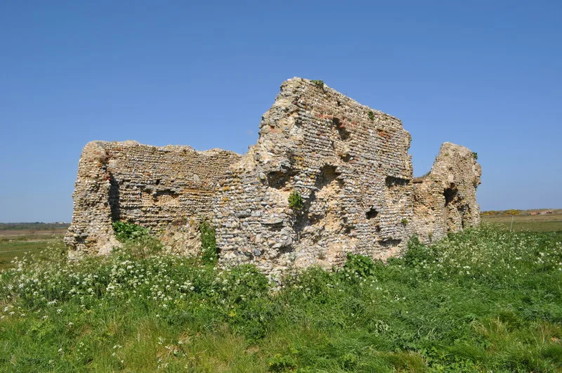
Leiston Abbey (first site) with later chapel and pill box
Abbeys & priories · 2.6 km
Leiston Abbey (first site) with later chapel and pill box
Abbeys & priories · 2.6 km

Leiston
Museums · 3.2 km

Leiston Film Theatre
Theatres · 3.3 km
Nearby
📷 5📷 3Public art & sculpture · East of England
Sizewell Gap Engelandvaarder Memorial
Sizewell Gap Engelandvaarder Memorial in England East, United Kingdom.
📷 5Campsites · East of England
Beach View Holiday Park (Formerly Cliff House Park)
Beach View Holiday Park (Formerly Cliff House Park) — a campsite in england east.
📷 3Wildlife reserves · East of England
Sizewell Belts
Sizewell Belts — Suffolk Wildlife Trust nature reserve.
📷 3📷 3Public art & sculpture · East of England
Sizewell Village Sign
Sizewell Village Sign — a public art in england-east, United Kingdom.
Where to eat & stay near Suffolk & Essex Coast & Heaths National Landscape
Places to stay
📷 5Campsites · East of England
Beach View Holiday Park (Formerly Cliff House Park)
Beach View Holiday Park (Formerly Cliff House Park) — a campsite in england east.
 📷 5
📷 5 📷 5
📷 5 📷 5
📷 5Caravan parks · East of England
Motorhome & Caravan Club, The Eels Foot
Motorhome & Caravan Club, The Eels Foot — a caravan park in england east.
 📷 5
📷 5 📷 5
📷 5Caravan parks · East of England
Cliff House Estate Caravan Park
Cliff House Estate Caravan Park — a caravan park in england east.
Places to eat & drink
 📷 7
📷 7Historic pubs · East of England
The Parrot And Punchbowl Public House
The Parrot And Punchbowl Public House in England East, United Kingdom.
 📷 7
📷 7Historic pubs · East of England
George and Dragon, Farnham
George and Dragon, Farnham in England East, United Kingdom.
 📷 5
📷 5 📷 6
📷 6Historic pubs · East of England
The Swan, Peasenhall
The Swan, Peasenhall in England East, United Kingdom.
 📷 7
📷 7Historic pubs · East of England
The Lion, Little Glemham
The Lion, Little Glemham in England East, United Kingdom.
 📷 7
📷 7Historic pubs · East of England
The Jolly Sailor Public House
The Jolly Sailor Public House in England East, United Kingdom.
More national landscapes in this region
 📷 3
📷 3National landscapes (AONB) · East of England
Dragon
Dragon — Public artwork (sculpture).
 📷 3
📷 3National landscapes (AONB) · East of England
Queen Victoria
Queen Victoria — Public artwork (sculpture).
 📷 3
📷 3National landscapes (AONB) · East of England
The Scallop
The Scallop — Public artwork (sculpture) by Maggi Hambling.
 📷 3
📷 3National landscapes (AONB) · East of England
The Sisters
The Sisters — Public artwork (sculpture) by Andrew Baldwin.
Frequently asked questions
- Where is Suffolk & Essex Coast & Heaths National Landscape?
- Suffolk & Essex Coast & Heaths National Landscape is in Suffolk, East of England, United Kingdom (postcode IP16 4UE), in the parish of Leiston.
- What is Suffolk & Essex Coast & Heaths National Landscape?
- The Suffolk & Essex Coast & Heaths National Landscape is an Area of Outstanding Natural Beauty in Suffolk and Essex, England. The AONB covers ancient woodland, commercial forestry, the estuaries of th
- How do I get to Suffolk & Essex Coast & Heaths National Landscape?
- The nearest railway station is Saxmundham, about 9.1 km away. The nearest town is Dunwich. Drivers can use postcode IP16 4UE.
- When was Suffolk & Essex Coast & Heaths National Landscape built?
- Built or established in 1970.
- Is Suffolk & Essex Coast & Heaths National Landscape a protected site?
- Yes — Suffolk & Essex Coast & Heaths National Landscape is part of the Suffolk Coast & Heaths National Landscape (AONB).
- Is Suffolk & Essex Coast & Heaths National Landscape free to visit?
- Yes, Suffolk & Essex Coast & Heaths National Landscape is free to enter.
- How do I get to Suffolk & Essex Coast & Heaths National Landscape?
- Drivers can navigate to postcode IP16 4UE. It sits within the Suffolk Coastal parliamentary constituency.