
Follies · East of England
Sizewell Hall Gazebo
In or near Dunwich.
Sizewell Hall Gazebo — Folly or eyecatcher.

Richard Law — CC BY-SA 2.0 via Wikimedia Commons licence

Plan your visit
- Typical visit
- 20 min–45 min
- Nearest railway station
- Saxmundham · 9.1 km
- Free entry
- Dog-friendly
About
Sizewell Hall Gazebo is a folly in Suffolk, East of England — built more for the eye than for any practical purpose, and a reminder of the British landscape's appetite for the eccentric. The site is within the Suffolk Coast & Heaths National Landscape (AONB), and is a designated Site of Special Scientific Interest. It sits within the Suffolk Coastal parliamentary constituency. The nearest railway station is Saxmundham, about 9.1 km away. Postcode area IP16.
Photo gallery
Protected designations
- Site of Special Scientific Interest: Leiston - Aldeburgh SSSI
- Area of Outstanding Natural Beauty: Suffolk Coast & Heaths
Designations sourced from Natural England open data under OGL v3.
Place summary
Sizewell Hall Gazebo is a folly located in Aldringham cum Thorpe, Suffolk, within the East of England. It is situated in a designated Site of Special Scientific Interest (SSSI) and an Area of Outstanding Natural Beauty (AONB), specifically the Leiston - Aldeburgh SSSI and Suffolk Coast & Heaths.
AI-generated from the structured facts on this page (operator, designation, listing, era). Not a substitute for visiting.
- Coordinates
- 52.1994, 1.6214
- County
- Suffolk
- District
- East Suffolk
- Parish
- Aldringham cum Thorpe
- Postcode
- IP16 4TX
- Parliamentary constituency
- Suffolk Coastal
- Nearest railway station
- Saxmundham — 9.1 km
Sources
- osm: w136114687 (ODbL)
Other places nearby

Beach View Holiday Park (Formerly Cliff House Park)
Campsites · 0.4 km

Sizewell Gap Engelandvaarder Memorial
Public art & sculpture · 0.9 km

Suffolk & Essex Coast & Heaths National Landscape
National landscapes (AONB) · 1.6 km

Sizewell
Villages · 1.6 km

Sizewell Village Sign
Public art & sculpture · 1.7 km

House in the Clouds
Historic houses · 2.1 km

Thorpeness Windmill
Windmills · 2.2 km

Thorpeness
Villages · 2.2 km
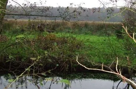
Sizewell Belts
Wildlife reserves · 2.3 km

Thorpeness Village Sign
Public art & sculpture · 2.3 km

Thorpeness & Aldringham Heritage Centre
Museums · 2.4 km

Aldringham War Memorial
Memorials & monuments · 2.9 km
Nearby
📷 5Campsites · East of England
Beach View Holiday Park (Formerly Cliff House Park)
Beach View Holiday Park (Formerly Cliff House Park) — a campsite in england east.
📷 3Public art & sculpture · East of England
Sizewell Gap Engelandvaarder Memorial
Sizewell Gap Engelandvaarder Memorial in England East, United Kingdom.
📷 4National landscapes (AONB) · East of England
Suffolk & Essex Coast & Heaths National Landscape
The Suffolk & Essex Coast & Heaths National Landscape is an Area of Outstanding Natural Beauty in Suffolk and Essex, England. The AONB covers ancient woodland, commercial forestry, the estuaries of th
📷 5📷 3Public art & sculpture · East of England
Sizewell Village Sign
Sizewell Village Sign — a public art in england-east, United Kingdom.
📷 5Historic houses · East of England
House in the Clouds
House in the Clouds — folly on top of a former water tower, in Thorpeness, Suffolk, England, UK.
Where to eat & stay near Sizewell Hall Gazebo
Places to stay
📷 5Campsites · East of England
Beach View Holiday Park (Formerly Cliff House Park)
Beach View Holiday Park (Formerly Cliff House Park) — a campsite in england east.
 📷 5
📷 5 📷 5
📷 5 📷 5
📷 5Caravan parks · East of England
Church Farm Holiday Park
Church Farm Holiday Park — a caravan park in england east.
 📷 5
📷 5 📷 5
📷 5Caravan parks · East of England
Motorhome & Caravan Club, The Eels Foot
Motorhome & Caravan Club, The Eels Foot — a caravan park in england east.
Places to eat & drink
 📷 7
📷 7Historic pubs · East of England
The Parrot And Punchbowl Public House
The Parrot And Punchbowl Public House in England East, United Kingdom.
 📷 7
📷 7Historic pubs · East of England
George and Dragon, Farnham
George and Dragon, Farnham in England East, United Kingdom.
 📷 7
📷 7Historic pubs · East of England
The Jolly Sailor Public House
The Jolly Sailor Public House in England East, United Kingdom.
 📷 7
📷 7Historic pubs · East of England
The Lion, Little Glemham
The Lion, Little Glemham in England East, United Kingdom.
 📷 6
📷 6Historic pubs · East of England
The Swan, Peasenhall
The Swan, Peasenhall in England East, United Kingdom.
 📷 5
📷 5More follies in this region
 📷 5
📷 5 📷 5
📷 5Follies · East of England
Audley End Ring Hill Temple
Audley End Ring Hill Temple — Folly or eyecatcher.
 📷 5
📷 5Follies · East of England
Barrington-White mausoleum
Barrington-White mausoleum is a folly in the United Kingdom.
 📷 5
📷 5Follies · East of England
Bridge End Garden Summerhouse
Bridge End Garden Summerhouse — Folly or eyecatcher.
Frequently asked questions
- Where is Sizewell Hall Gazebo?
- Sizewell Hall Gazebo is in Suffolk, East of England, United Kingdom (postcode IP16 4TX), in the parish of Aldringham cum Thorpe.
- What is Sizewell Hall Gazebo?
- Sizewell Hall Gazebo — Folly or eyecatcher.
- How do I get to Sizewell Hall Gazebo?
- The nearest railway station is Saxmundham, about 9.1 km away. The nearest town is Dunwich. Drivers can use postcode IP16 4TX.
- Is Sizewell Hall Gazebo a protected site?
- Yes — Sizewell Hall Gazebo is part of the Leiston - Aldeburgh SSSI Site of Special Scientific Interest and the Suffolk Coast & Heaths National Landscape (AONB).
- Is Sizewell Hall Gazebo free to visit?
- Yes, Sizewell Hall Gazebo is free to enter.
- How do I get to Sizewell Hall Gazebo?
- Drivers can navigate to postcode IP16 4TX. It sits within the Suffolk Coastal parliamentary constituency.