
Natural landmarks · Scottish Highlands
Stob Bàn
Also known as: Stob Ban
In or near Kinlochleven.
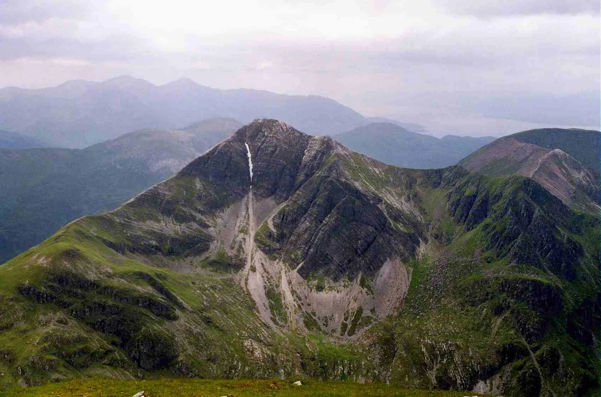
Stob Bàn — 999m high mountain in Highland, Scotland, UK.

Wikimedia Commons contributors — see linked file page for photographer and licence licence
_from_Sgurr_a'_Mhaim.jpg)
Plan your visit
- Typical visit
- 1 h–2 h
- Nearest railway station
- Fort William · 9.7 km
- Free entry
- Dog-friendly
Getting there & planning your visit
Stob Bàn is located in the Scottish Highlands, with the nearest railway station being Fort William, approximately 9.7 km away. Admission is free. There are no specific accessibility details provided.
About
Stob Bàn is a named natural landmark in the United Kingdom. Wikidata describes it as: "999m high mountain in Highland, Scotland, UK". Coordinates: 56.7437°, -5.0303°.
Photo gallery
Official information
Stob Bàn is a prominent and steep Munro peak located in the Mamores range, offering stunning views from various points in lower Glen Nevis. It is a popular destination for hikers, with several routes available for ascent, including options that involve scrambling and ridge traverses.
From the Wikipedia article
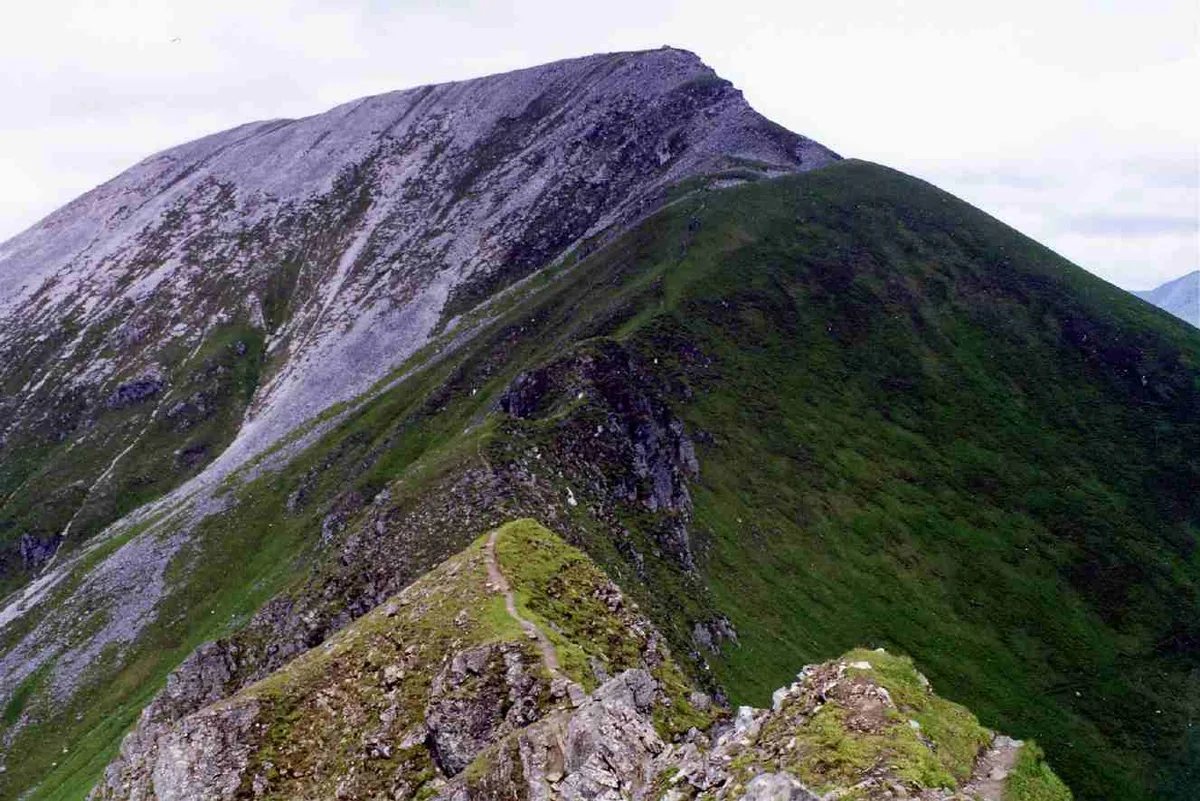
Stob Bàn is a Scottish mountain situated at the western end of the Mamores ridge, five and a half kilometres north-west of Kinlochleven. With a height of 999 metres (3,278 feet) it qualifies as a Munro. Stob Bàn is a distinctive sight when viewed from lower Glen Nevis with its sharp peak and capping of white quartzite rocks which are often mistaken for snow; its Gaelic name translates as White Peak or Light Coloured Peak. Stob Bàn exhibits striking examples of Dalradian rock geology and has been identified by the Joint Nature Conservation Committee (JNCC) as an important site in its Geological Conservation Review. Dalradian rocks were characteristically formed in the high ground to the east and south of the Great Glen of Scotland. Dalriada was the name for this ancient Celtic region. The mountain should not confused with another Stob Bàn, also a Munro which is located in the Grey Corries above Spean Bridge. Stob Bàn has three main ridges: the east ridge connects to the former Munro of Sgor an Iubhair via the top of the Coire a' Mhusgain (Corrie of the Shellfish), the western ridge links to the adjoining Munro of Mullach nan Coirean while the northern ridge drops steeply to Glen Nevis over a series of terraced rocky outcrops. There is a less significant fourth ridge which gives a steep descent south west to the West Highland Way en route from Kinlochleven to Fort William and is quick way off the mountain for walkers who have approached from the south. Stob Bàn can be climbed as part of the Highland High Way, a high level alternative of the West Highland Way, walkers often do the final day between Kinlochleven and Fort William over some of the Mamores peaks if the weather is fine. Stob Bàn's most striking physical characteristic are its crags on the north eastern face; these fall precipitously to Coire a' Mhusgain over 400 metres below and contribute greatly to the mountain's classic pyramidal shape. The buttresses on the northern ridge of the mountain attract winter…
Excerpt from Wikipedia under CC BY-SA 4.0. See the source article linked in Sources below.
- Coordinates
- 56.7437, -5.0303
- Address
- Highland, Scotland
- Nearest railway station
- Fort William — 9.7 km
- Official site
- www.walkhighlands.co.uk
Sources
- wikidata: Q926932 (CC0)
- wikipedia: Stob Bàn (Mamores) (CC BY-SA 4.0)
- commons: Stob Ban (Mamores) from Sgurr a' Mhaim.jpg (CC BY-SA 4.0)
Other places nearby

Stob Ban
Mountains & hills · 0.0 km
Stob Bàn
Mountains & hills · 0.0 km

Mullach nan Coirean East Top
Mountains & hills · 1.2 km

Wild Camp
Campsites · 1.2 km

Sgurr a' Mhaim - Stob Choire a' Mhail
Mountains & hills · 1.6 km

Stob Choire a' Mhail
Mountains & hills · 1.6 km
Mullach nan Coirean SE Top
Mountains & hills · 1.7 km

Sgùrr an Iubhair
Mountains & hills · 1.7 km

Sgor an Iubhair
Mountains & hills · 1.7 km

Stob Coire na h-Eirghe
Mountains & hills · 1.8 km

Sgurr a' Mhaim
Mountains & hills · 2.1 km
Sgùrr a' Mhàim
Natural landmarks · 2.1 km
Nearby
📷 5📷 3Mountains & hills · Scottish Highlands
Stob Bàn
Stob Bàn — Named summit at 999 m.
📷 3Mountains & hills · Scottish Highlands
Mullach nan Coirean East Top
Mullach nan Coirean East Top — a mountain in scotland-highlands, United Kingdom.
📷 5📷 3Mountains & hills · Scottish Highlands
Sgurr a' Mhaim - Stob Choire a' Mhail
Sgurr a' Mhaim - Stob Choire a' Mhail — a mountain in scotland-highlands, United Kingdom.
📷 5Mountains & hills · Scottish Highlands
Stob Choire a' Mhail
Stob Choire a' Mhail — a hill or mountain in scotland highlands.
Where to eat & stay near Stob Bàn
Places to stay
📷 5 📷 5
📷 5Campsites · Scottish Highlands
really small camp site
really small camp site — a campsite in scotland highlands.
📷 5Campsites · Scottish Highlands
not great but fits 2 person tent and has access to small river
not great but fits 2 person tent and has access to small river — a campsite in scotland highlands.
 📷 5
📷 5Campsites · Scottish Highlands
Caolasnacon Caravan & Camping Park
Caolasnacon Caravan & Camping Park — a campsite in scotland highlands.
 📷 7
📷 7Hotels · Scottish Highlands
MacDonald Hotel
MacDonald Hotel — a hotel in scotland highlands.
 📷 5
📷 5Campsites · Scottish Highlands
Kinlochleven Wild Camping Area
Kinlochleven Wild Camping Area — a campsite in scotland highlands.
Places to eat & drink
 📷 4
📷 4Historic pubs · Scottish Highlands
Clachaig Inn
Clachaig Inn in Scotland Islands, United Kingdom.
More natural landmarks in this region
 Flagship📷 3
Natural landmarks · Scottish Highlands
Dunalastair Water
Dunalastair Water — lake in Perth and Kinross, Scotland, UK, on the River Tummel.
 Flagship📷 3
Natural landmarks · Scottish Highlands
Loch Arkaig
Loch Arkaig — lake in Highland, Scotland, UK, outflows east to River Arkaig.
 Flagship📷 3
Natural landmarks · Scottish Highlands
Loch Assynt
Loch Assynt — lake in Highland, Scotland, UK, outflows to the River Inver and Loch na Garbh Uidhe.
 Flagship📷 5
Natural landmarks · Scottish Highlands
Loch Eilt
Loch Eilt — lake in Highland, Scotland, UK, outflows west to River Ailort.
Frequently asked questions
- Where is Stob Bàn?
- Stob Bàn is in the Scottish Highlands, United Kingdom.
- What is Stob Bàn?
- Stob Bàn — 999m high mountain in Highland, Scotland, UK.
- How do I get to Stob Bàn?
- The nearest railway station is Fort William, about 9.7 km away. Its coordinates are 56.7437°, -5.0303°.
- Is Stob Bàn free to visit?
- Yes, Stob Bàn is free to enter.