
Hill forts · South West England
Stanton Drew stone circles
In or near Chelwood.
Stanton Drew stone circles — Neolithic henge monument; stone circles.

Wikimedia Commons contributors — see linked file page for photographer and licence licence

Plan your visit
- Typical visit
- 1 h–2 h
- Nearest railway station
- Parson Street · 7.7 km
- Paid entry
- Family-friendly
- Dog-friendly
- Limited wheelchair access
Getting there & planning your visit
To visit Stanton Drew stone circles, the nearest railway station is Parson Street, located 7.7 km away. Entry is free, but wheelchair accessibility is limited. The postcode for sat-nav is BS39 4EP.
About
Stanton Drew stone circles is a hill fort in the United Kingdom. Heritage designation: scheduled monument. Owned by English Heritage. Managed by English Heritage. Wikidata describes it as: "Neolithic henge monument; stone circles". Coordinates: 51.3672°, -2.5756°.
Photo gallery
Summary from the official site
Stanton Drew Circles and Cove is a prehistoric site in Somerset featuring three stone circles and a cove. It is one of the largest complexes of standing stones in England, with the Great Circle being particularly notable for its size and the number of surviving stones.
Read more on the official property page.
Protected designations
- Site of Special Scientific Interest: Severn Estuary SSSI
Designations sourced from Natural England open data under OGL v3.
From the Wikipedia article
The Stanton Drew stone circles are just outside the village of Stanton Drew in the English county of Somerset. The largest stone circle is the Great Circle, 113 metres (371 ft) in diameter and the second largest stone circle in Britain (after Avebury); it is considered to be one of the largest Neolithic monuments to have been built. The date of construction is not known, but is thought to be between 3000 and 2000 BCE, which places it in the Late Neolithic to Early Bronze Age. It was made a scheduled monument in 1982. The Great Circle was surrounded by a ditch and is accompanied by smaller stone circles to the northeast and southwest. There is also a group of three stones, known as The Cove, in the garden of the local pub. Slightly further from the Great Circle is a single stone, known as Hautville's Quoit. Some of the stones are still vertical, but the majority are now recumbent, and some are no longer present. The stone circles have been studied since John Aubrey's visit in 1664, and some excavations of the site were performed in the 18th century. In the late 20th and early 21st centuries, geophysical surveys have confirmed the size of the stone circles and identified additional pits and postholes. The Cove has been shown to be around 1,000 years older than the stone circles, and so date from 4000–3000 BCE. A variety of myths and legends about the stone circles have been recorded, including one about dancers at a celebration who have been turned to stone.
Excerpt from Wikipedia under CC BY-SA 4.0. See the source article linked in Sources below.
- Coordinates
- 51.3672, -2.5756
- District
- Bath and North East Somerset
- Parish
- Stanton Drew
- Postcode
- BS39 4EP
- Parliamentary constituency
- North East Somerset and Hanham
- Nearest railway station
- Parson Street — 7.7 km
- Opening
- Open any reasonable time during daylight hours.
- Official site
- www.english-heritage.org.uk
Sources
- wikidata: Q1516300 (CC0)
- wikipedia: Stanton Drew stone circles (CC BY-SA 4.0)
- commons: Stanton Drew stone circle, Somerset.jpg (CC BY-SA 4.0)
Featured in these 2 guides
Other places nearby

Stanton Drew Great Circle
Archaeological sites · 0.0 km

Stanton Drew Circle North-east
Archaeological sites · 0.1 km

Stanton Drew Circle South-west
Archaeological sites · 0.2 km

Stanton Drew Circle South-west
Archaeological sites · 0.2 km
.jpg?width=1200)
The Court
Historic houses · 0.3 km
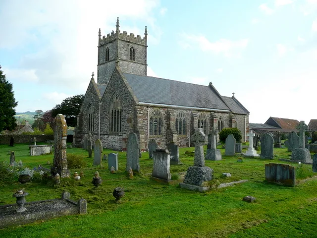
Church of St Mary the Virgin, Stanton Drew
Historic churches · 0.3 km

The Cove
Memorials & monuments · 0.3 km

The Round House, Stanton Drew
Historic houses · 0.5 km

Hautville's Quoit
Windmills · 0.5 km

Pensford Viaduct
Historic bridges · 1.7 km
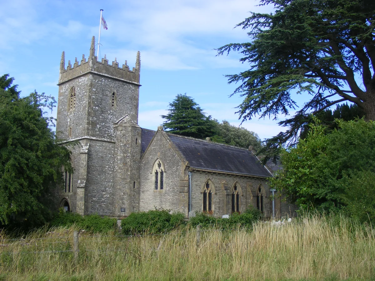
Holy Trinity Church, Norton Malreward
Historic churches · 1.8 km

Acker Bilk
Memorials & monuments · 1.8 km
Nearby
📷 3Archaeological sites · South West England
Stanton Drew Great Circle
Stanton Drew Great Circle — a archaeological in england-south-west, United Kingdom.
📷 3Archaeological sites · South West England
Stanton Drew Circle North-east
Stanton Drew Circle North-east — a archaeological in england-south-west, United Kingdom.
📷 3Archaeological sites · South West England
Stanton Drew Circle South-west
Stanton Drew Circle South-west — a archaeological in england-south-west, United Kingdom.
📷 5Archaeological sites · South West England
Stanton Drew Circle South-west
Stanton Drew Circle South-west — archaeological in england south west.
📷 3Historic houses · South West England
The Court
The Court — house in Stanton Drew, Somerset, England, UK.
📷 5Historic churches · South West England
Church of St Mary the Virgin, Stanton Drew
Church of St Mary the Virgin, Stanton Drew — church in Bath and North East Somerset, England, UK.
Where to eat & stay near Stanton Drew stone circles
Places to stay
 📷 5
📷 5Caravan parks · South West England
Chew Valley Caravan Park
Chew Valley Caravan Park — a caravan park in england south west.
 📷 5
📷 5Campsites · South West England
Chelwood Scout Campsite
Chelwood Scout Campsite — a campsite in england south west.
 📷 5
📷 5Campsites · South West England
Bristol View Glamping
Bristol View Glamping — a campsite in wales south.
 📷 5
📷 5Hotels · South West England
Cameley Lodge
Cameley Lodge — a hotel in england south west.
 📷 5
📷 5Campsites · South Wales
Walnut Tree Farm Camping
Walnut Tree Farm Camping — a campsite in wales south.
 📷 5
📷 5Campsites · South West England
Bury View Farm
Bury View Farm — a campsite in england south east.
Places to eat & drink
 📷 5
📷 5Historic pubs · South West England
The Trout Tavern
The Trout Tavern in England South West, United Kingdom.
 📷 5
📷 5Historic pubs · South West England
The Old Bank Public House
The Old Bank Public House in England South West, United Kingdom.
 📷 7
📷 7
 📷 5
📷 5Historic pubs · South West England
Black Castle Public House
Black Castle Public House in Wales South, United Kingdom.
 📷 5
📷 5Historic pubs · South West England
The Louisiana Public House
The Louisiana Public House in Wales South, United Kingdom.
More places run by English Heritage
 Flagship📷 10
Museums · London
Kenwood House
Kenwood House — art museum and historic house in Hampstead, London.
 📷 5
📷 5Galleries · London
Apsley House
Apsley House — London townhouse of the Dukes of Wellington.
 📷 5
📷 5Castles · London
Eynsford Castle
Eynsford Castle — castle, now ruinous, in Eynsford, Kent, England, UK.
 📷 5
📷 5Museums · London
Jewel Tower
Jewel Tower — medieval tower in Westminster, London, England, UK.
More places in this region
 Flagship📷 10
Hill forts · South West England
Maiden Castle
Maiden Castle — Iron Age hill fort in Dorset, England, UK.
 📷 5
📷 5Hill forts · South West England
All Cannings Cross
All Cannings Cross — archaeological site in All Cannings, Wiltshire, England, UK.
 📷 5
📷 5Hill forts · South West England
Aquae Sulis
Aquae Sulis — town in Roman Britain on the site of Bath, England.
 📷 5
📷 5Hill forts · South West England
Aston Valley Barrow Cemetery
Aston Valley Barrow Cemetery — group of Bronze Age burial mounds in England.
Frequently asked questions
- Where is Stanton Drew stone circles?
- Stanton Drew stone circles is in South-West England, United Kingdom (postcode BS39 4EP), in the parish of Stanton Drew.
- What is Stanton Drew stone circles?
- Stanton Drew stone circles — Neolithic henge monument; stone circles.
- How do I get to Stanton Drew stone circles?
- The nearest railway station is Parson Street, about 7.7 km away. Drivers can use postcode BS39 4EP.
- Who runs Stanton Drew stone circles?
- Stanton Drew stone circles is operated by English Heritage.
- Is Stanton Drew stone circles a listed building?
- Stanton Drew stone circles is officially recognised as scheduled monument listed.
- Is Stanton Drew stone circles a protected site?
- Yes — Stanton Drew stone circles is part of the Severn Estuary SSSI Site of Special Scientific Interest.
- Is Stanton Drew stone circles free to visit?
- Yes, Stanton Drew stone circles is free to enter.
- How do I get to Stanton Drew stone circles?
- The nearest railway station is Parson Street, about 7.7 km away. Drivers can navigate to postcode BS39 4EP.