
Mountains & hills · Yorkshire & the Humber
Standedge
In or near Marsden.
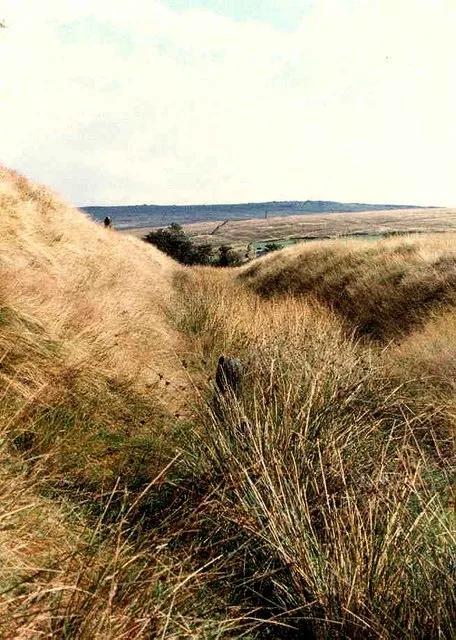
Standedge — Named summit at 457 m.

Wikimedia Commons contributors — see linked file page for photographer and licence licence

Plan your visit
- Typical visit
- 3 h–8 h
- Best time of year
- Late spring – early autumn (May–Oct)
- Nearest railway station
- Marsden · 3.8 km
- Free entry
- Dog-friendly
Getting there & planning your visit
To visit Standedge, the nearest railway station is Marsden, located 3.8 km away. Entry is free, and the postcode for navigation is OL3 5LU.
About
Standedge is a named summit in the United Kingdom. Wikidata describes it as: "Named summit at 457 m.". Coordinates: 53.5904°, -1.9828°.
Photo gallery
Protected designations
- Site of Special Scientific Interest: Dark Peak SSSI
- Site of Special Scientific Interest: South Pennine Moors SSSI
Designations sourced from Natural England open data under OGL v3.
From the Wikipedia article
Standedge () is a moorland escarpment in the Pennine Hills of northern England between Marsden, West Yorkshire and Diggle, Greater Manchester. Standedge has been a major moorland crossing point since Roman times and possibly earlier. From east to west, Standedge is crossed by five generations of road crossing, the earliest a Roman road from York to Chester and the latest the A62 road. The Huddersfield Narrow Canal and the railway line from Leeds to Manchester pass underground in the Standedge Tunnels. The Pennine Way long-distance footpath passes through Standedge in a north–south direction along the Pennines. Much of Standedge is in the National Trust's Marsden Moor Estate. Administratively, Standedge is split between Kirklees and Oldham.
Excerpt from Wikipedia under CC BY-SA 4.0. See the source article linked in Sources below.
- Coordinates
- 53.5904, -1.9828
- District
- Oldham
- Parish
- Saddleworth
- Postcode
- OL3 5LU
- Parliamentary constituency
- Oldham East and Saddleworth
- Nearest railway station
- Marsden — 3.8 km
Sources
- osm: n286792598 (ODbL)
- wikipedia: Standedge (CC BY-SA 4.0)
- commons: On Standedge - geograph.org.uk - 5351396.jpg (CC BY-SA 4.0)
Other places nearby

Thieves Clough Bridge
Historic bridges · 0.9 km

Standedge Tunnels
Canals · 1.2 km
Redbrook Engine House
Historic houses · 1.3 km

Rigodunum Roman Fort
Archaeological sites · 1.6 km
Castleshaw Roman fort
Hill forts · 1.6 km

Snow Stone
Public art & sculpture · 1.9 km

Pule Hill
Mountains & hills · 2.0 km

Harrop Edge
Mountains & hills · 2.4 km

Bridge And Weir At Hey Green
Historic bridges · 2.6 km

Diggle
Villages · 2.7 km

Dowry Castle
Castles · 2.9 km

Lee Top
Historic houses · 3.0 km
Nearby
📷 3Historic bridges · Yorkshire & the Humber
Thieves Clough Bridge
Thieves Clough Bridge — Grade II listed building-listed bridge in england-yorkshire, United Kingdom.
📷 5Canals · Yorkshire & the Humber
Standedge Tunnels
The Standedge Tunnels () are four parallel tunnels through the Pennine hills at the Standedge crossing between Marsden in Kirklees, West Yorkshire and Diggle in Oldham, Greater Manchester in northern
📷 3Historic houses · Yorkshire & the Humber
Redbrook Engine House
Redbrook Engine House — a historic house in Yorkshire & the Humber, United Kingdom.
📷 3Archaeological sites · North West England
Rigodunum Roman Fort
Rigodunum Roman Fort — an archaeological site in North West England, United Kingdom.
📷 3Hill forts · North West England
Castleshaw Roman fort
Castleshaw Roman fort — Roman fort in Saddleworth, Greater Manchester, England, UK.
📷 3Public art & sculpture · Yorkshire & the Humber
Snow Stone
Snow Stone — a public art in Yorkshire & the Humber, United Kingdom.
Where to eat & stay near Standedge
Places to stay
 📷 5
📷 5Caravan parks · North West England
The Moorlands
The Moorlands — a caravan park in england north west.
 📷 5
📷 5Campsites · North West England
Dog Hill Scout Campsite
Dog Hill Scout Campsite — a campsite in england north west.
 📷 5
📷 5Campsites · North West England
Well-i-Hole Farm Caravan and Camping
Well-i-Hole Farm Caravan and Camping — a campsite in england north west.
 📷 5
📷 5Caravan parks · North West England
Hollingworth Lake Caravan park
Hollingworth Lake Caravan park — a caravan park in england north west.
 📷 5
📷 5Caravan parks · North West England
Roch Vale Caravan Park
Roch Vale Caravan Park — a caravan park in england north west.
 📷 5
📷 5Places to eat & drink
 📷 5
📷 5Historic pubs · Yorkshire & the Humber
Shoulder of Mutton
Shoulder of Mutton in England Yorkshire, United Kingdom.
 📷 5
📷 5Historic pubs · North West England
Colliers Arms Public House
Colliers Arms Public House in England North West, United Kingdom.
.jpg?width=1200) 📷 3
📷 3Historic pubs · Yorkshire & the Humber
Old Bridge Inn
Old Bridge Inn — Historic pub — listed building or notable heritage status.
 📷 5
📷 5Historic pubs · Yorkshire & the Humber
Rising Sun Public House
Rising Sun Public House in England Yorkshire, United Kingdom.
 📷 7
📷 7 📷 5
📷 5More mountains in this region
 📷 3
📷 3 📷 5
📷 5Mountains & hills · Yorkshire & the Humber
Whaley Moor
Whaley Moor — a hill or mountain in england west midlands.
 📷 5
📷 5Mountains & hills · Yorkshire & the Humber
Idle Hill
Idle Hill — a hill or mountain in england west midlands.
 📷 5
📷 5Mountains & hills · Yorkshire & the Humber
Hollingworthhall Moor
Hollingworthhall Moor — a hill or mountain in england west midlands.
Frequently asked questions
- Where is Standedge?
- Standedge is in Yorkshire, United Kingdom (postcode OL3 5LU), in the parish of Saddleworth.
- What is Standedge?
- Standedge — Named summit at 457 m.
- How do I get to Standedge?
- The nearest railway station is Marsden, about 3.8 km away. The nearest town is Marsden. Drivers can use postcode OL3 5LU.
- Is Standedge a protected site?
- Yes — Standedge is part of the Dark Peak SSSI Site of Special Scientific Interest and the South Pennine Moors SSSI Site of Special Scientific Interest.
- Is Standedge free to visit?
- Yes, Standedge is free to enter.
- How do I get to Standedge?
- The nearest railway station is Marsden, about 3.8 km away. Drivers can navigate to postcode OL3 5LU.