
Towns & cities · South East England
Stadhampton
Stadhampton — village and civil parish in South Oxfordshire, England.

Wikimedia Commons contributors — see linked file page for photographer and licence licence

Plan your visit
- Typical visit
- 3 h–6 h
- Nearest railway station
- Radley · 7.5 km
- Free entry
- Family-friendly
- Dog-friendly
Getting there & planning your visit
To visit Stadhampton, the nearest railway station is Radley, located 7.5 km away. Entry to the town is free.
About
Stadhampton is a town, city, village or settlement in the United Kingdom. It covers approximately 10 km². Recent population estimates put it at around 775 people. Address: OX44. Wikidata describes it as: "village and civil parish in South Oxfordshire, England". Coordinates: 51.6810°, -1.1310°.
Photo gallery
See it from the streetimagery from 2024
Imagery © Mapillary contributors, CC BY-SA 4.0
Protected designations
- Area of Outstanding Natural Beauty: Chilterns
Designations sourced from Natural England open data under OGL v3.
From the Wikipedia article
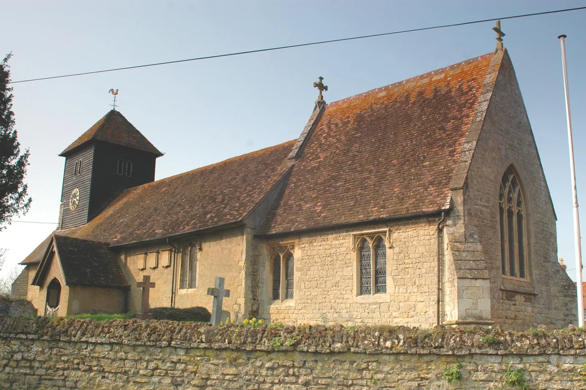
Stadhampton is a village and civil parish about 7 miles (11 km) southeast of Oxford in South Oxfordshire, England. Stadhampton is close to the River Thame, a tributary of the River Thames. The village was first mentioned by name in 1146, and was in the ownership of the bishops of Lincoln, the crown, and various Oxford colleges for most of subsequent history. The village includes several buildings of historical and architectural interest, including a parish church with features dating back to the 12th-century.
Excerpt from Wikipedia under CC BY-SA 4.0. See the source article linked in Sources below.
Background
History
The Domesday Book of 1086 does not mention Stadhampton by name, but the settlement evidently formed part of the demesne lands of the Bishop of Lincoln's Dorchester manor. Dorchester on Thames was the first Anglo-Saxon bishopric of England, and was the de facto capital of Wessex until being displaced by Winchester in 660. Dorchester manor and the village of Stadhampton remained in the ownership of the bishops of Lincoln for almost a thousand years until they passed into the ownership of Edward VI in 1547, continuing in the ownership of the crown until Elizabeth I granted the manor to Henry, Lord Norreys of Rycote. The village then passed through the ownership of several prominent families…
Sourced from Wikipedia under CC BY-SA 4.0.
- Coordinates
- 51.6810, -1.1310
- County
- Oxfordshire
- District
- South Oxfordshire
- Parish
- Stadhampton
- Postcode
- OX44
- Parliamentary constituency
- Henley and Thame
- Population
- 775
- Nearest railway station
- Radley — 7.5 km
- Official site
- www.stadhampton.org
Sources
- wikidata: Q1941960 (CC0)
- wikipedia: Stadhampton (CC BY-SA 4.0)
- commons: St.John the Baptist Church - Stadhampton - geograph.org.uk - 93497.jpg (CC BY-SA 4.0)
Other places nearby

The Bear And Ragged Staff Public House
Historic pubs · 0.1 km

Stadhampton Mill
Watermills · 0.2 km

Chiselhampton Bridge
Historic bridges · 0.9 km

The Coach & Horses
Historic pubs · 1.0 km

Chislehampton
Villages · 1.0 km

Ice house at Ascott House, 190m north west of Ascott Farm
Farms (open to visitors) · 1.0 km

Saint Katherine's Church
Historic churches · 1.3 km

D’Oyleys Farm Wild Camping
Campsites · 1.7 km

Beauforest House
Historic houses · 1.9 km

Newington House
Historic houses · 2.0 km
Drayton St. Leonard
Towns & cities · 2.1 km

Drayton Saint Leonard
Villages · 2.1 km
Stadhampton is a charming town in Oxfordshire, South East England, offering a peaceful retreat for visitors. You can explore the historic Stadhampton Mill or cross the scenic Chiselhampton Bridge during your stay. For a relaxing evening, enjoy a drink at The Bear And Ragged Staff Public House or The Coach & Horses.
At a glance
- Population
- 775
- Administrative county
- Oxfordshire
- Constituency
- Henley and Thame
- Top categories near here
Things to see in Stadhampton
12 attractions within 12 km. Full guide: things to do in Stadhampton →
📷 5Historic pubs · South East England
The Bear And Ragged Staff Public House
The Bear And Ragged Staff Public House in England South East, United Kingdom.
 📷 3
📷 3Forts · South East England
Battle of Chalgrove Field (1643)
Battle of Chalgrove Field (1643) is a fort in the United Kingdom.
 📷 3
📷 3Memorials & monuments · South East England
Hampden's Monument
Hampden's Monument is a memorial in the United Kingdom.
📷 3Historic pubs · South East England
The Coach & Horses
The Coach & Horses — Historic pub — listed building or notable heritage status.
📷 3Historic churches · South East England
Saint Katherine's Church
Saint Katherine's Church — a church in South East England, United Kingdom.
📷 3Historic bridges · South East England
Chiselhampton Bridge
Chiselhampton Bridge — a Grade II-listed bridge in england-west-midlands, United Kingdom.
📷 3Farms (open to visitors) · South East England
Ice house at Ascott House, 190m north west of Ascott Farm
Ice house at Ascott House, 190m north west of Ascott Farm — a Grade II-listed farm in england-west-midlands, United Kingdom.
📷 3Watermills · South East England
Stadhampton Mill
Stadhampton Mill — Grade II listed building-listed watermill in england-west-midlands, United Kingdom.
📷 3Memorials & monuments · South East England
Hampden Monument
Hampden Monument — Grade II listed building-listed memorial in england-west-midlands, United Kingdom.
📷 5Campsites · South East England
D’Oyleys Farm Wild Camping
D’Oyleys Farm Wild Camping — a campsite in england west midlands.
📷 5 📷 5
📷 5Nearby
📷 5Historic pubs · South East England
The Bear And Ragged Staff Public House
The Bear And Ragged Staff Public House in England South East, United Kingdom.
📷 3Watermills · South East England
Stadhampton Mill
Stadhampton Mill — Grade II listed building-listed watermill in england-west-midlands, United Kingdom.
📷 3Historic bridges · South East England
Chiselhampton Bridge
Chiselhampton Bridge — a Grade II-listed bridge in england-west-midlands, United Kingdom.
📷 3Historic pubs · South East England
The Coach & Horses
The Coach & Horses — Historic pub — listed building or notable heritage status.
📷 5📷 3Farms (open to visitors) · South East England
Ice house at Ascott House, 190m north west of Ascott Farm
Ice house at Ascott House, 190m north west of Ascott Farm — a Grade II-listed farm in england-west-midlands, United Kingdom.
Where to eat & stay near Stadhampton
Places to stay
📷 5Campsites · South East England
D’Oyleys Farm Wild Camping
D’Oyleys Farm Wild Camping — a campsite in england west midlands.
 📷 7
📷 7Hotels · South East England
The White Hart Hotel
The White Hart Hotel — a hotel in england west midlands.
 📷 5
📷 5Hotels · South East England
Le Manoir aux Quat'Saisons
Le Manoir aux Quat'Saisons — a hotel in england west midlands.
 📷 7
📷 7Hotels · South East England
The George Hotel
The George Hotel — a hotel in england west midlands.
 📷 7
📷 7B&Bs · South East England
The Plough Inn
The Plough Inn — a bed-and-breakfast in england west midlands.
 📷 5
📷 5Caravan parks · South East England
Bridge House Caravan Site
Bridge House Caravan Site — a caravan park in england west midlands.
Places to eat & drink
📷 5Historic pubs · South East England
The Bear And Ragged Staff Public House
The Bear And Ragged Staff Public House in England South East, United Kingdom.
📷 3Historic pubs · South East England
The Coach & Horses
The Coach & Horses — Historic pub — listed building or notable heritage status.
 📷 5
📷 5 📷 5
📷 5Historic pubs · South East England
The Six Bells Inn
The Six Bells Inn in England South East, United Kingdom.
 📷 5
📷 5Historic pubs · South East England
The Horse And Harrow Public House
The Horse And Harrow Public House in England South East, United Kingdom.
 📷 5
📷 5Historic pubs · South East England
The Lord Nelson Inn
The Lord Nelson Inn in England South East, United Kingdom.
More towns in this region
 Flagship📷 10
Towns & cities · South East England
Betchworth
Betchworth — village and civil parish in the Mole Valley district of Surrey, England.
 Flagship📷 10
Towns & cities · South East England
Boxley
Boxley — village and civil parish in Maidstone District, Kent, England, UK.
 Flagship📷 10
Towns & cities · South East England
Effingham
Effingham — village and civil parish in Guildford borough, Surrey, England, UK.
 Flagship📷 10
Towns & cities · South East England
Englefield Green
Englefield Green — village in the borough of Runnymede, Surrey, UK.
Frequently asked questions
- Where is Stadhampton?
- Stadhampton is in Oxfordshire, South-East England, United Kingdom (postcode OX44), in the parish of Stadhampton.
- What is Stadhampton?
- Stadhampton — village and civil parish in South Oxfordshire, England.
- How do I get to Stadhampton?
- The nearest railway station is Radley, about 7.5 km away. Drivers can use postcode OX44.
- Is Stadhampton a protected site?
- Yes — Stadhampton is part of the Chilterns National Landscape (AONB).
- Is Stadhampton free to visit?
- Yes, Stadhampton is free to enter.
- How do I get to Stadhampton?
- The nearest railway station is Radley, about 7.5 km away. Drivers can navigate to postcode OX44.