
Museums · South East England
South Oxfordshire
In or near Ewelme.
South Oxfordshire — a museum in england-west-midlands, United Kingdom.

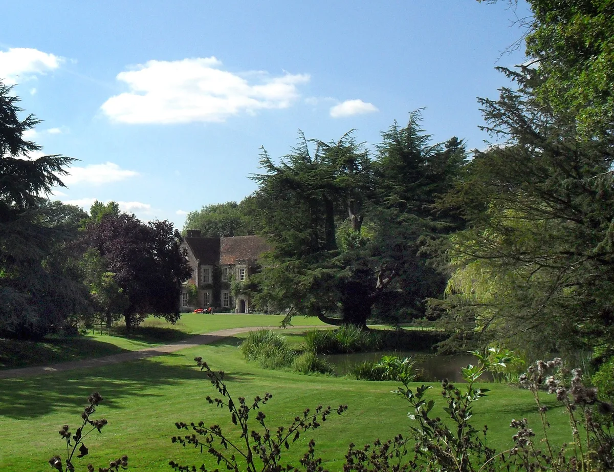
Graham Horn — CC BY-SA 2.0 via Wikimedia Commons licence

Plan your visit
- Typical visit
- 1.5 h–3 h
- Best time of year
- Year-round
- Nearest railway station
- Wallingford · 8.3 km
- Free entry
- Family-friendly
- Limited wheelchair access
About
South Oxfordshire is a museum in england-west-midlands, United Kingdom, listed in the Wikipedia register of British heritage and tourism sites. See the linked Wikipedia article for full details.
Photo gallery
Official information
South Oxfordshire is a district council area that provides various local services and information for residents and visitors. It covers topics such as waste collection, planning applications, community support, and environmental initiatives.
Protected designations
- Area of Outstanding Natural Beauty: Chilterns
Designations sourced from Natural England open data under OGL v3.
Place summary
South Oxfordshire is a museum located in the West Midlands. It showcases the region's history and culture through various exhibits and collections. The museum offers insights into local heritage and serves as a resource for research and education.
AI-generated from the structured facts on this page (operator, designation, listing, era). Not a substitute for visiting.
Background
History
The district was formed on 1 April 1974, under the Local Government Act 1972, covering the area of six former districts, which were abolished at the same time: The two Wallingford districts had previously been part of the administrative county of Berkshire, whilst the other four districts had been in the administrative county of Oxfordshire. The new district was originally given the name "Wallingford". The shadow authority elected in 1973 to oversee the transition requested a change of name to "South Oxfordshire", which was approved by the government before the new district formally came into being in 1974.
Sourced from Wikipedia under CC BY-SA 4.0.
- Coordinates
- 51.6500, -1.0500
- County
- Oxfordshire
- District
- South Oxfordshire
- Parish
- Brightwell Baldwin
- Postcode
- OX49 5NN
- Parliamentary constituency
- Henley and Thame
- Nearest railway station
- Wallingford — 8.3 km
- Official site
- www.southoxon.gov.uk
Sources
- wikipedia: South Oxfordshire (CC BY-SA 4.0)
Other places nearby

Brightwell Park, Bridge And Flanking Walls Approximately 290 Metres East Of Brightwell Park
Historic bridges · 0.4 km

The Lord Nelson Inn
Historic pubs · 0.5 km

Church of St Bartholomew, Brightwell Baldwin
Historic churches · 0.5 km

Cuxham
Villages · 0.9 km

Cutt Mill
Watermills · 1.2 km

Easington Manor
Manor houses · 2.1 km

The Red Lion Inn Public House
Historic pubs · 2.2 km

Chalgrove
Villages · 2.5 km

Hampden's Monument
Memorials & monuments · 2.5 km

Hampden Monument
Memorials & monuments · 2.5 km
Battle of Chalgrove Field (1643)
Forts · 2.6 km
Pyrton Manor
Stately homes · 2.8 km
Nearby
📷 3Historic bridges · South East England
Brightwell Park, Bridge And Flanking Walls Approximately 290 Metres East Of Brightwell Park
Brightwell Park, Bridge And Flanking Walls Approximately 290 Metres East Of Brightwell Park — Grade II listed building-listed bridge in england-west-midlands, United Kingdom.
📷 5Historic pubs · South East England
The Lord Nelson Inn
The Lord Nelson Inn in England South East, United Kingdom.
📷 3Historic churches · South East England
Church of St Bartholomew, Brightwell Baldwin
Church of St Bartholomew, Brightwell Baldwin — Grade I listed building-listed church in england-west-midlands, United Kingdom.
📷 5📷 3📷 3Manor houses · South East England
Easington Manor
Easington Manor — Grade II listed building-listed manor in england-west-midlands, United Kingdom.
Where to eat & stay near South Oxfordshire
Places to stay
 📷 5
📷 5Campsites · South East England
White Mark Farm Camp Site
White Mark Farm Camp Site — a campsite in england west midlands.
 📷 5
📷 5Campsites · South East England
Riverside Campsite
Riverside Campsite — a campsite in england west midlands.
 📷 5
📷 5Campsites · South East England
Newnham Manor Caravan Park
Newnham Manor Caravan Park — a campsite in england south east.
 📷 7
📷 7 📷 5
📷 5Caravan parks · South East England
Little Acre CL
Little Acre CL — a caravan park in england west midlands.
 📷 5
📷 5Campsites · South East England
D’Oyleys Farm Wild Camping
D’Oyleys Farm Wild Camping — a campsite in england west midlands.
Places to eat & drink
📷 5Historic pubs · South East England
The Lord Nelson Inn
The Lord Nelson Inn in England South East, United Kingdom.
📷 5Historic pubs · South East England
The Red Lion Inn Public House
The Red Lion Inn Public House in England South East, United Kingdom.
 📷 5
📷 5Historic pubs · South East England
Fox And Hounds Hotel And Public House
Fox And Hounds Hotel And Public House in England South East, United Kingdom.
 📷 5
📷 5Historic pubs · South East England
The Horse And Harrow Public House
The Horse And Harrow Public House in England South East, United Kingdom.
 📷 5
📷 5Historic pubs · South East England
The Castle Inn Public House
The Castle Inn Public House in England South East, United Kingdom.
 📷 7
📷 7Historic pubs · South East England
Fox And Hounds Inn Public House
Fox And Hounds Inn Public House in England South East, United Kingdom.
More museums in this region
 📷 5
📷 5Museums · South East England
Coldrum Long Barrow
Coldrum Long Barrow — neolithic chambered long barrow near Trottiscliffe, Kent, England, UK.
 📷 5
📷 5Museums · South East England
Guildford House
Guildford House — house in Guildford, Surrey, England, UK.
 📷 5
📷 5Museums · South East England
Huguenot Museum
Huguenot Museum — museum in Rochester, England, UK.
 📷 5
📷 5Museums · South East England
Medway megaliths
Medway megaliths — group of long barrows in Kent, England.
Frequently asked questions
- Where is South Oxfordshire?
- South Oxfordshire is in Oxfordshire, the West Midlands, United Kingdom (postcode OX49 5NN), in the parish of Brightwell Baldwin.
- What is South Oxfordshire?
- South Oxfordshire — a museum in england-west-midlands, United Kingdom.
- How do I get to South Oxfordshire?
- The nearest railway station is Wallingford, about 8.3 km away. Drivers can use postcode OX49 5NN.
- Who owns South Oxfordshire?
- South Oxfordshire is owned by South Oxfordshire District Council.
- Is South Oxfordshire a protected site?
- Yes — South Oxfordshire is part of the Chilterns National Landscape (AONB).
- How do I get to South Oxfordshire?
- Drivers can navigate to postcode OX49 5NN. It sits within the Henley and Thame parliamentary constituency.