
Historic churches · East of England
St Mary's Church, Redgrave
In or near Roydon.
St Mary's Church, Redgrave — Grade I listed church building in Mid Suffolk, England, UK.

Wikimedia Commons contributors — see linked file page for photographer and licence licence

Plan your visit
- Typical visit
- 30 min–1 h
- Nearest railway station
- Diss · 7.1 km
- Free entry
Getting there & planning your visit
St Mary's Church, Redgrave is located in Suffolk with the postcode IP22 1RJ. The nearest railway station is Diss, which is 7.1 km away. Entry to the church is free.
About
St Mary's Church, Redgrave is a historic church in the United Kingdom. Built in the English Gothic architecture style. Heritage designation: Grade I listed building. Wikidata describes it as: "Grade I listed church building in Mid Suffolk, England, UK". Coordinates: 52.3633°, 1.0197°.
Photo gallery
Heritage listing
St Mary's Church is the redundant Church of England parish church of the village of Redgrave, Suffolk, England. It is a Grade I listed building. and is under the care of the Churches Conservation Trust. The church is on a rise about 3⁄4 mile (1 km) east of the village.
From the Historic England List Entry under OGL v3.
From the Wikipedia article
St Mary's Church is the redundant Church of England parish church of the village of Redgrave, Suffolk, England. It is a Grade I listed building. and is under the care of the Churches Conservation Trust. The church is on a rise about 3⁄4 mile (1 km) east of the village.
Excerpt from Wikipedia under CC BY-SA 4.0. See the source article linked in Sources below.
Background
History
The initial building of the church was between about 1280 and 1350. Alterations and additions were made in the 15th century, and the vestry was added in the later part of the following century. The 16th-century tower was refaced in the late 18th century. Repairs were carried out in 1850, and further alterations were made later that century and in the 20th century. In 1506 the rector of the church was Cardinal Wolsey, later to be Lord Chancellor to Henry VIII.
Architecture
Inside the church are tall five-bay arcades with pointed arches carried on quatrefoil piers. The hammerbeam roof in the nave dates from the 15th century, and is in ten bays. The chancel roof dates from the 19th century, and has six bays. The 16th-century vestry roof has a large central pendant. In the south wall of the chancel is a piscina and an elaborate triple sedilia. The sedilia is in Perpendicular style, and has canted canopies with lierne vaulting. There is another piscina in the south aisle. The north aisle contains a 14th-century octagonal font. On the wall of the aisle is a re-set section of a reredos dated 1709, an 18th-century painting of the Holy Family, and elaborately…
Sourced from Wikipedia under CC BY-SA 4.0.
- Coordinates
- 52.3633, 1.0197
- County
- Suffolk
- District
- Mid Suffolk
- Parish
- Redgrave
- Postcode
- IP22 1RJ
- Parliamentary constituency
- Waveney Valley
- Nearest railway station
- Diss — 7.1 km
- Official site
- www.visitchurches.org.uk
Sources
- wikidata: Q7594411 (CC0)
- wikipedia: St Mary's Church, Redgrave (CC BY-SA 4.0)
- commons: Redgrave St Marys church - geograph.org.uk - 2108318.jpg (CC BY-SA 4.0)
Other places nearby

Redgrave Village Sign
Public art & sculpture · 1.2 km

Redgrave
Villages · 1.2 km

Redgrave and Lopham Fen
Forests & woodlands · 1.6 km
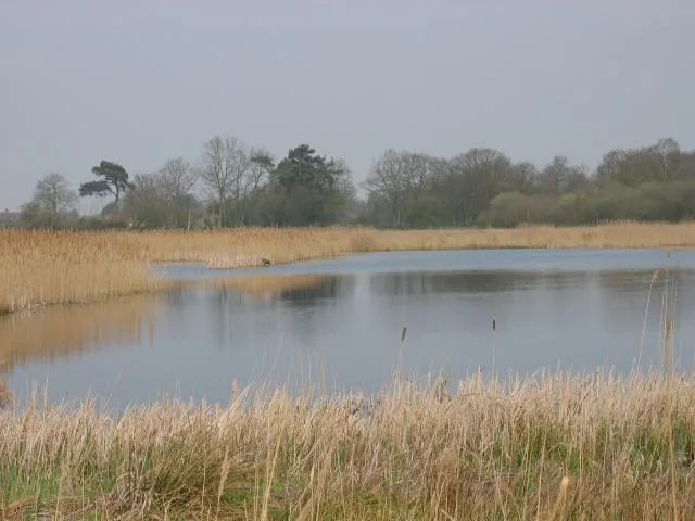
Redgrave and Lopham Fen
Wildlife reserves · 1.9 km

The Tithe War
Memorials & monuments · 2.1 km

Botesdale Village Sign
Public art & sculpture · 2.4 km

St Botolph's Chapel
Chapels · 2.5 km

Botesdale War Memorial
Memorials & monuments · 2.5 km
Botesdale, Redgrave and Rickinghall War Memorial
Memorials & monuments · 2.5 km

Wortham War Memorial
Memorials & monuments · 2.7 km

Church of St Mary the Virgin
Historic churches · 2.7 km

Wortham Village Sign
Public art & sculpture · 2.8 km
Nearby
📷 3Public art & sculpture · East of England
Redgrave Village Sign
Redgrave Village Sign — a public art in East of England, United Kingdom.
📷 5📷 3Forests & woodlands · East of England
Redgrave and Lopham Fen
Redgrave and Lopham Fen is a forest or woodland in the United Kingdom.
📷 3Wildlife reserves · East of England
Redgrave and Lopham Fen
Redgrave and Lopham Fen — Suffolk Wildlife Trust nature reserve.
📷 3Memorials & monuments · East of England
The Tithe War
The Tithe War — a memorial in East of England, United Kingdom.
📷 3Public art & sculpture · East of England
Botesdale Village Sign
Botesdale Village Sign — a public art in East of England, United Kingdom.
Where to eat & stay near St Mary's Church, Redgrave
Places to stay
 📷 5
📷 5Campsites · East of England
Hillside Farm Camping
Hillside Farm Camping — a campsite in england east.
 📷 5
📷 5Caravan parks · East of England
Barn Owl Meadow
Barn Owl Meadow — a caravan park in england east.
 📷 5
📷 5Caravan parks · East of England
Westbrook Green Farm
Westbrook Green Farm — a caravan park in england east.
 📷 5
📷 5Campsites · East of England
Swattesfield Campsite
Swattesfield Campsite — a campsite in england east.
 📷 5
📷 5B&Bs · East of England
The Red Lion
The Red Lion — a bed-and-breakfast in england east.
 📷 5
📷 5Places to eat & drink
 📷 5
📷 5Restaurants · East of England
Hong Xin
Hong Xin — a restaurant in england east.
 📷 5
📷 5 📷 5
📷 5Historic pubs · East of England
Saracens Head Inn
Saracens Head Inn in England East, United Kingdom.
 📷 7
📷 7Historic pubs · East of England
The Fighting Cocks Public House
The Fighting Cocks Public House in England East, United Kingdom.
 📷 5
📷 5 📷 5
📷 5More places in this region
 📷 5
📷 5Historic churches · East of England
All Saints Church
All Saints Church — church on Jesus Lane in central Cambridge, England.
 📷 5
📷 5Historic churches · East of England
All Saints Church, Conington
All Saints Church, Conington — church in Conington, Huntingdonshire, Cambridgeshire, England, UK.
 📷 5
📷 5Historic churches · East of England
All Saints Church, Vange
All Saints Church, Vange — church in Basildon, Essex, England, UK.
 📷 5
📷 5Historic churches · East of England
All Saints Parish Church, Kirtling
All Saints Parish Church, Kirtling — church in East Cambridgeshire, England, UK.
Frequently asked questions
- Where is St Mary's Church, Redgrave?
- St Mary's Church, Redgrave is in Suffolk, East of England, United Kingdom (postcode IP22 1RJ), in the parish of Redgrave.
- What is St Mary's Church, Redgrave?
- St Mary's Church, Redgrave — Grade I listed church building in Mid Suffolk, England, UK.
- How do I get to St Mary's Church, Redgrave?
- The nearest railway station is Diss, about 7.1 km away. The nearest town is Roydon. Drivers can use postcode IP22 1RJ.
- Is St Mary's Church, Redgrave a listed building?
- St Mary's Church, Redgrave is officially recognised as Grade I listed building listed.
- Is St Mary's Church, Redgrave free to visit?
- Yes, St Mary's Church, Redgrave is free to enter.
- How do I get to St Mary's Church, Redgrave?
- The nearest railway station is Diss, about 7.1 km away. Drivers can navigate to postcode IP22 1RJ.