
Towns & cities · East of England
Roydon
Roydon — village and civil parish in South Norfolk, United Kingdom.

Wikimedia Commons contributors — see linked file page for photographer and licence licence

Plan your visit
- Typical visit
- 3 h–6 h
- Nearest railway station
- Diss · 3.0 km
- Free entry
- Family-friendly
- Dog-friendly
Getting there & planning your visit
To visit Roydon, the nearest railway station is Diss, which is 3 km away. Entry to the town is free.
About
Roydon is a town, city, village or settlement in the United Kingdom. It covers approximately 6 km². Recent population estimates put it at around 2,298 people. Address: IP22. Wikidata describes it as: "village and civil parish in South Norfolk, United Kingdom". Coordinates: 52.3810°, 1.0810°.
Photo gallery
Protected designations
- Area of Outstanding Natural Beauty: Suffolk Coast & Heaths
Designations sourced from Natural England open data under OGL v3.
From the Wikipedia article
Roydon is a small village, parish and electoral ward in the county of Norfolk, England, about a mile west of Diss. It covers an area of 5.54 km2 (2.14 sq mi) and had a population of 2,358 in 981 households at the 2001 census, the population of both parish and ward increasing to 2,457 at the 2011 Census. It is mentioned in 1035 as Rygedune, and as Regadona and Regheduna in the Domesday Book, and later in 1242 as Reydon. In 1603 there were 124 communicants, and in 1736 there were 60 families, totalling 240 souls. In 1736 it was assessed for tax at 630 and a half pounds. Roydon's current village hall was built in 1988 on the site of a previous building. The exterior wall hosts a relief carving relocated from Aldrich Brothers brush factory, in Factory Lane, which was demolished in 1972 It also has a small village primary school, Roydon Primary that teaches 200 pupils from 4 to 11, Reception to Year 6 (Kindergarten to 5th Grade). Its church, St Remigius, is one of 124 existing round-tower churches in Norfolk. The dedication day was kept on the first of October, being the day of his translation.
Excerpt from Wikipedia under CC BY-SA 4.0. See the source article linked in Sources below.
Background
History
Roydon means 'rye hill' in Old English. It is mentioned in 1035 as Rygedune, and as Regadona and Regheduna in the Domesday Book, and later in 1242 as Reydon. However, there was settlement in the area long before with worked flint having been found in the area from the Paleolithic and Neolithic periods. In 1603 there were 124 communicants, and in 1736 there were 60 families, totalling 240 souls. In 1736 it was assessed for tax at 630 and a half pounds. The Roydon Riots were sparked in 1893 by the decision of the Lord of the Manor, John Tudor Frere, to fence off the last remaining sections of common land in the parish, including at Brewers Green. While several offenders were convicted of…
Architecture
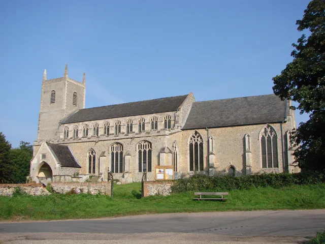
The church, St Remigius, is one of 124 existing round-tower churches in Norfolk and the oldest building in the village. The structure dates mostly from the 12-14th centuries although the interior is mostly Victorian. There is a 15th century font and a 17th century pulpit. The dedication day was kept on the first of October, being the day of his translation.. In the 18th century the Hall was home to the pioneering antiquary and archaeologist John Frere. Roydon's current village hall, on the High Road, was built in 1988 on the site of a previous building. The exterior wall hosts a relief carving relocated from Aldrich Brothers brush factory, in Factory Lane, which was demolished in 1972. The…
Visiting
Roydon Fen is a 49-acre wetland nature reserve to the south of the parish, managed by Suffolk Wildlife Trust. Flint tools dating back 10,000 years were found on the site, which was once cut by villagers for sedge and peat. Brewers Green is a County Wildlife Site managed by volunteers with the help of Norfolk Wildlife Trust and features grassland, a small wood and several ponds. Quaker Wood on Factory Lane is a 5.5 acre open space managed by Diss Community Woodland Project. It was established in 2010 and features mostly young woodland, a pond, meadow and paths.
Sourced from Wikipedia under CC BY-SA 4.0.
- Coordinates
- 52.3810, 1.0810
- County
- Norfolk
- District
- South Norfolk
- Parish
- Roydon
- Postcode
- IP22
- Parliamentary constituency
- Waveney Valley
- Population
- 2,298
- Nearest railway station
- Diss — 3 km
Sources
- wikidata: Q746725 (CC0)
- wikipedia: Roydon, South Norfolk (CC BY-SA 4.0)
- commons: St Remigius, Roydon, Norfolk - geograph.org.uk - 849720.jpg (CC BY-SA 4.0)
Other places nearby

Roydon War Memorial
Memorials & monuments · 0.1 km

Roydon Village Sign
Public art & sculpture · 0.4 km

Royden Fen
Forests & woodlands · 0.7 km
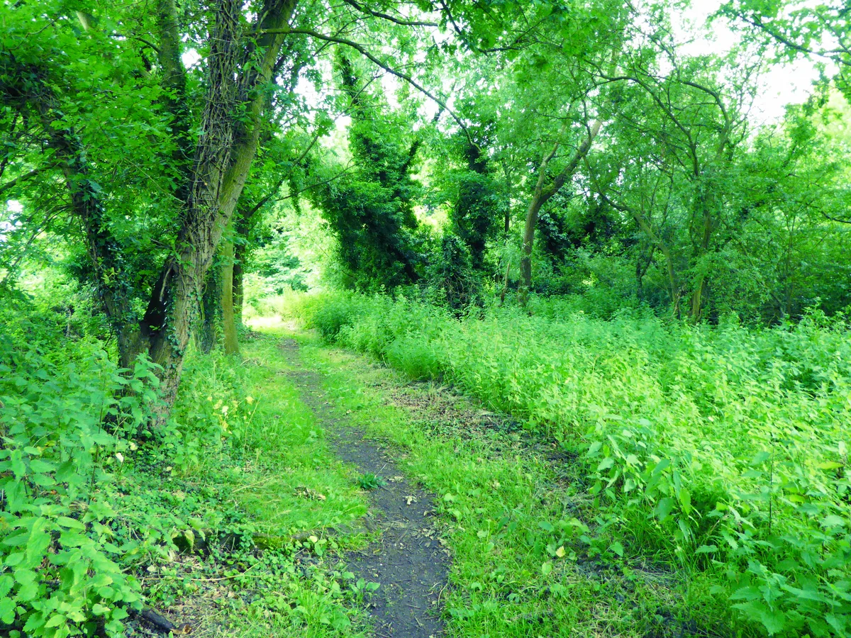
Roydon Fen
Wildlife reserves · 0.7 km

Wortham Ling SSSI
Forests & woodlands · 1.1 km

Jubilee Walk
Memorials & monuments · 1.2 km
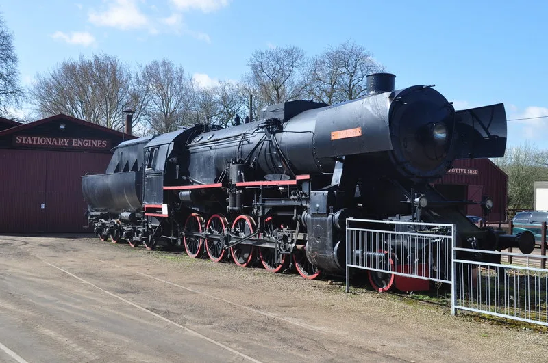
Bressingham Steam and Gardens
Museums · 1.7 km

Remember Tom Paine
Memorials & monuments · 1.7 km
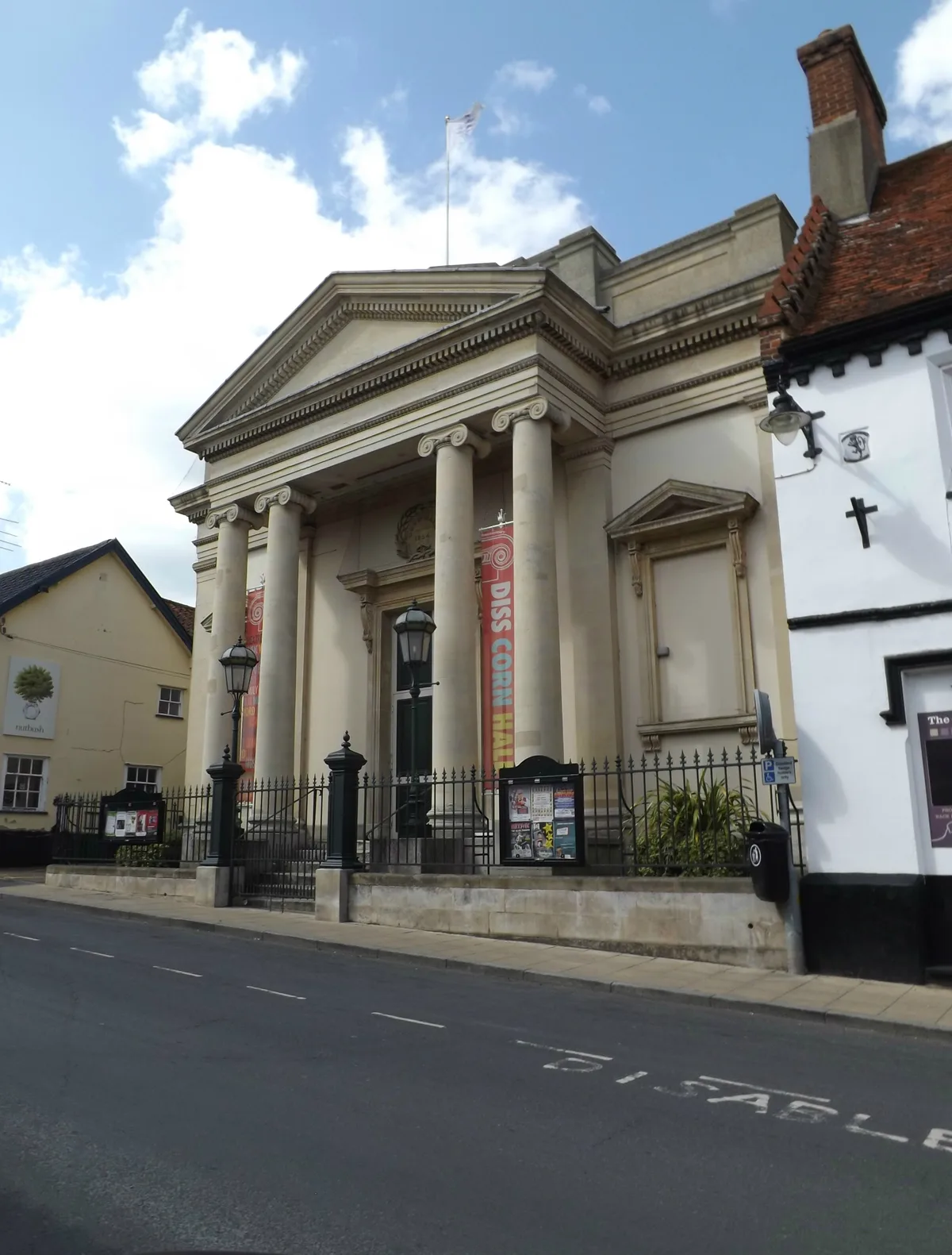
The Corn Hall
Theatres · 1.8 km

Diss, Norfolk
Museums · 1.8 km

Hong Xin
Restaurants · 1.9 km

Bressingham Village Sign
Public art & sculpture · 1.9 km
Roydon is a charming town located in Norfolk, within the East of England region. Visitors can explore the scenic beauty of Royden Fen, which serves as both a forest and a wildlife reserve. The area also offers cultural interests at the Bressingham Steam and Gardens museum, alongside historic sites like the Church of St Mary the Virgin.
At a glance
- Population
- 2,298
- Administrative county
- Norfolk
- Constituency
- Waveney Valley
- Top categories near here
Things to see in Roydon
32 attractions within 12 km — showing the 24 most editorially-significant. Full guide: things to do in Roydon →
.jpg?width=1200) 📷 3
📷 3Gardens · East of England
Bressingham Hall
Bressingham Hall — country house in Norfolk, England, UK.
📷 5Museums · East of England
Bressingham Steam and Gardens
Bressingham Steam and Gardens — Museum/various trains and visitor gardens in Norfolk.
 📷 3
📷 3Historic churches · East of England
Church of St John the Baptist
Church of St John the Baptist — Grade I listed church in Bressingham, Norfolk, England, UK.
 📷 4
📷 4Historic churches · East of England
Church of St Mary the Virgin
Church of St Mary the Virgin — Grade I listed church in Wortham, Suffolk, England, UK.
 📷 3
📷 3Historic houses · East of England
Dolphin House
Dolphin House — building in Diss, Norfolk, England, UK.
.jpg?width=1200) 📷 3
📷 3Historic houses · East of England
Park House
Park House — house in Diss, South Norfolk, England, UK.
📷 5Forests & woodlands · East of England
Royden Fen
Royden Fen is a forest or woodland in the United Kingdom.
📷 5Wildlife reserves · East of England
Roydon Fen
Roydon Fen — Suffolk Wildlife Trust nature reserve.
 📷 3
📷 3Historic churches · East of England
St Mary's Church, Redgrave
St Mary's Church, Redgrave — Grade I listed church building in Mid Suffolk, England, UK.
📷 3Theatres · East of England
The Corn Hall
The Corn Hall is a theatre in the United Kingdom.
📷 5Forests & woodlands · East of England
Wortham Ling SSSI
Wortham Ling SSSI is a forest or woodland in the United Kingdom.
 📷 3
📷 3Miniature railways · East of England
Garden Railway
Garden Railway — a miniature railway in england-east, United Kingdom.
 📷 3
📷 3Museums · East of England
Diss Museum
Diss Museum — a museum in East of England, United Kingdom.
 📷 3
📷 3Manor houses · East of England
Mere Manor
Mere Manor — Grade II listed building-listed manor in england-east, United Kingdom.
📷 3Memorials & monuments · East of England
Roydon War Memorial
Roydon War Memorial — Grade II listed building-listed memorial in england-east, United Kingdom.
 📷 3
📷 3Memorials & monuments · East of England
Palgrave War Memorial
Palgrave War Memorial — Grade II listed building-listed memorial in england-east, United Kingdom.
 📷 3
📷 3Memorials & monuments · East of England
Wortham War Memorial
Wortham War Memorial — Grade II listed building-listed memorial in england-east, United Kingdom.
📷 3Public art & sculpture · East of England
Bressingham Village Sign
Bressingham Village Sign — a public art in East of England, United Kingdom.
 📷 3
📷 3Public art & sculpture · East of England
Palgrave Village Sign
Palgrave Village Sign — a public art in East of England, United Kingdom.
 📷 3
📷 3Public art & sculpture · East of England
Wortham Village Sign
Wortham Village Sign — a public art in East of England, United Kingdom.
📷 3Public art & sculpture · East of England
Roydon Village Sign
Roydon Village Sign — a public art in East of England, United Kingdom.
 📷 3
📷 3Public art & sculpture · East of England
Diss Village Sign
Diss Village Sign — a public art in East of England, United Kingdom.
 📷 3
📷 3Memorials & monuments · East of England
The Tithe War
The Tithe War — a memorial in East of England, United Kingdom.
📷 4Memorials & monuments · East of England
Jubilee Walk
Jubilee Walk — a memorial in East of England, United Kingdom.
Nearby
📷 3Memorials & monuments · East of England
Roydon War Memorial
Roydon War Memorial — Grade II listed building-listed memorial in england-east, United Kingdom.
📷 3Public art & sculpture · East of England
Roydon Village Sign
Roydon Village Sign — a public art in East of England, United Kingdom.
📷 5Forests & woodlands · East of England
Royden Fen
Royden Fen is a forest or woodland in the United Kingdom.
📷 5Wildlife reserves · East of England
Roydon Fen
Roydon Fen — Suffolk Wildlife Trust nature reserve.
📷 5Forests & woodlands · East of England
Wortham Ling SSSI
Wortham Ling SSSI is a forest or woodland in the United Kingdom.
📷 4Memorials & monuments · East of England
Jubilee Walk
Jubilee Walk — a memorial in East of England, United Kingdom.
Where to eat & stay near Roydon
Places to stay
 📷 5
📷 5Caravan parks · East of England
Westbrook Green Farm
Westbrook Green Farm — a caravan park in england east.
 📷 5
📷 5Caravan parks · East of England
The Willows Campsite
The Willows Campsite — a caravan park in england east.
 📷 5
📷 5 📷 5
📷 5 📷 5
📷 5Caravan parks · East of England
Applewood Caravan & Camping Park
Applewood Caravan & Camping Park — a caravan park in england east.
 📷 5
📷 5B&Bs · East of England
The Red Lion
The Red Lion — a bed-and-breakfast in england east.
Places to eat & drink
📷 5Restaurants · East of England
Hong Xin
Hong Xin — a restaurant in england east.
 📷 5
📷 5Historic pubs · East of England
Saracens Head Inn
Saracens Head Inn in England East, United Kingdom.
 📷 5
📷 5 📷 7
📷 7Historic pubs · East of England
The Fighting Cocks Public House
The Fighting Cocks Public House in England East, United Kingdom.
 📷 5
📷 5 📷 5
📷 5More towns in this region
 Flagship📷 10
 Flagship📷 10
Towns & cities · East of England
Cambridge
Cambridge — city in Cambridgeshire, England.
 Flagship📷 10
Towns & cities · East of England
Chelmsford
Chelmsford — city in Essex, United Kingdom.
 Flagship📷 10
Towns & cities · East of England
Colney Heath
Colney Heath — village and civil parish in St Albans, Hertfordshire, England, UK.
Frequently asked questions
- Where is Roydon?
- Roydon is in Norfolk, East of England, United Kingdom (postcode IP22), in the parish of Roydon.
- What is Roydon?
- Roydon — village and civil parish in South Norfolk, United Kingdom.
- How do I get to Roydon?
- The nearest railway station is Diss, about 3.0 km away. Drivers can use postcode IP22.
- Is Roydon a protected site?
- Yes — Roydon is part of the Suffolk Coast & Heaths National Landscape (AONB).
- Is Roydon free to visit?
- Yes, Roydon is free to enter.
- How do I get to Roydon?
- The nearest railway station is Diss, about 3.0 km away. Drivers can navigate to postcode IP22.