
Archaeological sites · East of England
St Margarets Priory (Remains)
In or near Little Gaddesden.
St Margarets Priory (Remains) — archaeological in england west midlands.

Colin Smith — CC BY-SA 2.0 via Wikimedia Commons licence

Plan your visit
- Typical visit
- 45 min–1.5 h
- Nearest railway station
- Berkhamsted · 4.3 km
About
St Margarets Priory (Remains) is a archaeological located in england west midlands. A British archaeological site recorded in OpenStreetMap with at least one heritage quality signal (Wikidata link, Wikipedia article or designated operator).
Photo gallery
Protected designations
- Area of Outstanding Natural Beauty: Chilterns
Designations sourced from Natural England open data under OGL v3.
Place summary
St Margarets Priory (Remains) is an archaeological site located in the West Midlands. It features the remnants of a former priory, providing insight into monastic life in the area. The site is of historical significance, reflecting the architectural and cultural heritage of the period. Visitors can explore the ruins and consider their role in the region's ecclesiastical history.
AI-generated from the structured facts on this page (operator, designation, listing, era). Not a substitute for visiting.
- Coordinates
- 51.7957, -0.5287
- County
- Hertfordshire
- District
- Dacorum
- Parish
- Little Gaddesden
- Postcode
- HP4 1QW
- Parliamentary constituency
- Harpenden and Berkhamsted
- Established
- 1101
- Nearest railway station
- Berkhamsted — 4.3 km
Sources
- osm: w224175465 (ODbL)
- wikidata: Q7594116 (CC0)
Other places nearby

St Margarets Priory (Remains)
Abbeys & priories · 0.0 km

Amaravati Temple
Historic churches · 0.6 km
Amaravati Monastery
Historic churches · 0.6 km

Great Gaddesden War Memorial Cross
Memorials & monuments · 1.4 km

Bridge Over Road And Revetments To Cutting, 160 Metres To South Of Nettleden Road
Historic bridges · 1.5 km

Highridge Farm Camping
Campsites · 1.5 km

Great Gaddesden
Villages · 1.7 km
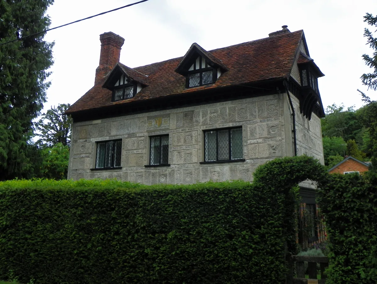
Little Manor
Stately homes · 1.9 km

Little Gaddesden
Towns & cities · 2.0 km
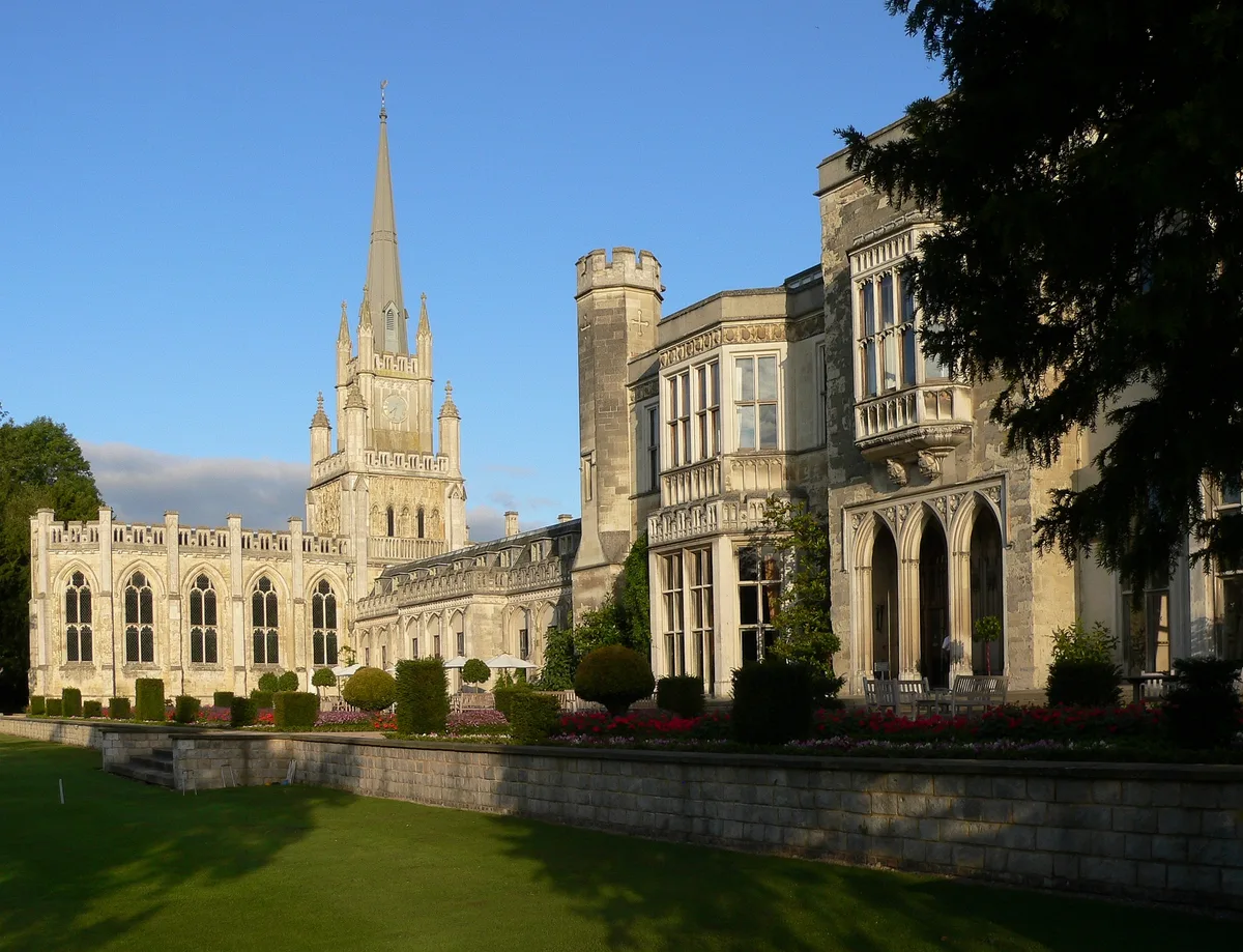
Ashridge
Towns & cities · 2.2 km

Kilbury Camp
Vineyards · 2.2 km

Brownlow Memorial
Memorials & monuments · 2.2 km
Nearby
📷 3Abbeys & priories · East of England
St Margarets Priory (Remains)
St Margarets Priory (Remains) — a abbey in england-west-midlands, United Kingdom.
📷 5Historic churches · East of England
Amaravati Temple
Amaravati Temple — a church in england-west-midlands, United Kingdom.
📷 5Historic churches · East of England
Amaravati Monastery
Amaravati Monastery — a church in england-west-midlands, United Kingdom.
📷 3Memorials & monuments · East of England
Great Gaddesden War Memorial Cross
Great Gaddesden War Memorial Cross — Grade II listed building-listed memorial in england-west-midlands, United Kingdom.
📷 3Historic bridges · East of England
Bridge Over Road And Revetments To Cutting, 160 Metres To South Of Nettleden Road
Bridge Over Road And Revetments To Cutting, 160 Metres To South Of Nettleden Road — Grade II listed building-listed bridge in england-west-midlands, United Kingdom.
📷 5Campsites · East of England
Highridge Farm Camping
Highridge Farm Camping — a campsite in england west midlands.
Where to eat & stay near St Margarets Priory (Remains)
Places to stay
📷 5Campsites · East of England
Highridge Farm Camping
Highridge Farm Camping — a campsite in england west midlands.
 📷 5
📷 5Campsites · South East England
Norcott Campsite - Camping In The Orchard
Norcott Campsite - Camping In The Orchard — a campsite in england west midlands.
 📷 3
📷 3 📷 5
📷 5Hotels · East of England
Aubrey Park Hotel
Aubrey Park Hotel — a hotel in england london.
 📷 4
📷 4 📷 5
📷 5Campsites · East of England
Phasels Wood Activity Centre
Phasels Wood Activity Centre — a campsite in england london.
Places to eat & drink
 📷 5
📷 5Historic pubs · East of England
The Red Lion Public House And Attached Coachhouse
The Red Lion Public House And Attached Coachhouse in England East, United Kingdom.
 📷 5
📷 5Historic pubs · East of England
Ye Olde Chequers Public House
Ye Olde Chequers Public House in England East, United Kingdom.
 📷 5
📷 5Cafés · East of England
Fred and Ginger Coffee
Fred and Ginger Coffee — a café in england west midlands.
 📷 5
📷 5Historic pubs · East of England
Saint George And The Dragon Public House
Saint George And The Dragon Public House in England East, United Kingdom.
 📷 5
📷 5Historic pubs · East of England
The Valiant Trooper Public House
The Valiant Trooper Public House in England East, United Kingdom.
 📷 5
📷 5More archaeological sites in this region
 Flagship📷 10
Archaeological sites · East of England
Nunn Wood
Nunn Wood — woods in Essex, England, a Site of Special Scientific Interest.
 📷 5
📷 5Archaeological sites · East of England
A Bronze Age post alignment and timber platform at Flag Fen and associated Bronze Age and later field systems and settlement to
A Bronze Age post alignment and timber platform at Flag Fen and associated Bronze Age and later field systems and settlement to — archaeological site in Thorney, City of Peterborough, England, UK.
 📷 5
📷 5Archaeological sites · East of England
Causewayed enclosure 900m west of Great Wilbraham parish church
Causewayed enclosure 900m west of Great Wilbraham parish church — archaeological site in Great Wilbraham, South Cambridgeshire, England, UK.
 📷 5
📷 5Archaeological sites · East of England
Dray's Ditches
Dray's Ditches — archaeological site in Streatley, Central Bedfordshire, England, UK.
Frequently asked questions
- Where is St Margarets Priory (Remains)?
- St Margarets Priory (Remains) is in Hertfordshire, the West Midlands, United Kingdom (postcode HP4 1QW), in the parish of Little Gaddesden.
- What is St Margarets Priory (Remains)?
- St Margarets Priory (Remains) — archaeological in england west midlands.
- How do I get to St Margarets Priory (Remains)?
- The nearest railway station is Berkhamsted, about 4.3 km away. Drivers can use postcode HP4 1QW.
- When was St Margarets Priory (Remains) built?
- Built or established in 1101.
- Is St Margarets Priory (Remains) a protected site?
- Yes — St Margarets Priory (Remains) is part of the Chilterns National Landscape (AONB).
- How do I get to St Margarets Priory (Remains)?
- The nearest railway station is Berkhamsted, about 4.3 km away. Drivers can navigate to postcode HP4 1QW.