
Archaeological sites · East of England
Nunn Wood
In or near Hadstock.
Nunn Wood — woods in Essex, England, a Site of Special Scientific Interest.

Wikimedia Commons contributors — see linked file page for photographer and licence licence

Plan your visit
- Typical visit
- 45 min–1.5 h
- Nearest railway station
- Great Chesterford · 5.7 km
- Free entry
- Dog-friendly
Getting there & planning your visit
To visit Nunn Wood in Uttlesford, Essex, the nearest railway station is Great Chesterford, located 5.7 km away. The postcode for Nunn Wood is CB10 1XQ, and entry is free.
About
Nunn Wood is an archaeological site in the United Kingdom. It covers approximately 10 km². Heritage designation: Site of Special Scientific Interest. Wikidata describes it as: "woods in Essex, England, a Site of Special Scientific Interest". Coordinates: 52.0620°, 0.2770°.
Photo gallery
Protected designations
- Site of Special Scientific Interest: Nunn Wood SSSI
Designations sourced from Natural England open data under OGL v3.
From the Wikipedia article
Nunn Wood is a 9.7-hectare (24-acre) biological Site of Special Scientific Interest between Great Chesterford and Ashdon in Essex, England. The site is an ancient coppice wood on chalky boulder clay. It is mainly hornbeam with other trees such as pedunculate oak, ash and field maple. The understorey is dominated by bluebells and dog's mercury. Ramsons are common, and there are occasional orchids. The site has the nationally uncommon oxlip, and one of the largest colonies of early purple orchids. A footpath from Bowsers Lane goes through the wood.
Excerpt from Wikipedia under CC BY-SA 4.0. See the source article linked in Sources below.
- Coordinates
- 52.0620, 0.2770
- County
- Essex
- District
- Uttlesford
- Parish
- Hadstock
- Postcode
- CB10 1XQ
- Parliamentary constituency
- North West Essex
- Nearest railway station
- Great Chesterford — 5.7 km
Sources
- wikidata: Q24993851 (CC0)
- wikipedia: Nunn Wood (CC BY-SA 4.0)
- commons: Nunn Wood 10.JPG (CC BY-SA 4.0)
Featured in this guide
Other places nearby

Hadstock
Towns & cities · 2.0 km

Little Walden
Villages · 2.0 km

Hadstock Village Sign
Public art & sculpture · 2.0 km

Ashwell House
Campsites · 2.1 km

The Kings Head Inn
Historic pubs · 2.1 km

Marpa House
Historic churches · 2.3 km

Ashdon
Towns & cities · 2.3 km

Medieval settlement immediately east of All Saints Church
Vineyards · 2.4 km
Ashdon Village Museum
Museums · 2.6 km

Ashdon War Memorial
Memorials & monuments · 2.6 km
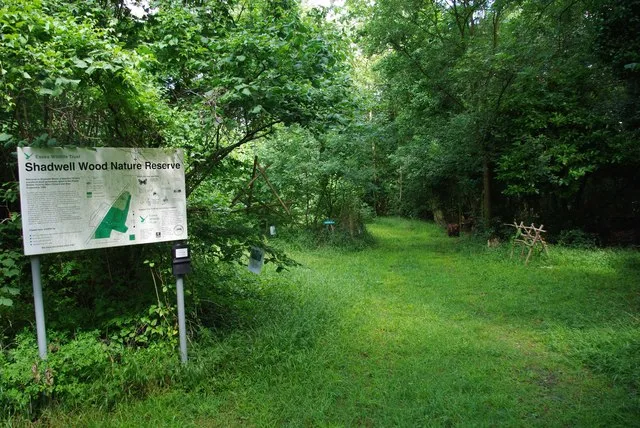
Hales and Shadwell Woods
Wildlife reserves · 2.7 km

Emanuel Wood
Vineyards · 2.9 km
Nearby
📷 5📷 5📷 5Public art & sculpture · East of England
Hadstock Village Sign
Hadstock Village Sign — a public art in england-london, United Kingdom.
📷 5Campsites · East of England
Ashwell House
Ashwell House — a campsite in england london.
📷 5Historic pubs · East of England
The Kings Head Inn
The Kings Head Inn in England East, United Kingdom.
📷 5Historic churches · East of England
Marpa House
Marpa House — a church in england-london, United Kingdom.
Where to eat & stay near Nunn Wood
Places to stay
📷 5Campsites · East of England
Ashwell House
Ashwell House — a campsite in england london.
 📷 7
📷 7 📷 7
📷 7Hotels · East of England
Crown House
Crown House — a hotel in england london.
 📷 5
📷 5 📷 5📷 5
Places to eat & drink
📷 5Historic pubs · East of England
The Kings Head Inn
The Kings Head Inn in England East, United Kingdom.
 📷 5
📷 5Historic pubs · East of England
The Victory Public House
The Victory Public House in England East, United Kingdom.
 📷 7
📷 7 📷 7
📷 7Historic pubs · East of England
Old Carpenters Arms
Old Carpenters Arms in England East, United Kingdom.
 📷 5
📷 5 📷 5
📷 5Historic pubs · East of England
Tickells Arms Public House
Tickells Arms Public House in England East, United Kingdom.
More archaeological sites in this region
 📷 5
📷 5Archaeological sites · East of England
A Bronze Age post alignment and timber platform at Flag Fen and associated Bronze Age and later field systems and settlement to
A Bronze Age post alignment and timber platform at Flag Fen and associated Bronze Age and later field systems and settlement to — archaeological site in Thorney, City of Peterborough, England, UK.
 📷 5
📷 5Archaeological sites · East of England
Causewayed enclosure 900m west of Great Wilbraham parish church
Causewayed enclosure 900m west of Great Wilbraham parish church — archaeological site in Great Wilbraham, South Cambridgeshire, England, UK.
 📷 5
📷 5Archaeological sites · East of England
Dray's Ditches
Dray's Ditches — archaeological site in Streatley, Central Bedfordshire, England, UK.
 📷 5
📷 5Archaeological sites · East of England
Ford Wood
Ford Wood — woodland in Cambridgeshire, England.
Frequently asked questions
- Where is Nunn Wood?
- Nunn Wood is in Essex, East of England, United Kingdom (postcode CB10 1XQ), in the parish of Hadstock.
- What is Nunn Wood?
- Nunn Wood — woods in Essex, England, a Site of Special Scientific Interest.
- How do I get to Nunn Wood?
- The nearest railway station is Great Chesterford, about 5.7 km away. The nearest town is Hadstock. Drivers can use postcode CB10 1XQ.
- Is Nunn Wood a listed building?
- Nunn Wood is officially recognised as Site of Special Scientific Interest listed.
- Is Nunn Wood a protected site?
- Yes — Nunn Wood is part of the Nunn Wood SSSI Site of Special Scientific Interest.
- Is Nunn Wood free to visit?
- Yes, Nunn Wood is free to enter.
- How do I get to Nunn Wood?
- The nearest railway station is Great Chesterford, about 5.7 km away. Drivers can navigate to postcode CB10 1XQ.