
Mountains & hills · South West England
St Ives Bay
In or near Lelant.
St Ives Bay — bay on the north coast of Cornwall, England, UK.

Wikimedia Commons contributors — see linked file page for photographer and licence licence

Plan your visit
- Typical visit
- 3 h–8 h
- Best time of year
- Late spring – early autumn (May–Oct)
- Nearest railway station
- Carbis Bay · 2.0 km
- Free entry
- Dog-friendly
Getting there & planning your visit
To visit St Ives Bay, the nearest railway station is Carbis Bay, located 2 km away. The postcode for sat-nav is TR27 5FJ, and entry to the area is free.
About
St Ives Bay is a named summit in the United Kingdom. Wikidata describes it as: "bay on the north coast of Cornwall, England, UK". Coordinates: 50.2083°, -5.4421°.
Photo gallery
Protected designations
- Area of Outstanding Natural Beauty: Cornwall
Designations sourced from Natural England open data under OGL v3.
From the Wikipedia article
St Ives Bay (Cornish: Roda Ia, meaning "Ia's anchorage") is a bay on the Atlantic coast of north-west Cornwall, England, United Kingdom. It is in the form of a shallow crescent, some 4 miles or 6 km across, between St Ives in the west and Godrevy Head in the east. At the most southerly point of St Ives Bay, the River Hayle flows into the sea through sand dunes and across the beach. Behind the dunes, the river forms a broad tidal estuary which includes an area of salt marsh and a largely disused port (see article on the industrial history of Hayle). The estuary is a popular place for birdwatching and the Royal Society for the Protection of Birds maintains a reserve there. The eastern coast of the bay is a three-mile (5 km) unbroken sandy beach backed by a substantial system of coastal dunes known as The Towans which stretches from Porth Kidney Sands in the west to Godrevy Head in the east. This stretch of beach is popular for surfing, particularly in the Gwithian area. The western side of the bay is on higher ground and is more densely inhabited with substantial settlements at Lelant, Carbis Bay and St Ives. The western coast of the bay is rockier with several small beaches separated by headlands. The Stones reef lies about one mile north-west of Godrevy Head and presents a hazard to navigation - the lighthouse on Godrevy Island warns mariners of the danger. Inshore hazards include the strong tidal stream around Godrevy Island and the tidal current at the mouth of the River Hayle.
Excerpt from Wikipedia under CC BY-SA 4.0. See the source article linked in Sources below.
- Coordinates
- 50.2083, -5.4421
- District
- Cornwall
- Parish
- Hayle
- Postcode
- TR27 5FJ
- Parliamentary constituency
- Camborne and Redruth
- Nearest railway station
- Carbis Bay — 2 km
Sources
- wikidata: Q7593412 (CC0)
- wikipedia: St Ives Bay (CC BY-SA 4.0)
- commons: Godrevy Island - geograph.org.uk - 1540638.jpg (CC BY-SA 4.0)
Other places nearby
Saint Ives Bay
Natural landmarks · 0.9 km

Porth Kidney Sands
Beaches · 1.5 km

Riviere Sands
Caravan parks · 1.7 km

Carbis Bay Beach
Beaches · 1.8 km

River Hayle
Museums · 1.9 km

Carbis Bay Hotel
Hotels · 2.1 km

Carbis Bay
Historic churches · 2.1 km

Beachside Holiday Park
Campsites · 2.1 km
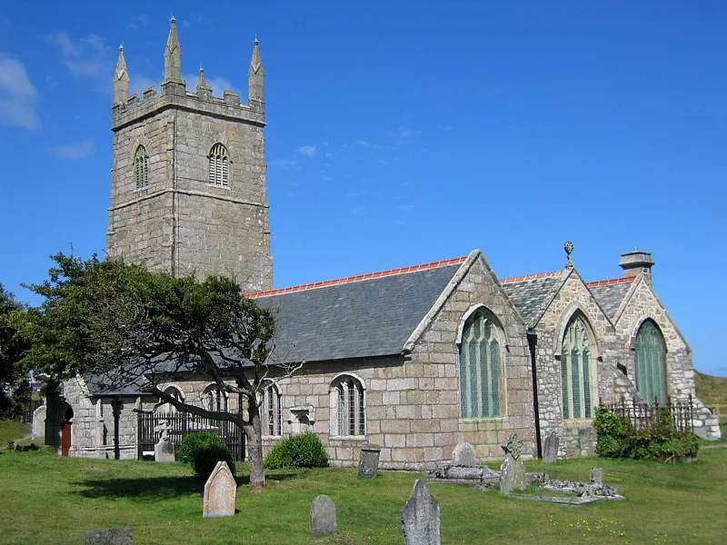
St Uny's Church, Lelant
Historic churches · 2.2 km

Porthminster Beach
Beaches · 2.3 km

St Felicitas and St Piala's Church, Phillack
Historic churches · 2.4 km

St Ives Archive
Museums · 2.4 km
Nearby
Natural landmarks · South West England
Saint Ives Bay
Saint Ives Bay — a natural feature in england south west.
📷 5Beaches · South West England
Porth Kidney Sands
Porth Kidney Sands is a beach in the United Kingdom.
📷 5Caravan parks · South West England
Riviere Sands
Riviere Sands — a caravan park in england south west.
📷 5Beaches · South West England
Carbis Bay Beach
Carbis Bay Beach is a beach in the United Kingdom.
📷 5Museums · South West England
River Hayle
River Hayle — a museum in england-south-west, United Kingdom.
📷 7Hotels · South West England
Carbis Bay Hotel
Carbis Bay Hotel — a hotel in england south west.
Where to eat & stay near St Ives Bay
Places to stay
📷 5Caravan parks · South West England
Riviere Sands
Riviere Sands — a caravan park in england south west.
📷 7Hotels · South West England
Carbis Bay Hotel
Carbis Bay Hotel — a hotel in england south west.
📷 5Campsites · South West England
Beachside Holiday Park
Beachside Holiday Park — a campsite in england south west.
 📷 6
📷 6Hotels · South West England
St Ives Harbour Hotel
St Ives Harbour Hotel — a hotel in england south west.
 📷 5
📷 5Hotels · South West England
Tregenna Castle Hotel
Tregenna Castle Hotel — a hotel in england south west.
 📷 5
📷 5Campsites · South West England
St Ives Bay Holiday Park
St Ives Bay Holiday Park — a campsite in england south west. Brand: Away Resorts.
Places to eat & drink
 📷 5
📷 5Historic pubs · South West England
The Bucket of Blood
The Bucket of Blood in England South West, United Kingdom.
 📷 5
📷 5Historic pubs · South West England
The Sloop Inn
The Sloop Inn in England South West, United Kingdom.
 📷 7
📷 7Historic pubs · South West England
The Pendarves Arms
The Pendarves Arms in England South West, United Kingdom.
 📷 5
📷 5 📷 7
📷 7Restaurants · South West England
The Old Lifeboat House Bistro
The Old Lifeboat House Bistro — a restaurant in england south west. Cuisine: seafood.
 📷 5
📷 5Historic pubs · South West England
First And Last Inn
First And Last Inn in England South West, United Kingdom.
More mountains in this region
 📷 5
📷 5 📷 5
📷 5 📷 5
📷 5 📷 5
📷 5Frequently asked questions
- Where is St Ives Bay?
- St Ives Bay is in South-West England, United Kingdom (postcode TR27 5FJ), in the parish of Hayle.
- What is St Ives Bay?
- St Ives Bay — bay on the north coast of Cornwall, England, UK.
- How do I get to St Ives Bay?
- The nearest railway station is Carbis Bay, about 2.0 km away. The nearest town is Lelant. Drivers can use postcode TR27 5FJ.
- Is St Ives Bay a protected site?
- Yes — St Ives Bay is part of the Cornwall National Landscape (AONB).
- Is St Ives Bay free to visit?
- Yes, St Ives Bay is free to enter.
- How do I get to St Ives Bay?
- The nearest railway station is Carbis Bay, about 2.0 km away. Drivers can navigate to postcode TR27 5FJ.