
Villages · South East England
South Nutfield
In or near Ardingly.
South Nutfield — a village in england south east.

Paul Gillett — CC BY-SA 2.0 via Wikimedia Commons licence

Plan your visit
- Typical visit
- 1 h–2 h
- Nearest railway station
- Haywards Heath · 2.4 km
About
A British village — settlements of this size traditionally cluster a green, parish church, pub and post office around historic land routes.
Photo gallery
Protected designations
- Area of Outstanding Natural Beauty: High Weald
Designations sourced from Natural England open data under OGL v3.
Place summary
South Nutfield is a village located in South-East England, with a population of 1,920. The village offers a quiet rural setting, characterised by its residential areas and local amenities. Visitors can expect a small community atmosphere typical of English villages, with basic facilities and nearby access to larger towns for additional services.
AI-generated from the structured facts on this page (operator, designation, listing, era). Not a substitute for visiting.
- Coordinates
- 51.0167, -0.1333
- County
- West Sussex
- District
- Mid Sussex
- Parish
- Cuckfield
- Postcode
- RH17 5HL
- Parliamentary constituency
- Mid Sussex
- Population
- 1,920
- Nearest railway station
- Haywards Heath — 2.4 km
Sources
- manual: geonames-2637356 (CC BY 4.0)
Other places nearby

Mid Sussex District
Museums · 0.5 km

Cuckfield
Museums · 0.9 km

Mantell Monument
Memorials & monuments · 1.0 km

Borde Hill
Natural landmarks · 1.1 km

Cuckfield Museum
Museums · 1.2 km

Warden Park School
Parks · 1.4 km
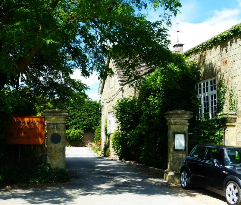
Ockenden Manor
Stately homes · 1.4 km

Monument To Charles Howard Approximately 10 Metres West Of Lychgate To Church Street
Memorials & monuments · 1.5 km

Monument To Henry Bowles, 1 Metre East Of East Window Of Church
Memorials & monuments · 1.5 km
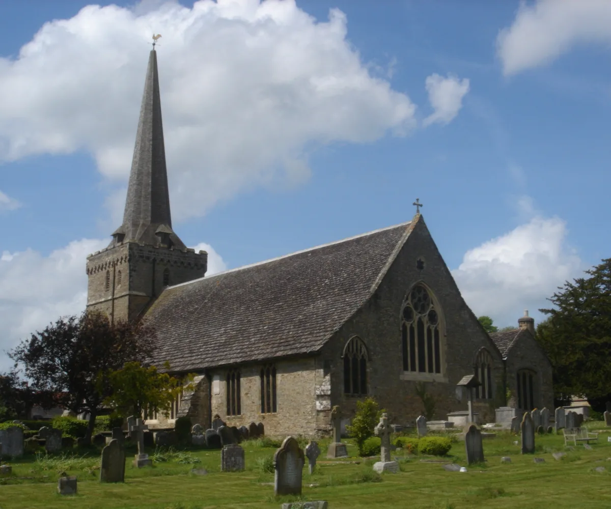
Holy Trinity Church, Cuckfield
Historic churches · 1.5 km

Kelsley Monument Approximately 5 Metres South Of Chancel Of Church
Memorials & monuments · 1.5 km
Monument Approximately 2 Metres South Of Item 8/29
Memorials & monuments · 1.5 km
Nearby
📷 5Museums · South East England
Mid Sussex District
Mid Sussex District — a museum in england-south-east, United Kingdom.
📷 5Museums · South East England
Cuckfield
Cuckfield ( KUUK-feeld) is a village and civil parish in the Mid Sussex District of West Sussex, England, on the southern slopes of the Weald. It lies 34 miles (55 km) south of London, 13 miles (21 km
📷 5Memorials & monuments · South East England
Mantell Monument
Mantell Monument — a memorial in england-south-east, United Kingdom.
📷 5Natural landmarks · South East England
Borde Hill
Borde Hill — a other in england-south-east, United Kingdom.
📷 5Museums · South East England
Cuckfield Museum
Cuckfield Museum — a museum in england-south-east, United Kingdom.
📷 5Parks · South East England
Warden Park School
Warden Park School — a school heritage in england-south-east, United Kingdom.
Where to eat & stay near South Nutfield
Places to stay
 📷 5
📷 5Caravan parks · South East England
Woodside Park
Woodside Park — a caravan park in england south east.
 📷 5
📷 5Campsites · South East England
Bluebell Camp Site
Bluebell Camp Site — a campsite in england south east.
 📷 5
📷 5Campsites · South East England
Wild Boar Wood Campsite
Wild Boar Wood Campsite — a campsite in england south east.
📷 5 📷 5
📷 5Campsites · South East England
Kitt's Cottage Campsite
Kitt's Cottage Campsite — a campsite in england south east.
 📷 5
📷 5Campsites · South East England
Hook Farm Campsite
Hook Farm Campsite — a campsite in england south east.
Places to eat & drink
 📷 7
📷 7Historic pubs · South East England
The Sergison Arms Public House
The Sergison Arms Public House in England South East, United Kingdom.
 📷 5
📷 5Historic pubs · South East England
The Jolly Tanners Public House
The Jolly Tanners Public House in England South East, United Kingdom.
 📷 5
📷 5Historic pubs · South East England
The Five Bells Inn
The Five Bells Inn in England South East, United Kingdom.
 📷 5
📷 5 📷 5
📷 5Historic pubs · South East England
White Hart Inn
White Hart Inn in England South East, United Kingdom.
 📷 5
📷 5Historic pubs · South East England
Old Punch Bowl
Old Punch Bowl in England South East, United Kingdom.
More places in this region
 📷 5
📷 5 📷 5
📷 5 📷 5
📷 5 📷 5
📷 5Frequently asked questions
- Where is South Nutfield?
- South Nutfield is in West Sussex, South-East England, United Kingdom (postcode RH17 5HL), in the parish of Cuckfield.
- What is South Nutfield?
- South Nutfield — a village in england south east.
- How do I get to South Nutfield?
- The nearest railway station is Haywards Heath, about 2.4 km away. Drivers can use postcode RH17 5HL.
- Is South Nutfield a protected site?
- Yes — South Nutfield is part of the High Weald National Landscape (AONB).
- How do I get to South Nutfield?
- The nearest railway station is Haywards Heath, about 2.4 km away. Drivers can navigate to postcode RH17 5HL.