
Museums · South West England
South Gloucestershire
In or near Tormarton.
South Gloucestershire is a unitary authority area in the ceremonial county of Gloucestershire, South West England. The majority of its population lies in the suburban towns of the Greater Bristol urba

Neil Owen — CC BY-SA 2.0 via Wikimedia Commons licence

Plan your visit
- Typical visit
- 1.5 h–3 h
- Best time of year
- Year-round
- Nearest railway station
- Oldland Common · 7.2 km
- Free entry
- Family-friendly
- Limited wheelchair access
Getting there & planning your visit
To visit South Gloucestershire museum, the nearest railway station is Oldland Common, located 7.2 km away. The postcode for the museum is SN14 8EZ. Please note that wheelchair accessibility is limited.
About
South Gloucestershire is a unitary authority area in the ceremonial county of Gloucestershire, South West England. The majority of its population lies in the suburban towns of the Greater Bristol urban area surrounding the city of Bristol, including Kingswood, Filton, Patchway, Bradley Stoke, and Emersons Green. It is also home to standalone towns including Yate, Chipping Sodbury, and Thornbury. South Gloucestershire was created in 1996 to replace the Northavon district and Borough of Kingswood of the abolished county of Avon. It is separate from Gloucestershire County Council, but is part of the ceremonial county and shares Gloucestershire's Lord Lieutenant (the Sovereign's representative to the county). Because of its history as part of the county of Avon, South Gloucestershire works closely with the other unitary authorities that took over when that county was abolished, including shared services such as Avon Fire and Rescue Service and Avon and Somerset Police, together with co-operation in planning strategy for transport, roads and housing.
Photo gallery
See it from the streetimagery from 2020
Imagery © Mapillary contributors, CC BY-SA 4.0
Summary from the official site
South Gloucestershire is a diverse area in the UK that offers various attractions, parks, and cultural sites for visitors. It features a mix of natural landscapes and urban amenities, making it suitable for outdoor activities and community events.
Read more on the official property page.
Protected designations
- Area of Outstanding Natural Beauty: Cotswolds
Designations sourced from Natural England open data under OGL v3.
From the Wikipedia article
South Gloucestershire is a unitary authority area in the ceremonial county of Gloucestershire, South West England. The majority of its population lies in the suburban towns of the Greater Bristol urban area surrounding the city of Bristol, including Kingswood, Filton, Patchway, Bradley Stoke, and Emersons Green. It is also home to standalone towns including Yate, Chipping Sodbury, and Thornbury. South Gloucestershire was created in 1996 to replace the Northavon district and Borough of Kingswood of the abolished county of Avon. It is separate from Gloucestershire County Council, but is part of the ceremonial county and shares Gloucestershire's Lord Lieutenant (the Sovereign's representative to the county). Because of its history as part of the county of Avon, South Gloucestershire works closely with the other unitary authorities that took over when that county was abolished, including shared services such as Avon Fire and Rescue Service and Avon and Somerset Police, together with co-operation in planning strategy for transport, roads and housing.
Excerpt from Wikipedia under CC BY-SA 4.0. See the source article linked in Sources below.
Background
History
Prior to the implementation of the Local Government Act 1972 on 1 April 1974, the area that now forms South Gloucestershire formed part of the shire county of Gloucestershire, comprising the urban districts of Kingswood and Mangotsfield and the Rural Districts of Warmley, Sodbury and Thornbury. However, under the terms of that act, the area was removed from Gloucestershire, and became part of the county of Avon, forming the districts of Kingswood and Northavon. In 1996, the county of Avon was abolished, and South Gloucestershire was created as a unitary authority area comprising the former districts of Kingswood and Northavon. The area borders the city and county of Bristol, the Bath and…
Sourced from Wikipedia under CC BY-SA 4.0.
- Coordinates
- 51.4790, -2.3800
- District
- South Gloucestershire
- Parish
- Dyrham and Hinton
- Postcode
- SN14 8EZ
- Parliamentary constituency
- Thornbury and Yate
- Nearest railway station
- Oldland Common — 7.2 km
- Official site
- southglos.gov.uk
Sources
- wikipedia: South Gloucestershire (CC BY-SA 4.0)
Other places nearby

Dyrham
Villages · 0.0 km
Dyrham House
Manor houses · 0.5 km

Dyrham Park
Parks · 0.7 km

Neptune
National landscapes (AONB) · 0.7 km

Dyrham
Museums · 1.0 km

Dyrham Camp
Vineyards · 1.2 km

Hinton
Villages · 1.2 km

Tollgate teahouse
Cafés · 1.3 km

Doynton
Villages · 2.1 km

Tog Hill
Mountains & hills · 2.9 km

The Manor House
Historic houses · 3.3 km

Garden Walls And Gateways About 15 Metres South Of The Manor House
Holy wells · 3.3 km
Nearby
📷 5Manor houses · South West England
Dyrham House
Dyrham House — a manor in england south west.
📷 5Parks · South West England
Dyrham Park
Dyrham Park — a other in england-south-east, United Kingdom.
📷 5National landscapes (AONB) · South West England
Neptune
Neptune — Public artwork (statue).
📷 5Museums · South West England
Dyrham
Dyrham is a village and parish in South Gloucestershire, England.
📷 5Vineyards · South West England
Dyrham Camp
Dyrham Camp — a UK vineyard in england south east, producing English or Welsh wine from cool-climate grape varieties.
Where to eat & stay near South Gloucestershire
Places to stay
 📷 5
📷 5Hotels · South West England
Rounceval House Hotel
Rounceval House Hotel — a hotel in england south east.
📷 7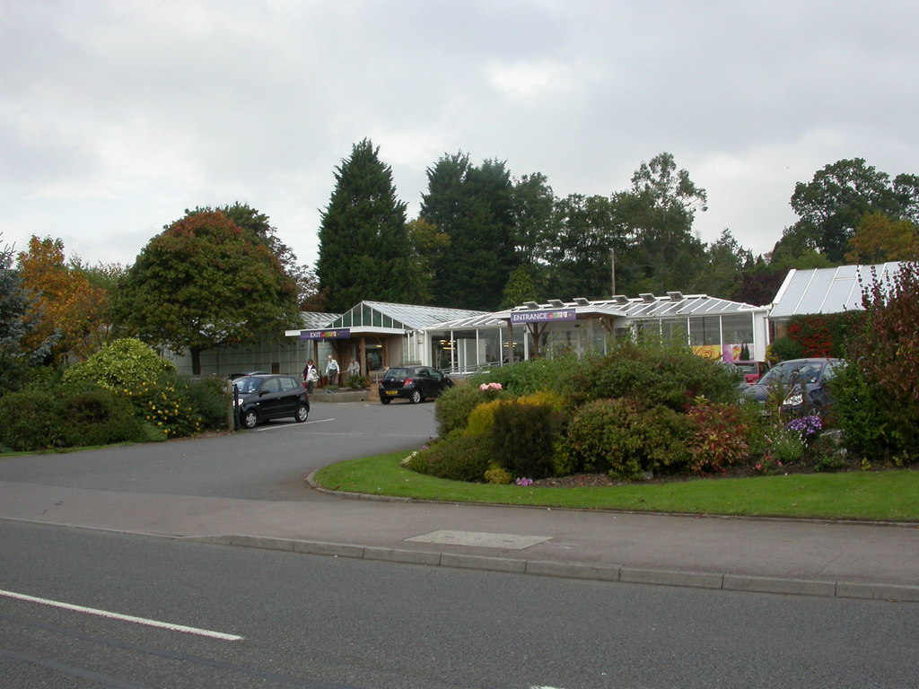 📷 5
📷 5Campsites · South West England
Knights Folly Farm
Knights Folly Farm — a campsite in england south east.
 📷 5
📷 5Campsites · South West England
The Stables
The Stables — a campsite in england south east.
 📷 6
📷 6B&Bs · South West England
Dolphin House
Dolphin House — a bed-and-breakfast in england south east.
 📷 5
📷 5Caravan parks · South West England
Green Gables
Green Gables — a caravan park in england south west.
Places to eat & drink
📷 6 📷 5
📷 5Historic pubs · South West England
The Crown And 2 Rear Wings And Outbuilding To Rear
The Crown And 2 Rear Wings And Outbuilding To Rear in England South West, United Kingdom.
 📷 7📷 7
Restaurants · South West England
Il Gusto
Il Gusto — a restaurant in england south east.
📷 7 📷 7
📷 7More museums in this region
 📷 5
📷 5Museums · South West England
Alexander Keiller Museum
Alexander Keiller Museum — museum in South West England, United Kingdom.
 📷 5
📷 5Museums · South West England
American Museum and Gardens
American Museum and Gardens — culture and arts museum near Bath, England, United Kingdom.
 📷 5
📷 5Museums · South West England
Atwell-Wilson Motor Museum
Atwell-Wilson Motor Museum — museum in Calne, England, UK.
 📷 5
📷 5Museums · South West England
Bath Abbey Heritage Vaults
Bath Abbey Heritage Vaults — museum in Bath Abbey, Bath, England, UK.
Frequently asked questions
- Where is South Gloucestershire?
- South Gloucestershire is in South-West England, United Kingdom (postcode SN14 8EZ), in the parish of Dyrham and Hinton.
- What is South Gloucestershire?
- South Gloucestershire is a unitary authority area in the ceremonial county of Gloucestershire, South West England. The majority of its population lies in the suburban towns of the Greater Bristol urba
- How do I get to South Gloucestershire?
- The nearest railway station is Oldland Common, about 7.2 km away. The nearest town is Tormarton. Drivers can use postcode SN14 8EZ.
- Who owns South Gloucestershire?
- South Gloucestershire is owned by South Gloucestershire Council.
- Is South Gloucestershire a protected site?
- Yes — South Gloucestershire is part of the Cotswolds National Landscape (AONB).
- Is South Gloucestershire free to visit?
- Yes, South Gloucestershire is free to enter.
- How do I get to South Gloucestershire?
- The nearest railway station is Oldland Common, about 7.2 km away. Drivers can navigate to postcode SN14 8EZ.