
Museums · South West England
Bradley Stoke
In or near Little Stoke.
Bradley Stoke is a suburban town and civil parish in South Gloucestershire, England, situated 6 miles (10 kilometres) north-northeast of Bristol city centre. The town is the northernmost part of the

Gareth James — CC BY-SA 2.0 via Wikimedia Commons licence

Plan your visit
- Typical visit
- 1.5 h–3 h
- Best time of year
- Year-round
- Nearest railway station
- Patchway · 1.5 km
- Family-friendly
- Limited wheelchair access
Getting there & planning your visit
To visit the museum in Bradley Stoke, you can take a train to Patchway station, which is 1.5 km away. The postcode for the museum is BS32 9BS. Please note that wheelchair accessibility is limited.
About
Bradley Stoke is a suburban town and civil parish in South Gloucestershire, England, situated 6 miles (10 kilometres) north-northeast of Bristol city centre. The town is the northernmost part of the Bristol built-up area. Planned in the late-1970s, building works began in 1987. Bradley Stoke was Europe's largest new town built with private investment. It is named after two local streams, the Bradley Brook and Stoke Brook. Bradley Stoke is part of the North Fringe of Bristol, an extensive area of housing and employment developed during the late 20th and early 21st centuries. It is bordered by Patchway to the west and Stoke Gifford to the south, but unlike these neighbours, Bradley Stoke has fewer major employers and is primarily a residential suburb, being 40% detached housing. The M5 and M4 motorways form its northern and eastern boundaries, beyond which is the Avon Green Belt.
Photo gallery
See it from the streetimagery from 2024
Imagery © Mapillary contributors, CC BY-SA 4.0
Protected designations
- Site of Special Scientific Interest: Severn Estuary SSSI
- Ramsar wetland: Severn Estuary
Designations sourced from Natural England open data under OGL v3.
From the Wikipedia article
Bradley Stoke is a suburban town and civil parish in South Gloucestershire, England, situated 6 miles (10 kilometres) north-northeast of Bristol city centre. The town is the northernmost part of the Bristol built-up area. Planned in the late-1970s, building works began in 1987. Bradley Stoke was Europe's largest new town built with private investment. It is named after two local streams, the Bradley Brook and Stoke Brook. Bradley Stoke is part of the North Fringe of Bristol, an extensive area of housing and employment developed during the late 20th and early 21st centuries. It is bordered by Patchway to the west and Stoke Gifford to the south, but unlike these neighbours, Bradley Stoke has fewer major employers and is primarily a residential suburb, being 40% detached housing. The M5 and M4 motorways form its northern and eastern boundaries, beyond which is the Avon Green Belt.
Excerpt from Wikipedia under CC BY-SA 4.0. See the source article linked in Sources below.
Background
History
The area that is now Bradley Stoke was once farmland north of the village of Stoke Gifford near Bristol city. The land was divided amongst the civil parishes of Stoke Gifford, Almondsbury, Patchway and Winterbourne. The area consisted of a number of farms, Bailey's Court and Watch Elm Farm in the south, Bowsland Farm and Manor Farm in the north and Webb's Farm in the middle. Some of the lands were used as pasture. A number of woods also existed, Sherbourne's Brake, Webb's Wood and the large Savage's Wood have all been preserved. Fiddlers Wood, the name of which lives on in Fiddlers Wood Lane was all but obliterated by the M4 motorway. Baileys Court Farmhouse is the only original building…
Sourced from Wikipedia under CC BY-SA 4.0.
- Coordinates
- 51.5356, -2.5464
- District
- South Gloucestershire
- Parish
- Bradley Stoke
- Postcode
- BS32 9BS
- Parliamentary constituency
- Filton and Bradley Stoke
- Nearest railway station
- Patchway — 1.5 km
- Official site
- www.bradleystoke.gov.uk
Sources
- wikipedia: Bradley Stoke (CC BY-SA 4.0)
Other places nearby

Three Brooks Nature Reserve
Forests & woodlands · 0.2 km
Three Brooks Local Nature Reserve
Parks · 0.7 km

Jackie Beard
Memorials & monuments · 1.4 km

Little Stoke
Towns & cities · 1.6 km

DoubleTree by Hilton Hotel Bristol North
Hotels · 1.7 km

Aztec Hotel & Spa
Hotels · 1.7 km

The Holy Family in Sequoia
Public art & sculpture · 1.7 km

RAC Regional Control Centre
Gardens · 1.7 km

"Feathers" Gromit
Public art & sculpture · 1.9 km

Stoke Gifford
Towns & cities · 2.1 km

Callicroft Farm Track 2
Memorials & monuments · 2.1 km
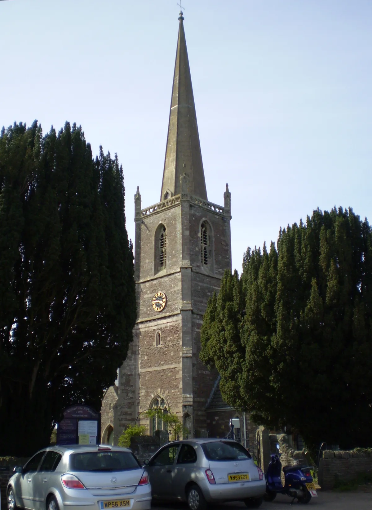
St Michael's Church, Winterbourne
Historic churches · 2.2 km
Nearby
📷 3Forests & woodlands · South West England
Three Brooks Nature Reserve
Three Brooks Nature Reserve is a forest or woodland in the United Kingdom.
📷 3Parks · South West England
Three Brooks Local Nature Reserve
Three Brooks Local Nature Reserve — park in Bradley Stoke, United Kingdom.
📷 3Memorials & monuments · South West England
Jackie Beard
Jackie Beard — a memorial in england-south-west, United Kingdom.
📷 5Towns & cities · South West England
Little Stoke
Little Stoke — village in South Gloucestershire, England, UK.
📷 5Hotels · South West England
DoubleTree by Hilton Hotel Bristol North
DoubleTree by Hilton Hotel Bristol North — a hotel in england south west. 4-star. Brand: DoubleTree.
📷 7Hotels · South West England
Aztec Hotel & Spa
Aztec Hotel & Spa — a hotel in england south west.
Where to eat & stay near Bradley Stoke
Places to stay
📷 5Hotels · South West England
DoubleTree by Hilton Hotel Bristol North
DoubleTree by Hilton Hotel Bristol North — a hotel in england south west. 4-star. Brand: DoubleTree.
📷 7Hotels · South West England
Aztec Hotel & Spa
Aztec Hotel & Spa — a hotel in england south west.
 📷 5
📷 5Campsites · South West England
Bristol Camping
Bristol Camping — a campsite in england south west.
 📷 5
📷 5Campsites · South West England
Woodhouse Park Activity Centre
Woodhouse Park Activity Centre — a campsite in england south west.
 📷 5
📷 5Caravan parks · South West England
Green Gables
Green Gables — a caravan park in england south west.
 📷 5
📷 5Campsites · South West England
The Wave Campsite
The Wave Campsite — a campsite in wales south.
Places to eat & drink
 📷 5
📷 5Historic pubs · South West England
The Old Tavern Public House
The Old Tavern Public House in Wales South, United Kingdom.
 📷 7
📷 7Historic pubs · South West England
Blaise Inn Public House
Blaise Inn Public House in Wales South, United Kingdom.
 📷 7
📷 7 📷 5
📷 5 📷 5
📷 5Historic pubs · South West England
Old England Public House
Old England Public House in Wales South, United Kingdom.
 📷 5
📷 5Restaurants · South West England
Casa
Casa — a restaurant in england west midlands.
More museums in this region
 📷 5
📷 5Museums · South West England
Alexander Keiller Museum
Alexander Keiller Museum — museum in South West England, United Kingdom.
 📷 5
📷 5Museums · South West England
American Museum and Gardens
American Museum and Gardens — culture and arts museum near Bath, England, United Kingdom.
 📷 5
📷 5Museums · South West England
Atwell-Wilson Motor Museum
Atwell-Wilson Motor Museum — museum in Calne, England, UK.
 📷 5
📷 5Museums · South West England
Bath Abbey Heritage Vaults
Bath Abbey Heritage Vaults — museum in Bath Abbey, Bath, England, UK.
Frequently asked questions
- Where is Bradley Stoke?
- Bradley Stoke is in South-West England, United Kingdom (postcode BS32 9BS), in the parish of Bradley Stoke.
- What is Bradley Stoke?
- Bradley Stoke is a suburban town and civil parish in South Gloucestershire, England, situated 6 miles (10 kilometres) north-northeast of Bristol city centre. The town is the northernmost part of the
- How do I get to Bradley Stoke?
- The nearest railway station is Patchway, about 1.5 km away. The nearest town is Little Stoke. Drivers can use postcode BS32 9BS.
- Is Bradley Stoke a protected site?
- Yes — Bradley Stoke is part of the Severn Estuary SSSI Site of Special Scientific Interest and the Severn Estuary Ramsar wetland.
- How do I get to Bradley Stoke?
- The nearest railway station is Patchway, about 1.5 km away. Drivers can navigate to postcode BS32 9BS.