
Holy wells · South West England
Garden Walls And Gateways About 15 Metres South Of The Manor House
In or near Marshfield.
Garden Walls And Gateways About 15 Metres South Of The Manor House — Grade I listed wall in South Gloucestershire, England, UK.

Wikimedia Commons contributors — see linked file page for photographer and licence licence

Plan your visit
- Typical visit
- 15 min–30 min
- Nearest railway station
- Oldland Common · 7.4 km
- Free entry
- Dog-friendly
About
Garden Walls And Gateways About 15 Metres South Of The Manor House is a place of interest in South-East England. Officially recognised as Grade I listed building. The site is within the Cotswolds National Landscape (AONB). It sits within the Thornbury and Yate parliamentary constituency. The nearest railway station is Oldland Common, about 7.4 km away. Postcode area SN14.
Photo gallery
See it from the streetimagery from 2020
Imagery © Mapillary contributors, CC BY-SA 4.0
Protected designations
- Area of Outstanding Natural Beauty: Cotswolds
Designations sourced from Natural England open data under OGL v3.
Place summary
The Garden Walls and Gateways, located about 15 metres south of the Manor House in Cold Ashton, South-East England, are a Grade I listed building. These structures are situated within an Area of Outstanding Natural Beauty (AONB) in the Cotswolds, reflecting significant historical and architectural value.
AI-generated from the structured facts on this page (operator, designation, listing, era). Not a substitute for visiting.
- Coordinates
- 51.4520, -2.3610
- District
- South Gloucestershire
- Parish
- Cold Ashton
- Postcode
- SN14 8JU
- Parliamentary constituency
- Thornbury and Yate
- Nearest railway station
- Oldland Common — 7.4 km
Sources
- wikidata: Q17530376 (CC0)
- commons: Garden wall and gateway to the Manor House, Cold Ashton - geograph.org.uk - 5475733.jpg (CC BY-SA 4.0)
Other places nearby

The Manor House
Historic houses · 0.0 km

Tog Hill
Mountains & hills · 1.4 km

Tollgate teahouse
Cafés · 2.1 km
.jpg?width=1200)
Hamswell House
Historic houses · 2.1 km

Neptune
National landscapes (AONB) · 3.1 km

Dyrham Park
Parks · 3.2 km

The Crown And 2 Rear Wings And Outbuilding To Rear
Historic pubs · 3.2 km
Dyrham House
Manor houses · 3.2 km

Marshfield House
Historic houses · 3.2 km
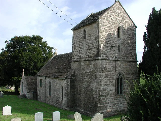
St Mary Magdalene's Church, Langridge
Historic churches · 3.2 km

Marshfield
Towns & cities · 3.2 km

Dyrham
Villages · 3.3 km
Nearby
📷 5Historic houses · South West England
The Manor House
The Manor House — Grade I listed house in South Gloucestershire, England, UK.
📷 5📷 6📷 5Historic houses · South West England
Hamswell House
Hamswell House — house in Cold Ashton, South Gloucestershire, England, UK.
📷 5National landscapes (AONB) · South West England
Neptune
Neptune — Public artwork (statue).
📷 5Parks · South West England
Dyrham Park
Dyrham Park — a other in england-south-east, United Kingdom.
Where to eat & stay near Garden Walls And Gateways About 15 Metres South Of The Manor House
Places to stay
 📷 6
📷 6B&Bs · South West England
Dolphin House
Dolphin House — a bed-and-breakfast in england south east.
 📷 5
📷 5Hotels · South West England
Bailbrook House Hotel
Bailbrook House Hotel — a hotel in england south east.
📷 7Hotels · South West England
Bailbrook Lodge Hotel
Bailbrook Lodge Hotel — a hotel in england south east.
 📷 5
📷 5Hotels · South West England
The Lansdown Grove Hotel
The Lansdown Grove Hotel — a hotel in england south east.
 📷 5
📷 5Hotels · South West England
The Bath Priory
The Bath Priory — a hotel in england south east.
 📷 5
📷 5Caravan parks · South West England
Penn Hill CL Site
Penn Hill CL Site — a caravan park in england south east.
Places to eat & drink
📷 6📷 5Historic pubs · South West England
The Crown And 2 Rear Wings And Outbuilding To Rear
The Crown And 2 Rear Wings And Outbuilding To Rear in England South West, United Kingdom.
 📷 7
📷 7Restaurants · South West England
The Bathampton Mill
The Bathampton Mill — a restaurant in england south east.
 📷 7
📷 7 📷 5
📷 5Historic pubs · South West England
The Fox And Hounds Public House
The Fox And Hounds Public House in England South West, United Kingdom.
 📷 7
📷 7Historic pubs · South West England
The Inn And Public House
The Inn And Public House in England South West, United Kingdom.
More places in this region
 📷 5
📷 5Holy wells · South West England
Park Wall
Park Wall — Grade I listed wall in Shaftesbury, Dorset, England, UK.
 📷 5
📷 5Holy wells · South West England
Boundary Wall, Piers and Gates of Broadway House
Boundary Wall, Piers and Gates of Broadway House — walls in Topsham, Devon, England, UK.
 📷 5
📷 5Holy wells · South West England
Boundary Walls To Numbers 1-13
Boundary Walls To Numbers 1-13 — Grade I listed wall in Mendip, United Kingdom.
 📷 5
📷 5Holy wells · South West England
Boundary walls to Numbers 14-27, Vicars' Close
Boundary walls to Numbers 14-27, Vicars' Close — wall in Wells, Somerset, England, UK.
Frequently asked questions
- Where is Garden Walls And Gateways About 15 Metres South Of The Manor House?
- Garden Walls And Gateways About 15 Metres South Of The Manor House is in South-West England, United Kingdom (postcode SN14 8JU), in the parish of Cold Ashton.
- What is Garden Walls And Gateways About 15 Metres South Of The Manor House?
- Garden Walls And Gateways About 15 Metres South Of The Manor House — Grade I listed wall in South Gloucestershire, England, UK.
- How do I get to Garden Walls And Gateways About 15 Metres South Of The Manor House?
- The nearest railway station is Oldland Common, about 7.4 km away. The nearest town is Marshfield. Drivers can use postcode SN14 8JU.
- Is Garden Walls And Gateways About 15 Metres South Of The Manor House a listed building?
- Garden Walls And Gateways About 15 Metres South Of The Manor House is officially recognised as Grade I listed building listed.
- Is Garden Walls And Gateways About 15 Metres South Of The Manor House a protected site?
- Yes — Garden Walls And Gateways About 15 Metres South Of The Manor House is part of the Cotswolds National Landscape (AONB).
- Is Garden Walls And Gateways About 15 Metres South Of The Manor House free to visit?
- Yes, Garden Walls And Gateways About 15 Metres South Of The Manor House is free to enter.
- How do I get to Garden Walls And Gateways About 15 Metres South Of The Manor House?
- The nearest railway station is Oldland Common, about 7.4 km away. Drivers can navigate to postcode SN14 8JU.